|
St. Matthias Islands
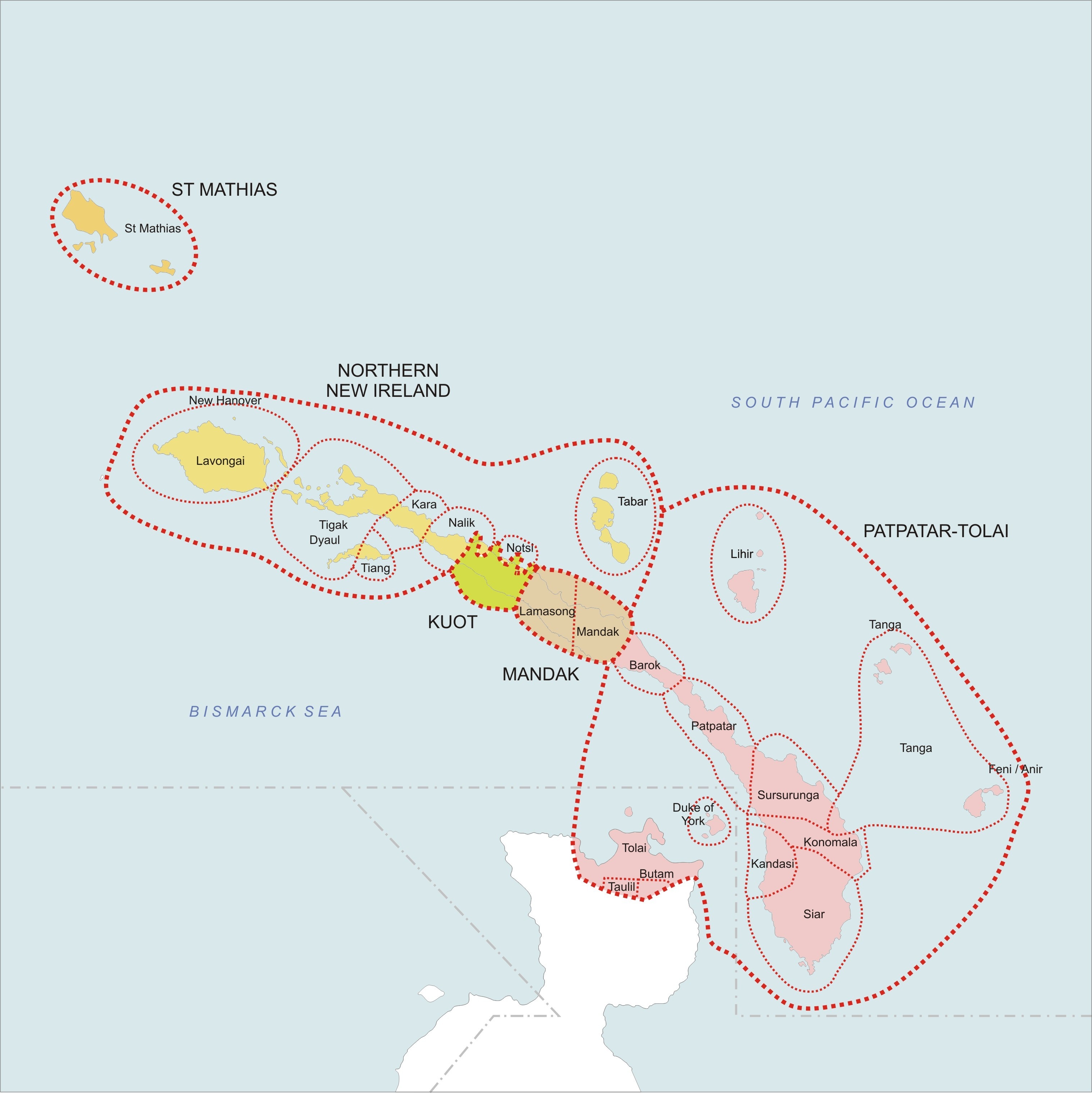
The St Matthias Islands (also known as the Mussau islands) are a small archipelago group of islands in the Bismarck Archipelago, in northern Papua New Guinea. They are within New Ireland Province. Geography There are at least 10 islands. The largest and most northerly is Mussau. To the southwest of Mussau are: Eloaua, Emananus, Boliu, Emussau, Ebanalu, Ekaleu, and a few smaller isles. To the east of Mussau are: Emirau, and further east is Tench Island. The islands have been designated as an Endemic Bird Area by Birdlife International BirdLife International is a global partnership of non-governmental organizations that strives to conserve birds and their habitats. BirdLife International's priorities include preventing extinction of bird species, identifying and safeguarding .... Archipelagoes of Papua New Guinea Bismarck Archipelago New Ireland Province {{PapuaNewGuinea-island-stub ... [...More Info...] [...Related Items...] OR: [Wikipedia] [Google] [Baidu] |
Archipelago
An archipelago ( ), sometimes called an island group or island chain, is a chain, cluster, or collection of islands, or sometimes a sea containing a small number of scattered islands. Examples of archipelagos include: the Indonesian Archipelago, the Andaman and Nicobar Islands, the Lakshadweep Islands, the Galápagos Islands, the Japanese archipelago, the Philippine Archipelago, the Maldives, the Balearic Islands, The Bahamas, the Aegean Islands, the Hawaiian Islands, the Canary Islands, Malta, the Azores, the Canadian Arctic Archipelago, the British Isles, the islands of the Archipelago Sea, and Shetland. They are sometimes defined by political boundaries. For example, the Gulf archipelago off the northeastern Pacific coast forms part of a larger archipelago that geographically includes Washington state's San Juan Islands; while the Gulf archipelago and San Juan Islands are geographically related, they are not technically included in the same archipelago due to manmad ... [...More Info...] [...Related Items...] OR: [Wikipedia] [Google] [Baidu] |
Bismarck Archipelago
The Bismarck Archipelago (, ) is a group of islands off the northeastern coast of New Guinea in the western Pacific Ocean and is part of the Islands Region of Papua New Guinea. Its area is about 50,000 square km. History The first inhabitants of the archipelago arrived around 30–40,000 years ago. They may have traveled from New Guinea, by boat across the Bismarck Sea or via a temporary land bridge, created by an uplift in the Earth's Crust (geology), crust. Later arrivals included the Lapita people. The first European to visit these islands was Dutch explorer Willem Schouten in 1616. The islands remained unsettled by western Europeans until they were annexed as part of the German protectorate of German New Guinea in 1884. The area was named in honour of the Chancellor of Germany (German Reich), Chancellor Otto von Bismarck. On 1888 Ritter Island eruption and tsunami, 13 March 1888, a volcano erupted on Ritter Island causing a megatsunami. Almost the entire volcano fell into t ... [...More Info...] [...Related Items...] OR: [Wikipedia] [Google] [Baidu] |
Papua New Guinea
Papua New Guinea (abbreviated PNG; , ; tpi, Papua Niugini; ho, Papua Niu Gini), officially the Independent State of Papua New Guinea ( tpi, Independen Stet bilong Papua Niugini; ho, Independen Stet bilong Papua Niu Gini), is a country in Oceania that comprises the eastern half of the island of New Guinea and its offshore islands in Melanesia (a region of the southwestern Pacific Ocean north of Australia). Its capital, located along its southeastern coast, is Port Moresby. The country is the world's third largest island country, with an area of . At the national level, after being ruled by three external powers since 1884, including nearly 60 years of Australian administration starting during World War I, Papua New Guinea established its sovereignty in 1975. It became an independent Commonwealth realm in 1975 with Elizabeth II as its queen. It also became a member of the Commonwealth of Nations in its own right. There are 839 known languages of Papua New Guinea, one of ... [...More Info...] [...Related Items...] OR: [Wikipedia] [Google] [Baidu] |
New Ireland Province
New Ireland Province, formerly New Mecklenburg (german: Neu-Mecklenburg), and Nova Hibernia, is the northeasternmost province of Papua New Guinea. Physical geography The largest island of the province is New Ireland. Also part of the province are numerous smaller islands, including Saint Matthias Group (Mussau, Emirau), New Hanover, Djaul, Tabar Group ( Tabar, Tatau, Simberi), Lihir, Tanga Group (Malendok, Boang), Feni Islands (Ambitle, Babase) and Anir. The land area of the province is around 9 560 km². The sea area within the Exclusive Economic Zone (EEZ) of New Ireland Province is around 230,000 km². Ecology In the early days of the French Revolution while searching for a lost scientific expedition the vessel La Recherche passed by New Ireland. On board was the prominent botanist Jacques-Julien Houtou de Labillardière who noted in his journal fine stands of teak (tectona grandis) trees growing at the southern end of the island. This marks the easter ... [...More Info...] [...Related Items...] OR: [Wikipedia] [Google] [Baidu] |
Mussau
Mussau Island is the largest island of St Matthias Islands, Papua New Guinea, at . It is currently part of the New Ireland Province of Papua New Guinea. The island is a noted Biodiversity hotspot with pristine primeval Rainforest Rainforests are characterized by a closed and continuous tree canopy, moisture-dependent vegetation, the presence of epiphytes and lianas and the absence of wildfire. Rainforest can be classified as tropical rainforest or temperate rainfores ... covering most of Mussau's hilly landscape. The island has over 243 endemic plant species as well as at least 47 native butterfly species. References https://asiapacific.anu.edu.au/mapsonline/base-maps/mussau-island https://www.researchgate.net/publication/280134331_A External links OrchidsPNG.com Islands of Papua New Guinea Bismarck Archipelago New Ireland Province Volcanoes of Papua New Guinea {{NewIrelandProvince-geo-stub ... [...More Info...] [...Related Items...] OR: [Wikipedia] [Google] [Baidu] |
Emirau
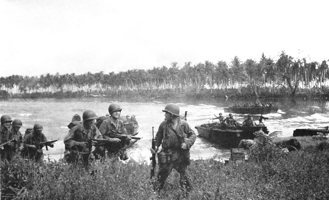
Emirau Island, also called Emira, is an island in the Bismarck Archipelago located at . It is currently part of the New Ireland Province of Papua New Guinea. The local language is a dialect of the Mussau-Emira language. Emira is part of what on many maps are charted as the St Matthias Islands, also known as the Mussau Islands, a small group to the north-west of the main-island group of New Ireland. Early explorers named it Squally Island, a name still found in some early records. History World War II Early in World War II this small island became international news when over 500 prisoners from various ships (including RMS ''Rangitane'') sunk by German surface raiders were released following the first attack on Nauru and subsequently rescued by the Australian authorities. Emirau was seized unopposed by two battalions of the United States 4th Marine Division on 20 March 1944. Base development Naval Base Emirau construction activities were taken in hand by the US Navy Seab ... [...More Info...] [...Related Items...] OR: [Wikipedia] [Google] [Baidu] |


