|
St. Charles County, Missouri Territory
St. Charles County is in the central eastern part of the U.S. state of Missouri. As of the 2020 census, the population was 405,262, making it Missouri's third-most populous county. Its county seat is St. Charles. The county was organized October 1, 1812, and named for Saint Charles Borromeo, an Italian cardinal. St. Charles County is part of the St. Louis, MO- IL Metropolitan Statistical Area and contains many of the city's northwestern suburbs. The wealthiest county in Missouri, St. Charles County is one of the nation's fastest-growing counties. St. Charles County includes a part of the Augusta AVA, an area of vineyards and wineries designated by the federal government in 1980 as the first American Viticultural Area. The county's rural outer edge along the south-facing bluffs above the Missouri River, is also part of the broader Missouri Rhineland. History The County of St. Charles was originally called the District of St. Charles and had no definite limits until ... [...More Info...] [...Related Items...] OR: [Wikipedia] [Google] [Baidu] |
County Executive
A county executive, county manager or county mayor is the head of the executive branch of government in a United States county. The executive may be an elected or an appointed position. When elected, the executive typically functions either as a voting member of the elected county government, or may have veto power similar to other elected executives such as a governor, president or mayor. When appointed, the executive is usually hired for a specific period of time, but frequently can be dismissed prior to this. The position of an appointed county executive is analogous to that of a city manager (rather than that of an appointed governor common outside the U.S.), and is similar to a chief administrative officer, depending on the state. The executive is generally given full responsibility for the total operation of all departments based on general directives provided by the elected county government that hired the executive. States with county executives The title for a person h ... [...More Info...] [...Related Items...] OR: [Wikipedia] [Google] [Baidu] |
Jersey County, Illinois
Jersey County is a county located in the U.S. state of Illinois. At the 2020 census, it had a population of 21,512. The county seat and largest community is Jerseyville, with a population of 8,337 in 2010. The county's smallest incorporated community is Otterville, with a population of 87. Jersey County is included in the St. Louis, MO-IL Metropolitan Statistical Area. History Jersey County lies just northeast of where the great Mississippi and Illinois rivers meet. It is the former home of the Kickapoo, Menomini, Potawatomi, and Illiniwek Confederation American Indians. The first European explorers to visit the area, Father Marquette and Louis Jolliet, arrived in 1673,Jersey County description & history , retrieved August 24, 2007 where they encountered the fearsome painting of the |
US 67
U.S. Route 67 is a major north–south U.S. highway which extends for 1,560 miles (2,511 km) in the Central United States. The southern terminus of the route is at the United States-Mexico border in Presidio, Texas, where it continues south as Mexican Federal Highway 16 upon crossing the Rio Grande. The northern terminus is at U.S. Route 52 in Sabula, Iowa. US 67 crosses the Mississippi River twice along its routing. The first crossing is at West Alton, Missouri, where US 67 uses the Clark Bridge to reach Alton, Illinois. About to the north, US 67 crosses the river again at the Rock Island Centennial Bridge between Rock Island, Illinois, and Davenport, Iowa. Additionally, the route crosses the Missouri River via the Lewis Bridge a few miles southwest of the Clark Bridge. Route description , - , TX , 766 , 1233 , - , AR , 325 , 523 , - , MO , 201 , 323 , - , IL , 212 , 341 , - , IA , 56 , 90 , - , Total , 1560 , 2511 Texas Throughout Texas, US 67 runs in a ... [...More Info...] [...Related Items...] OR: [Wikipedia] [Google] [Baidu] |
US 61
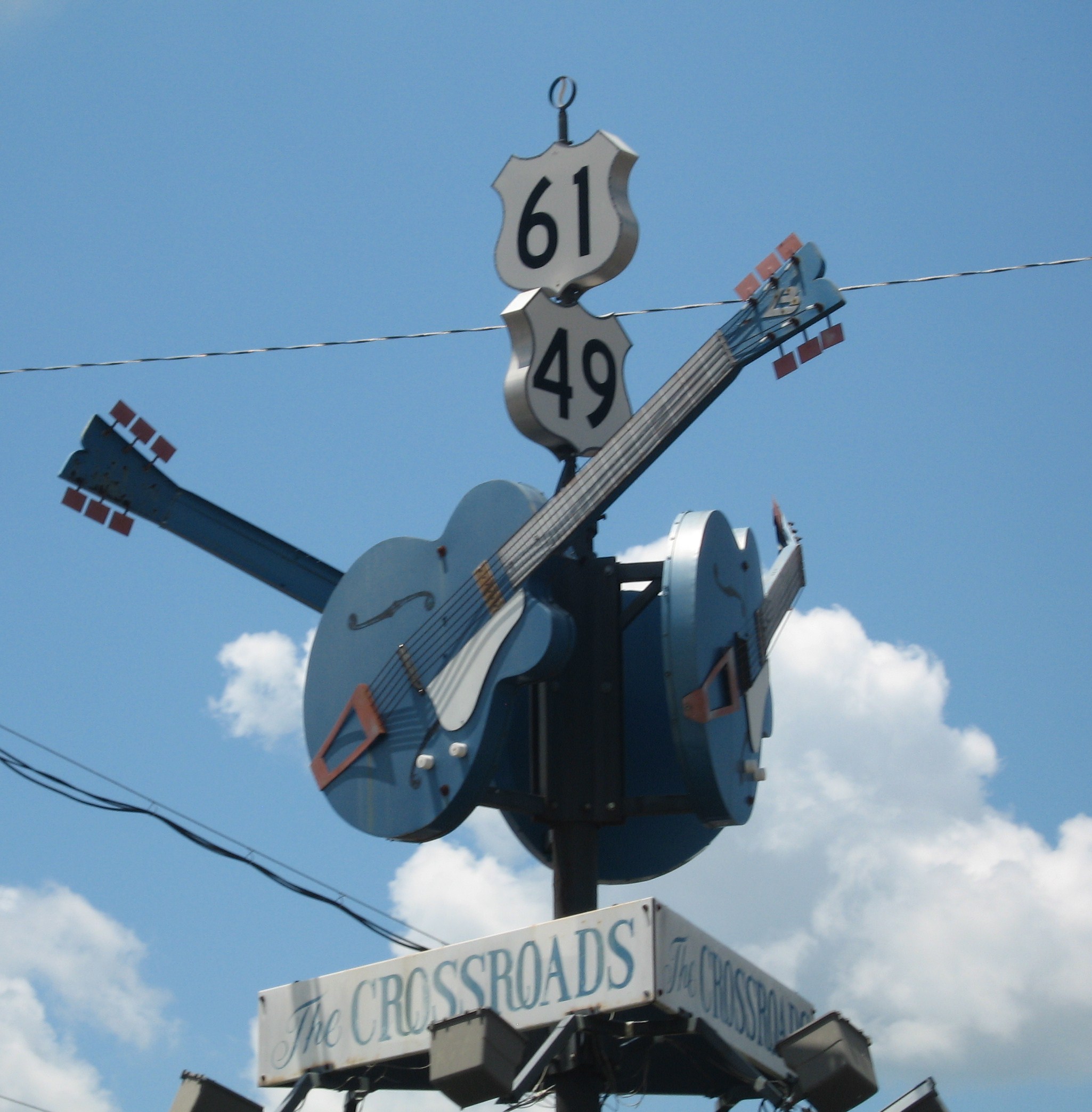
U.S. Route 61 or U.S. Highway 61 (U.S. 61) is a major United States highway that extends between New Orleans, Louisiana and the city of Wyoming, Minnesota. The highway generally follows the course of the Mississippi River and is designated the Great River Road for much of its route. As of 2004, the highway's northern terminus in Wyoming, Minnesota, is at an intersection with Interstate 35 (I-35). Until 1991, the highway extended north on what is now Minnesota State Highway 61 (MN 61) through Duluth to the Canada–U.S. border near Grand Portage. Its southern terminus in New Orleans is at an intersection with U.S. Route 90 (US 90). The route was an important south–north connection in the days before the interstate highway system. The highway is often called the Blues Highway because of its long history in blues music; Part of the route lies on the Mississippi Blues Trail and is denoted by markers in Vicksburg and Tunica. It is also the subject of numerous musical works, ... [...More Info...] [...Related Items...] OR: [Wikipedia] [Google] [Baidu] |
US 40
U.S. Route 40 or U.S. Highway 40 (US 40), also known as the Main Street of America, is a major east–west United States Highway traveling across the United States from the Mountain States to the Mid-Atlantic States. As with most routes whose numbers end in a zero, US 40 once traversed the entire United States. It is one of the first U.S. Highways created in 1926 and its original termini were in San Francisco, California, and Atlantic City, New Jersey. US 40 currently ends at a junction with I-80 in Silver Summit, Utah, just outside Salt Lake City. West of this point US 40 was functionally replaced with I-80, and as these segments of I-80 were constructed the western portion of US 40 was truncated several times. Starting at its western terminus in Utah, US 40 crosses a total of 12 states, including Colorado, Kansas, Missouri, Illinois, Indiana, Ohio, West Virginia, Pennsylvania, Maryland, Delaware, and New Jersey. US 40 passes through or by major ci ... [...More Info...] [...Related Items...] OR: [Wikipedia] [Google] [Baidu] |
Business Routes Of Interstate 70
Business routes of Interstate 70 (I-70) exist in three states, though historically they have existed in five. Utah and Missouri each have three existing Interstate 70 (I-70) business routes. Business routes in Kansas have either been proposed and rejected or decommissioned. Another 13 I-70 business routes also exist in Colorado, and four others have also existed in the past, leading to a grand total of 17 within the Centennial State. Utah Richfield business loop Interstate 70 Business (I-70 Bus.) is a business loop of I-70 along State Route 120 (SR-120) in Richfield that runs between exits 37 and 40. Salina business spur Interstate 70 Business (I-70 Bus.) is a business spur of I-70 along U.S. Route 50 (US 50)/ US 89 in Salina running north from exit 56 for until terminating at the end of the US 50/US 89 overlap. Green River business loop Interstate 70 Business (I-70 Bus.) is a business loop of I-70 along SR-19 i ... [...More Info...] [...Related Items...] OR: [Wikipedia] [Google] [Baidu] |
Business Loop 70
The Interstate Highway System of the United States, in addition to being a network of freeways, also includes a number of Business Routes assigned by the American Association of State Highway and Transportation Officials (AASHTO). These routes connect a central or commercial district of a city or town with an Interstate bypass, and are signed with green shields resembling the Interstate Highway shield. The word BUSINESS is used instead of INTERSTATE, and, above the number, where the state name is sometimes included, the word LOOP or SPUR appears. A business loop has both ends as its "parent", while a business spur has a "dangling end", sometimes running from the end of the Interstate to the downtown area. As the main purpose of a Business Interstate is to serve a downtown area, it is typically routed on surface roads. Thus Business Interstates do not have to meet Interstate Highway standards and are not considered part of the Interstate Highway System. AASHTO does, however, apply s ... [...More Info...] [...Related Items...] OR: [Wikipedia] [Google] [Baidu] |
Interstate 70 In Missouri
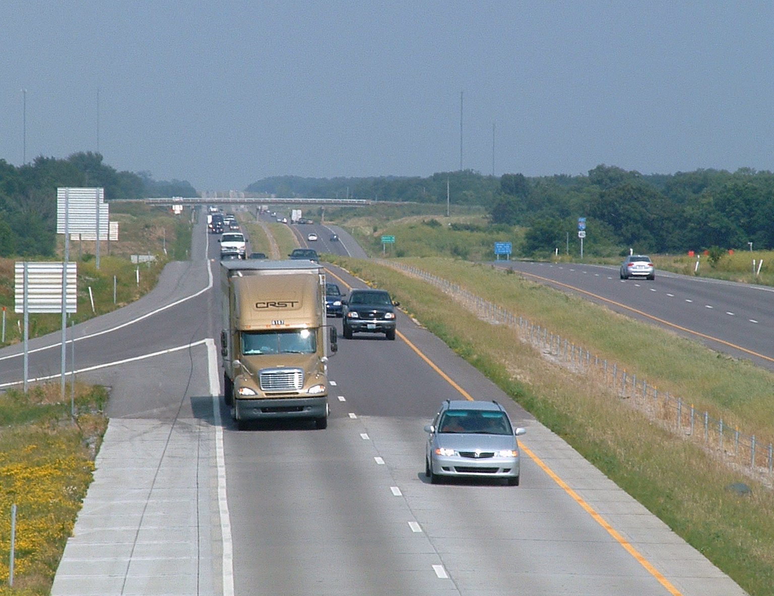
Interstate 70 (I-70) in the US state of Missouri is generally parallel to the Missouri River. This section of the transcontinental Interstate begins at the Kansas state line on the Lewis and Clark Viaduct, running concurrently with U.S. Route 24 (US 24), US 40, and US 169, and the east end is on the Stan Musial Veterans Memorial Bridge in St. Louis. Route description Crossing into Missouri on the Lewis and Clark Viaduct, I-70 immediately encounters the Alphabet Loop, a small but complex loop of freeways with all of its exits having the number 2 and a letter suffix that uses the entire alphabet (except I, O, and Z). I-70 runs concurrently with I-35 once it enters into the Loop. Both Interstates maintain the concurrency until they approach the northeastern corner of the Loop. Back at the northwest corner, US 169 splits off to the north, leaving four routes concurrent with each other. There is a large interchange with Route 9 in th ... [...More Info...] [...Related Items...] OR: [Wikipedia] [Google] [Baidu] |
I-70 (MO)
Interstate 70 (I-70) in the US state of Missouri is generally parallel to the Missouri River. This section of the transcontinental Interstate begins at the Kansas state line on the Lewis and Clark Viaduct, running concurrently with U.S. Route 24 (US 24), US 40, and US 169, and the east end is on the Stan Musial Veterans Memorial Bridge in St. Louis. Route description Crossing into Missouri on the Lewis and Clark Viaduct, I-70 immediately encounters the Alphabet Loop, a small but complex loop of freeways with all of its exits having the number 2 and a letter suffix that uses the entire alphabet (except I, O, and Z). I-70 runs concurrently with I-35 once it enters into the Loop. Both Interstates maintain the concurrency until they approach the northeastern corner of the Loop. Back at the northwest corner, US 169 splits off to the north, leaving four routes concurrent with each other. There is a large interchange with Route 9 in the ... [...More Info...] [...Related Items...] OR: [Wikipedia] [Google] [Baidu] |
Wentzville, Missouri
Wentzville is an exurb of St. Louis that is located in western St. Charles County, Missouri, United States. As of the 2020 census, the city had a total population of 44,372, making it the 15th largest city in Missouri. Wentzville has been the fastest growing city in Missouri, by percentage population increase, for two consecutive decades from 2000 to 2020. As the site of the Rotary Park, Wentzville is host to the St. Charles County Fair and the St. Louis Renaissance Festival. History Wentzville was laid out in 1855. The community has the name of the chief engineer of the Northern Missouri Railroad Erasmus Livingston Wentz. A post office called Wentzville has been in operation since 1859. The Wentzville Tobacco Company Factory was listed on the National Register of Historic Places in 1990. Wentzville is the location of the first Vietnam Veterans Memorial in the United States. It began as a tree of lights to help raise money in 1967 to send gifts to active servicemen, but later ... [...More Info...] [...Related Items...] OR: [Wikipedia] [Google] [Baidu] |
Interstate 64 In Missouri
Interstate 64 (I-64) passes through the Greater St. Louis area in the US state of Missouri. The entire route overlaps U.S. Route 40 (US 40). Because the road was a main thoroughfare in the St. Louis area before the development of the Interstate Highway System, it is not uncommon for locals to refer to the stretch of highway as "Highway 40" rather than "I-64". On December 6, 2009, the portion of the highway running through the city of St. Louis was named the Jack Buck Memorial Highway in honor of the late sportscaster. Route description I-64 begins at an interchange with I-70, US 40, and US 61 in St. Charles County and heads south. Previously, the freeway was a divided highway signed only as US 40 with at-grade intersections, which were slowly converted to limited-access exits. The final intersection at Callahan Road was removed on October 14, 2009. The next major exit is for Route N and the western terminus of Route 364. ... [...More Info...] [...Related Items...] OR: [Wikipedia] [Google] [Baidu] |
I-64 (MO)
Interstate 64 (I-64) passes through the Greater St. Louis area in the US state of Missouri. The entire route overlaps U.S. Route 40 (US 40). Because the road was a main thoroughfare in the St. Louis area before the development of the Interstate Highway System, it is not uncommon for locals to refer to the stretch of highway as "Highway 40" rather than "I-64". On December 6, 2009, the portion of the highway running through the city of St. Louis was named the Jack Buck Memorial Highway in honor of the late sportscaster. Route description I-64 begins at an interchange with I-70, US 40, and US 61 in St. Charles County and heads south. Previously, the freeway was a divided highway signed only as US 40 with at-grade intersections, which were slowly converted to limited-access exits. The final intersection at Callahan Road was removed on October 14, 2009. The next major exit is for Route N and the western terminus of Route 36 ... [...More Info...] [...Related Items...] OR: [Wikipedia] [Google] [Baidu] |


