|
Sprouston
Sprouston is a village, parish and former feudal barony in the Scottish Borders area of Scotland, as well as the historic county of Roxburghshire, located 2 miles north-east of Kelso.Survey Gazetteer of the British Isles, publ. J.G. Bartholomew, 1904, p. 746 The village is close to the south bank of the river Tweed (200 yards awayNew Statistical Account of Scotland, Vol III Roxburgh, Peebles, Selkirk, publ.William Blackwood, 1845 pp.235-240), which forms the northern boundary of the parish. The eastern border of the parish is also the border with England and with the parish of Carham, Northumberland in that country, Sprouston being the last Scottish parish on the south side of the Tweed. The parish of Linton borders Sprouston to the south and the parishes of Eckford and Kelso to the west. The parish forms a rough square shape about 4 miles across and has an area of 8637 acres Sprouston Community Council covers roughly the same area as the civil parish. History The earli ... [...More Info...] [...Related Items...] OR: [Wikipedia] [Google] [Baidu] |
The Kelso And Jedburgh Railway Branch Lines
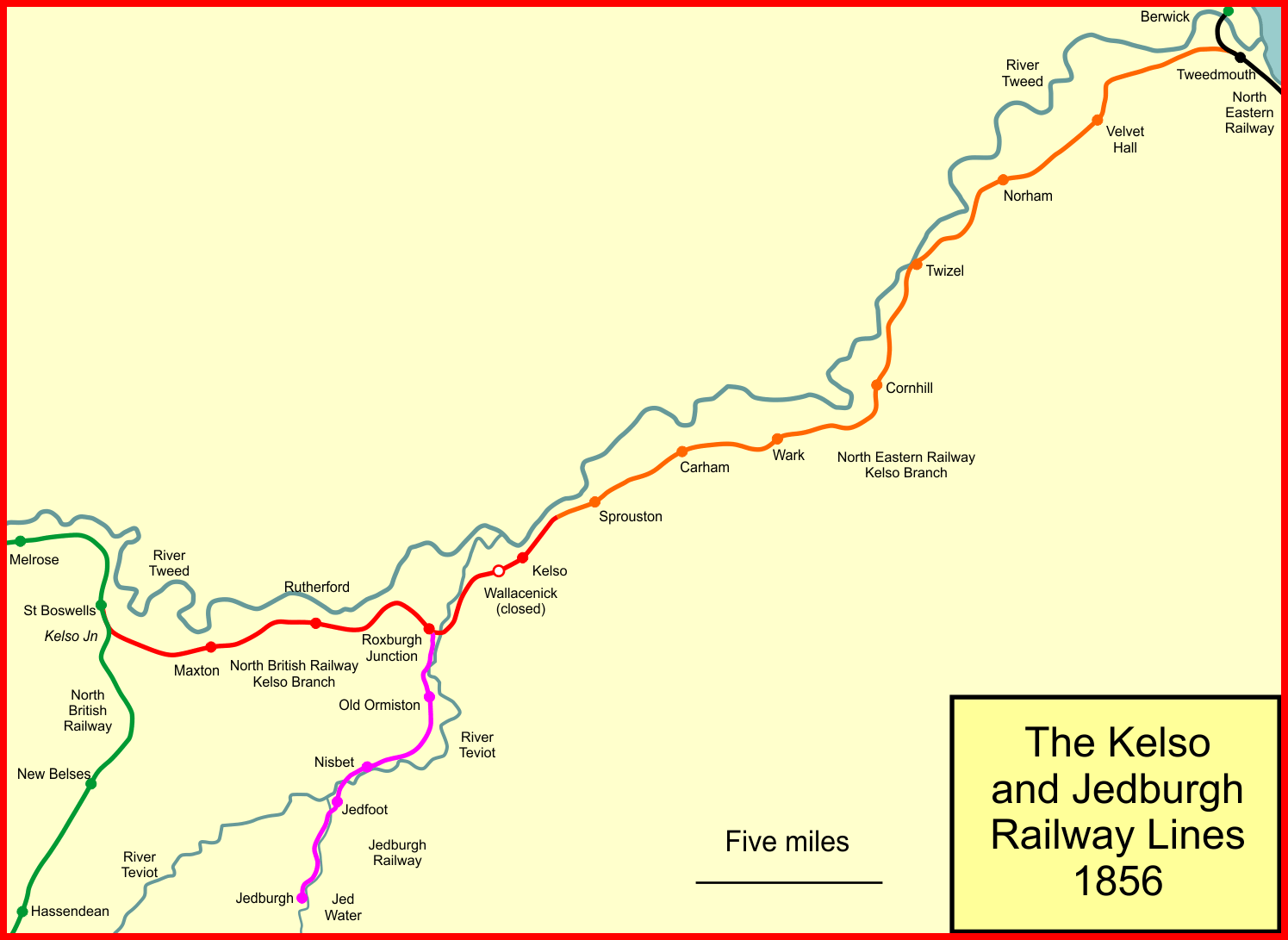
The Railway of Kelso and Jedburgh branch lines was a 'network' of three distinct railway services serving Kelso in the Scottish Borders. The first of these was a branch of the Newcastle and Berwick Railway, departing from a junction at Tweedmouth, near Berwick-upon-Tweed, and initially terminating at Sprouston, two miles west of Kelso. This was opened in 1849. The second line, opened in 1850, was a branch of the North British Railway which departed from the line for Hawick at St Boswells and initially terminated at a second temporary station just outside Kelso. After another year, in 1851, the gap between the two Kelso stations was closed and a permanent station at Kelso opened. The two companies, however, operated under competing managements and failed to develop a through service over the line. Around five years later, in 1856, a further independent company, the Jedburgh Railway, opened its connection for Jedburgh. This branch departed from the Kelso line at the Roxburgh ... [...More Info...] [...Related Items...] OR: [Wikipedia] [Google] [Baidu] |
Roxburghshire
Roxburghshire or the County of Roxburgh ( gd, Siorrachd Rosbroig) is a historic county and registration county in the Southern Uplands of Scotland. It borders Dumfriesshire to the west, Selkirkshire and Midlothian to the north-west, and Berwickshire to the north. To the south-west it borders Cumberland and to the south-east Northumberland, both in England. It was named after the Royal Burgh of Roxburgh, a town which declined markedly in the 15th century and is no longer in existence. Latterly, the county town of Roxburghshire was Jedburgh. The county has much the same area as Teviotdale, the basin drained by the River Teviot and tributaries, together with the adjacent stretch of the Tweed into which it flows. The term is often treated as synonymous with Roxburghshire, but may omit Liddesdale as Liddel Water drains to the west coast.Ordnance Gazetteer of Scotland, by, Francis Groome, publ. 2nd edition 1896. Article on Roxburghshire History The county appears to have orig ... [...More Info...] [...Related Items...] OR: [Wikipedia] [Google] [Baidu] |
Lempitlaw
Lempitlaw is a hamlet, former parish and former feudal barony in the Scottish Borders area of Scotland, as well as the historic county of Roxburghshire. History The parish was joined with Sprouston in the 16th century. The former parish forms the southern part of the current Sprouston parish. The remains of the kirk (church) were visible until the late 18th century. The barony of Lempitlaw was granted by David I of Scotland to Richard Germyn. In the 19th century the barony was in the possession of the Duke of Buccleuch Buccleuch may refer to: __NOTOC__ Places Australia * Buccleuch County, an administrative division in New South Wales, Australia * Buccleuch, South Australia, a small locality and railway station * County of Buccleuch, an administrative division in ...,New Statistical Account of Scotland, Vol III Roxburgh, Peebles, Selkirk, publ.William Blackwood, 1845. pp.235-240 References {{coord, 55, 35, 16, N, 2, 20, 23, W, type:city_region:GB, display=title Popula ... [...More Info...] [...Related Items...] OR: [Wikipedia] [Google] [Baidu] |
Battle Of Haddon Rig
The Battle of Hadden Rig was a battle fought about three miles east of Kelso, in the Scottish Borders, between Scotland and England on 24 August 1542, during the reigns of King James V of Scotland and Henry VIII of England. The English army was led by Robert Bowes, Deputy Warden of the English East March. It was a significant Scottish victory, but it was overshadowed by the disastrous Scottish defeat at the Battle of Solway Moss in November. "Roy depicts a small medieval settlement at Hadden surrounded by agricultural land but there is no reference to Haddon Rig. However, it is named Crawford and Brooke's 1843 county map of Roxburghshire. The First Edition Ordnance Survey (1859) map depicts a woodland plantation Haddonrig Wood, within an area of land called Haddon Rig. To the west of Haddon rig wood is a small circular area of woodland named Jockscairn plantation, the naming of which may have some association with the battle, or its commemoration. Immediately to the so ... [...More Info...] [...Related Items...] OR: [Wikipedia] [Google] [Baidu] |


