|
Spokane Metropolitan Area
The Spokane–Spokane Valley Metropolitan Statistical Area, as defined by the United States Census Bureau, is an area consisting of Spokane and Stevens counties in Washington state, anchored by the city of Spokane and its largest suburb, Spokane Valley. As of July 1, 2021, the MSA had an estimated population of 593,466. The Spokane Metropolitan Area and the neighboring Coeur d'Alene metropolitan area, make up the larger Spokane–Coeur d'Alene combined statistical area. The urban areas of the two MSAs largely follow the path of Interstate 90 between Spokane and Coeur d'Alene. In 2010, the Spokane–Spokane Valley MSA had a gross metropolitan product of $20.413 billion. Counties *Spokane * Stevens Communities Over 200,000 inhabitants *Spokane - (principal city) 50,000 to 199,999 inhabitants *Spokane Valley - (principal city) 10,000 to 49,999 inhabitants * Airway Heights * Cheney * Fairwood * Liberty Lake 5,000 to 9,999 inhabitants * Country Homes * Fairchild AFB * ... [...More Info...] [...Related Items...] OR: [Wikipedia] [Google] [Baidu] |
Metropolitan Statistical Area
In the United States, a metropolitan statistical area (MSA) is a geographical region with a relatively high population density at its core and close economic ties throughout the area. Such regions are neither legally Incorporated town, incorporated as a city or town would be, nor are they legal administrative divisions like County (United States), counties or separate entities such as U.S. state, states; because of this, the precise definition of any given metropolitan area can vary with the source. The statistical criteria for a standard metropolitan area were defined in 1949 and redefined as metropolitan statistical area in 1983. A typical metropolitan area is centered on a single large city that wields substantial influence over the region (e.g., New York City or Chicago). However, some metropolitan areas contain more than one large city with no single municipality holding a substantially dominant position (e.g., Dallas–Fort Worth metroplex, Hampton Roads, Virginia B ... [...More Info...] [...Related Items...] OR: [Wikipedia] [Google] [Baidu] |
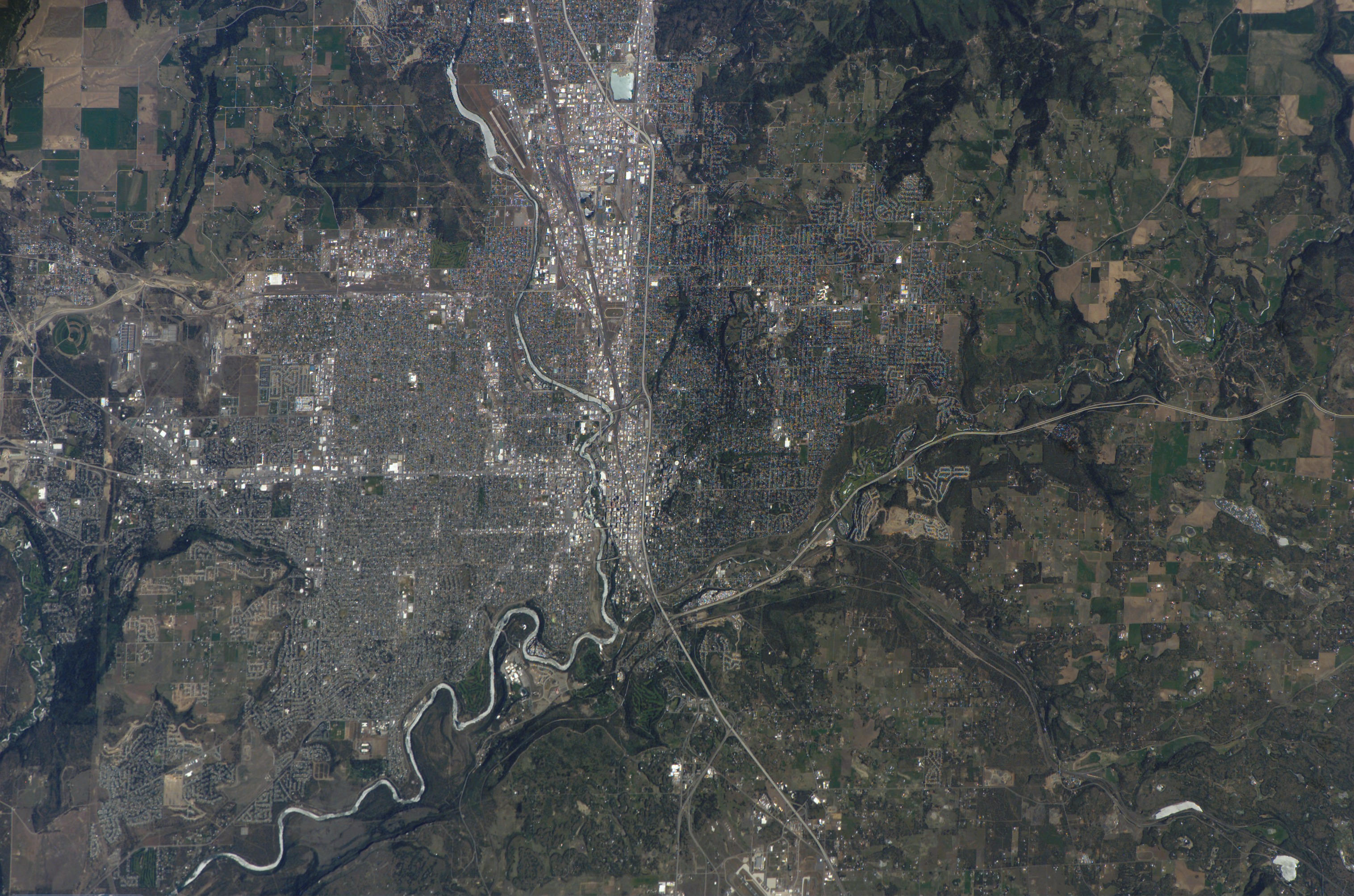
ISS015-E-7200 - View Of Washington
The International Space Station (ISS) is the largest modular space station currently in low Earth orbit. It is a multinational collaborative project involving five participating space agencies: NASA (United States), Roscosmos (Russia), JAXA (Japan), ESA (Europe), and CSA (Canada). The ownership and use of the space station is established by intergovernmental treaties and agreements. The station serves as a microgravity and space environment research laboratory in which scientific research is conducted in astrobiology, astronomy, meteorology, physics, and other fields. The ISS is suited for testing the spacecraft systems and equipment required for possible future long-duration missions to the Moon and Mars. The ISS programme evolved from the Space Station ''Freedom'', a 1984 American proposal to construct a permanently crewed Earth-orbiting station, and the contemporaneous Soviet/Russian ''Mir-2'' proposal from 1976 with similar aims. The ISS is the ninth space station to be i ... [...More Info...] [...Related Items...] OR: [Wikipedia] [Google] [Baidu] |
Millwood, Washington
Millwood is a city in Spokane County, Washington, United States. The population was 1,786 at the 2010 census. Millwood is a suburb of Spokane, and is surrounded on three sides by the city of Spokane Valley. The Spokane River flows along the northern edge of the city. Government The city government is organized using the Mayor-Council form. The mayor as of November 2022 is Kevin Freeman, who was first elected in November 2013 and took office in January 2014. In November 2017, he was elected to his second term. Freeman is simultaneously a member of the board of directors for the Spokane Regional Health District, and the Spokane Regional Clean Air Agency. The city council consists of five members, who are elected to serve terms of four years. History Millwood was officially incorporated on October 26, 1927. It was named for the local sawmill. According to the Tacoma Public Library's Washington Place Names database: "In 1900, it was chosen as a station by the Spokane-Coeur d'Al ... [...More Info...] [...Related Items...] OR: [Wikipedia] [Google] [Baidu] |
Kettle Falls, Washington
Kettle Falls is a city in Stevens County, Washington, United States, named for the nearby Kettle Falls on the Kettle River. The city itself is located on the Colville River immediately upstream from its confluence with the Columbia River. The population of the city was 1,595 at the time of the 2010 census, a 4.5% increase over the 2000 census. History The original Kettle Falls was officially incorporated on December 17, 1891 on the bank of the Columbia. After it was flooded by the Grand Coulee Dam in 1940, city planners relocated the town at a community called Meyers Falls, near the railroad lines, helping to ensure its success as a trans-shipment point for the logging, agriculture, and paper industries. This is its present location, eight miles northwest of Colville and roughly 80 miles northwest of Spokane. Geography It is south of the Canada–United States border at Laurier and adjacent to Lake Roosevelt, the reservoir of the Columbia River. According to the United St ... [...More Info...] [...Related Items...] OR: [Wikipedia] [Google] [Baidu] |
Deer Park, Washington
Deer Park is a city in Spokane County, Washington. The population was 3,652 at the time of the 2010 census, up from 3,017 in 2000. History North of Spokane, the city of Deer Park was officially incorporated on June 24, 1908. Deer Park got its name when railroad surveyors saw deer grazing in the area. It was settled in 1889 when a railroad siding was built for the Spokane Falls & Northern Railway. Soon the Standard Lumber Company sawmill was established by William Short and George Crawford to provide the lumber needed to rebuild the nearby city of Spokane Falls (later renamed Spokane) following the great fire of 1889. By 1900 the population of Deer Park was approximately 300 residents. In addition to the sawmill, the community consisted of three general stores (owned separately by P. Kelly, Dan Weis, and A. Baldwin), a blacksmith and harness shop, a livery and feed stable, Jeff Moore's hotel, Dr. Prince's drug store, a public school with approximately 75 students, and a Congreg ... [...More Info...] [...Related Items...] OR: [Wikipedia] [Google] [Baidu] |
Colville, Washington
Colville is a city in Stevens County, Washington, United States. The population was 4,673 at the 2010 census. It is the county seat of Stevens County. History John Work, an agent for The Hudson's Bay Company, established Fort Colvile near the Kettle Falls fur trading site in 1825. It replaced the Spokane House and the Flathead Post as the main trading center on the Upper Columbia River. The area was named for Andrew Colvile, a Hudson's Bay Company governor. The fort continued to be used for some time as a center of mining and transportation/supply support associated with gold rushes in the 1850s, particularly the Fraser Canyon Gold Rush. After it was abandoned in 1870, some buildings stood until as late as 1910. The site was flooded by Lake Roosevelt after construction of the Grand Coulee Dam on the Columbia River. Americans also wanted to operate in this territory. In the first half of the 19th century, the Oregon boundary dispute (or Oregon question) arose as a result of co ... [...More Info...] [...Related Items...] OR: [Wikipedia] [Google] [Baidu] |
Chewelah, Washington
Chewelah ( ) is a city in Stevens County, Washington, United States. It is located approximately northwest of Spokane. The population was 2,607 at the 2010 census, a 19.3% increase from 2000. History The name of the town comes from a Kalispel word, , meaning 'watersnake' or ' gartersnake'. Prior to colonization by European-Americans, Chewelah was home to a band of the Kalispel people. The band was known as the ''slet̓éw̓si'', meaning "valley people". Originally, the area was called Fool's Prairie, after the indigenous Kalispel who left his own tribe because of a dispute. Chewelah and the rest of the Colville River Valley were part of the Colville Indian Reservation from April 9, 1872, when the reservation was created, until July 2, 1872, when a subsequent executive order reduced the size of the reservation. The Chewelah Band of Indians is currently part of the Spokane Tribe. Thomas and Mary Brown moved to the Fool's Prairie in 1859. On May 8, 1872, Thomas Brown received aut ... [...More Info...] [...Related Items...] OR: [Wikipedia] [Google] [Baidu] |
Town And Country, Washington
Town and Country (often referred to locally as 'Lynwood') is a census-designated place (CDP) in Spokane County, Washington, United States. The population was 5,068 at the 2020 census. Geography Town and Country is located at (47.721441, -117.421383). According to the United States Census Bureau, the CDP has a total area of 1.2 square miles (3.6 km2), all of it land. The city of Spokane surrounds the CDP on three sides: the east, south and west. The city's street grid continues into Town and Country uninterrupted in the east, though it breaks down in the west along the bluff leading up to Five Mile Prairie. The bulk of the CDP lies on flat ground like the surrounding north side of Spokane. Along the west, however, the terrain rises rapidly from Town and Country's elevation of roughly 2,000 feet to over 2,300 at the crest over less than 1,000 feet of distance in places. As is the case with the city of Spokane to the east and south, Town and Country blends into its nei ... [...More Info...] [...Related Items...] OR: [Wikipedia] [Google] [Baidu] |
Otis Orchards-East Farms, Washington
Otis Orchards-East Farms is a census-designated place (CDP) in Spokane County, Washington, United States, near the county's border with Idaho. The population was 6,220 at the 2010 census. The CDP includes the unincorporated communities of Otis Orchards and East Farms. Otis Orchards contains the bulk of the businesses of the community. Otis Orchards-East Farms is north of the Spokane River from Liberty Lake, Washington and west of Rathdrum, Idaho and Stateline, Idaho. Part of Otis Orchards was recently incorporated into the new city of Spokane Valley. Otis Orchards is in the eastern part of the Spokane River valley, and is in the Spokane, Washington metro area. Geography Otis Orchards-East Farms CDP is located at (47.704799, -117.079874). According to the United States Census Bureau, the CDP has a total area of 8.1 square miles (21.1 km2), of which, 8.1 square miles (20.8 km2) of it is land and 0.1 square miles (0.3 km2) of it (1.23%) is water. De ... [...More Info...] [...Related Items...] OR: [Wikipedia] [Google] [Baidu] |
Medical Lake, Washington
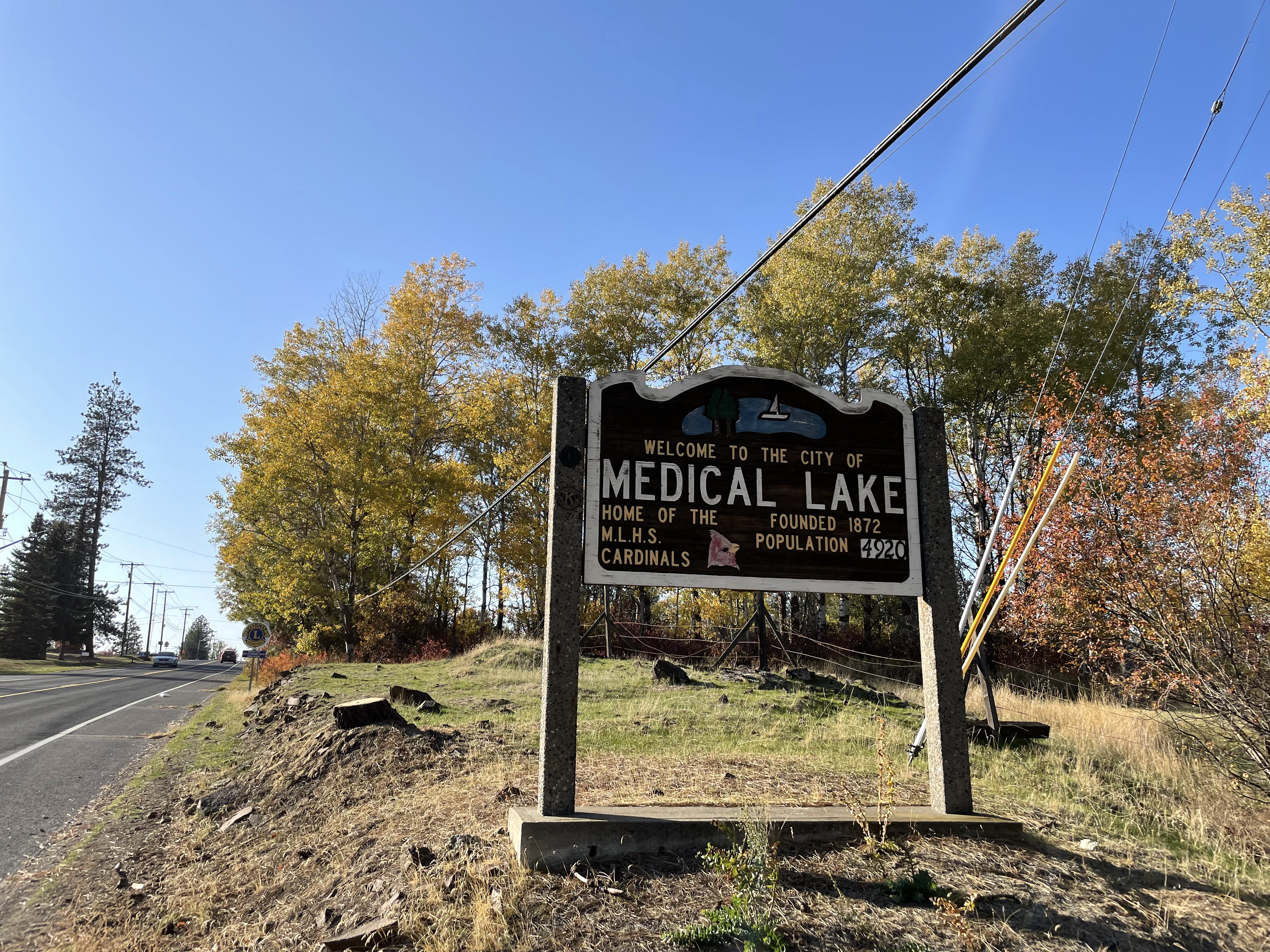
Medical Lake is a small city in Spokane County, eastern Washington, United States. At the 2010 census, the population was 5,060. The city is the site of a psychiatric hospital, Eastern State Hospital, and of Fairchild Air Force Base, two major employers. History The city of Medical Lake was incorporated in 1890. The city took its name from the nearby eponymous lake. The Spokane people, a Native American tribe which had long inhabited the area, believed the water and mud of the lake to possess curative properties. White settlers such as Andrew Lefevre and Stanley Hallett, who moved to the area in the 1870s, promoted this belief and marketed the lake salts for medicinal uses. A salt and soap industry developed here, followed by the construction of commercial bath houses in the 1880s. This was a period when springs and spas were popular developments across the country. Several resort hotels were constructed along the lake shore. In 1891, the state constructed Eastern State Hospi ... [...More Info...] [...Related Items...] OR: [Wikipedia] [Google] [Baidu] |
Mead, Washington
Mead is an unincorporated suburb and census-designated place north of Spokane, Washington, Spokane in Spokane County, Washington, Spokane County, Washington (state), Washington, United States. Named for Civil War general George Meade, this rural area is tracked by the United States Census Bureau. As of 2010, the population of Mead was 7,275. In 1900 Mead was the second stop on the Spokane Falls & Northern Railway. The community included the Cushing & Bryant general store, a blacksmith shop, a public school with approximately 60 students, a Methodist Episcopal church, and a Sunday school. At the time the post office was located in the Cushing & Bryant store. Mead is home to the computer game development firm, Cyan Worlds, makers of ''Myst'' and ''Riven''. The Kaiser Aluminum Mead Works, which operated as a leading area employer from 1942 until curtailment in 2001, is nearby. Mead is also home to the Hierophant Meadery, makers of Metheglin-style mead, otherwise known as honey win ... [...More Info...] [...Related Items...] OR: [Wikipedia] [Google] [Baidu] |
Fairchild AFB, Washington
Fairchild Air Force Base (AFB) is a United States Air Force base, located in the northwest United States in eastern Washington, approximately southwest of Spokane. The host unit at Fairchild is the 92nd Air Refueling Wing (92 ARW) assigned to the Air Mobility Command's Eighteenth Air Force. The 92 ARW is responsible for providing air refueling, as well as passenger and cargo airlift and aero-medical evacuation missions supporting U.S. and coalition conventional operations as well as U.S. Strategic Command strategic deterrence missions. Fairchild AFB was established in 1942 as the Spokane Army Air Depot. and is named in honor of General Muir S. Fairchild a World War I aviator from the state, he was the Vice Chief of Staff of the Air Force at the time of his death. During the Cold War, Fairchild was a Strategic Air Command (SAC) base for 45 years (1947–1992), with bombers and tankers, as well as missiles for a brief period (1960–1965). , the 92d Air Refueling Wing was ... [...More Info...] [...Related Items...] OR: [Wikipedia] [Google] [Baidu] |


