|
Soyuz-17 Cliff
Soyuz-17 Cliff () is a prominent rock cliff, 3.5 nautical miles (6 km) long, on the north side of Carlyon Glacier in the Cook Mountains. The cliff is 4 nautical miles (7 km) west-northwest of Cape Murray Conway Range () is a mountain range in the Cook Mountains of Antarctica, on the west edge of the Ross Ice Shelf. Location The Conway Range is in the northeast part of the Cook Mountains. It lies between Mulock Glacier to the north and Carlyon Gl ... and rises to c. . Named after the Soviet spacecraft Soyuz 17 of January 17, 1975. Cliffs of Oates Land {{OatesLand-geo-stub ... [...More Info...] [...Related Items...] OR: [Wikipedia] [Google] [Baidu] |
Carlyon Glacier
Carlyon Glacier () is a large glacier which flows east-southeast from the névé east of Mill Mountain to the Ross Ice Shelf at Cape Murray. It was mapped in 1958 by the Darwin Glacier party of the Commonwealth Trans-Antarctic Expedition (1956–58), and named by the New Zealand Antarctic Place-Names Committee New Zealand Antarctic Place-Names Committee (NZ-APC) is an adjudicating committee established to authorize the naming of features in the Ross Dependency on the Antarctic continent. It is composed of the members of the New Zealand Geographic Board pl ... for R.A. Carlyon, who with Harry Ayres made up the party. See also * Soyuz-17 Cliff * Yoshida Bluff References * Glaciers of Hillary Coast {{RossDependency-glacier-stub ... [...More Info...] [...Related Items...] OR: [Wikipedia] [Google] [Baidu] |
Cook Mountains
The Cook Mountains is a group of mountains bounded by the Mulock and Darwin glaciers in Antarctica. Parts of the group were first viewed from the Ross Ice Shelf by the British National Antarctic Expedition (1901–04). Additional portions of these mountains were mapped by a New Zealand party of the CTAE (1956–58), and they were completely mapped by the USGS from Tellurometer surveys and US Navy air photos, 1959–63. Named by the NZ-APC for Captain James Cook. Cook Mountains landforms include Bowling Green Col Bowling Green Col () is an ice-filled east–west col between Reeves Plateau and Bowling Green Plateau in the Cook Mountains. It was named by the Advisory Committee on Antarctic Names The Advisory Committee on Antarctic Names (ACAN or US-ACAN) is ..., Bowling Green Plateau, Bromwich Terrace, DeZafra Ridge, Soyuz-13 Rock, Schoonmaker Ridge, Wright Hill, and the Brown Hills. See also * Butcher Ridge, near the polar plateau in the west part of the Cook Mounta ... [...More Info...] [...Related Items...] OR: [Wikipedia] [Google] [Baidu] |
Cape Murray
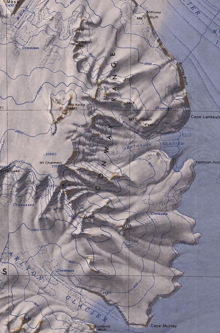
Conway Range () is a mountain range in the Cook Mountains of Antarctica, on the west edge of the Ross Ice Shelf. Location The Conway Range is in the northeast part of the Cook Mountains. It lies between Mulock Glacier to the north and Carlyon Glacier to the south, both of which empty into the Ross Ice Shelf. The Worcester Range forms the other side of the Mulock Glacier. The Heap Glacier enters the Mulock Glacier to the west of the north end of the range. The range was discovered by the British National Antarctic Expedition, 1901–1904, but the name appears to be first used in the reports of the British Antarctic Expedition, 1907–1909. Glaciers Bertoglio Glacier . Glacier long, flowing from the Conway Range eastward between Cape Lankester and Hoffman Point to the Ross Ice Shelf. Mapped by the USGS from tellurometer surveys and Navy air photos, 1959-63. Named by US-ACAN for Cdr. Lloyd W. Bertoglio, USN, commander of the McMurdo Station winter party, 1960. Coastal feature ... [...More Info...] [...Related Items...] OR: [Wikipedia] [Google] [Baidu] |
