|
Southwestern Railways
Southwestern Railways (PZZ), ( uk, Південно-Західна залізниця) headquartered in Kyiv, the capital of Ukraine, is a component part of the Ukrzaliznytsia company, its regional branch. It is named "Southwestern" because it is Southwest of Moscow, despite being in the Northern part of Ukraine. Structure As of 2008, SWR's rail system included of track, of which 93,3% were electrified. The SWR consists of five sections (directions) named after the cities of their administration seat * Kyiv * Kozyatyn * Zhmerynka * Korosten * Konotop. The above mentioned directions administrative seats beside regular train stations have also locomotive and railcar depots. In addition such depots also are located in Shepetivka, Darnytsia (left-bank Kyiv), Bakhmach, Vorozhba, Hrechany (neighborhood of Khemlnytskyi), and Snovsk (formerly Shchors). There are 315 railway stations in the SWR system. Geography SWR's route map includes all the railroads in the Kyiv, Zhyt ... [...More Info...] [...Related Items...] OR: [Wikipedia] [Google] [Baidu] |
Central Ukraine
Central Ukraine ( uk, Центральна Україна, ''Tsentralna Ukraina'') consists of historical regions of left-bank Ukraine and right-bank Ukraine that reference to the Dnipro River. It is situated away from the Black Sea Littoral North and a midstream of the Dnipro River and its basin. Territory The cities of central Ukraine are among the oldest in Ukraine. Also in contrast to the southeastern portion of the country, the region is more agricultural with extensive grain and sunflower fields in the heart of Ukraine. Surzhyk, a term for mixed Russian-Ukrainian dialects, is commonly spoken throughout Central Ukraine, though, according to RATING and Research & Branding Group, most of the people self-identify as Ukrainian speakers.The language question, the results ... [...More Info...] [...Related Items...] OR: [Wikipedia] [Google] [Baidu] |
Russia
Russia (, , ), or the Russian Federation, is a transcontinental country spanning Eastern Europe and Northern Asia. It is the largest country in the world, with its internationally recognised territory covering , and encompassing one-eighth of Earth's inhabitable landmass. Russia extends across eleven time zones and shares land boundaries with fourteen countries, more than any other country but China. It is the world's ninth-most populous country and Europe's most populous country, with a population of 146 million people. The country's capital and largest city is Moscow, the largest city entirely within Europe. Saint Petersburg is Russia's cultural centre and second-largest city. Other major urban areas include Novosibirsk, Yekaterinburg, Nizhny Novgorod, and Kazan. The East Slavs emerged as a recognisable group in Europe between the 3rd and 8th centuries CE. Kievan Rus' arose as a state in the 9th century, and in 988, it adopted Orthodox Christianity from the ... [...More Info...] [...Related Items...] OR: [Wikipedia] [Google] [Baidu] |
Moscow Railway
Moscow Railway (russian: Московская железная дорога) is a subsidiary of Russian Railways that handles half of Russia's suburban railway operations and a quarter of the country's passenger traffic. As of 2009 the railway, which has its headquarters near Komsomolskaya Square in Moscow, employed 73 600 people.http://mzd.rzd.ru/ It manages railway services in much of Central Russia, including Moscow and Moscow Oblast (all railways except the railroad to Saint Petersburg, which is managed by October Railway), Smolensk, Vladimir, Ryazan, Tula, Kaluga, Bryansk, Oryol, Lipetsk, and Kursk Oblasts. Railway lines *Ryazansky suburban railway line * Kazansky suburban railway line * Gorkovsky suburban railway line *Kursky suburban railway line *Paveletsky suburban railway line *Kiyevsky suburban railway line *Belorussky suburban railway line *Rizhsky suburban railway line * Savyolovsky suburban railway line * Yaroslavsky suburban railway line * Little Ring of the Mo ... [...More Info...] [...Related Items...] OR: [Wikipedia] [Google] [Baidu] |
Belarus
Belarus,, , ; alternatively and formerly known as Byelorussia (from Russian ). officially the Republic of Belarus,; rus, Республика Беларусь, Respublika Belarus. is a landlocked country in Eastern Europe. It is bordered by Russia to the east and northeast, Ukraine to the south, Poland to the west, and Lithuania and Latvia to the northwest. Covering an area of and with a population of 9.4 million, Belarus is the 13th-largest and the 20th-most populous country in Europe. The country has a hemiboreal climate and is administratively divided into seven regions. Minsk is the capital and largest city. Until the 20th century, different states at various times controlled the lands of modern-day Belarus, including Kievan Rus', the Principality of Polotsk, the Grand Duchy of Lithuania, the Polish–Lithuanian Commonwealth, and the Russian Empire. In the aftermath of the Russian Revolution in 1917, different states arose competing for legitimacy amid the ... [...More Info...] [...Related Items...] OR: [Wikipedia] [Google] [Baidu] |
Belarusian Railway
Belarusian Railway (BCh) ( be, Беларуская чыгунка () / ''Biełaruskaja čyhunka'', russian: Белорусская железная дорога) is the national state-owned railway company of Belarus. It operates all of the rail transport network in Belarus. As of 2005, the railway employs 112,173 people. Overview The company, formed in 1992 after the dissolution of the Soviet Union, is one of the inheritors of the Soviet Railways. It administrates 5,512 km of railway with (). The railway's most important station is Minsk Terminal, the central station of the capital. BCh reports to the ministry of transport and as of 2010 was composed of 84 organizations; 46 enterprises, 38 institutions, and 7 factories/plants. The rail network is divided into 6 departments: named after the regions around Minsk, Baranovichi, Brest, Gomel, Mogilev and Vitebsk. Rolling stock ;Electric locomotives * ChS4T; Co'Co' electric locomotive * VL80, BCG-1; twin-unit (Bo'Bo')-(Bo' ... [...More Info...] [...Related Items...] OR: [Wikipedia] [Google] [Baidu] |
Administrative Divisions Of Ukraine
The administrative divisions of Ukraine ( Ukrainian: Адміністрати́вний у́стрій Украї́ни, tr. ''Administratyvnyi ustrii Ukrainy'') are subnational administrative divisions within the geographical area of Ukraine under the jurisdiction of the Ukrainian Constitution. Ukraine is a unitary state with three levels of administrative divisions: 27 regions (24 oblasts, two cities with special status and one autonomous republic), 136 raions and 1469 hromadas. The first tier consists of 27 subdivisions, of which there are 24 oblasts, one autonomous republic (Crimea) and two cities with special status ( Kyiv and Sevastopol). The second tier includes 136 raions. Ukraine directly inherited its administrative divisions from the local republican administration of the Soviet Union, the Ukrainian Soviet Socialist Republic, and the overall structure did not change significantly from the middle of the 20th century until reforms of July 2020; it was somew ... [...More Info...] [...Related Items...] OR: [Wikipedia] [Google] [Baidu] |
Sumy Oblast
Sumy Oblast ( uk, Сумська́ о́бласть, translit=Sumska oblast; also referred to as Sumshchyna – uk, Су́мщина) is an oblast (province) in the northeastern part of Ukraine. Population: The oblast was created in its most recent form, from the merging of raions from Kharkiv Oblast, Chernihiv Oblast, and Poltava Oblast in 1939 by the Presidium of the Supreme Soviet of the Soviet Union. The administrative center of the oblast is the city of Sumy. Other important cities within the oblast include Konotop, Okhtyrka, Romny, and Shostka. The oblast has a heavy mix of agriculture and industry, with over 600 industrial locations. Importantly, seven rivers pass through the oblast. Geography The Sumy Oblast is situated in the northeastern part of Ukraine. It is situated on a border of two historical regions of Ukraine — Cossack Hetmanate (annexed by Russia in the 18th century as Little Russia, previously known as Severia) and Sloboda Ukraine. El ... [...More Info...] [...Related Items...] OR: [Wikipedia] [Google] [Baidu] |
Khmelnytskyi Oblast
Khmelnytskyi Oblast ( uk, Хмельни́цька о́бласть, translit=Khmelnytska oblast; also referred to as Khmelnychchyna — uk, Хмельни́ччина) is an oblast (province) of western Ukraine covering portions of the historical regions of western Podolia and southern Volhynia. The administrative center of the oblast is the city of Khmelnytskyi. The current estimated population is around . Created in 1937 out of border okrugs of Vinnytsia Oblast, in 1941–44 it was under Nazi Germany occupation and part of the Reichskommissariat Ukraine (Wolhynien und Podolien general district). Following the Kamenets-Podolsky pocket in spring of 1944 as part of the Proskurov-Chernovtsy operation, Soviet troops removed the German occupation in the region. Until 4 February 1954 it was called Kamianets-Podilsky Oblast () and was centered in Kamianets-Podilsky until 1941. The region rebranding took place after the official renaming of the region's administrative center to ... [...More Info...] [...Related Items...] OR: [Wikipedia] [Google] [Baidu] |
Vinnytsia Oblast
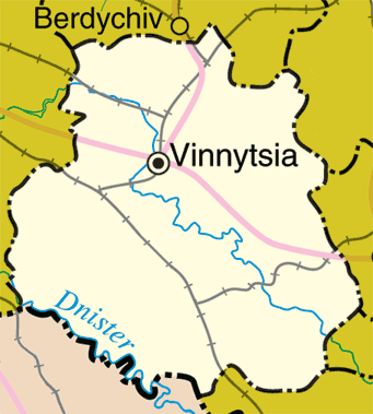
Vinnytsia Oblast ( uk, Ві́нницька о́бласть, translit=Vinnytska oblast; ; also referred to as Vinnychchyna — uk, Ві́нниччина) is an oblast of western and southwestern Ukraine. Its administrative center is Vinnytsia. The oblast has a population of History Vinnytsia Oblast, first established on February 27, 1932, originally comprised raions (regions) of the following former okruhas of Ukraine (districts of Soviet Ukraine): * Uman Okruha * Berdychiv Okruha * Vinnytsia Okruha * Mohyliv Okruha * Tulchyn Okruha * Shepetivka Okruha * Proskuriv Okruha * Kamianets Okruha In 1935 bordering territories of the oblast were transformed into Soviet border districts: Shepetivka Okrug, Proskuriv Okrug, and Kamianets Okrug. In 1937 the Kamianets Oblast, based on the border districts, was formed (it later became Khmelnytsky Oblast). During World War II the occupying Axis powers split the territory of Vinnytsia Oblast between the General District Shitomir (Zhy ... [...More Info...] [...Related Items...] OR: [Wikipedia] [Google] [Baidu] |
Chernihiv Oblast
Chernihiv Oblast ( uk, Черні́гівська о́бласть, translit=Chernihivska oblast; also referred to as Chernihivshchyna, uk, Черні́гівщина, translit=Chernihivshchyna) is an oblast (province) of northern Ukraine. The administrative center of the oblast is the city of Chernihiv. Within the Oblast are 1,511 settlements of various sizes ranging from large cities to very small villages. Population: Geography The total area of the province is around 31,900 km². On the west, the oblast is bordered by the Kyiv Reservoir of the Dnieper River and Kyiv Oblast, which has a enclave known as Slavutych, which was created from Chernihiv Oblast for the inhabitants of Chernobyl following the Chernobyl disaster. It is bordered by Sumy Oblast to the east and Poltava Oblast to the south. The northern border of the oblast is part of Ukraine's international border abutting Belarus's Homyel Voblast in the north-west and the Russian Bryansk Oblast in the nor ... [...More Info...] [...Related Items...] OR: [Wikipedia] [Google] [Baidu] |
Zhytomyr Oblast
Zhytomyr Oblast ( uk, Жито́мирська о́бласть, translit=Zhytomyrska oblast), also referred to as Zhytomyrshchyna ( uk, Жито́мирщина}) is an oblast (province) of northern Ukraine. The administrative center of the oblast is the city of Zhytomyr. Its population is approximately . History The oblast was created as part of the Ukrainian Soviet Socialist Republic on September 22, 1937, out of territories of Vinnytsia and Kyiv oblasts as well as two border okrugs of Kyiv Oblast – Korosten Okrug and Novohrad-Volynsky Okrug. The oblast covers territories of the historic regions of Polesia, Volhynia, and Podolia, which are reflected on the oblast's coat of arms. Before the 18th century bigger half of the oblast belonged to the Kyiv Voivodeship (), while smaller western half around the city of Zviahel belonged to the Volyn Voivodeship. Following the treaty of Andrusovo, the city of Zhytomyr () continued to act as an administrative center of the Ky ... [...More Info...] [...Related Items...] OR: [Wikipedia] [Google] [Baidu] |


_Zhitomir_Province%2C_Ukraine.jpg)