|
Southport Bathing Pavilion
Southport Bathing Pavilion is a heritage-listed changing rooms at Marine Parade, Southport, Gold Coast City, Queensland, Australia. It was designed by Hall & Phillips and built in 1934 by A. Ledbury. It was added to the Queensland Heritage Register on 13 January 1995. History This single storeyed building was built in 1934 by the Southport Town Council, as a dressing and showering facility for bathers using the Broadwater. The architects were Hall and Phillips and the contractor A. Ledbury, who built the pavilion at a cost of £1,195. The pavilion was erected at an important stage of the development of the coastal regions of South East Queensland. There was unprecedented growth in these areas as swimming and sun bathing became increasingly popular. The majority of the population, by the late 1930s benefited from paid holiday leave, increasing their leisure time. The councils of the various coastal regions were competing for holiday trade, beautification schemes and th ... [...More Info...] [...Related Items...] OR: [Wikipedia] [Google] [Baidu] |
Southport, Queensland
Southport is a coastal Suburbs and localities (Australia), suburb in the City of Gold Coast in Queensland, Australia. In the , Southport had a population of 31,908 people. It contains the Gold Coast central business district. Geography Southport is bounded to the south-east by the Nerang River (), where it flows into Gold Coast Broadwater, The Broadwater, the southernmost end of Moreton Bay, which then bounds the suburb to the north-east. King Reach is a reach () of the Nerang River. It was named in honour of Jeremy King (3 March 1935 - 13 October 2010) for his coaching, involvement and dedication to the sport of rowing within the Southport district. He was involved with rowing for over 50 years. It was gazetted on 28 November 2014. Ray Newlyn Channel is a channel () in The Broadwater. It is an east-to-west channel across The Broadwater to Main Beach, Queensland, Main Beach avoiding two large sandbanks. Raymond Paul (Ray) Newlyn was a Southport resident and a Commander in ... [...More Info...] [...Related Items...] OR: [Wikipedia] [Google] [Baidu] |
Beenleigh, Queensland
Beenleigh is a town and suburb in the City of Logan, Queensland, Australia. In the , the suburb of Beenleigh had a population of 8,252 people. A government survey for the new town was conducted in 1866. The town is the terminus for the Beenleigh railway line, which first opened in 1885 and a stop on the South Coast railway line, which reached Southport in 1889. Beenleigh was the administrative centre of the former Shire of Albert. It is known for the heritage-listed tourist attraction called the Beenleigh Artisan Distillery. In recent years it has seen many high rise developments. Geography Beenleigh and adjoining suburbs are located near the confluence of the Logan and Albert Rivers. The urban centre lies southwest of the Pacific Motorway after it crosses the Logan River and is crossed by the Gold Coast railway line. Logan River Parklands contain a boat ramp, barbeques, and a picnic area. Whilst it was once a stand-alone town built on sugar and home to Australia's olde ... [...More Info...] [...Related Items...] OR: [Wikipedia] [Google] [Baidu] |
Harry Bruce (politician)
Henry Adam Bruce (16 May 1884 – 11 October 1958), known as Harry Bruce, was an Australian politician and former union organiser. First entering state politics in Queensland before later entering Parliament of the Commonwealth. Biography Born in Wandiligong, Victoria, he was educated at Haileybury College in Melbourne before moving to Queensland to become a bushworker in 1902. Later, he was a sugar grower and an organiser of the Australian Workers' Union (AWU). In 1923 Bruce was elected to the Legislative Assembly of Queensland as the Labor member for the district of Kennedy. In 1932, he was elected as member for The Tableland. In that year he was appointed Secretary of Public Works; in 1938 he was also made Secretary of Public Instruction, a position he held until 1941. In 1947 he was transferred from Public Works to Public Instruction. During this time, the Bruce Highway was named in his honour. Bruce left the Queensland Legislative Assembly in 1950, and the following ... [...More Info...] [...Related Items...] OR: [Wikipedia] [Google] [Baidu] |
Queensland Times
''The Queensland Times'' is an online newspaper serving Ipswich, Queensland, Ipswich and surrounds in Queensland, Australia. The newspaper is owned by News Corp Australia. The circulation of ''The Queensland Times'' is 10,804 Monday to Friday and 14,153 on Saturday. ''The Queensland Times'' is circulated to the Ipswich city area (all residential suburbs including the new the suburbs Springfield, Springfield Lakes and Brookwater) and the Ipswich rural area including Harrisville, Queensland, Harrisville, Rosewood, Queensland, Rosewood, Laidley, Queensland, Laidley, Forest Hill, Queensland, Forest Hill, Lowood, Queensland, Lowood, Boonah, Queensland, Boonah, Aratula, Queensland, Aratula, Gatton, Queensland, Gatton, Esk, Queensland, Esk and Toogoolawah, Queensland, Toogoolawah. ''The Queensland Times'' website is part of the APN Regional News Network. History ''The Queensland Times'' is the oldest surviving provincial paper in Queensland. Founded on 4 July 1859 as the ''Ipswich H ... [...More Info...] [...Related Items...] OR: [Wikipedia] [Google] [Baidu] |
Southport Railway Station, Queensland
Southport is a seaside town in the Metropolitan Borough of Sefton in Merseyside, England. At the 2001 census, it had a population of 90,336, making it the eleventh most populous settlement in North West England. Southport lies on the Irish Sea coast and is fringed to the north by the Ribble estuary. The town is north of Liverpool and southwest of Preston. Within the boundaries of the historic county of Lancashire, the town was founded in 1792 when William Sutton, an innkeeper from Churchtown, built a bathing house at what is now the south end of Lord Street.''North Meols and Southport – a History'', Chapter 9, Peter Aughton (1988) At that time, the area, known as South Hawes, was sparsely populated and dominated by sand dunes. At the turn of the 19th century, the area became popular with tourists due to the easy access from the nearby Leeds and Liverpool Canal. The rapid growth of Southport largely coincided with the Industrial Revolution and the Victorian era ... [...More Info...] [...Related Items...] OR: [Wikipedia] [Google] [Baidu] |
Main Beach Pavilion
Main Beach Pavilion and Southport Surf Lifesaving Club are heritage-listed beach buildings off Macarthur Parade, Main Beach, Queensland, Australia. The Main Beach Pavilion was designed by Thomas Ramsay Hall and Lionel Blythewood Phillips of the architectural firm Hall and Phillips and built in 1934 for the Southport Town Council. The Surf Lifesaving Club was also designed by Hall and Phillips and built adjacent in 1936 for the club. They were added to the Queensland Heritage Register on 1 March 1995. History The Main Beach Pavilion and Southport Surf Lifesaving Club were constructed on Main Beach at Southport, in the mid 1930s by the Southport Town Council. The Main Beach Pavilion was erected in 1934, and provided public bathing facilities. The Surf Lifesaving Club was built 1936, and provided dormitory space, equipment shelter and club room facilities for the surf lifesavers. Both buildings were designed by Hall and Phillips. The buildings were erected during an important s ... [...More Info...] [...Related Items...] OR: [Wikipedia] [Google] [Baidu] |
Southport Pier, Gold Coast
Southport Pier is a pier spanning the Gold Coast Broadwater in Southport, a suburb on the Gold Coast in South East Queensland, Australia. The current pier was constructed in 2009, replacing a previous structure demolished in 1969. History Located in the sheltered Broadwater, the pier and its surrounds was an attraction to visitors in the late 19th and the first half of the 20th century who sailed along the coast or, after the arrival of the railway, traveled down from Brisbane by steam train. Passengers were also transported to Brisbane via steamboats. Southport has had a number of jetties along the curve of beach between the mouth of the Nerang River and Deep Water Point in Labrador, some of them operating concurrently, since the 1870s. Without a wharf or similar structure it was not possible to land goods or passengers directly onto the shore without using a smaller boat. Differing opinions were held within the growing township as to the best position for a wharf or jetty. I ... [...More Info...] [...Related Items...] OR: [Wikipedia] [Google] [Baidu] |
Newcastle, New South Wales
Newcastle ( ; Awabakal: ) is a metropolitan area and the second most populated city in the state of New South Wales, Australia. It includes the Newcastle and Lake Macquarie local government areas, and is the hub of the Greater Newcastle area, which includes most parts of the local government areas of City of Newcastle, City of Lake Macquarie, City of Cessnock, City of Maitland and Port Stephens Council. Located at the mouth of the Hunter River, it is the predominant city within the Hunter Region. Famous for its coal, Newcastle is the largest coal exporting harbour in the world, exporting 159.9 million tonnes of coal in 2017. Beyond the city, the Hunter Region possesses large coal deposits. Geologically, the area is located in the central-eastern part of the Sydney Basin. History Aboriginal history Newcastle and the lower Hunter Region were traditionally occupied by the Awabakal and Worimi Aboriginal people, who called the area Malubimba. Based on Aboriginal language refere ... [...More Info...] [...Related Items...] OR: [Wikipedia] [Google] [Baidu] |
Bondi Beach
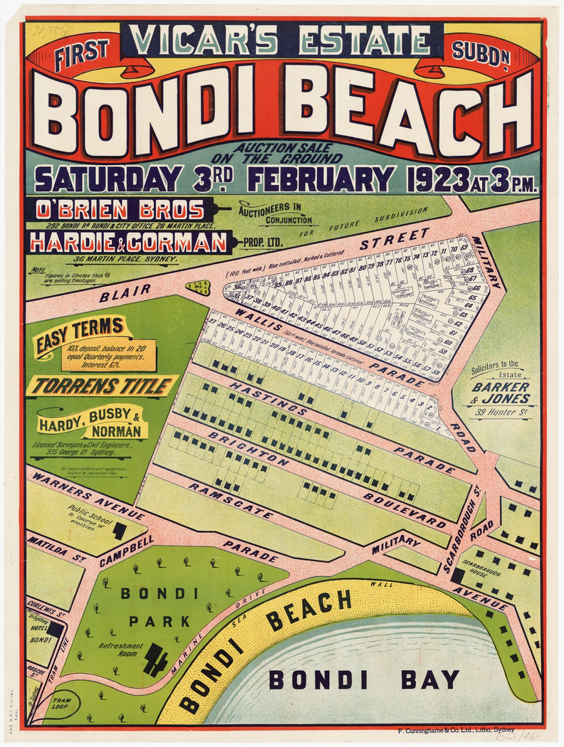
Bondi Beach is a popular beach and the name of the surrounding suburb in Sydney, New South Wales, Australia. Bondi Beach is located east of the Sydney central business district, in the local government area of Waverley Council, in the Eastern Suburbs. It has a population of 11,656 residents. Its postcode is 2026. Bondi, North Bondi, and Bondi Junction are neighboring suburbs. Bondi Beach is one of the most visited tourist sites in Australia. History "Bondi," originally "Boondi" is an Aboriginal word which has the same meaning as the word "surf" in English. The first record of "bondi" by European-ancestry Australians was made between 1899 and 1903. It describes the meaning as "noise made by sea waves breaking on the beach," which is essentially the definition of "surf" in contemporary American English. The Australian Museum records that Bondi means ''place where a fight using bondi sticks (nulla nullas or fighting sticks) took place''. In 1809 the road builder William ... [...More Info...] [...Related Items...] OR: [Wikipedia] [Google] [Baidu] |
Manly, New South Wales
Manly is a beach-side suburb of northern Sydney, in the state of New South Wales, Australia. It is north-east of the Sydney central business district and is currently one of the three administrative centres of the Local government in Australia, local government area of Northern Beaches Council. Manly has a long-standing reputation as a Tourism, tourist destination, owing to its attractive setting on the Pacific Ocean and easy accessibility by Sydney Ferries, ferry. History Manly was named by Arthur Phillip, Captain Arthur Phillip for the Australian aborigine, Indigenous people living there, stating that "their confidence and manly behaviour made me give the name of Manly Cove to this place". These men were of the Kay-ye-my clan (of the Dharug-speaking Gayemaygal people). While scouting for fresh water in the area, Phillip encountered members of the clan, and after a misunderstanding he was speared in the shoulder by one of the clan as a punishment ritual; the progressively-min ... [...More Info...] [...Related Items...] OR: [Wikipedia] [Google] [Baidu] |
New South Wales
) , nickname = , image_map = New South Wales in Australia.svg , map_caption = Location of New South Wales in AustraliaCoordinates: , subdivision_type = Country , subdivision_name = Australia , established_title = Before federation , established_date = Colony of New South Wales , established_title2 = Establishment , established_date2 = 26 January 1788 , established_title3 = Responsible government , established_date3 = 6 June 1856 , established_title4 = Federation , established_date4 = 1 January 1901 , named_for = Wales , demonym = , capital = Sydney , largest_city = capital , coordinates = , admin_center = 128 local government areas , admin_center_type = Administration , leader_title1 = Monarch , leader_name1 = Charles III , leader_title2 = Governor , leader_name2 = Margaret Beazley , leader_title3 = Premier , leader_name3 = Dominic Perrottet (Liberal) , national_representation = Parliament of Australia , national_representation_type1 = Senat ... [...More Info...] [...Related Items...] OR: [Wikipedia] [Google] [Baidu] |
Redcliffe Town Council
The City of Redcliffe is a former local government area in South East Queensland, Australia. In 2008 it was amalgamated with the Shires of Pine Rivers and Caboolture to create Moreton Bay Region. It is in the northern part of the County of Stanley, with a total area of 38.1 km² and a population of 51,174. Suburbs The City of Redcliffe included the following suburbs: * Redcliffe * Clontarf * Kippa-Ring * Margate * Newport * Rothwell * Scarborough * Woody Point History Caboolture Division was created on 11 November 1879 as one of 74 divisions around Queensland under the ''Divisional Boards Act 1879''. It was centred on Caboolture, which was at that time a small logging town, and initially covered all of Moreton Bay and much of the Sunshine Coast, but by 1890 had shrunk considerably with the separate incorporation of the Pine Division (21 January 1888), Redcliffe Division (5 April 1888) and Maroochy Division (5 July 1890). Redcliffe Division became the Shire of Re ... [...More Info...] [...Related Items...] OR: [Wikipedia] [Google] [Baidu] |


