|
Southern Tablelands Temperate Grassland
The Southern Tablelands Temperate Grassland, formally Natural Temperate Grassland of the Southern Tablelands, is a temperate grassland community situated in the Southern Tablelands and Monaro region of New South Wales, extending into the Australian Capital Territory and the Victorian border.Natural Temperate Grassland of the Southern Tablelands of NSW and the Australian Capital Territory. Department of Climate Change, Energy, the Environment and Water. |
Australasian Realm
The Australasian realm is a biogeographic realm that is coincident with, but not (by some definitions) the same as, the geographical region of Australasia. The realm includes Australia, the island of New Guinea (comprising Papua New Guinea and the Indonesian province of Papua), and the eastern part of the Indonesian archipelago, including the island of Sulawesi, the Moluccan islands (the Indonesian provinces of Maluku and North Maluku), and the islands of Lombok, Sumbawa, Sumba, Flores, and Timor, often known as the Lesser Sundas. The Australasian realm also includes several Pacific island groups, including the Bismarck Archipelago, Vanuatu, the Solomon Islands, and New Caledonia. New Zealand and its surrounding islands are a distinctive sub-region of the Australasian realm. The rest of Indonesia is part of the Indomalayan realm. In the classification scheme developed by Miklos Udvardy, New Guinea, New Caledonia, Solomon Islands and New Zealand are placed in the Oceania ... [...More Info...] [...Related Items...] OR: [Wikipedia] [Google] [Baidu] |
Braidwood, New South Wales
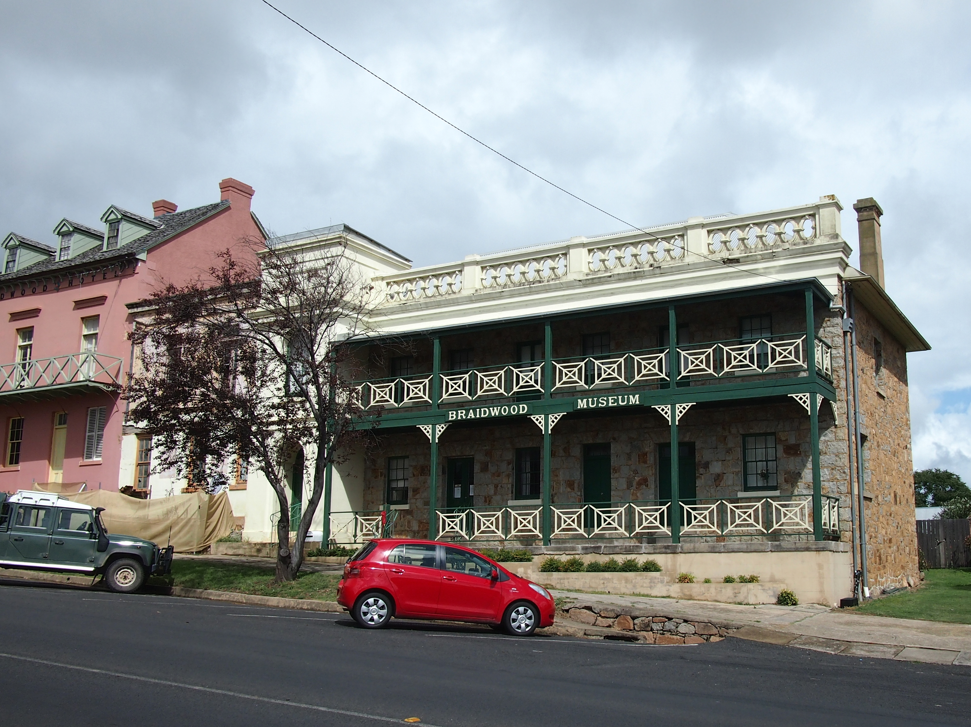
Braidwood is a town in the Southern Tablelands of New South Wales, Australia, in Queanbeyan–Palerang Regional Council. It is located on the Kings Highway linking Canberra with Batemans Bay. It is approximately 200 kilometres south west of Sydney, 60 kilometres inland from the coast, and 55 kilometres east of Canberra. Braidwood is a service town for the surrounding district which is based on sheep and cattle grazing, and forestry operations. Indigenous History Braidwood is located within the Yuin Nation, on Walbanga Country. The Walbanga People speak dialects of the Thurga (Durga/Dhurga) language. The Walbanga Peoples relied on the plentiful supply of vegetables available in the tablelands, such as the tubers of the yam daisy, wattle-seeds, and orchid tubers. In September to May, fish and crayfish were eaten, while possums and larger grazing animals were hunted year round. The Walbanga People and neighbouring groups made annual trips in December and January from to the B ... [...More Info...] [...Related Items...] OR: [Wikipedia] [Google] [Baidu] |
Wyangala Dam
Wyangala Dam is a major gated rock fill with clay core embankment and gravity dam with eight radial gates and a concrete chute spillway across the Lachlan River, located in the south-western slopes region of New South Wales, Australia. The dam's purpose includes flood mitigation, hydro-power, irrigation, water supply and conservation. The impounded reservoir is called Lake Wyangala. Location and features Commenced in 1928, completed in 1935, and upgraded in 1971, Wyangala Dam is a major reservoir situated below the confluence of the Lachlan and Abercrombie rivers, located approximately upstream, east of Cowra. The dam was built by the New South Wales Water Conservation & Irrigation Commission to supply water for irrigation, flood mitigation and potable water for the towns of Cowra, Forbes, Parkes, Condobolin, Lake Cargelligo, Euabalong and Euabalong West. The dam also provides water for a far larger area and operates in conjunction with Lake Brewster and Lake Cargelligo ... [...More Info...] [...Related Items...] OR: [Wikipedia] [Google] [Baidu] |
Lachlan River
The Lachlan River is an intermittent river that is part of the Murrumbidgee catchment within the Murray–Darling basin, located in the Southern Tablelands, Central West, and Riverina regions of New South Wales, Australia. The Lachlan River is connected to the Murray–Darling basin only when both the Lachlan and Murrumbidgee Rivers are in flood. It is the only river in New South Wales with significant wetlands along its length, rather than just towards its end, including Lake Cowal-Wilbertroy, Lake Cargelligo and Lake Brewster, and nine wetlands of national significance. Course The river rises on the western slopes of the Great Dividing Range in the Southern Tablelands district of New South Wales, formed by the confluence of Hannans Creek and Mutmutbilly Creek, east of Gunning, and 26 kilometres (16 mi) west of Goulburn. The river flows generally north-west, north, west and south-west, joined by thirty-seven tributaries including the Crookwell, Abercrombie, Boorowa, and ... [...More Info...] [...Related Items...] OR: [Wikipedia] [Google] [Baidu] |
Burrinjuck Dam
Burrinjuck Dam is a heritage-listed major gated concrete-walled gravity hydro-electric dam at Burrinjuck, Yass Valley Shire, New South Wales, Australia. It has three spillways across the Murrumbidgee River located in the South West Slopes region of New South Wales, Australia. The dam's purpose includes flood mitigation, hydro-power, irrigation, water supply and conservation. The impounded reservoir is called Lake Burrinjuck. It was designed by Lawrence Augustus Burton Wade (of the New South Wales Public Works Department)Article on Leslie Wade by C.J. Lloyd in Australian Dictionary of Biography Volume 12 (1990), Melbourne University Press. and built from 1907 to 1927 by Lane & Peters, Sydney. It is also known as Barren Jack Dam and Barrenjack. The property was ... [...More Info...] [...Related Items...] OR: [Wikipedia] [Google] [Baidu] |
Brindabella Range
The Brindabella Range, commonly called The Brindabellas or The Brindies, is a mountain range located in Australia, on a state and territory border of New South Wales and the Australian Capital Territory (ACT). The range rises to the west of Canberra, the capital city of Australia, and includes the Namadgi National Park in the ACT and the Bimberi Nature Reserve and Brindabella National Park in New South Wales. The Brindabellas are visible to the west of Canberra and form an important part of the city's landscape. Location and features The Brindabella Range is located in the northern tip of the Australian Alps bioregion, marking the dividing line with the southern tip of the South Eastern Highlands bioregion and the eastern limits of the Riverina. The northern point of the range is Mount Coree, situated west-northwest of Canberra. From this point the range heads generally south, towards the eastern watershed of the Murrumbidgee River, in a line that marks the western edge of ... [...More Info...] [...Related Items...] OR: [Wikipedia] [Google] [Baidu] |
Snowy Mountains
The Snowy Mountains, known informally as "The Snowies", is an IBRA subregion in southern New South Wales, Australia, and is the tallest mountain range in mainland Australia, being part of the continent's Great Dividing Range cordillera system. It makes up the northeastern half of the Australian Alps (the other half being the Victorian Alps) and contains Australia's five tallest peaks, all of which are above , including the tallest Mount Kosciuszko, which reaches to a height of above sea level. The offshore Tasmanian highlands makes up the only other major alpine region present in the whole of Australia. The Snowy Mountains experiences large natural snowfalls every winter, normally during June, July, August and early September, with the snow cover melting by late spring. It is considered to be one of the centers of the Australian ski industry during the winter months, with all four snow resorts in New South Wales being located in the region. The range is host to the mou ... [...More Info...] [...Related Items...] OR: [Wikipedia] [Google] [Baidu] |
Inversion (meteorology)
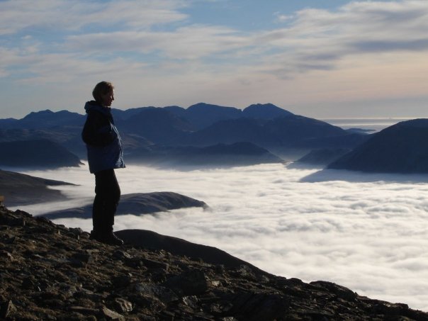
In meteorology, an inversion is a deviation from the normal change of an atmosphere, atmospheric property with altitude. It almost always refers to an inversion of the air temperature lapse rate, in which case it is called a temperature inversion. Normally, air temperature decreases with an increase in altitude, but during an inversion warmer air is held above cooler air. An inversion traps air pollution, such as smog, close to the ground. An inversion can also suppress Atmospheric convection, convection by acting as a "cap". If this cap is broken for any of several reasons, convection of any moisture present can then erupt into violent thunderstorms. Temperature inversion can notoriously result in freezing rain in cold climates. Normal atmospheric conditions Usually, within the lower atmosphere (the troposphere) the air near the surface of the Earth is warmer than the air above it, largely because the atmosphere is heated from below as solar radiation warms the Earth's su ... [...More Info...] [...Related Items...] OR: [Wikipedia] [Google] [Baidu] |
Kosciuszko National Park
The Kosciuszko National Park () is a national park and contains mainland Australia's highest peak, Mount Kosciuszko, for which it is named, and Cabramurra, the highest town in Australia. Its borders contain a mix of rugged mountains and wilderness, characterised by an alpine climate, which makes it popular with recreational skiers and bushwalkers. The park is located in the southeastern corner of New South Wales, southwest of Sydney, and is contiguous with the Alpine National Park in Victoria to the south, and the Namadgi National Park in the Australian Capital Territory to the northeast. The larger towns of Cooma, Tumut and Jindabyne lie just outside and service the park. The waters of the Snowy River, the Murray River, the Murrumbidgee River, and the Gungarlin River all rise in this park. Other notable peaks in the park include Gungartan, Mount Jagungal, Bimberi Peak and Mount Townsend. On 7 November 2008, the Park was added to the Australian National Heritage List as on ... [...More Info...] [...Related Items...] OR: [Wikipedia] [Google] [Baidu] |
Delegate, New South Wales
Delegate is a small town in New South Wales, Australia in Snowy Monaro Regional Council, south of the state capital, Sydney. The township is situated on the Delegate River, just a few kilometres north of the state border between New South Wales and Victoria (Australia), Victoria. At the , Delegate had a population of 351 people. Location and features The place name, Delegate, may have derived from an Aboriginal Australians, Aboriginal word meaning "high mountains". The first village began in 1852 and was sited at Hayden's Bog, on the property now called "Bendolba". Mount Delegate, commonly known in the local area as "Delegate Hill", is situated across the border in Victoria, and stands at approximately above sea level. It is the only single mountain in the Great Divide and of an unusual shape. Because of its height, Mount Delegate now has several telecommunication towers serving both NSW & Victoria. Climate Delegate has an oceanic climate (''Cfb''), typical of the New South Wa ... [...More Info...] [...Related Items...] OR: [Wikipedia] [Google] [Baidu] |
Bombala
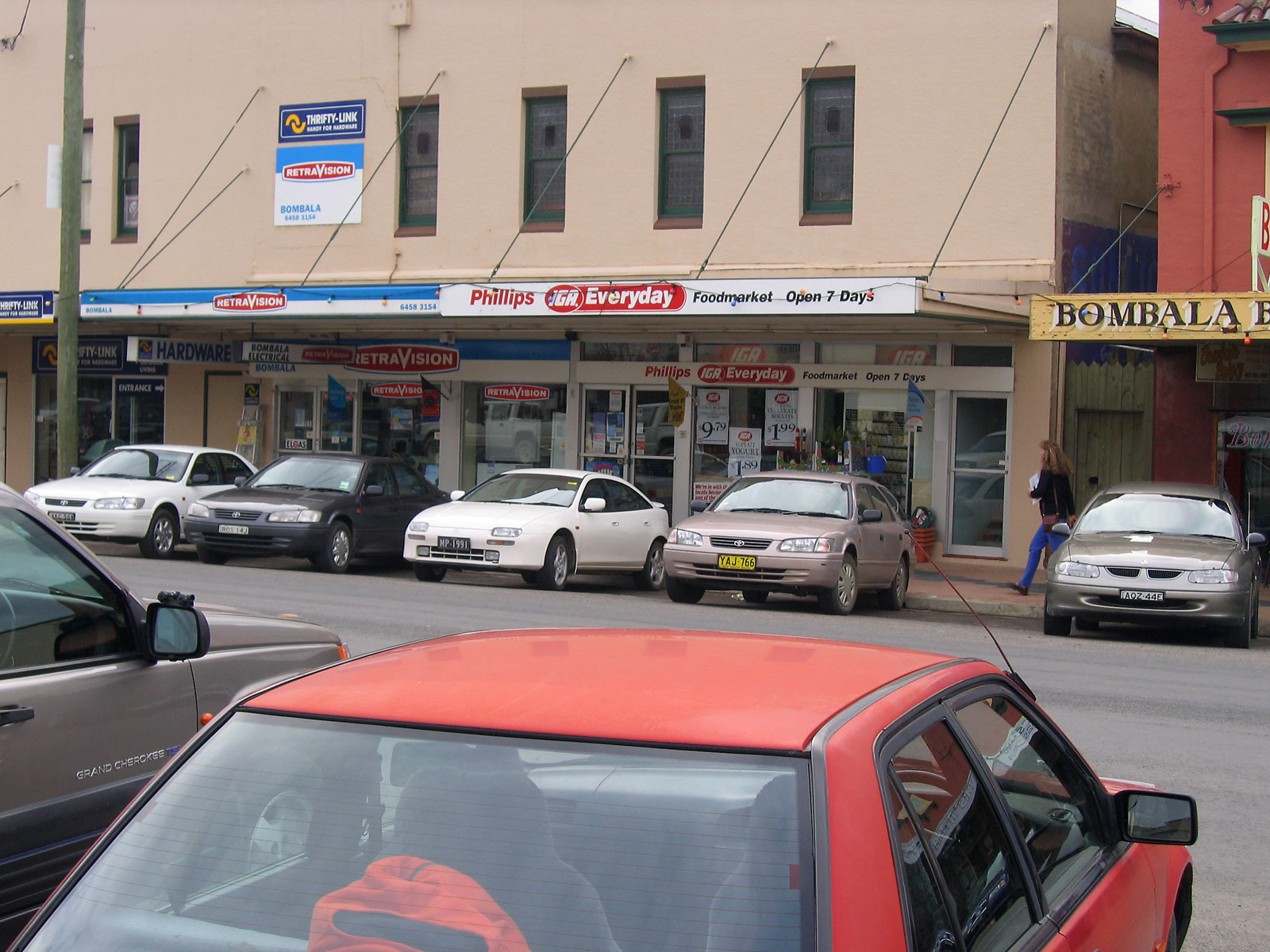
Bombala is a town in the Monaro region of south-eastern New South Wales, Australia, in Snowy Monaro Regional Council. It is approximately south of the state capital, Sydney, and south of the town of Cooma. The name derives from an Aboriginal word meaning "Meeting of the waters". The town lies on the banks of the Bombala River. At the , Bombala had a population of 1,387. History The Bombala area was inhabited by the Ngarigu Aboriginal people prior to the first European settlers arriving in the 1830s. Captain Ronald Campbell established a large property in 1833 that he named 'Bombalo'. More European settlers arrived in the Bombala area in the 1840s during which time the small township developed. Bombala had a post office by 1849 and had a number of large commercial and public buildings by the mid 1850s. Bombala was proposed in 1903 by King O'Malley as the site of the parliamentary seat of Australia. It was considered as a location because it was halfway between the two citie ... [...More Info...] [...Related Items...] OR: [Wikipedia] [Google] [Baidu] |
Jindabyne
Jindabyne () is a town in south-east New South Wales, Australia that overlooks Lake Jindabyne near the Snowy Mountains, in Snowy Monaro Regional Council. It is a popular holiday destination year round, especially in winter. This is due to its proximity to major ski resort developments within the Kosciuszko National Park, including Thredbo, Perisher and Charlotte Pass. Originally situated on land that is now under Lake Jindabyne, the township was transferred to its present location in the 1960s due to the construction of Jindabyne Dam, on the Snowy River, as part of the Snowy Mountains Scheme. At the , Jindabyne had a population of 2,629 people. The town's name is derived from an aboriginal word meaning "valley". Jindabyne is one of the highest settlements of its size in Australia, at 918 metres above sea level. Snowfalls regularly occur during winter. In mid-July in 2004 and 2005, snow fell up to half a metre following freak snowfalls over a large area of New South Wales. Jin ... [...More Info...] [...Related Items...] OR: [Wikipedia] [Google] [Baidu] |


