|
Southern Islands
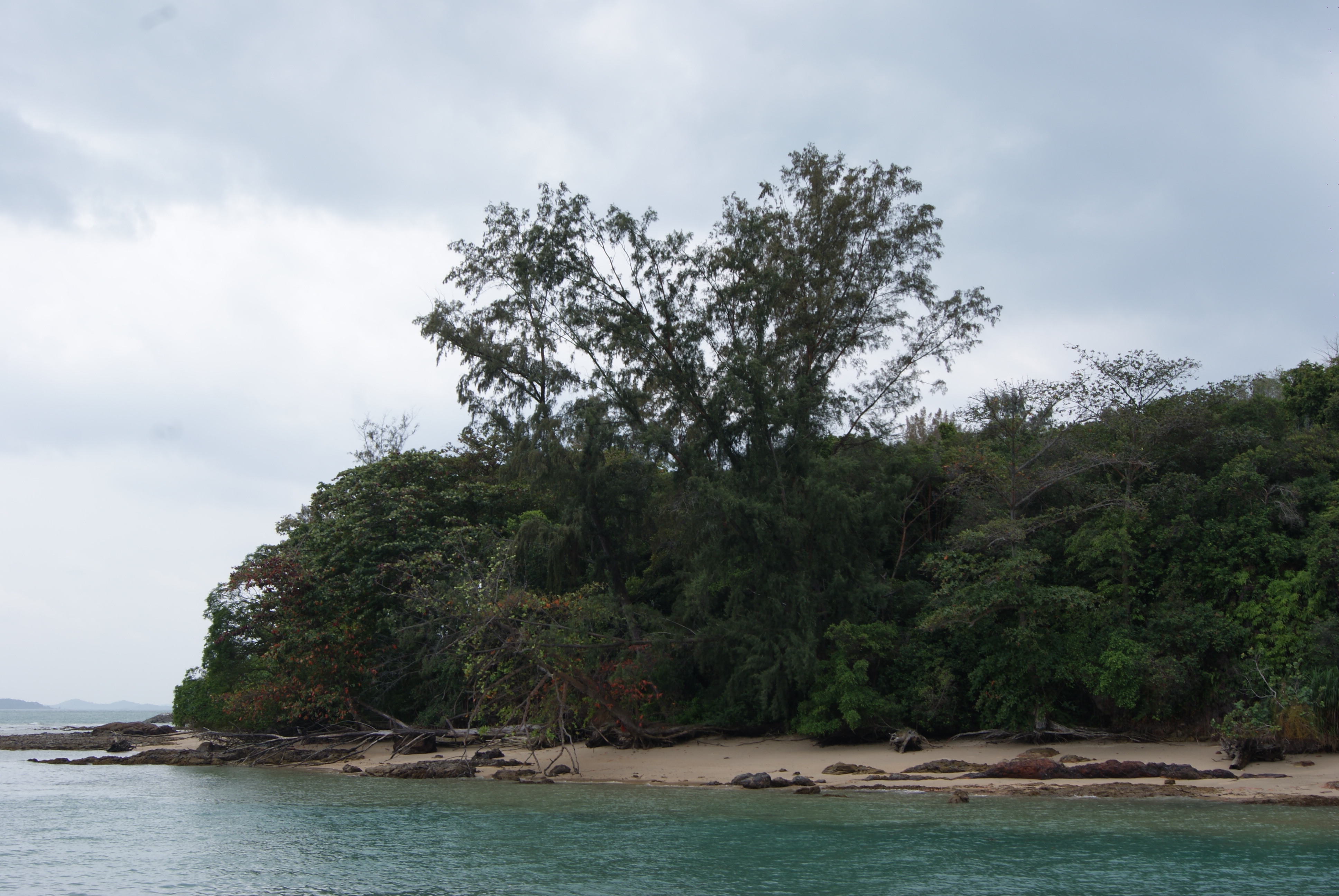
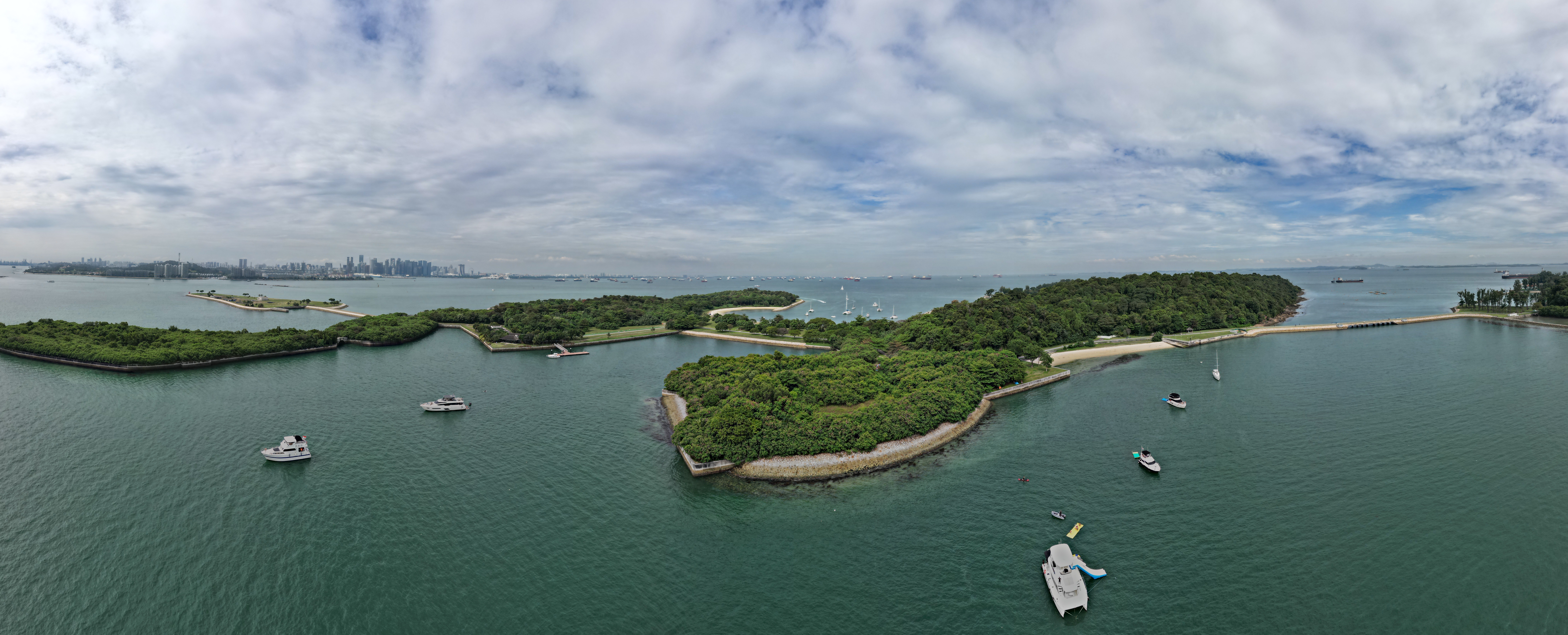
The Southern Islands is a planning area consisting of a collection of islets located within the Central Region of Singapore, once home to the native Malay islanders and sea nomads before they were relocated to the mainland for urban redevelopment and future use. The islands that form the planning area are Kusu Island, Lazarus Island, Pulau Seringat, Pulau Tekukor, Saint John's Island, Sentosa and the two Sisters' Islands. The islands encompass a total land area of about . The Sentosa Development Corporation oversaw the development and maintenance of these offshore islands south of Singapore from 1976 to March 2017, when it handed it back to the Singapore Land Authority. Southern Islands planning area is situated on the Singapore Straits, south of the mainland planning area of Bukit Merah. It also shares maritime boundary with the Western Islands planning area. Development As part of the Singapore Tourism Board's (STB) plan to develop the other Southern Islands after Sentosa ... [...More Info...] [...Related Items...] OR: [Wikipedia] [Google] [Baidu] |
Planning Areas Of Singapore
Planning areas, also known as DGP areas or DGP zones, are the main urban planning and census divisions of Singapore delineated by the Urban Redevelopment Authority. There are a total of 55 of these areas, organised into Regions of Singapore, five regions. A Development Guide Plan is then drawn up for each planning area, providing for detailed planning guidelines for every individual plot of land throughout the country. The planning areas were first introduced in the early 1990s after the release of the 1991 Concept Plan. Since the implementation of these boundaries, other government ministries and departments have also increasingly adopted these boundaries for their administrative purposes. For example, the Statistics Department of Singapore published its 2000 census data based on planning area boundaries for the first time, compared to using census divisions based on Constituencies of Singapore, electoral boundaries for previous exercises. The Singapore Police Force's (SPF) neigh ... [...More Info...] [...Related Items...] OR: [Wikipedia] [Google] [Baidu] |
Indian Singaporeans
Indian Singaporeans (Tamil: ') are Singaporeans of Indian or South Asian ancestry, who constitute 9.0% of the country's citizens, making them the third largest ancestry and ethnic group in Singapore. While contact with ancient India left a deep impact on Singapore's indigenous Malay culture, the mass settlement of Indians on the island only began with the founding of modern Singapore by the British in 1819. Initially, the Indian population was transient, mainly comprising young men who came as workers, soldiers and convicts. By the mid-20th century, a settled community had emerged, with a more balanced gender ratio and a better spread of age groups. Indian Singaporeans are linguistically and religiously diverse, with ethnic Tamils and Hindus forming majorities. The Indo-Singaporean culture has endured and evolved over almost 200 years. By the 1990s, it had grown somewhat distinct from contemporary South Asian cultures, even as Indian elements became diffused within a broader ... [...More Info...] [...Related Items...] OR: [Wikipedia] [Google] [Baidu] |
Land Reclamation
Land reclamation, usually known as reclamation, and also known as land fill (not to be confused with a waste landfill), is the process of creating new land from oceans, seas, riverbeds or lake beds. The land reclaimed is known as reclamation ground or land fill. In some jurisdictions, including parts of the United States, the term "reclamation" can refer to returning disturbed lands to an improved state. In Alberta, Canada, for example, reclamation is defined by the provincial government as "The process of reconverting disturbed land to its former or other productive uses." In Oceania, it is frequently referred to as land rehabilitation. History One of the earliest large-scale projects was the Beemster Polder in the Netherlands, realized in 1612 adding of land. In Hong Kong the Praya Reclamation Scheme added of land in 1890 during the second phase of construction. It was one of the most ambitious projects ever taken during the Colonial Hong Kong era.Bard, Solomon. 002 ... [...More Info...] [...Related Items...] OR: [Wikipedia] [Google] [Baidu] |
Singapore Tourism Board
The Singapore Tourism Board (STB) is a statutory board under the Ministry of Trade and Industry of the Government of Singapore, tasked to promote the country's tourism industry. History The board was first established on 1 January 1964 and was called the Singapore Tourist Promotion Board (Abbreviation: STPB). In that year, there were 91,000 visitors. The primary task of STPB was to coordinate the efforts of hotels, airlines and travel agents to develop the fledgling tourism industry of the country. Later, STPB began to initiate new marketing ideas to promote Singapore's image abroad. The board created the Merlion, a symbol based on a Singapore mythical legend, that became an icon of the Singapore destination. The board has also been providing travel agent licensing and tourist guide training. STPB actively promoted the development of infrastructure, including the building of hotels and tourist attractions such as the Jurong Bird Park and Sentosa which is now a popular resort ... [...More Info...] [...Related Items...] OR: [Wikipedia] [Google] [Baidu] |
Western Islands, Singapore
The Western Islands is a Planning Areas of Singapore, planning area located within the West Region, Singapore, West Region of Singapore. It comprises a collection of islands located in the south-western waters of Singapore, namely Jurong Island, Jurong, Pulau Bukom, Bukum and Pulau Sudong, Sudong Islands. The Western Islands originally comprised 27 islands, once home to the native Malay Singaporeans, Malay islanders in the past. In the 1990s, the government decided to reclaim land to form one major island, called Jurong Island. It was subsequently formed from the amalgamation of several offshore islands, chiefly the seven main islands of Pulau Ayer Chawan, Pulau Ayer Merbau, Pulau Merlimau, Pulau Pesek, Pulau Pesek Kechil, Pulau Sakra and Pulau Soraya. The planning area is located on the Singapore Straits, with Tuas situated to its west, as well as Pioneer, Singapore, Pioneer, Boon Lay Planning Area, Boon Lay, Jurong East and Queenstown, Singapore, Queenstown to its north. Western ... [...More Info...] [...Related Items...] OR: [Wikipedia] [Google] [Baidu] |
Bukit Merah
Bukit Merah, also known as Redhill, is a planning area and new town situated in the southernmost part of the Central Region of Singapore. the planning area borders Tanglin to the north, Queenstown to the west and the Downtown Core, Outram and Singapore River planning areas of the Central Area to the east. Bukit Merah shares a maritime boundary with the Southern Islands planning area located beyond its southernmost point. It is the most populated planning area in the Central Region, and the 12th most populated planning area in the country overall, being home to more than 150,000 residents. Etymology ''Bukit Merah'' translates to “red hill” in Malay, and is a reference to the red-coloured lateritic soil found on the hill. According to the ''Sejarah Melayu'', Singapore used to be plagued by swordfish attacking the people living in the coastal regions. A young boy named Hang Nadim proposed an ingenious solution, to build a wall of banana stems along the coast at the pre ... [...More Info...] [...Related Items...] OR: [Wikipedia] [Google] [Baidu] |
Singapore Straits
The Singapore Strait is a , strait between the Strait of Malacca in the west and the South China Sea in the east. Singapore is on the north of the channel, and the Indonesian Riau Islands are on the south. The two countries share a maritime border along the strait. It includes Keppel Harbour and many small islands. The strait provides the deepwater passage to the Port of Singapore, which makes it very busy. Approximately 2,000 merchant ships traverse the waters on a daily basis in 2017. The depth of the Singapore Strait limits the maximum draft of vessels going through the Straits of Malacca, and the Malaccamax ship class. Historical records The 9th century AD Muslim author Ya'qubi referred a ''Bahr Salahit'' or Sea of Salahit (from the Malay ''selat'' meaning strait), one of the Seven Seas to be traversed to reach China. Some have interpreted Sea of Salahit as referring to Singapore, although others generally considered it the Malacca Strait, a point of contact between th ... [...More Info...] [...Related Items...] OR: [Wikipedia] [Google] [Baidu] |
Sentosa Development Corporation
Sentosa Development Corporation (SDC) is a statutory board under the Ministry of Trade and Industry of the Government of Singapore. Purpose Islands The Sentosa Development Corporation (SDC) was formed on 1 September 1972. Its main task is to oversee the development, management and promotion of the island resort, Sentosa Island. Subsidiaries SDC is in charge of the following three subsidiary companies: # Sentosa Leisure Management (SLM) oversees the day-to-day operations of Sentosa. # Sentosa Cove Resort Management (SCRM) is the place manager for Sentosa Cove, a residential and commercial district on the island's waterfront. # Mount Faber Leisure Group (MFLG) operates Singapore's sole cableway system and offers lifestyle merchandise as well as F&B dining on the hill at Faber Peak (formerly the Jewel Box). Registered Society # Sentosa Golf Club (SGC) manages two award-winning 18-holes, par-72 championship golf courses on the island - The Serapong, which is ranked 58th in the ... [...More Info...] [...Related Items...] OR: [Wikipedia] [Google] [Baidu] |
Sisters' Islands
Sisters' Islands are two of the Southern Islands in Singapore and are located to the south of the main island of Singapore, off the Straits of Singapore. It can be reached via a boat ride from Marina South Pier or West Coast Pier. Big Sister's Island, about in area and also known as ''Pulau Subar Laut'' in Malay, faces the open sea, while Little Sister's Island, about in area and also known as ''Pulau Subar Darat'' in Malay, faces the mainland. The two islands are separated by a narrow channel. Currents through this channel can be very dangerous to swimmers and divers. Legends There are three legends on how the Sisters's Islands come about. The first version tells of two orphaned daughters, Minah and Linah, who stayed with their uncle on an island. One day, Linah met some pirates when fetching water from a well near the sea. The pirates chased her home and at her home, the pirate chief demanded to marry Linah the next day. On the next day, the pirates forcibly took Linah from h ... [...More Info...] [...Related Items...] OR: [Wikipedia] [Google] [Baidu] |
Saint John's Island
Saint John's Island also known as Saint John's is the largest of the Southern Islands in Singapore. Its indigenous Malay name is Pulau Sekijang Bendera. It is located approximately 6.5 km to the south of the main island of Singapore, off the Straits of Singapore. It is accessible by taking by a boat from Marina South Pier, and has a causeway connecting it directly to neighboring Lazarus Island. Saint John's Island formerly housed a quarantine station for cholera cases detected among immigrants in the late 19th century, and starting from 1901, victims of beriberi were also brought to the island. By 1930, the island gained world recognition as a quarantine centre screening immigrants and pilgrims returning from Mecca. The quarantine station was eventually also used to house victims of other diseases, such as leprosy. When mass immigration was closed in mid-20th century, the island was used to house a penal settlement and from 1955 a drug rehabilitation centre. The 40.5-hectar ... [...More Info...] [...Related Items...] OR: [Wikipedia] [Google] [Baidu] |
Pulau Tekukor
Pulau Tekukor (Turtle Dove) is one of the Southern Islands of Singapore Singapore (), officially the Republic of Singapore, is a sovereign island country and city-state in maritime Southeast Asia. It lies about one degree of latitude () north of the equator, off the southern tip of the Malay Peninsula, bor .... The island was also known as Pulau Penyabong. It is also the site of a former ammunition dump. There have been proposals to turn the island into a residential area, resort or eco-park (Monkey Island). External links Monkey Island Islands of Singapore Southern Islands {{Singapore-geo-stub ... [...More Info...] [...Related Items...] OR: [Wikipedia] [Google] [Baidu] |
Pulau Seringat
Pulau Seringat is an island off the south coast of Singapore, and part of the Southern Islands region.  Islands of Singapore
{{Singapore-geo-stub ...
[...More Info...] [...Related Items...] OR: [Wikipedia] [Google] [Baidu] |


