|
South Peninsula, Sulawesi
The South Peninsula is one of the four principal peninsulas on the island of Sulawesi, stretching south from the central part of the island. It is part of the province of South Sulawesi. The southern peninsula is the most densely populated peninsula in Sulawesi; over 45% of the population of Sulawesi (or 8.8 million people) are on the southern peninsula. Inhabited by an Austronesian people who came thousands of years ago. The largest ethnic group in Sulawesi is the Bugis, followed by Makassar and Toraja. Mount Lompobattang lies near the southern tip of this peninsula. and the latimojong mountain is the highest mountain in the southern peninsula of sulawesi and on the island of sulawesi. History South Peninsula was first inhabited by humans about 30,000 years ago. The archaeological remains of the earliest inhabitants were discovered in caves near limestone hills around Maros, about 30 km northeast of Makassar, the capital of the South Sulawesi province. Pebble and flake ... [...More Info...] [...Related Items...] OR: [Wikipedia] [Google] [Baidu] |
Makassar
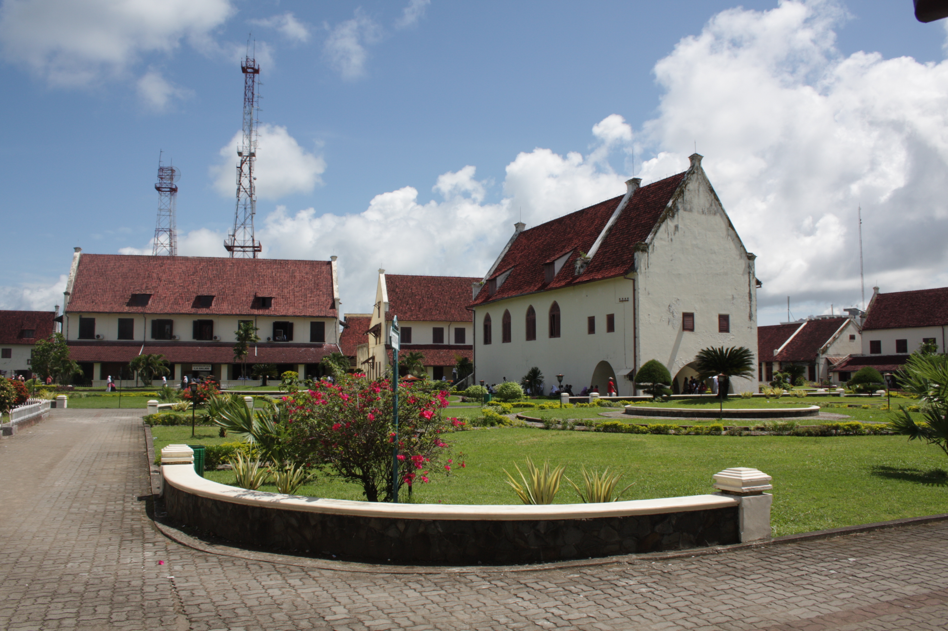
Makassar (, mak, ᨆᨀᨔᨑ, Mangkasara’, ) is the capital of the Indonesian province of South Sulawesi. It is the largest city in the region of Eastern Indonesia and the country's fifth-largest urban center after Jakarta, Surabaya, Medan, and Bandung.Ministry of Internal AffairsRegistration Book for Area Code and Data of 2013/ref> The city is located on the southwest coast of the island of Sulawesi, facing the Makassar Strait. Throughout its history, Makassar has been an important trading port, hosting the center of the Gowa Sultanate and a Portuguese naval base before its conquest by the Dutch East India Company in the 17th century. It remained an important port in the Dutch East Indies, serving Eastern Indonesian regions with Makassarese fishers going as far south as the Australian coast. For a brief period after Indonesian independence, Makassar became the capital of the State of East Indonesia, during which an uprising occurred. The city's area is , a ... [...More Info...] [...Related Items...] OR: [Wikipedia] [Google] [Baidu] |
Moncong Lompobatang
Moncong Lompobattang is a mountain in Indonesia with an elevation of 2,874 m. Moncong Lompobattang is ranked 116th in the world by topographic prominence. There is a small antenna compound at the summit of Moncong Lompobattang, along with a triangular pillar and a boulder with the names previous climbers written on it."Moncong Lompobattang" GunungBagging.com. Retrieved 2012-04-17. One kilometre north of the summit lies a slightly lower sub-peak known as Puncak Ko’bang (2,870 m) which is the alleged site of the tomb of a King of Gowa. The two peaks, including the entire mountain and its surrounding area, are considered spiritually significant among local people. |
Sultanate Of Gowa
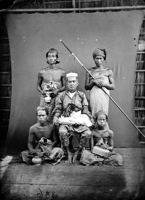
The Sultanate of Gowa (sometimes written as ''Goa''; not to be confused with Goa in India) was one of the great kingdoms in the history of Indonesia and the most successful kingdom in the South Sulawesi region. People of this kingdom come from the Makassar tribe who lived in the south end and the west coast of southern Sulawesi. History Before the establishment of the kingdom, the region had been known as ''Makassar'' and its people as ''Suku Makassar'' ( tribe of Makassar). The history of the kingdom can be divided into two eras: pre-Islamic kingdom and post-Islamic sultanate. Pre-Islamic Kingdom According to the epic poem The Nagarakretagama, in praise of King Rajasanagara of Majapahit, it lists Makassar as one of the kingdom's tributaries in 1365. The first queen of Gowa was ''Tomanurung Baine''. There is not much known about the exact time when the kingdom was established nor about the first queen, and only during the ruling of the 6th king, ''Tonatangka Kopi'', local ... [...More Info...] [...Related Items...] OR: [Wikipedia] [Google] [Baidu] |
Celebes In 1905
Sulawesi (), also known as Celebes (), is an island in Indonesia. One of the four Greater Sunda Islands, and the world's eleventh-largest island, it is situated east of Borneo, west of the Maluku Islands, and south of Mindanao and the Sulu Archipelago. Within Indonesia, only Sumatra, Borneo, and Papua are larger in territory, and only Java and Sumatra have larger populations. The landmass of Sulawesi includes four peninsulas: the northern Minahasa Peninsula, the East Peninsula, the South Peninsula, and the Southeast Peninsula. Three gulfs separate these peninsulas: the Gulf of Tomini between the northern Minahasa and East peninsulas, the Tolo Gulf between the East and Southeast peninsulas, and the Bone Gulf between the South and Southeast peninsulas. The Strait of Makassar runs along the western side of the island and separates the island from Borneo. Etymology The name ''Sulawesi'' possibly comes from the words ''sula'' ("island") and ''besi'' ("iron") and may refer to ... [...More Info...] [...Related Items...] OR: [Wikipedia] [Google] [Baidu] |
Pettakere Cave
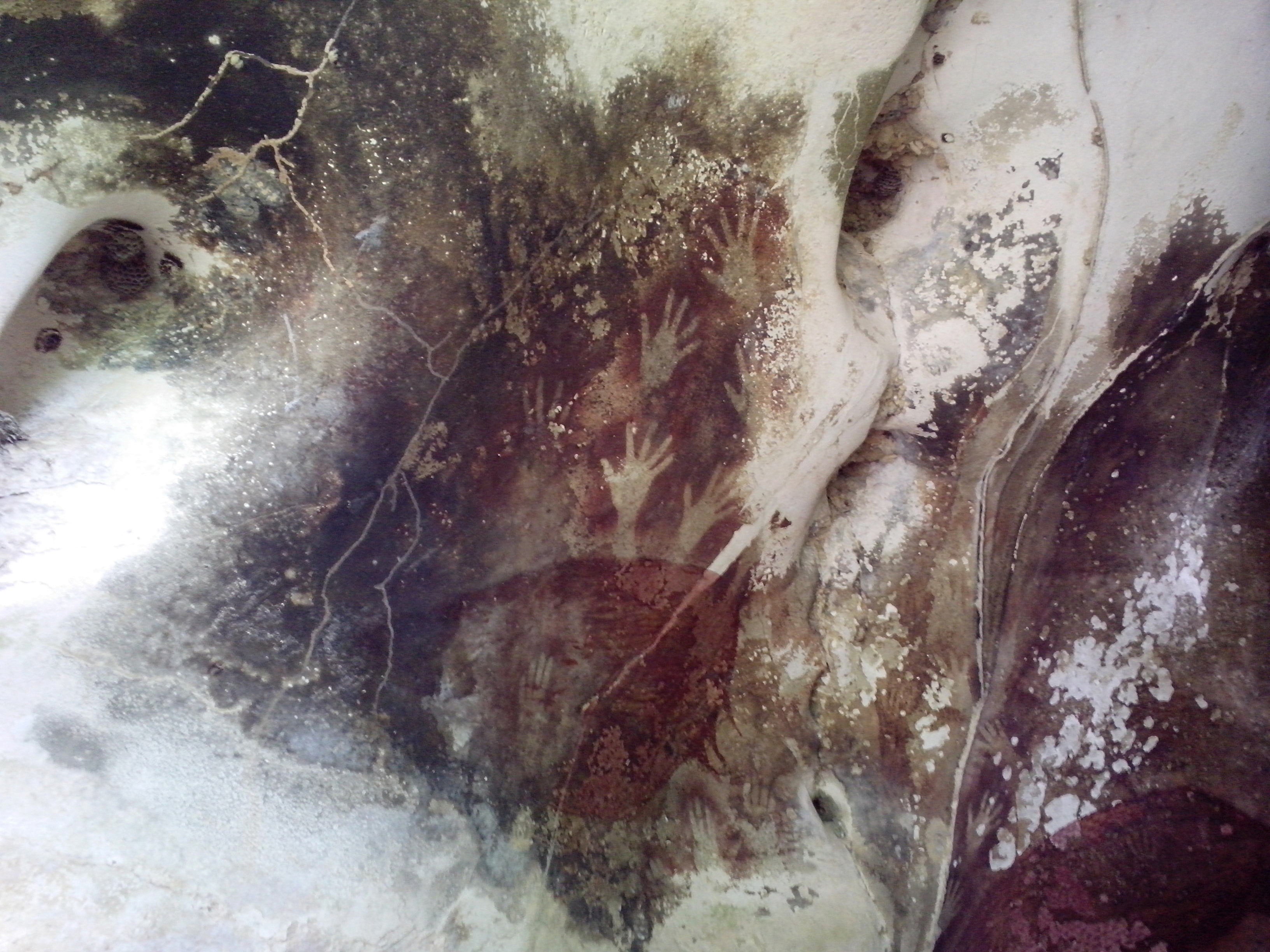
The caves in the Maros-Pangkep karst are situated in South Sulawesi, Indonesia, and contain paintings from the Paleolithic considered to be the earliest figurative art in the world, dated to at least 43,900 years ago. Description The caves in the Maros-Pangkep karst are a cave complex, where prehistoric finds were made. The whole complex is also called "Prehistoric place Leang-Leang" – the name stems from the Makassarese language. The various caves - named Pettae, Jane, Saripa, Jarie, Karrasa, and so on - consist of limestone. They are located from the town of Maros and from the city of Makassar. The entrance to the caves is located above a rice field, accessible by ladder. A hand stencil in the Leang Tempuseng cave was dated to at least 39,900 years old in a 2014 study. The depiction of a babirusa is also located in this cave. It is estimated to be 35,400 years old. The art works were examined with the help of the Uranium-Thorium method of the sintering on the paint ... [...More Info...] [...Related Items...] OR: [Wikipedia] [Google] [Baidu] |
Sengkang, Indonesia
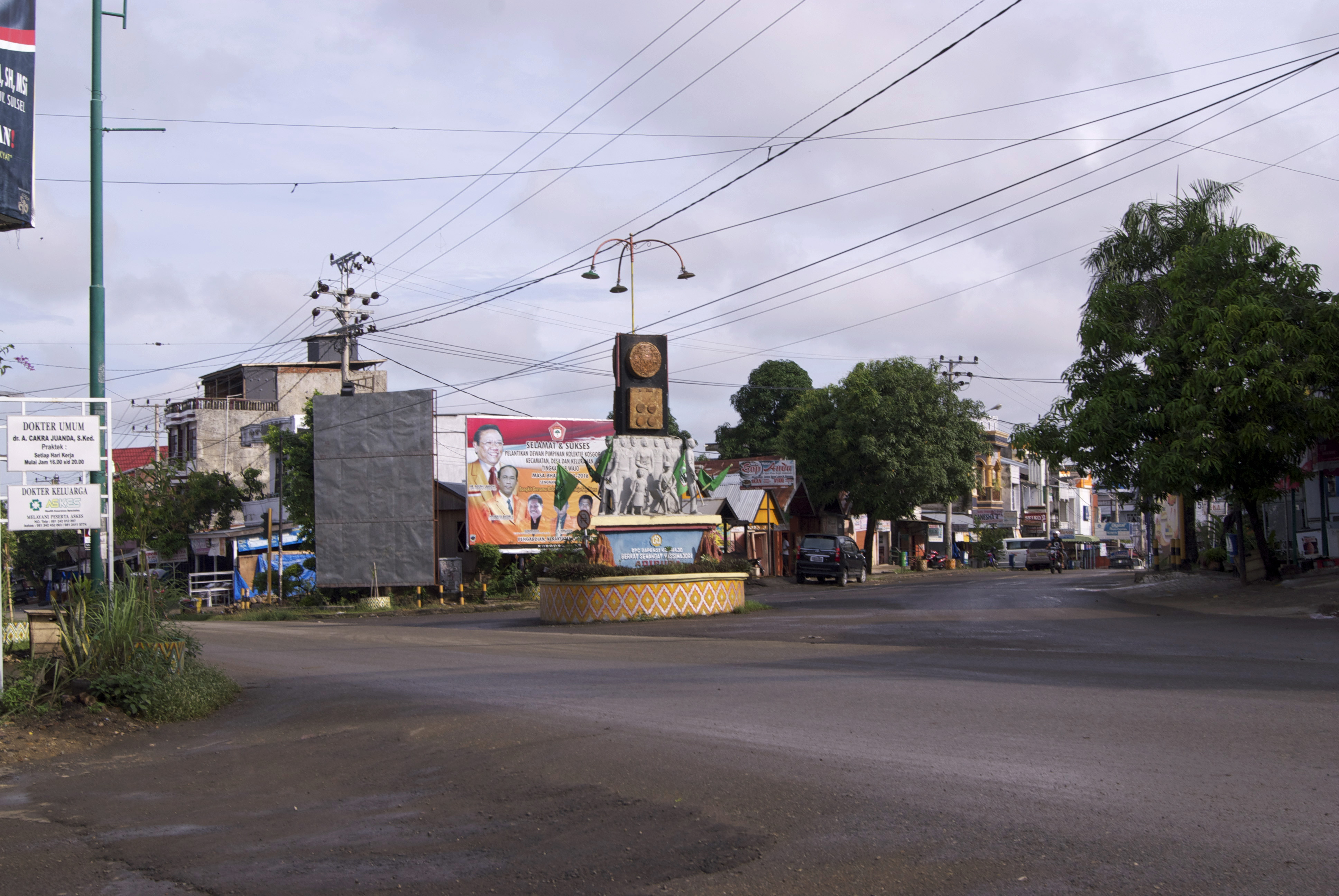
Sengkang is a town in the South Sulawesi province of Indonesia and it is the seat (capital) of Wajo Regency. It lies on the east side of Lake Tempe. Climate Sengkang has a tropical rainforest climate A tropical rainforest climate, humid tropical climate or equatorial climate is a tropical climate sub-type usually found within 10 to 15 degrees latitude of the equator. There are some other areas at higher latitudes, such as the coast of southea ... (Af) with moderate to heavy rainfall year-round. References Gallery File:COLLECTIE TROPENMUSEUM Huis van lokale bestuurders in Singkang TMnr 60028779.jpg, The palace of a prince in Sengkang in the 1930s File:Sengkang Wajo Regency South Sulawesi.jpg, The city centre of Sengkang Populated places in South Sulawesi Regency seats of South Sulawesi {{SSulawesi-geo-stub ... [...More Info...] [...Related Items...] OR: [Wikipedia] [Google] [Baidu] |
Soppeng
Soppeng Regency is a landlocked regency in South Sulawesi province of Indonesia. Soppeng Regency has its seat of government (capital) in the town of Watansoppeng, located 180 km from Makassar. The regency covers an area of 1,557 km2, and had a population of 223,826 at the 2010 Census and 235,167 at the 2020 Census. Administration Soppeng Regency in 2020 (as in 2010) comprised eight administrative Districts (''Kecamatan''), tabulated below with their areas and their populations at the 2010 Census and the 2020 Census.Badan Pusat Statistik, Jakarta, 2021. The table also includes the location of the district administrative centres, and the number of administrative villages (rural ''desa'' and urban ''kelurahan'') in each district. See also * List of regencies and cities of Indonesia Regencies (''kabupaten'') and cities (''kota'') are the second-level administrative subdivision in Indonesia, immediately below the provinces, and above the districts. Regencies a ... [...More Info...] [...Related Items...] OR: [Wikipedia] [Google] [Baidu] |
Walanae
Walanae River is a river in South Sulawesi on the island of Sulawesi, Indonesia, about 1500 km northeast of the capital Jakarta. at Geonames.org (cc-by); Last updated 2013-06-04; Database dump downloaded 2015-11-27 Geography The river flows in the southwest area of Sulawesi with predominantly (designated as ''Am'' in the Köppen-Geiger climate classification). The annual average temperature in the area is 23 °C. The warmest month is October, when the average temperature is around 25 °C, and the coldest is July, at 21 °C. The average annual rainfall is 2550 mm. The w ...[...More Info...] [...Related Items...] OR: [Wikipedia] [Google] [Baidu] |
Maros
Maros is a town in the South Sulawesi province of Indonesia close to the provincial capital of Makassar. It is the capital of the Maros Regency. Maros is the location of the Indonesian Cereals Research Institute, a branch of the Indonesian Agency for Agricultural Research and Development. In 2012, regional cement producer PT Semen Bosowa Maros began construction in Maros of a new clinker plant estimated to cost over $300 million. The clinker plant was expected to help the cement company increase production in the region in response to the growing demand for cement to support construction activities. Maros Water Park is in Maros. Rock art in caves Nearby to Maros, in the area of the Maros Regency to the north of Makassar, are Pettakere cave and other prehistoric cave A cave or cavern is a natural void in the ground, specifically a space large enough for a human to enter. Caves often form by the weathering of rock and often extend deep underground. The word ''cave'' can ... [...More Info...] [...Related Items...] OR: [Wikipedia] [Google] [Baidu] |
Hands In Pettakere Cave
A hand is a prehensile, multi-fingered appendage located at the end of the forearm or forelimb of primates such as humans, chimpanzees, monkeys, and lemurs. A few other vertebrates such as the koala (which has two opposable thumbs on each "hand" and fingerprints extremely similar to human fingerprints) are often described as having "hands" instead of paws on their front limbs. The raccoon is usually described as having "hands" though opposable thumbs are lacking. Some evolutionary anatomists use the term ''hand'' to refer to the appendage of digits on the forelimb more generally—for example, in the context of whether the three digits of the bird hand involved the same homologous loss of two digits as in the dinosaur hand. The human hand usually has five digits: four fingers plus one thumb; these are often referred to collectively as five fingers, however, whereby the thumb is included as one of the fingers. It has 27 bones, not including the sesamoid bone, the number of w ... [...More Info...] [...Related Items...] OR: [Wikipedia] [Google] [Baidu] |
Toraja People
The Torajans are an ethnic group indigenous people, indigenous to a mountainous region of South Sulawesi, Indonesia. Their population is approximately 1,100,000, of whom 450,000 live in the List of regencies and cities of Indonesia, regency of Tana Toraja ("Land of Toraja"). Most of the population is Christianity, Christian, and others are Islam, Muslim or have local animism, animist beliefs known as ''aluk'' ("the way"). The Indonesian government has recognised this animistic belief as ''Aluk To Dolo'' ("Way of the Ancestors"). The word ''Toraja'' comes from the Buginese language term ''to riaja'', meaning "people of the uplands". The Dutch East Indies, Dutch colonial government named the people ''Toraja'' in 1909. Torajans are renowned for their elaborate Funeral, funeral rites, burial sites carved into rocky cliffs, massive peaked-roof traditional houses known as ''tongkonan'', and colourful wood carvings. Toraja funeral rites are important social events, usually attended by ... [...More Info...] [...Related Items...] OR: [Wikipedia] [Google] [Baidu] |
Mount Latimojong
Latimojong (Indonesian: Gunung Latimojong), also known by its peak name Rantemario, is a mountain located in the province of South Sulawesi, Sulawesi, Indonesia. At , it is the highest mountain on the island, although some sources state Mount Rantekombola as the highest point. Locally, Rantemario is more commonly referred to as Latimojong. Latimojong is also the name of local mountain range and forest area of which Rantemario is the highest peak. Rantemario can be climbed from the village of Karangan and has eight designated staging points, some of which are suitable for camping and have access to water. The nearest town is Baraka, 8 km off the main highway between Makassar and Tana Toraja. See also * List of islands by highest point * List of peaks by prominence This is a list of mountain peaks ordered by their topographic prominence. Terminology The prominence of a peak is the minimum height of climb to the summit on any route from a higher peak, or from sea level if ... [...More Info...] [...Related Items...] OR: [Wikipedia] [Google] [Baidu] |


