|
South Lee Historic District
The South Lee Historic District encompasses the historic portion of the village of South Lee in Lee, Massachusetts. Extending mainly along Massachusetts Route 102 (Pleasant Street) between Fairview Street and the Stockbridge town line, the village is a well-preserved 19th-century mill village, with fine Federal and Greek Revival buildings and a later 19th-century paper mill. It was listed on the National Register of Historic Places in 1999. Description and history The town of Lee was settled in 1760, comparatively later than neighboring towns, and was incorporated in 1777. South Lee was a remote outpost off major roads until the Housatonic River Turnpike was built in 1806 by Col. Joseph Whiton, who had in 1794 built the house now known as the Merrell Tavern. Whiton was a major early economic force in the village, operating a sawmill, forge, and brickyard. Now on a major east–west route, and close to what became a major north–south route (now United States Route 7), the ... [...More Info...] [...Related Items...] OR: [Wikipedia] [Google] [Baidu] |
Lee, Massachusetts
Lee is a town in Berkshire County, Massachusetts, United States. It is part of the Pittsfield, Massachusetts, metropolitan statistical area. The population was 5,788 at the 2020 census. Lee, which includes the villages of South and East Lee, is part of the Berkshires resort area. History Lee occupies land that was originally territory of Mahican Indians. The first non-native settlement in the area was known as Dodgetown as early as 1760. Dodgetown was named after its founding settler, Asahel Dodge, who immigrated to the area from Cape Cod. Lee was incorporated in 1777 from parts of Great Barrington and Washington. It is named after Revolutionary War General Charles Lee. Lee is a former mill town. In the autumn of 1786 during Shays' Rebellion, about 250 followers of Daniel Shays encountered state troops commanded by General John Paterson near East Lee. The Shaysites paraded a fake cannon crafted from a yarn beam, and the troops fled. Early industries included agriculture ... [...More Info...] [...Related Items...] OR: [Wikipedia] [Google] [Baidu] |
Massachusetts Route 102
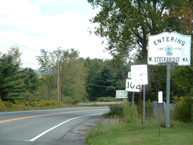
Massachusetts Route 102 (MA 102) is a west–east state highway in western Massachusetts. Its western terminus is at the New York border where it connects to New York State Route 22 (NY 22) in Canaan, New York, and its eastern terminus is at the intersection U.S. Route 20 (US 20) and the Massachusetts Turnpike ( Interstate 90) exit 10 in Lee. Along the way it intersects several major highways, including Route 41 in West Stockbridge and US 7 and Route 183 in Stockbridge. Route description Route 102 begins in West Stockbridge at the New York state line. It continues into Canaan, New York to meet New York State Route 22 (NY 22) via a connector road. The road, maintained by the New York State Department of Transportation, is designated NY 980D, an unsigned reference route. The route crosses Interstate 90 (Massachusetts Turnpike) twice in its first , where it is also known as State Line Road. It joins Route 41 for a co ... [...More Info...] [...Related Items...] OR: [Wikipedia] [Google] [Baidu] |
Stockbridge, Massachusetts
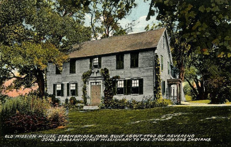
Stockbridge is a town in Berkshire County in Western Massachusetts, United States. It is part of the Pittsfield, Massachusetts, Metropolitan Statistical Area. The population was 2,018 at the 2020 census. A year-round resort area, Stockbridge is home to the Norman Rockwell Museum, the Austen Riggs Center (a psychiatric treatment center), and Chesterwood, home and studio of sculptor Daniel Chester French. History Stockbridge was settled by British missionaries in 1734, who established it as a praying town for the Stockbridge Indians, an indigenous Mohican tribe. The township was set aside for the tribe by Massachusetts colonists as a reward for their assistance against the French in the French and Indian Wars. The Rev. John Sergeant, from Newark, New Jersey, was their first missionary. Sergeant was succeeded in this post by Jonathan Edwards, a Christian theologian associated with the First Great Awakening. First chartered as Indian Town in 1737, the village was incorporated on ... [...More Info...] [...Related Items...] OR: [Wikipedia] [Google] [Baidu] |
National Register Of Historic Places
The National Register of Historic Places (NRHP) is the United States federal government's official list of districts, sites, buildings, structures and objects deemed worthy of preservation for their historical significance or "great artistic value". A property listed in the National Register, or located within a National Register Historic District, may qualify for tax incentives derived from the total value of expenses incurred in preserving the property. The passage of the National Historic Preservation Act (NHPA) in 1966 established the National Register and the process for adding properties to it. Of the more than one and a half million properties on the National Register, 95,000 are listed individually. The remainder are contributing resources within historic districts. For most of its history, the National Register has been administered by the National Park Service (NPS), an agency within the U.S. Department of the Interior. Its goals are to help property owners and inte ... [...More Info...] [...Related Items...] OR: [Wikipedia] [Google] [Baidu] |
Merrell Tavern
The Merrell Tavern, known more recently as the Merrell Inn, is a historic tavern at 1565 Pleasant Street (Massachusetts Route 102) in South Lee, Massachusetts. Built in 1794 as a residence, it has served for most of two centuries as a local traveler's accommodation, and retains fine Federal period architectural details. > It was added to the National Register of Historic Places in 1972. It continues to serve its historic function, and is now operated as a bed and breakfast inn. Description and history The Merrell Tavern is located on the south side of Pleasant Street, near the western end of the roughly linear village. It is a -story wood-frame structure, five bays wide, with a gable roof and brick sidewalls. The main facade is covered by a two-story porch extending across its full width. The porch is supported by tapered square columns on the first level, and round Doric columns on the second. The tavern was built as a residence in 1794 by Joseph Whiton, a local militia co ... [...More Info...] [...Related Items...] OR: [Wikipedia] [Google] [Baidu] |
United States Route 7
U.S. Route 7 (US 7) is a north–south United States highway in western New England that runs for through the states of Connecticut, Massachusetts, and Vermont. The highway's southern terminus is at Interstate 95 (I-95) exit 15 in Norwalk, Connecticut. Its northern terminus is at I-89 exit 22 near the village of Highgate Springs, Vermont, immediately south of the Canada–US border. Route description Connecticut US 7 in Connecticut (also known as Route 7, Ethan Allen Highway and Super 7) is mostly a surface road but has two short expressway sections in the Norwalk and Danbury areas. US 7 begins in Norwalk with a expressway to nearly the Wilton town line. There are three exits on this short section, signed as " The Forty Third Infantry Division Memorial Highway". Exit 1, just past Interstate 95 in Connecticut, I-95 (the southern terminus), leads to the Central Norwalk Business District and US 1 (CT), US 1. Exit 2 leads to ... [...More Info...] [...Related Items...] OR: [Wikipedia] [Google] [Baidu] |
Housatonic River
The Housatonic River ( ) is a river, approximately long,U.S. Geological Survey. National Hydrography Dataset high-resolution flowline dataThe National Map , accessed April 1, 2011 in western Massachusetts and western Connecticut in the United States. It flows south to southeast, and drains about of southwestern Connecticut into Long Island Sound. Its Drainage basin, watershed is just to the west of the watershed of the lower Connecticut River. History Indigenous history Indigenous people began using the river area for fishing and hunting at least 6,000 years ago. By 1600, the inhabitants were mostly Mohicans and may have numbered 30,000. The river's name is derived from the Mohican phrase ''"usi-a-di-en-uk"'', translated as "beyond the mountain place" or "river of the mountain place".Housatonic Valley Association. Cornwall Bridge, CT"History of the Housatonic Valley." Accessed 2015-10-1. It is referred to in the deed by which a group of twelve colonists called "The Proprietor ... [...More Info...] [...Related Items...] OR: [Wikipedia] [Google] [Baidu] |
National Register Of Historic Places Listings In Berkshire County, Massachusetts
__NOTOC__ This is a list of the National Register of Historic Places listings in Berkshire County, Massachusetts. This is intended to be a complete list of the properties and districts on the National Register of Historic Places in Berkshire County, Massachusetts, United States. Latitude and longitude coordinates are provided for many National Register properties and districts; these locations may be seen together in a map. There are 178 properties and districts listed on the National Register in the county, including 10 National Historic Landmarks. Current listings See also * List of National Historic Landmarks in Massachusetts * National Register of Historic Places listings in Massachusetts This is a list of properties and districts in Massachusetts listed on the National Register of Histor ... [...More Info...] [...Related Items...] OR: [Wikipedia] [Google] [Baidu] |
Historic Districts On The National Register Of Historic Places In Massachusetts
History (derived ) is the systematic study and the documentation of the human activity. The time period of event before the invention of writing systems is considered prehistory. "History" is an umbrella term comprising past events as well as the memory, discovery, collection, organization, presentation, and interpretation of these events. Historians seek knowledge of the past using historical sources such as written documents, oral accounts, art and material artifacts, and ecological markers. History is not complete and still has debatable mysteries. History is also an academic discipline which uses narrative to describe, examine, question, and analyze past events, and investigate their patterns of cause and effect. Historians often debate which narrative best explains an event, as well as the significance of different causes and effects. Historians also debate the nature of history as an end in itself, as well as its usefulness to give perspective on the problems of the p ... [...More Info...] [...Related Items...] OR: [Wikipedia] [Google] [Baidu] |
National Register Of Historic Places In Berkshire County, Massachusetts
__NOTOC__ This is a list of the National Register of Historic Places listings in Berkshire County, Massachusetts. This is intended to be a complete list of the properties and districts on the National Register of Historic Places in Berkshire County, Massachusetts, United States. Latitude and longitude coordinates are provided for many National Register properties and districts; these locations may be seen together in a map. There are 178 properties and districts listed on the National Register in the county, including 10 National Historic Landmarks. Current listings See also * List of National Historic Landmarks in Massachusetts * National Register of Historic Places listings in Massachusetts This is a list of properties and districts in Massachusetts listed on the National Register of Histor ... [...More Info...] [...Related Items...] OR: [Wikipedia] [Google] [Baidu] |


.jpg)