|
South Island Main Trunk Railway
The Main North Line between Picton and Christchurch and the Main South Line between Lyttelton and Invercargill, running down the east coast of the South Island of New Zealand, are sometimes together referred to collectively as the South Island Main Trunk Railway (SIMT). Construction of a line running the length of the east coast began in the 1860s and was completed all the way from Picton to Invercargill in 1945; the last sections being on the Main North Line south of Picton. The designation "South Island Main Trunk" originally referred to only that line between Christchurch and Invercargill. Construction Main South Line Construction of the Main South Line (originally known as the "Great Southern Railway") began in 1865 when the Canterbury Provincial Railways began work on a broad gauge line south from Christchurch. It reached Rolleston on 13 October 1866 and Selwyn a year later. A number of routes south were considered, and the one chosen was a compromise betwee ... [...More Info...] [...Related Items...] OR: [Wikipedia] [Google] [Baidu] |
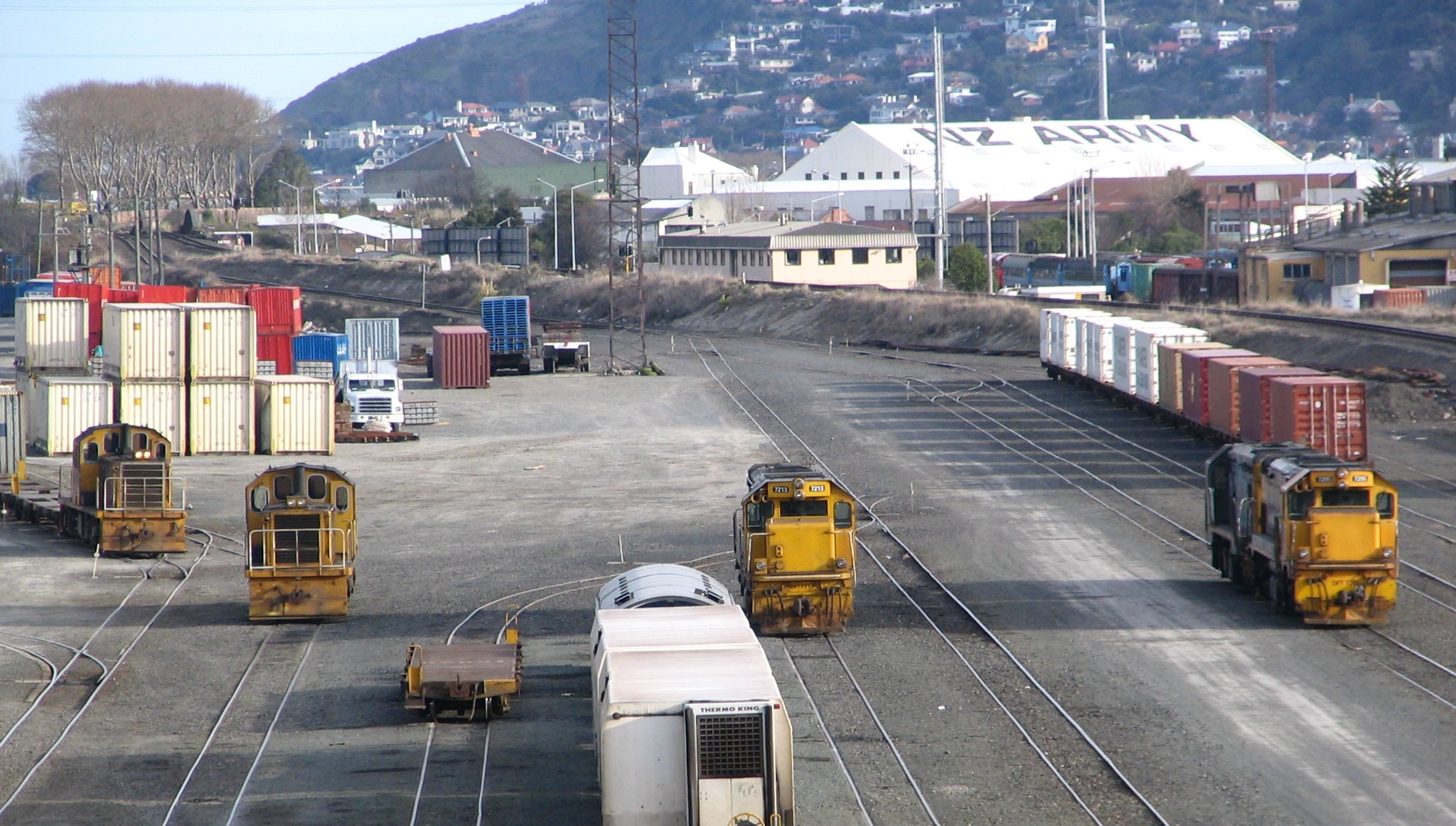
Main South Line Shunting Yards Dunedin
Main may refer to: Geography * Main River (other) **Most commonly the Main (river) in Germany *Main, Iran, a village in Fars Province *"Spanish Main", the Caribbean coasts of mainland Spanish territories in the 16th and 17th centuries *''The Main'', the diverse core running through Montreal, Quebec, Canada, also separating the Two Solitudes *Main (lunar crater), located near the north pole of the Moon *Main (Martian crater) People and organisations *Main (surname), a list of people with this family name *Ma'in, alternate spelling for the Minaeans, an ancient people of modern-day Yemen *Main (band), a British ambient band formed in 1991 *Chas. T. Main, an American engineering and hydroelectric company founded in 1893 *MAIN (Mountain Area Information Network), former operator of WPVM-LP (MAIN-FM) in Asheville, North Carolina, U.S. Ships * ''Main'' (ship), an iron sailing ship launched in 1884 * SS ''Main'', list of steamships with this name * ''Main'' (A515), a modern G ... [...More Info...] [...Related Items...] OR: [Wikipedia] [Google] [Baidu] |
Rail Gauge
In rail transport, track gauge (in American English, alternatively track gage) is the distance between the two rails of a railway track. All vehicles on a rail network must have wheelsets that are compatible with the track gauge. Since many different track gauges exist worldwide, gauge differences often present a barrier to wider operation on railway networks. The term derives from the metal bar, or gauge, that is used to ensure the distance between the rails is correct. Railways also deploy two other gauges to ensure compliance with a required standard. A ''loading gauge'' is a two-dimensional profile that encompasses a cross-section of the track, a rail vehicle and a maximum-sized load: all rail vehicles and their loads must be contained in the corresponding envelope. A ''structure gauge'' specifies the outline into which structures (bridges, platforms, lineside equipment etc.) must not encroach. Uses of the term The most common use of the term "track gauge" refers to the ... [...More Info...] [...Related Items...] OR: [Wikipedia] [Google] [Baidu] |
Waipara
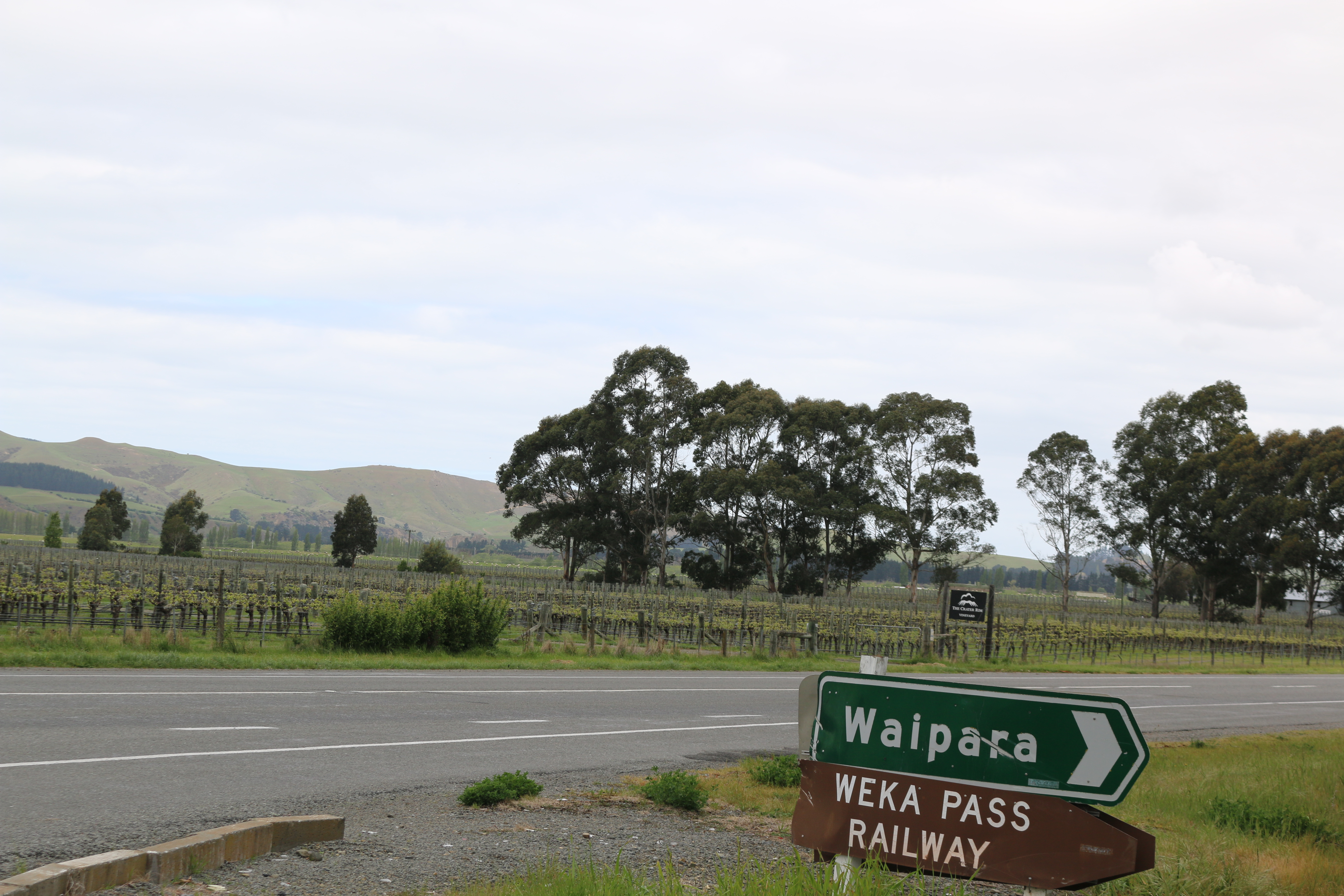
Waipara is a small town in north Canterbury, New Zealand, on the banks of the Waipara River. Its name translates to "Muddy Water", ''wai'' meaning water and ''para'' meaning mud. It is at the junction of state highways 1 and 7, 60 kilometres north of Christchurch. Hanmer Springs is 76 kilometres (55 minutes drive) north of Waipara. It is also situated on the Main North Line railway. Waipara lies at one of the points of the Alpine Pacific Triangle, which also includes the major tourist centers of Hanmer Springs and Kaikoura. The Weka Pass Railway has its base in Waipara, and runs on 12 kilometres of track between there and Waikari over the former route of the Waiau Branch, a branch line railway that diverged from the Main North Line and ran to Waiau. The Glenmark station is based in Waipara. The Glenmark church has closed down. It was damaged during the 2010 Christchurch earthquakes. The Waipara Hotel burnt down in 2014. It was not insured at the time and has not been r ... [...More Info...] [...Related Items...] OR: [Wikipedia] [Google] [Baidu] |
Amberley, New Zealand
Amberley (Māori: ''Kōwai'') is a town located in the Hurunui District in north Canterbury, on the east coast of the South Island of New Zealand. It is located on State Highway 1 approximately 50 km north of Christchurch. It is the seat of the Hurunui District Council. The nearest town to the north of Amberly via state highway one is Waipara (11 km) and the nearest town to the south is Leithfield (5.7 km). History Amberley was established in 1864 by Mrs. Frederica Josephine Carter who owned freehold land north of the Kowai river. Mrs. Carter subdivided and sold her pastoral run for eight pounds per quarter acre. This price was very attractive as it made the land some of the cheapest in Canterbury. The town was named Amberley after Mrs. Carter's family farm in Oxfordshire, England. The earliest residents included a blacksmith, a wheelwright and a carpenter. A courthouse was established in 1870. The town developed slowly at first until the railway, built by Cant ... [...More Info...] [...Related Items...] OR: [Wikipedia] [Google] [Baidu] |
Rangiora
Rangiora is the largest town and seat of the Waimakariri District, in Canterbury, New Zealand. It is north of Christchurch, and is part of the Christchurch metropolitan area. With an estimated population of Rangiora is the 30th largest urban area in New Zealand, and the fifth-largest in the Canterbury region (behind Christchurch, Timaru, Ashburton and Rolleston). Geography Rangiora is north of Christchurch's Cathedral Square or 20 minutes drive north of the Christchurch International Airport. It is close to the northern end of Canterbury's Inland Scenic Route (formerly State Highway 72), which skirts the inner edge of the Canterbury Plains, running southwest to Timaru via Oxford and Geraldine. The Ashley River / Rakahuri is just to the north of the town. Climate Rangiora has an oceanic climate, (''Cfb'' according to the Köppen climate classification), with warm summers and mild winters. Rangiora has an average annual mean of , an average annual high of and an average ... [...More Info...] [...Related Items...] OR: [Wikipedia] [Google] [Baidu] |
Kaiapoi
Kaiapoi is a town in the Waimakariri District of the Canterbury region, in the South Island of New Zealand. The town is located approximately 17 kilometres north of central Christchurch, close to the mouth of the Waimakariri River. It is considered a satellite town of Christchurch and is part of the Christchurch functional urban area. Kaiapoi is known for its substantial precolonial pā, established by powerful Kāi Tahu nobleman Tūrākautahi. One of the sons of the powerful rangatira Tūāhuriri, Tūrākautahi exerted vast influence over historical Ōtautahi (the site of modern-day Christchurch). His family controlled the pā he established in the area until it was sacked in 1830. The pā was one of the greatest centre of knowledge, economics and natural resources, with a highly complex social structure. All decisions were undertaken by the nobility, who consulted with highly skilled tohunga. In selecting the pā site, Tūrākautahi determined that food ( kai) would need ... [...More Info...] [...Related Items...] OR: [Wikipedia] [Google] [Baidu] |
Canterbury, New Zealand
Canterbury ( mi, Waitaha) is a region of New Zealand, located in the central-eastern South Island. The region covers an area of , making it the largest region in the country by area. It is home to a population of The region in its current form was established in 1989 during nationwide local government reforms. The Kaikoura District joined the region in 1992 following the abolition of the Nelson-Marlborough Regional Council. Christchurch, the South Island's largest city and the country's second-largest urban area, is the seat of the region and home to percent of the region's population. Other major towns and cities include Timaru, Ashburton, Rangiora and Rolleston. History Natural history The land, water, flora, and fauna of Waitaha/Canterbury has a long history stretching from creation of the greywacke basement rocks that make up the Kā Tiritiri o te Moana/Southern Alps to the arrival of the first humans. This history is linked to the creation of the earth, the s ... [...More Info...] [...Related Items...] OR: [Wikipedia] [Google] [Baidu] |
Timaru
Timaru (; mi, Te Tihi-o-Maru) is a port city in the southern Canterbury Region of New Zealand, located southwest of Christchurch and about northeast of Dunedin on the eastern Pacific coast of the South Island. The Timaru urban area is home to people, and is the largest urban area in South Canterbury, and the second largest in the Canterbury Region overall, after Christchurch. The town is the seat of the Timaru District, which includes the surrounding rural area and the towns of Geraldine, Pleasant Point and Temuka, which combined have a total population of . Caroline Bay beach is a popular recreational area located close to Timaru's main centre, just to the north of the substantial port facilities. Beyond Caroline Bay, the industrial suburb of Washdyke is at a major junction with State Highway 8, the main route into the Mackenzie Country. This provides a road link to Pleasant Point, Fairlie, Twizel, Lake Tekapo, Aoraki / Mount Cook and Queenstown. Timaru has been built ... [...More Info...] [...Related Items...] OR: [Wikipedia] [Google] [Baidu] |
Balclutha, New Zealand
Balclutha ( mi, Iwikatea) is a town in South Otago, lying towards the end of the Clutha River, on the east coast of the South Island of New Zealand. It is about halfway between Dunedin and Gore on the Main South Line railway, State Highway 1 and the Southern Scenic Route. Balclutha has a population of (as of ), and is the largest town in South Otago. The Clutha District Council is based in Balclutha. The major service centre for the fertile farming region around the lower reaches of the Clutha River, it is also the nearest large town to the Catlins, a scenic region of native forest, wildlife, and rugged coastline. History Known locally as "Clutha", Balclutha's name – and that of the river on which it stands – reflects the Scottish origin of the town's settlement. The name comes from Scottish Gaelic and would be spelt Baile Chluaidh in that language; this translates into English as "Town on the Clyde". James McNeil from Bonn Hill, Dumbartonshire, Scotland, who is re ... [...More Info...] [...Related Items...] OR: [Wikipedia] [Google] [Baidu] |
Gore, New Zealand
Gore ( mi, Maruawai) is a town and Gore District, New Zealand, district in the Southland Region, Southland region of the South Island of New Zealand. Geography The town of Gore is located on State Highway 1 (New Zealand), State Highway 1 64 kilometres northeast of Invercargill and 70 km west of Balclutha, New Zealand, Balclutha – Dunedin and Invercargill are the nearest cities. The Gore District, New Zealand, Gore District has a resident population of The urban area estimated resident population in was , the second largest in Southland. Gore is a service town for the surrounding farm communities. It is divided by the Mataura River into Gore and East Gore, the majority of the town being situated on the western banks of the river. The Main South Line railway from Christchurch to Invercargill runs through the town, though passenger services ceased in 2002 with the cancellation of the Southerner. Gore was once a busy railway junction; the Waimea Plains Railway ran ... [...More Info...] [...Related Items...] OR: [Wikipedia] [Google] [Baidu] |
Oamaru
Oamaru (; mi, Te Oha-a-Maru) is the largest town in North Otago, in the South Island of New Zealand, it is the main town in the Waitaki District. It is south of Timaru and north of Dunedin on the Pacific coast; State Highway 1 and the railway Main South Line connect it to both cities. With a population of , Oamaru is the 28th largest urban area in New Zealand, and the third largest in Otago behind Dunedin and Queenstown. The town is the seat of Waitaki District, which includes the surrounding towns of Kurow, Weston, Palmerston, and Hampden. which combined have a total population of 23,200. Friendly Bay is a popular recreational area located at the edge of Oamaru Harbour, south to Oamaru's main centre. Just to the north of Oamaru is the substantial Alliance Abattoir at Pukeuri, at a major junction with State Highway 83, the main route into the Waitaki Valley. This provides a road link to Kurow, Omarama, Otematata and via the Lindis Pass to Queenstown and Wanaka. Oamaru serv ... [...More Info...] [...Related Items...] OR: [Wikipedia] [Google] [Baidu] |
Port Chalmers Branch
The Port Chalmers Branch was the first railway line built in Otago, New Zealand, and linked the region's major city of Dunedin with the port in Port Chalmers. The line is still operational today. Construction and early history Built by the Dunedin and Port Chalmers Railway Company Limited during 1872, the line was approved by and constructed under the auspices of the Otago Provincial Council, not the central government. It was built to the recently adopted national track gauge of , and it was the first line in the country with that gauge to open, on 1 January 1873. The line was formally opened by Sir George Bowen, former Governor of New Zealand, on a farewell trip prior to his transfer to Victoria. Not long after opening, the central Government purchased the Dunedin and Port Chalmers Railway Company for £150,000, with the transaction completed in May 1873. Otago Provincial Council was abolished along with the other provincial councils of New Zealand in 1876. The first locomotiv ... [...More Info...] [...Related Items...] OR: [Wikipedia] [Google] [Baidu] |






_Josephine_Otago_Settlers_Museum.jpg)