|
South Eastern Freeway
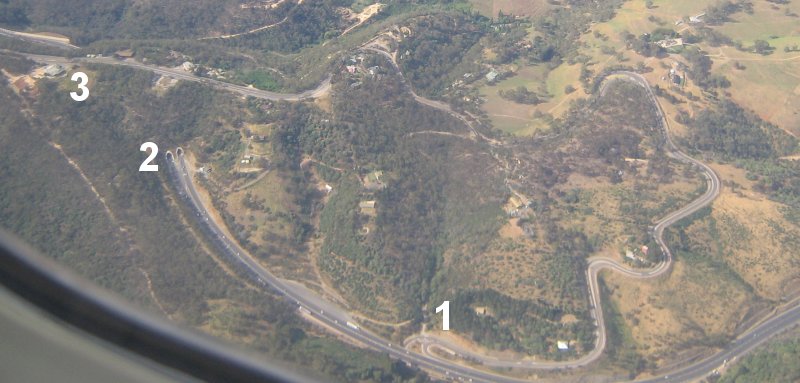
South Eastern Freeway is a freeway in South Australia (SA). It is a part of the National Highway network linking the state capital cities of Adelaide, SA, and Melbourne, Victoria, and signed as National Highway M1. It carries traffic over the Adelaide Hills between Adelaide and the River Murray, near Murray Bridge, where it is connected via the Swanport Bridge to the Dukes Highway, which is the main road route to Victoria. It was formerly signposted as Princes Highway, which refers to the coastal route from Adelaide to Sydney via Melbourne. It is often referred to by South Australians simply as the Freeway, as it was the first freeway in South Australia, and is still the longest, and the only one with "Freeway" in its name rather than "Expressway" or "Highway". The South Eastern Freeway includes twin-tube tunnels (the Heysen Tunnels) in the descent towards Adelaide, the first of their kind on the National Highway. Route South Eastern Freeway commences at the intersec ... [...More Info...] [...Related Items...] OR: [Wikipedia] [Google] [Baidu] |
Glen Osmond Road, Adelaide
Glen Osmond Road is a major section of the Princes Highway (and Highway 1) in the city of Adelaide, South Australia. Connecting the Adelaide city centre with the Adelaide Hills via the South Eastern Freeway; Glen Osmond Road carries half of Adelaide's freight traffic and is the major commuter route from the southern Adelaide Hills. It is designated part of route A1. Route Glen Osmond Road starts at the intersection with South Terrace along the southern border of the Adelaide city centre and heads southeast, intersecting with Hutt and Greenhill Roads through the Adelaide Park Lands, continues southeast through Eastwood and Frewville, before ending at the intersection with Cross Road, Portrush Road and South Eastern Freeway in Glen Osmond. Glen Osmond Road houses a strip shopping precinct on the section between Greenhill and Fullarton Roads. The precinct is largely populated by independent boutiques. It is a community main street stationed in the leafy suburbs of Adelaide's so ... [...More Info...] [...Related Items...] OR: [Wikipedia] [Google] [Baidu] |
Victoria (Australia)
Victoria is a state in southeastern Australia. It is the second-smallest state with a land area of , the second most populated state (after New South Wales) with a population of over 6.5 million, and the most densely populated state in Australia (28 per km2). Victoria is bordered by New South Wales to the north and South Australia to the west, and is bounded by the Bass Strait to the south (with the exception of a small land border with Tasmania located along Boundary Islet), the Great Australian Bight portion of the Southern Ocean to the southwest, and the Tasman Sea (a marginal sea of the South Pacific Ocean) to the southeast. The state encompasses a range of climates and geographical features from its temperate coastal and central regions to the Victorian Alps in the northeast and the semi-arid north-west. The majority of the Victorian population is concentrated in the central-south area surrounding Port Phillip Bay, and in particular within the metropolit ... [...More Info...] [...Related Items...] OR: [Wikipedia] [Google] [Baidu] |
Mount Barker, South Australia
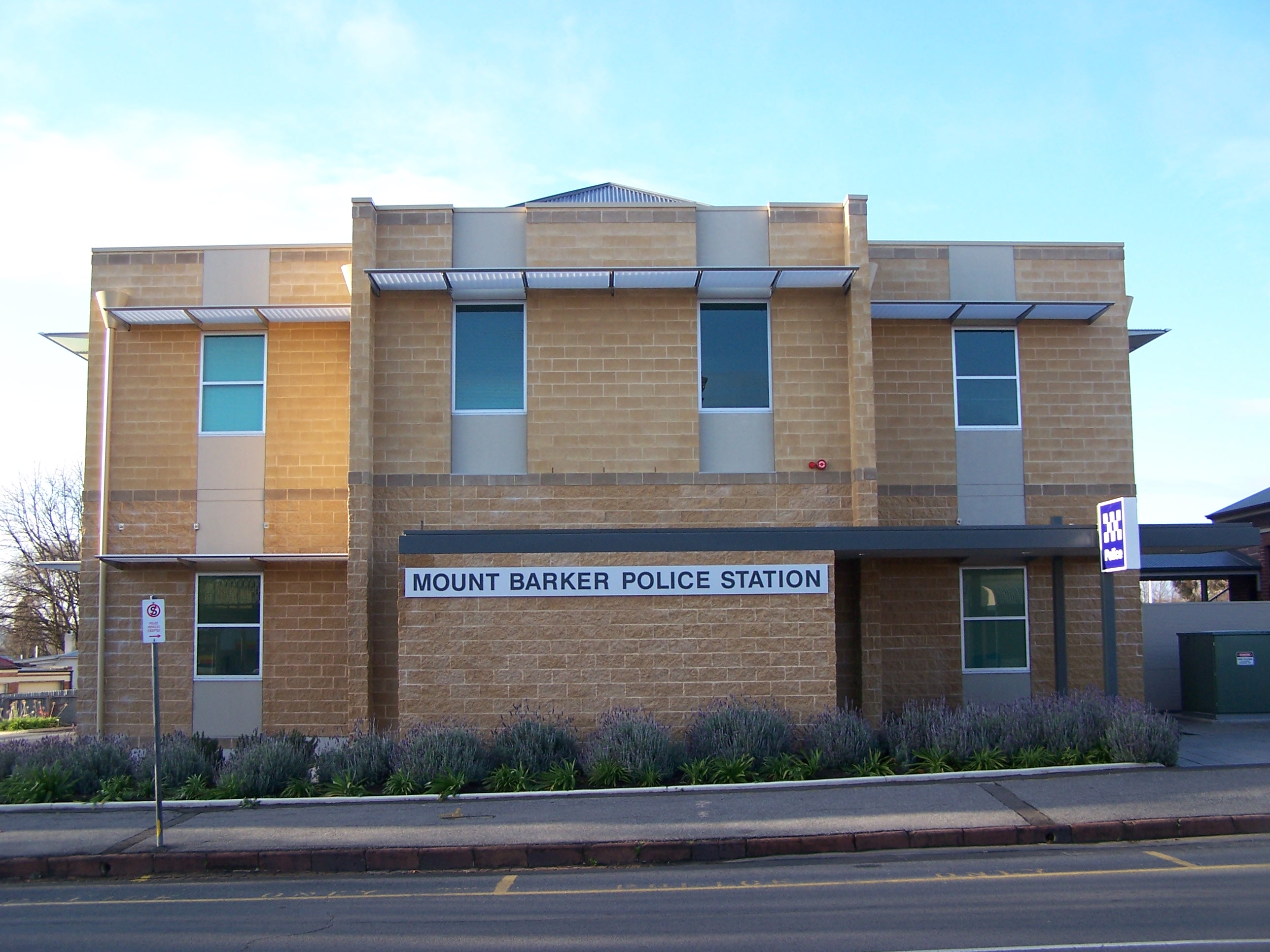
Mount Barker is a city in South Australia. Located approximately 33 kilometres (21 miles) from the Adelaide city centre, it is home to 16,629 residents. It is the seat of the District Council of Mount Barker, the largest town in the Adelaide Hills, as well as one of the fastest-growing areas in the state. Mount Barker lies at the base of a local eponymous peak called the Mount Barker summit. It is 50 kilometres from the Murray River. Mount Barker was traditionally a farming area; many of the lots just outside the town area are farming lots, although some of them have been replaced with new subdivisions in recent times. History Mount Barker, the mountain, was sighted by Captain Charles Sturt in 1830, although he thought he was looking at the previously discovered Mount Lofty. This sighting of Mount Barker was the first by a European. Captain Collet Barker corrected Sturt's error when he surveyed the area in 1831. Sturt named the mountain in honour of Captain Barker after he was ... [...More Info...] [...Related Items...] OR: [Wikipedia] [Google] [Baidu] |
Hahndorf, South Australia
Hahndorf is a small town in the Adelaide Hills region of South Australia. Currently an important tourism spot, it has previously been a centre for farming and services. Geography It is accessible from Adelaide, the South Australian capital, via the South Eastern Freeway. Climate Hahndorf has a warm-summer Mediterranean climate abbreviated ''Csb'' on the Köppen climate classification scale. History The town was settled by Lutheran migrants largely from in and around a small village then named Kay in Prussia and now known as Kije, Lubusz Voivodeship in Poland. Many of the settlers arrived aboard the ''Zebra'' on 28 December 1838. The town is named after Dirk Meinerts Hahn, the Danish captain of the ''Zebra''. It is Australia's oldest surviving German settlement. Early German settlers During the British colonisation of South Australia, the settlers were mostly British, but some German "Old Lutherans" also emigrated in the early years. The first large group of Germans ... [...More Info...] [...Related Items...] OR: [Wikipedia] [Google] [Baidu] |
Stirling, South Australia
Stirling is a town in the Adelaide Hills, South Australia, approximately 15 km from the Adelaide city centre. It is administered by the Adelaide Hills Council. Neighbouring townships are Crafers and Aldgate. Other nearby towns are Heathfield and Bridgewater. Of those five, Stirling has by far the largest commercial strip, with the greatest number and widest variety of shops, and the only banks. Stirling East, a similar sized area towards Aldgate, is home to several schools. History Stirling is named after Edward Stirling. He was the illegitimate son of Archibald Stirling, a planter in the British West Indies, and a Creole woman. He was able to travel to South Australia because of a financial gift from his father who had been freshly compensated for his slaves on the emancipation of the British West Indies. Founded in 1854, Stirling grew rapidly as a result of the expansion of apple growing and market gardening to satisfy the demand of the expanding city of Adelaide, ... [...More Info...] [...Related Items...] OR: [Wikipedia] [Google] [Baidu] |
Crafers, South Australia
The town of Crafers is in the Adelaide Hills to the south-east of Adelaide, South Australia, considered to be an outer suburb of Adelaide. History Crafers was named after David Crafer, who arrived in Adelaide in 1838 and moved to the area. With his wife he established an inn, the Sawyers Arms, in 1839 three years after the colony of South Australia was created. He then built the Norfolk Arms on in 1840 with banquet seating for 150. He moved to Adelaide and sold the Norfolk Arms in 1842, at which point it was known as The Crafers Inn. A new hotel was built on the site in 1880, remaining into the 21st century as The Crafers Inn, but the original building was burned down in 1926. At the time the area at the foot of nearby Mount Lofty was known as the Tiers, infamous for being the haunt of numerous Tiersmen and woodcutters on the run from authorities in Adelaide. The historic Crafers Primary School was first established in the area in 1865 by Mr Edward Smith. The school was in ... [...More Info...] [...Related Items...] OR: [Wikipedia] [Google] [Baidu] |
Runaway Truck Ramp
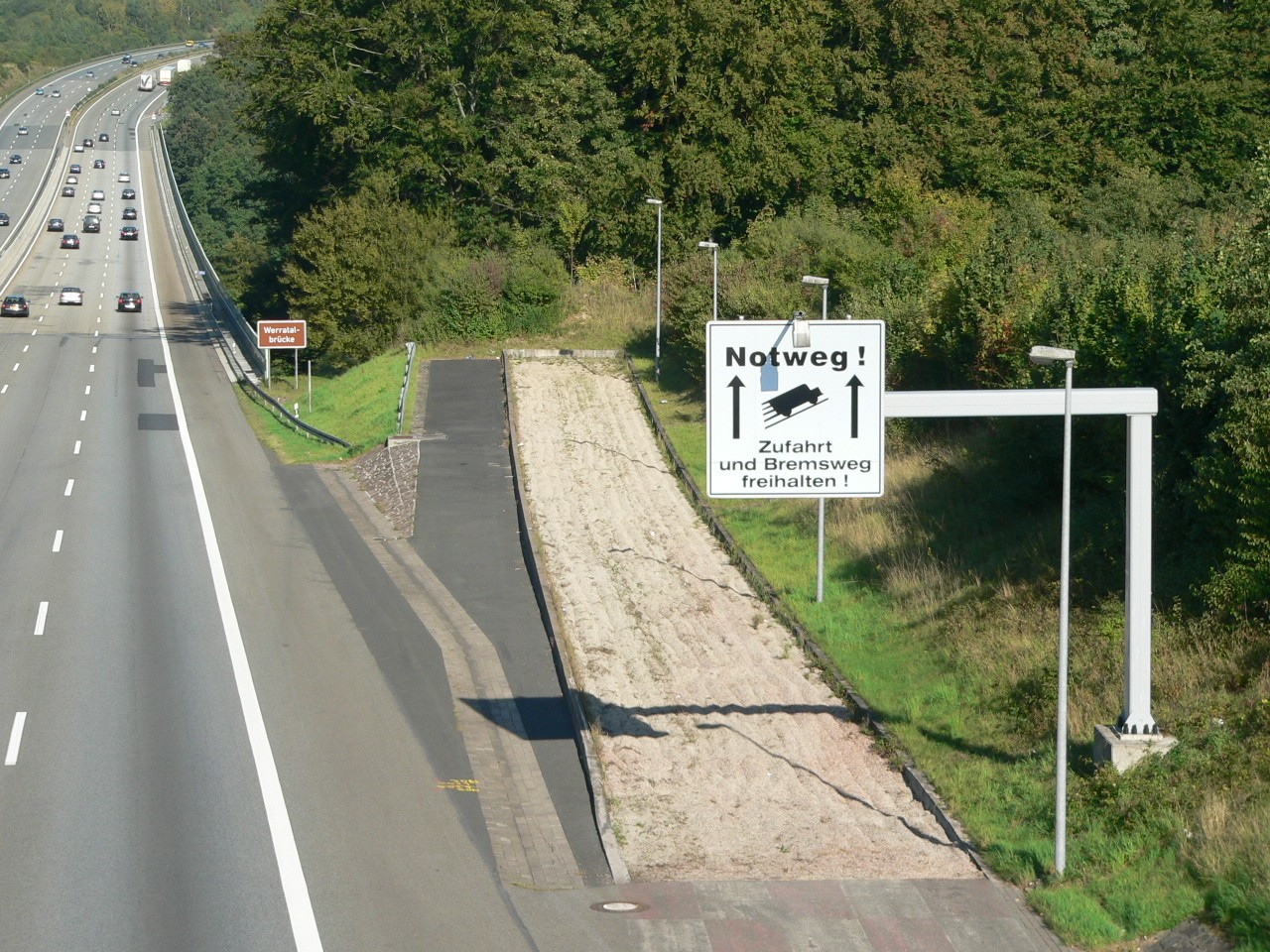
A runaway truck ramp, runaway truck lane, escape lane, emergency escape ramp, or truck arrester bed is a traffic device that enables vehicles which are having braking problems to safely stop. It is typically a long, sand- or gravel-filled lane connected to a steep downhill grade section of a main road, and is designed to accommodate large trucks or buses. It allows a moving vehicle's kinetic energy to be dissipated gradually in a controlled and relatively harmless way, helping the operator stop it safely. Design Emergency escape ramps are usually located in mountainous areas which cause high construction costs and present difficult site selection. A ramp may cost US$1 million. Designs include: *''Arrester bed'': a gravel-filled ramp adjacent to the road that uses rolling resistance to stop the vehicle. The required length of the bed depends on the mass and speed of the vehicle, the grade of the arrester bed, and the rolling resistance provided by the gravel. *''Gravity escape ra ... [...More Info...] [...Related Items...] OR: [Wikipedia] [Google] [Baidu] |
Glen Osmond Road
Glen Osmond Road is a major section of the Princes Highway (and Highway 1) in the city of Adelaide, South Australia. Connecting the Adelaide city centre with the Adelaide Hills via the South Eastern Freeway; Glen Osmond Road carries half of Adelaide's freight traffic and is the major commuter route from the southern Adelaide Hills. It is designated part of route A1. Route Glen Osmond Road starts at the intersection with South Terrace along the southern border of the Adelaide city centre and heads southeast, intersecting with Hutt and Greenhill Roads through the Adelaide Park Lands, continues southeast through Eastwood and Frewville, before ending at the intersection with Cross Road, Portrush Road and South Eastern Freeway in Glen Osmond. Glen Osmond Road houses a strip shopping precinct on the section between Greenhill and Fullarton Roads. The precinct is largely populated by independent boutiques. It is a community main street stationed in the leafy suburbs of Adelaide's sou ... [...More Info...] [...Related Items...] OR: [Wikipedia] [Google] [Baidu] |
Heysen Tunnels
The Heysen Tunnels are twin tube road tunnels which carry the South Eastern Freeway under Eagle On The Hill in the Mount Lofty Ranges in South Australia. The tunnels were excavated using a tunnelling machine normally used in heavy-duty mining operations which tunnelled through of rock for each tunnel at an average rate of per day. The tunnels were completed in 1998 and opened on 5 March 2000. Each tunnel carries three lanes of traffic. As at 2015, 45,700 vehicles passed through them daily. The maximum height of vehicles permitted in the tunnels is , the same as the Crafers and Mt Osmond interchanges. Laser height detectors monitor traffic to provide warnings to drivers before they attempt to enter the tunnel. The tunnels are named after artist Sir Hans Heysen. See also *List of tunnels in Australia This is a list of tunnels in Australia which includes any road, railway, waterway or other form of tunnel, anywhere in the country. Australian Capital Territory New South Wa ... [...More Info...] [...Related Items...] OR: [Wikipedia] [Google] [Baidu] |
Sydney
Sydney ( ) is the capital city of the state of New South Wales, and the most populous city in both Australia and Oceania. Located on Australia's east coast, the metropolis surrounds Sydney Harbour and extends about towards the Blue Mountains to the west, Hawkesbury to the north, the Royal National Park to the south and Macarthur to the south-west. Sydney is made up of 658 suburbs, spread across 33 local government areas. Residents of the city are known as "Sydneysiders". The 2021 census recorded the population of Greater Sydney as 5,231,150, meaning the city is home to approximately 66% of the state's population. Estimated resident population, 30 June 2017. Nicknames of the city include the 'Emerald City' and the 'Harbour City'. Aboriginal Australians have inhabited the Greater Sydney region for at least 30,000 years, and Aboriginal engravings and cultural sites are common throughout Greater Sydney. The traditional custodians of the land on which modern Sydney stands are ... [...More Info...] [...Related Items...] OR: [Wikipedia] [Google] [Baidu] |
Dukes Highway
Dukes Highway is a 190 kilometre highway corridor in South Australia which is part of the link between the Australian cities of Adelaide and Melbourne. It is part of the National Highway (Australia), National Highway system spanning Australia, and is signed as route A8. Route Dukes Highway commences at the intersection with Princes Highway in Tailem Bend, South Australia, Tailem Bend and heads in a southeast direction to the state border with Victoria (Australia), Victoria just east of Bordertown, South Australia, Bordertown, continuing into Victoria as Western Highway, Victoria, Western Highway, with the same route signage (route A8). It is mostly a single carriageway of one lane each way, plus a total of 36 overtaking lanes. Approximately has "wide centre lines" providing a boundary between traffic travelling in opposite directions. Generally, the quality of Dukes Highway is of a high standard, with the entire road having wide lane widths and sealed shoulders with at least f ... [...More Info...] [...Related Items...] OR: [Wikipedia] [Google] [Baidu] |
Swanport Bridge
Swanport Bridge is a road bridge that carries Highway 1 across the Murray River, located approximately southeast of the town of Murray Bridge in South Australia, Australia. Opened on 30 May 1979 by transport minister Geoff Virgo, the bridge connects the communities of Murray Bridge and Tailem Bend. Characteristics The bridge itself is in length with two lanes, one for each direction of traffic, and no separating median. It is constructed from prestressed concrete. There is a footpath on the northern side, with no barrier from the roadway, signposted as being for emergency use only. The bridge serves as a link between the South Eastern Freeway to the west and the Princes Highway continuing to the east, and as such is an integral part of the Adelaide–Melbourne Melbourne ( ; Boonwurrung/Woiwurrung: ''Narrm'' or ''Naarm'') is the capital and most populous city of the Australian state of Victoria, and the second-most populous city in both Australia and Oceania. Its n ... [...More Info...] [...Related Items...] OR: [Wikipedia] [Google] [Baidu] |


