|
South East Dorset Conurbation
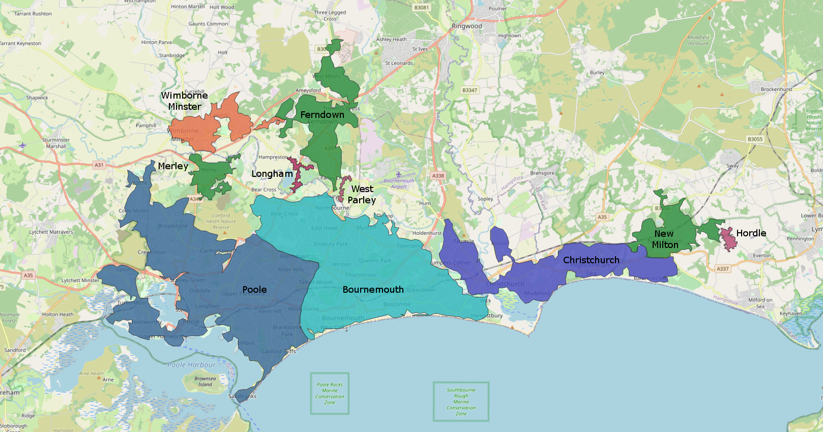
The South East Dorset conurbation (also known as the South Dorset conurbation, Poole-Bournemouth urban area and Bournemouth urban area) is a multi-centred conurbation on the south coast of Dorset in England. Extent The main population centres are Bournemouth, Christchurch, and Poole which are served by the single unitary authority of Bournemouth, Christchurch and Poole. However, the urbanised area spreads into the area of the Dorset unitary authority and into the New Forest District as far east as Barton on Sea. There are a number of satellite towns peripheral to the urban centres, including (listed clockwise) Wareham, Verwood, and Ringwood (Hampshire). The urban area is generally surrounded by a green belt. In 2006, the South West England Regional Development Agency and the Highways Agency, which maintains England's trunk roads, defined a South East Dorset Conurbation with over 400,000 people. The term has also been applied to the Bournemouth, Christchurch and Poole b ... [...More Info...] [...Related Items...] OR: [Wikipedia] [Google] [Baidu] |
South West Hampshire/South East Dorset Green Belt
The South West Hampshire & South East Dorset Green Belt is a Green belt (United Kingdom), green belt environmental policy, environmental and Planning in the United Kingdom, planning policy that regulates the rural space in the South West England, South West region of England. It is mainly within the county of Dorset, extending cross border into Hampshire. Essentially, the function of the belt is to control development expansion in the South East Dorset conurbation and outlying towns and villages. It is managed by Local planning authority (UK), local planning authorities on guidance from central government. Geography First created in 1958 (Hampshire) and 1980 (Dorset), land area taken up by the green belt is , 0.3% of the total land area of England (2017). Much of this is within the Dorset (unitary authority), Dorset Council unitary authority area, with smaller portions within the Bournemouth, Christchurch, Dorset, Christchurch and Poole (Bournemouth, Christchurch and Poole, BCP) ... [...More Info...] [...Related Items...] OR: [Wikipedia] [Google] [Baidu] |
Lytchett Matravers
Lytchett Matravers is a village and civil parish in Dorset, England. The 2011 census recorded the parish as having 1,439 households and a population of 3,424. History The name comes from the Brittonic ''litchet'' meaning "grey wood" and the Norman surname "Maltravers." Until the Norman Conquest of England in 1066 a Danish lord called Tholf held the manor of Lytchett. An alternative derivation of the name Lytchett is from the word lynchet or linchet, which is an earth terrace found on the side of a hill. Lynchets are a feature of ancient field systems of the British Isles. Such terraces were visible in Garden Wood above the Church and Manor in the 1970's. After the conquest William I granted the manor to Hugh Maltravers, who was still the feudal overlord when the Domesday Book of 1086 recorded Lytchett Matravers as part of Cogdean Hundred in 1086. The Maltravers family held the village for about 300 years, until the Black Death reduced the population in the second half of ... [...More Info...] [...Related Items...] OR: [Wikipedia] [Google] [Baidu] |
Corfe Mullen
Corfe Mullen is a village in Dorset, England, on the north-western urban fringe of the South East Dorset conurbation. The village had a population of 10,133 at the 2011 Census. It is served by six churches, four pubs, five schools, a library, various shops and local businesses, a village hall, and many community and sports organisations. On 10 December 2019 The Corfe Mullen Parish Council resolved to adopt Town Council status, citing potential financial benefits. In all other aspects Corfe Mullen is still very much a village, albeit a large one. The name ''Corfe Mullen'' is derived from (the Old English for a or pass) and (the Old French for a mill). The mill referred to is the old water mill on the River Stour, mentioned in the Domesday Book, where the village originally stood. Despite the proximity of the urban area, Corfe Mullen is surrounded by Green Belt. It lies within the Dorset Heaths. History Early nomadic tribes and settlers The first evidence of people livi ... [...More Info...] [...Related Items...] OR: [Wikipedia] [Google] [Baidu] |
Bransgore
Bransgore is a village and civil parish within the New Forest District, Hampshire, England. The village developed in the 19th century when a church and a school were built. It is technically classified as an urban area, although in some respects it still has the picturesque character of a rural English village. Overview Bransgore is a village and civil parish in the New Forest District of Hampshire. The parish includes the village of Thorney Hill, and the hamlets of Neacroft, Godwinscroft, Beckley, Hinton, and Waterditch. At the time of the last national census of 2011, Bransgore had a total population of 4,238, with just over half being aged between 20 and 64. Bransgore now straddles the border of the newly created New Forest National Park, with the majority of the village being outside the park. Bransgore has a wide variety of shops including a post office, pharmacy, bakery, greengrocer, hairdresser, and take-away food shops. [...More Info...] [...Related Items...] OR: [Wikipedia] [Google] [Baidu] |
New Milton
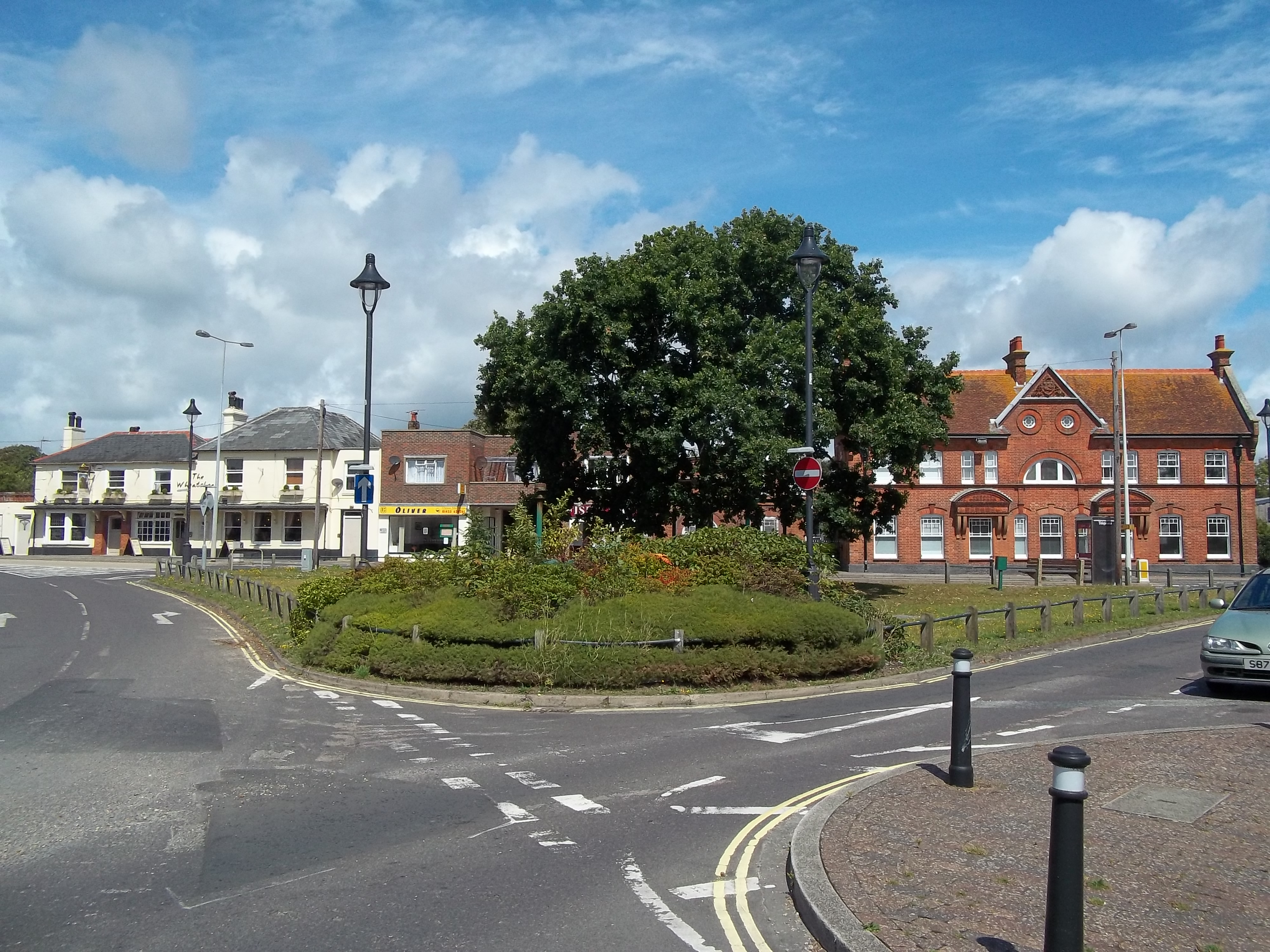
New Milton is a market town in southwest Hampshire, England. To the north is in the New Forest and to the south the coast at Barton-on-Sea. The town is equidistant between Lymington and Christchurch, 6 miles (10 km) away. History New Milton dates back to Anglo-Saxon times, and encompasses Old Milton, Barton on Sea, Ashley, Bashley, and Wootton. It is recorded as having a population of 25,717 in the 2011 census. Milton The manor of ("Mildeltune") is listed in the Domesday Book of 1086 and literally means "Middle farm." It was part of the lands belonging to Hugh de Port, and the estate was held from him by William Chernet.William Page (editor), 1912''A History of the County of Hampshire: Volume 5'' Victoria County History The Chernet family maintained possession of Milton into the 13th century, although lesser families were managing the estate on their behalf. The most important of these were the Chaucombe (or Chalcombe) family, who were probably the first people ... [...More Info...] [...Related Items...] OR: [Wikipedia] [Google] [Baidu] |
Wimborne Minster
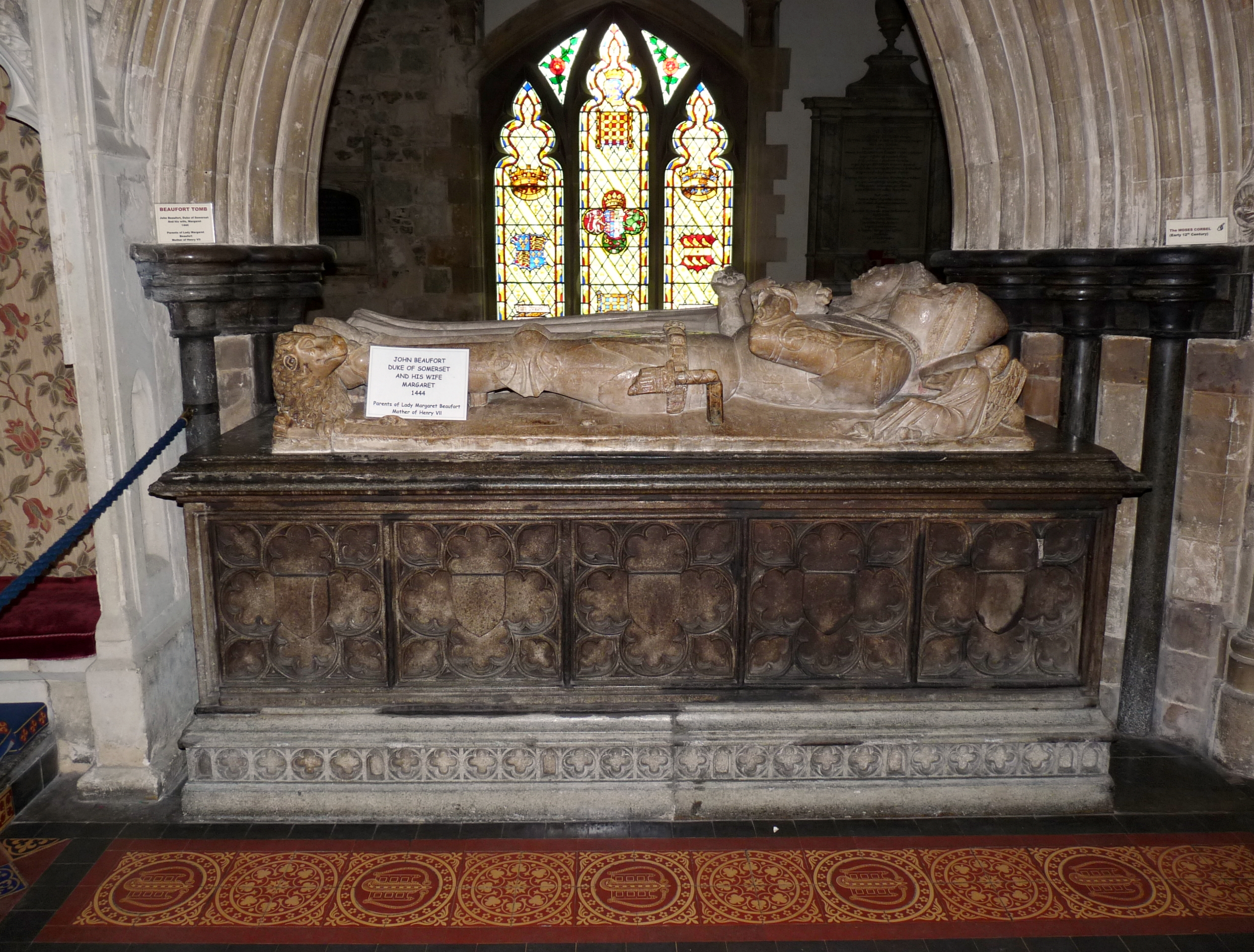
Wimborne Minster (often referred to as Wimborne, ) is a market town in Dorset in South West England, and the name of the Church of England church in that town. It lies at the confluence of the River Stour and the River Allen, north of Poole, on the Dorset Heaths, and is part of the South East Dorset conurbation. According to Office for National Statistics data the population of the Wimborne Minster built-up area was 15,552. Governance The town and its administrative area are served by eleven councillors plus one from the nearby ward of Cranfield. The electoral ward of Wimborne Minster is slightly bigger than the parish, with a 2011 population of 7,014. Wimborne Minster is part of the Mid Dorset and North Poole parliamentary constituency. Buildings and architecture Wimborne has one of the foremost collections of 15th-, 16th- and 17th-century buildings in Dorset. Local planning has restricted the construction of new buildings in areas such as the Cornmarket and the High S ... [...More Info...] [...Related Items...] OR: [Wikipedia] [Google] [Baidu] |
Ferndown
Ferndown is a town and civil parish in Dorset in southern England, immediately to the north of Bournemouth and Poole. The parish, which until 1972 was called ''Hampreston'', includes the communities of Hampreston, Longham, Stapehill and Trickett's Cross.About Ferndown - Ferndown Town Council website At the 2011 Census, the population of the parish was 26,559, making Ferndown the largest inland town in Dorset in terms of population, being larger than Dorchester. The district has a relatively large elderly population: in 2006, 38.5% were aged 60 or above.
|
Office For National Statistics
The Office for National Statistics (ONS; cy, Swyddfa Ystadegau Gwladol) is the executive office of the UK Statistics Authority, a non-ministerial department which reports directly to the UK Parliament. Overview The ONS is responsible for the collection and publication of statistics related to the economy, population and society of the UK; responsibility for some areas of statistics in Scotland, Northern Ireland and Wales is devolved to the devolved governments for those areas. The ONS functions as the executive office of the National Statistician, who is also the UK Statistics Authority's Chief Executive and principal statistical adviser to the UK's National Statistics Institute, and the 'Head Office' of the Government Statistical Service (GSS). Its main office is in Newport near the United Kingdom Intellectual Property Office and Tredegar House, but another significant office is in Titchfield in Hampshire, and a small office is in London. ONS co-ordinates data collection wi ... [...More Info...] [...Related Items...] OR: [Wikipedia] [Google] [Baidu] |
City Status In The United Kingdom
City status in the United Kingdom is granted by the monarch of the United Kingdom to a select group of communities. , there are 76 cities in the United Kingdom—55 in England, seven in Wales, eight in Scotland, and six in Northern Ireland. Although it carries no special rights, the status of city can be a marker of prestige and confer local pride. The status does not apply automatically on the basis of any particular criterion, though in England and Wales it was traditionally given to towns with diocesan cathedrals. This association between having an Anglican cathedral and being called a city was established in the early 1540s when King Henry VIII founded dioceses (each having a cathedral in the see city) in six English towns and granted them city status by issuing letters patent. City status in Ireland was granted to far fewer communities than in England and Wales, and there are only two pre-19th-century cities in present-day Northern Ireland. In Scotland, city status ... [...More Info...] [...Related Items...] OR: [Wikipedia] [Google] [Baidu] |
Local Transport Plan
{{Unreferenced, date=April 2008 Local transport plans, divided into full local transport plans (LTP) and local implementation plans for transport (LIP) are an important part of transport planning in England. Strategic transport authorities (county councils, unitary authorities, passenger transport authorities and London Borough councils), are expected to prepare them as forward-looking plans covering a number of years (typically five years), and present them to the Department for Transport (DfT). Different arrangements apply to Scotland, Wales and Northern Ireland as transport is a devolved matter. LTPs must: * Outline the current baseline with regard to transport, accessibility and pollution * Set out challenging but achievable objectives * Set out the programme for achieving these objectives * Outline 'bids' for funding from the DfT Once an LTP is prepared it is submitted to the Secretary of State for Transport (England only); in London, the related LIP is submitted to the May ... [...More Info...] [...Related Items...] OR: [Wikipedia] [Google] [Baidu] |


.jpg)