|
South Devon Area Of Outstanding Natural Beauty
The South Devon Area of Outstanding Natural Beauty (AONB) covers 337 square kilometres, including much of the South Hams area of Devon and the rugged coastline from Jennycliff Bay to Elberry Cove near Brixham. The purpose of an Area of Outstanding Natural Beauty is to conserve and enhance the area's natural beauty. In South Devon this includes: undeveloped coastline, estuaries, geological and geomorphological features, expansive panoramic views, ancient agricultural field pattern, Devon banks, areas of high tranquility, dark night skies and natural nightscapes, historic features, green lanes, well known cultural associations, picturesque villages and hamlets. South Devon AONB was formally designated in August 1960 under the National Parks and Access to the Countryside Act 1949 (South Devon AONB Management Plan 2009-14). The highest point in the AONB is Blackdown Camp at 199 metres above sea level. Towns and villages within the area include Bigbury/Burgh Island, Kingsbridge, Newto ... [...More Info...] [...Related Items...] OR: [Wikipedia] [Google] [Baidu] |
Slapton Sands
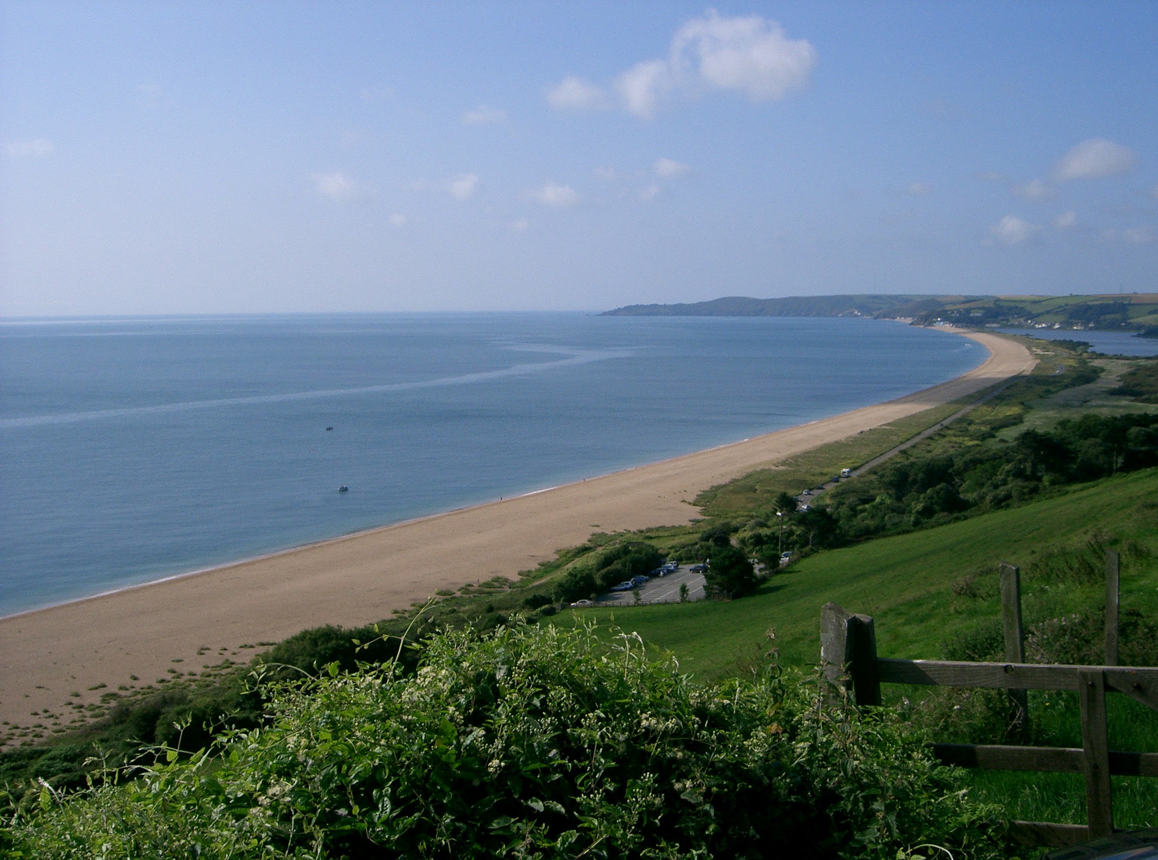
Slapton is a village and civil parish in the South Hams district of Devon, England. It is located near the A379 road between Kingsbridge and Dartmouth, and lies within the South Devon Area of Outstanding Natural Beauty (AONB). The nearby beach is Slapton Sands; despite its name, it is not a sandy beach but a shingle one. In 1901 the population of the civil parish was 527, decreasing to 473 in 2001, and decreasing further to 434 at the 2011 census. The parish is surrounded clockwise from the north by the parishes of Blackawton, Strete, Stokenham and East Allington. History Slapton was recorded in the Domesday Book of 1086 as ''Sladone''. The Collegiate Chantry of St Mary was founded in 1372 or 1373 by Sir Guy de Brian. The Tower Inn and West tower remain and the tower has been designated by English Heritage as a grade I listed building. The Church of St James dates from the late 13th or early 14th century, and is also grade I listed. The nearby beach is a coastal bar (see ... [...More Info...] [...Related Items...] OR: [Wikipedia] [Google] [Baidu] |
Kingswear
Kingswear is a village and civil parish in the South Hams area of the English county of Devon. The village is located on the east bank of the tidal River Dart, close to the river's mouth and opposite the small town of Dartmouth. It lies within the South Devon Area of Outstanding Natural Beauty, and has a population of 1,332, reducing to 1,217 at the 2011 census. Kingswear is noted for being the railhead for Dartmouth, a role continued to this day by the presence of the Paignton and Dartmouth Steam Railway in the village. Two vehicle ferries and one pedestrian ferry provide links to Dartmouth. The village itself contains several small tourist-oriented shops and public houses, and is home to the Royal Dart Yacht Club. Kingswear Castle, a privately owned 15th century artillery tower, is situated on the outskirts. Kingswear also contains the Church of St Thomas, which is a member of the Anglican Diocese of Exeter and whose patron saint is Saint Thomas of Canterbury. History ... [...More Info...] [...Related Items...] OR: [Wikipedia] [Google] [Baidu] |
Prawle Point
Prawle Point ( oe, Prǣwhyll, "lookout hill") is a coastal headland in south Devon, England. It is the southernmost point of Devon. Just to the west is Elender Cove, and further west are Gammons Head Beach, also known as Maceley Cove, and Gammon Head. Access is from the village of East Prawle along a single-track road, at the end of which a National Trust car park is present. At the point itself, there are high cliffs. The National Coastwatch Institution has a station at the point. The area around the point is a noted area for cirl bunting, a localised bird in Britain, while the area has also attracted many rare vagrant birds including Britain's second chestnut-sided warbler. The point is included within the Prawle Point and Start Point Site of Special Scientific Interest, which stretches from here to Start Point. Shipwrecks Many ships have been wrecked at Prawle Point. ''Lalla Rookh'', a tea clipper, was wrecked after striking Gammon head, afterwards being broken up and b ... [...More Info...] [...Related Items...] OR: [Wikipedia] [Google] [Baidu] |
National Trust For Places Of Historic Interest Or Natural Beauty
The National Trust, formally the National Trust for Places of Historic Interest or Natural Beauty, is a charity and membership organisation for heritage conservation in England, Wales and Northern Ireland. In Scotland, there is a separate and independent National Trust for Scotland. The Trust was founded in 1895 by Octavia Hill, Sir Robert Hunter and Hardwicke Rawnsley to "promote the permanent preservation for the benefit of the Nation of lands and tenements (including buildings) of beauty or historic interest". It was given statutory powers, starting with the National Trust Act 1907. Historically, the Trust acquired land by gift and sometimes by public subscription and appeal, but after World War II the loss of country houses resulted in many such properties being acquired either by gift from the former owners or through the National Land Fund. Country houses and estates still make up a significant part of its holdings, but it is also known for its protection of wild lands ... [...More Info...] [...Related Items...] OR: [Wikipedia] [Google] [Baidu] |
Bolberry Down
Bolberry Down is a clifftop area on the coast of Devon, England. The headland of Bolt Tail lies to the west and Bolt Head and the town of Salcombe to the east. It is one of the longest coastal areas owned by the National Trust and lies within the South Devon Area of Outstanding Natural Beauty An Area of Outstanding Natural Beauty (AONB; , AHNE) is an area of countryside in England, Wales, and Northern Ireland, that has been designated for conservation due to its significant landscape value. Areas are designated in recognition of .... The down provides views across the English Channel. ''Bolberry Down'' was the site of a Decca Navigator station in the SOUTH WEST BRITISH 1B chain which operated from 1952 until 31 March 2000, covering the south-west approaches. The visible sign of this system were three 150ft tubular masts and these were located to the east of the access road to Bolberry Down, together with the former bungalows for the staff. One mast remains in use tod ... [...More Info...] [...Related Items...] OR: [Wikipedia] [Google] [Baidu] |
Bolt Head
Bolt Head is a National Trust headland on the South Coast of Devon, England, United Kingdom, situated west of the Kingsbridge Estuary. ''''. It is a popular viewpoint on the between , , Bolberry Down< ... [...More Info...] [...Related Items...] OR: [Wikipedia] [Google] [Baidu] |
South West Coast Path
The South West Coast Path is England's longest waymarked long-distance footpath and a National Trail. It stretches for , running from Minehead in Somerset, along the coasts of Devon and Cornwall, to Poole Harbour in Dorset. Because it rises and falls with every river mouth, it is also one of the more challenging trails. The total height climbed has been calculated to be 114,931 ft (35,031 m), almost four times the height of Mount Everest. It has been voted 'Britain's Best Walking route' twice in a row by readers of The Ramblers' ''Walk'' magazine, and regularly features in lists of the world's best walks. The final section of the path was designated as a National Trail in 1978. Many of the landscapes which the South West Coast Path crosses have special status, either as a national park or one of the heritage coasts. The path passes through two World Heritage Sites: the Dorset and East Devon Coast, known as the Jurassic Coast, was designated in 2001, and the Cornwall ... [...More Info...] [...Related Items...] OR: [Wikipedia] [Google] [Baidu] |
Tettigoniidae
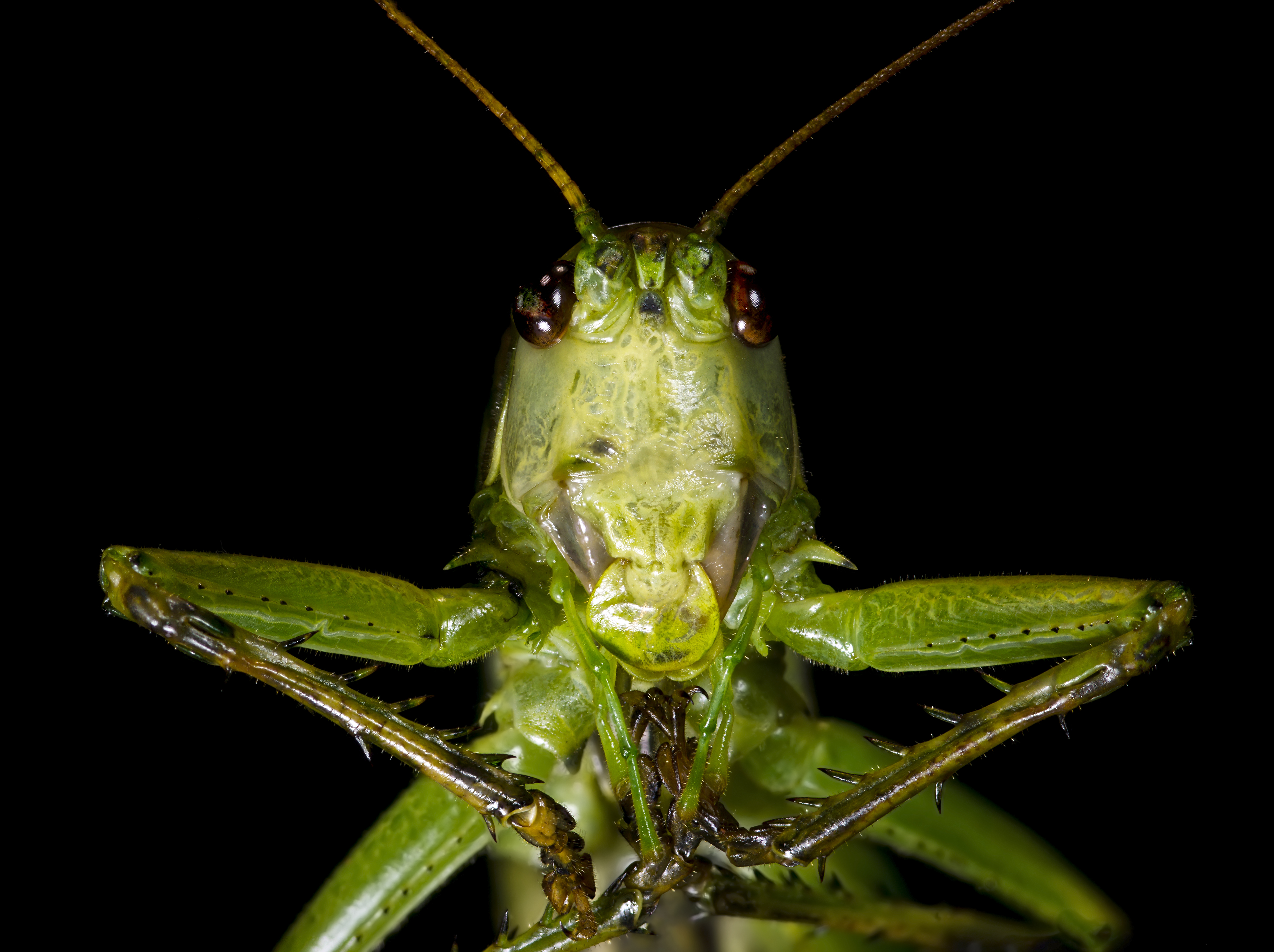
Insects in the family Tettigoniidae are commonly called katydids (especially in North America), or bush crickets. They have previously been known as "long-horned grasshoppers". More than 8,000 species are known. Part of the suborder Ensifera, the Tettigoniidae are the only extant (living) family in the superfamily Tettigonioidea. They are primarily nocturnal in habit with strident mating calls. Many species exhibit mimicry and camouflage, commonly with shapes and colors similar to leaves. Etymology The family name Tettigoniidae is derived from the genus ''Tettigonia'', first described by Carl Linnaeus in 1758. In Latin ''tettigonia'' means a kind of small cicada, leafhopper; it is from the Greek τεττιγόνιον ''tettigonion'', the diminutive of the imitative ( onomatopoeic) τέττιξ, ''tettix'', cicada. All of these names such as ''tettix'' with repeated sounds are onomatopoeic, imitating the stridulation of these insects. The common name ''katydid'' is also onomat ... [...More Info...] [...Related Items...] OR: [Wikipedia] [Google] [Baidu] |
Rumex
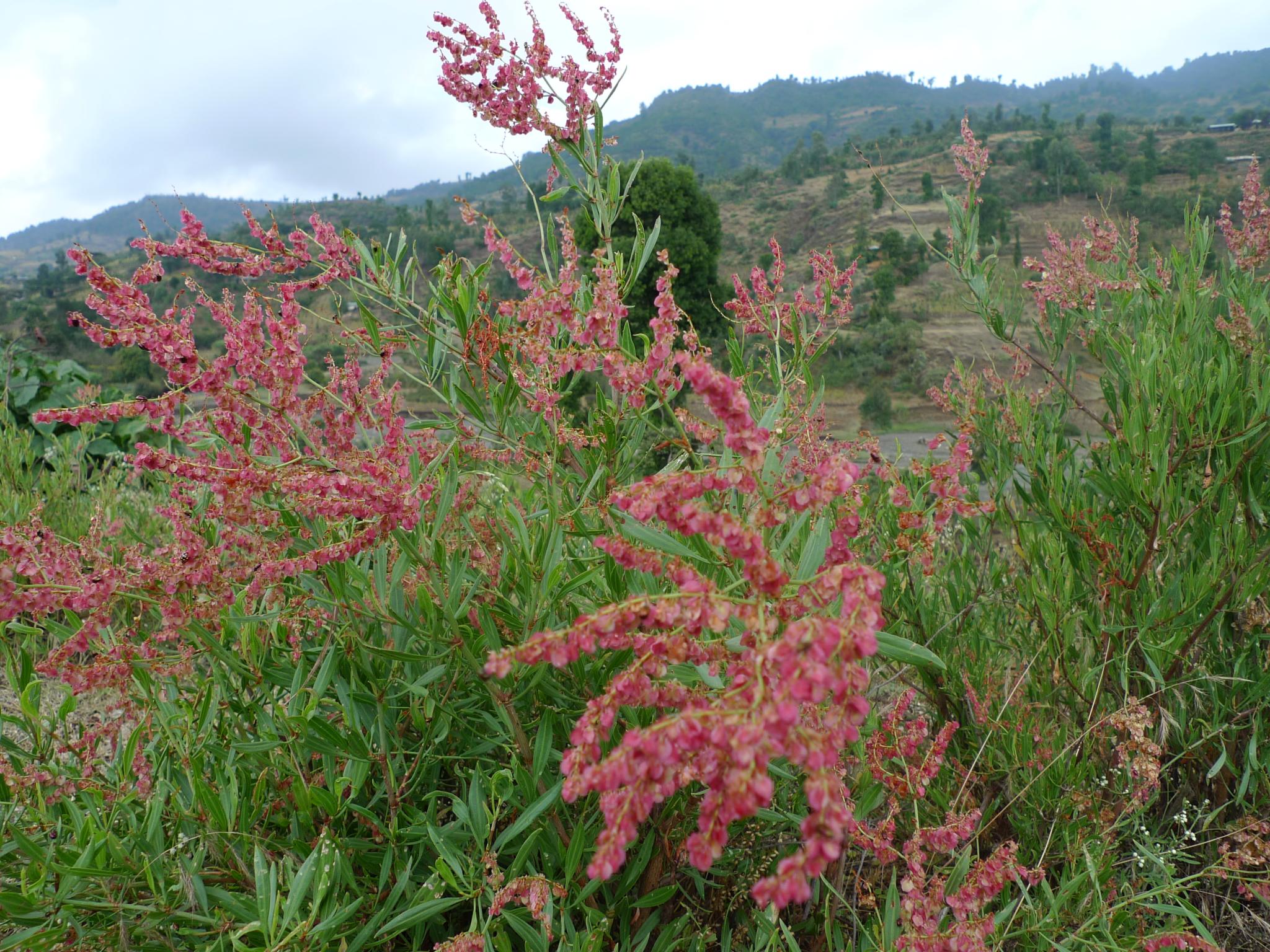
The docks and sorrels, genus ''Rumex'', are a genus of about 200 species of annual, biennial, and perennial herbs in the buckwheat family, Polygonaceae. Members of this genus are very common perennial herbs with a native almost worldwide distribution, and introduced species growing in the few places where the genus is not native. Some are nuisance weeds (and are sometimes called dockweed or dock weed), but some are grown for their edible leaves. ''Rumex'' species are used as food plants by the larvae of a number of Lepidoptera species, and are the only host plants of ''Lycaena rubidus.'' Description They are erect plants, usually with long taproots. The fleshy to leathery leaves form a basal rosette at the root. The basal leaves may be different from those near the inflorescence. They may or may not have stipules. Minor leaf veins occur. The leaf blade margins are entire or crenate. The usually inconspicuous flowers are carried above the leaves in clusters. The fertile flowers a ... [...More Info...] [...Related Items...] OR: [Wikipedia] [Google] [Baidu] |
Cirl Bunting
The cirl bunting ( ), (''Emberiza cirlus''), is a passerine bird in the bunting family Emberizidae, a group now separated by most modern authors from the finches, Fringillidae. It breeds across southern Europe, on the Mediterranean islands and in north Africa. It is a resident of these warmer areas, and does not migrate in winter. It is common in all sorts of open areas with some scrub or trees, but has a preference for sunny slopes. In the 19th century it has been introduced to New Zealand and the persistent population remains in the South Island. Changes in agricultural practice have affected this species very adversely at the northern fringes of its range, and in England, where it once occurred over much of the south of the country, it is now restricted to south Devon. The cirl bunting is the mascot on the signs for the village of Stokeinteignhead in Devon. Taxonomy The cirl bunting was formally described by the Swedish naturalist Carl Linnaeus in 1766 in the twelfth e ... [...More Info...] [...Related Items...] OR: [Wikipedia] [Google] [Baidu] |
Greater Horseshoe Bat
The greater horseshoe bat (''Rhinolophus ferrumequinum'') is an insectivorous bat of the genus '' Rhinolophus''. Its distribution covers Europe, Northern Africa, Central Asia and Eastern Asia. It is the largest of the horseshoe bats in Europe and is thus easily distinguished from other species. The species is sedentary, typically travelling up to between the winter and summer roosts, with the longest recorded movement being . The frequencies used by this bat species for echolocation lie between 69–83 kHz, have most energy at 81 kHz and have an average duration of 37.4 ms. Description The greater horseshoe bat is the largest horseshoe bat in Europe.Schober, W., E. Grimmberger. 1997. It has a distinctive noseleaf, which has a pointed upper part and a horseshoe-shaped lower part. Its horseshoe noseleaf helps to focus the ultrasound it uses to 'see'. The greater horseshoe bat also has tooth and bone structures that are distinct from that of other rhinolophids. ... [...More Info...] [...Related Items...] OR: [Wikipedia] [Google] [Baidu] |
Special Area Of Conservation
A Special Area of Conservation (SAC) is defined in the European Union's Habitats Directive (92/43/EEC), also known as the ''Directive on the Conservation of Natural Habitats and of Wild Fauna and Flora''. They are to protect the 220 habitats and approximately 1,000 species listed in annex I and II of the directive which are considered to be of European interest following criteria given in the directive. They must be chosen from the Sites of Community Importance by the member states and designated SAC by an act assuring the conservation measures of the natural habitat. SACs complement Special Protection Areas and together form a network of protected sites across the European Union called Natura 2000. This, in turn, is part of the Emerald network of Areas of Special Conservation Interest (ASCIs) under the Berne Convention. Assessment methodology in the United Kingdom Prior to being designated as a Special Area of Conservation (SAC), sites have been assessed under a two-stage process ... [...More Info...] [...Related Items...] OR: [Wikipedia] [Google] [Baidu] |


