|
Solar Eclipse Of October 23, 2014
A partial solar eclipse occurred on Thursday, October 23, 2014, with a magnitude of 0.81141. A solar eclipse occurs when the Moon passes between Earth and the Sun, thereby totally or partly obscuring the image of the Sun for a viewer on Earth. A partial solar eclipse occurs in the polar regions of the Earth when the center of the Moon's shadow misses the Earth. Occurring only 5.7 days after apogee (Apogee on October 18, 2014), the Moon's apparent diameter was smaller. It was the 9th eclipse of the 153rd Saros cycle, which began with a partial eclipse on July 28, 1870 and will conclude with a partial eclipse on August 22, 3114. Viewing The center of the Moon's shadow missed the Earth, passing above the North Pole, but a partial eclipse was visible at sunrise (October 24 local time) in far eastern Russia, and before sunset (October 23) across most of North America. Gallery Solar_eclipse_of_October_23_2014_greatest_partiality.png, Simulated greatest partiality from Nunav ... [...More Info...] [...Related Items...] OR: [Wikipedia] [Google] [Baidu] |
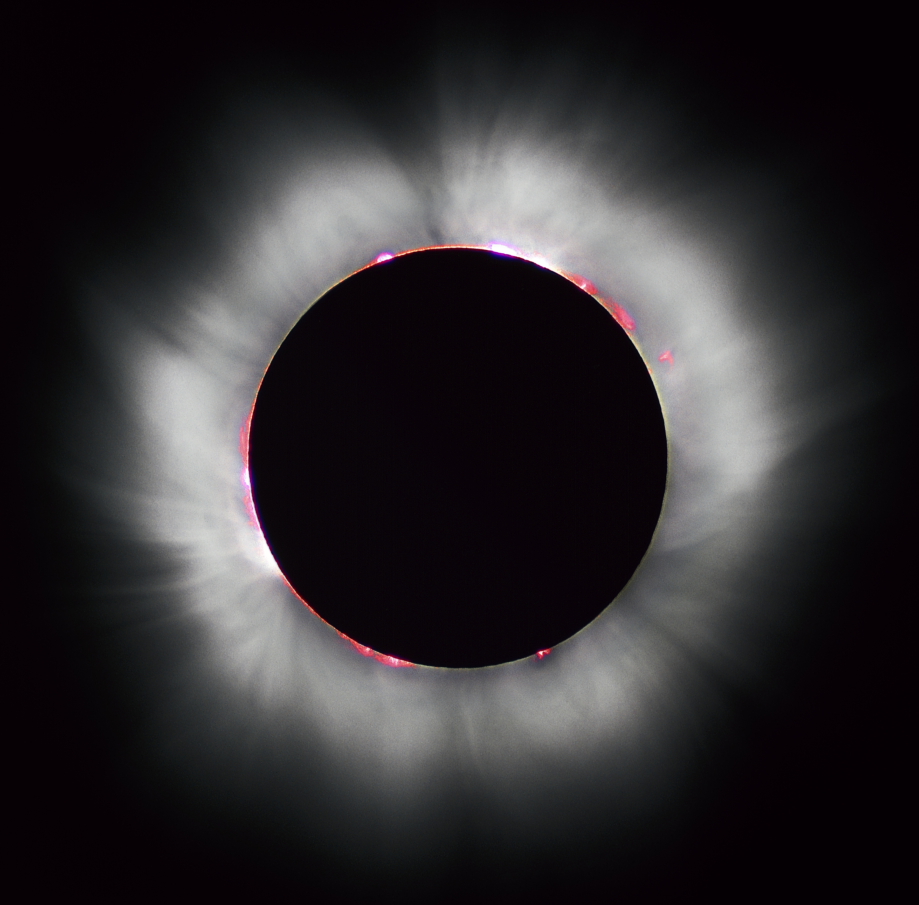
Solar Eclipse
A solar eclipse occurs when the Moon passes between Earth and the Sun, thereby obscuring the view of the Sun from a small part of the Earth, totally or partially. Such an alignment occurs during an eclipse season, approximately every six months, during the new moon phase, when the Moon's orbital plane is closest to the plane of the Earth's orbit. In a total eclipse, the disk of the Sun is fully obscured by the Moon. In partial and annular eclipses, only part of the Sun is obscured. Unlike a lunar eclipse, which may be viewed from anywhere on the night side of Earth, a solar eclipse can only be viewed from a relatively small area of the world. As such, although total solar eclipses occur somewhere on Earth every 18 months on average, they recur at any given place only once every 360 to 410 years. If the Moon were in a perfectly circular orbit and in the same orbital plane as Earth, there would be total solar eclipses once a month, at every new moon. Instead, because the Moon ... [...More Info...] [...Related Items...] OR: [Wikipedia] [Google] [Baidu] |
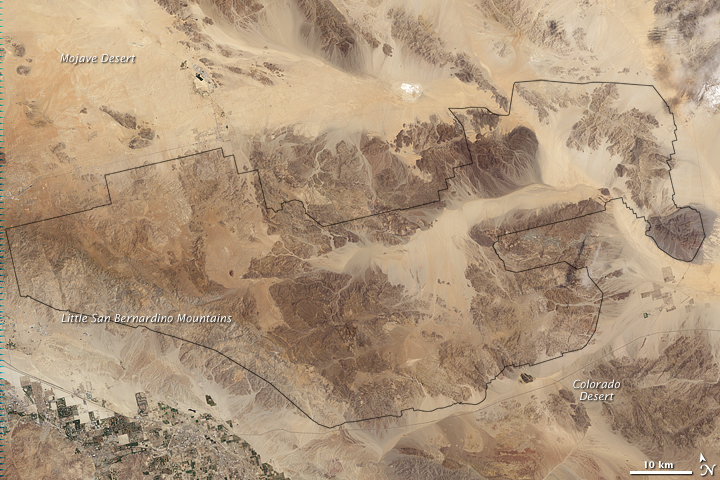
Joshua Tree National Park
Joshua Tree National Park is an American national park in southeastern California, east of San Bernardino and Los Angeles and north of Palm Springs, California, Palm Springs. It is named after the Joshua trees (''Yucca brevifolia'') native to the Mojave Desert. Originally declared a National monument (United States), national monument in 1936, Joshua Tree was redesignated as a national park in 1994 when the United States Congress, U.S. Congress passed the California Desert Protection Act of 1994, California Desert Protection Act. Encompassing a total of – slightly larger than the state of Rhode Island – the park includes of designated National Wilderness Preservation System#Wilderness areas, wilderness. Straddling San Bernardino County, California, San Bernardino and Riverside County, California, Riverside Counties, the park includes parts of two deserts, each an ecosystem whose characteristics are determined primarily by elevation: the higher Mojave Desert and the ... [...More Info...] [...Related Items...] OR: [Wikipedia] [Google] [Baidu] |
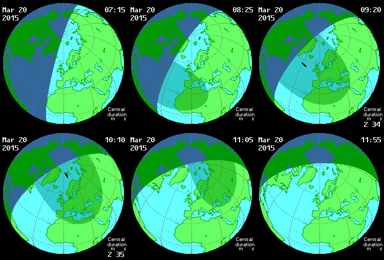
Solar Eclipse Of March 20, 2015
A total solar eclipse occurred on March 20, 2015. A solar eclipse occurs when the Moon passes between Earth and the Sun, thereby totally or partly obscuring the image of the Sun for a viewer on Earth. A total solar eclipse occurs when the Moon's apparent diameter is larger than the Sun's, blocking all direct sunlight, turning day into darkness. Totality occurs in a narrow path across Earth's surface, with a partial solar eclipse visible over a surrounding region thousands of kilometres wide. This total solar eclipse is notable in that the path of totality passed over the North Pole. Totality was visible in the Faroe Islands and Svalbard. It had a magnitude of 1.0445. The longest duration of totality was 2 minutes and 47 seconds off the coast of the Faroe Islands. It was the last total solar eclipse visible in Europe until the eclipse of August 12, 2026. The track of totality passed across the North Atlantic and into the Arctic Ocean. Event The solar eclipse began at 08:30 GMT ... [...More Info...] [...Related Items...] OR: [Wikipedia] [Google] [Baidu] |
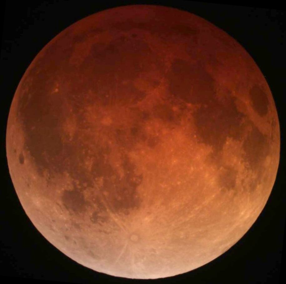
October 2014 Lunar Eclipse
A total lunar eclipse took place on Wednesday 8 October 2014. It is the second of two total lunar eclipses in 2014, and the second in a ''tetrad'' (four total lunar eclipses in series). Other eclipses in the tetrad are those of 15 April 2014, 4 April 2015, and 28 September 2015. Occurring only 2.1 days after perigee (Perigee on 6 October 2014), the Moon's apparent diameter was larger, 1960.6 arcseconds (32 arcminutes, 40.6 arcseconds). This is the 42nd member of Lunar Saros 127. The previous event is the September 1996 lunar eclipse. The next event is October 2032 lunar eclipse. Visibility and appearance The eclipse was visible in its entirety over the Northern Pacific. Viewers in North America experienced the eclipse after midnight on Wednesday, 8 October, and the eclipse was visible from the Philippines, Western Pacific, Australia, Indonesia, Japan, and Eastern Asia after sunset on the evening of 8 October. Many areas of North America experienced a selenelion, able to ... [...More Info...] [...Related Items...] OR: [Wikipedia] [Google] [Baidu] |
Solar Eclipse Of April 29, 2014
An annular solar eclipse occurred on Tuesday, April 29, 2014. A solar eclipse occurs when the Moon passes between Earth and the Sun, thereby totally or partly obscuring the image of the Sun for a viewer on Earth. An annular solar eclipse occurs when the Moon's apparent diameter is smaller than the Sun's, blocking most of the Sun's light and causing the Sun to look like an annulus (ring). An annular eclipse appears as a partial eclipse over a region of the Earth thousands of kilometres wide. The center of the Moon's shadow missed the Earth's South Pole, but the partial eclipse was visible from parts of Antarctica and Australia, and an annular eclipse was visible from a small part of Antarctica. This eclipse's gamma value was closer to 1 than any other eclipse from 2000 B.C. to 3000 A.D. This means the center of the moon shadow passed almost exactly at the surface of the Earth, barely missing the Antarctic continent by a few kilometers. Visibility Animation of eclipse path Images ... [...More Info...] [...Related Items...] OR: [Wikipedia] [Google] [Baidu] |
April 2014 Lunar Eclipse
A total lunar eclipse took place on 15 April 2014. It was the first of two total lunar eclipses in 2014, and the first in a tetrad (four total lunar eclipses in a series). Subsequent eclipses in the tetrad are those of 8 October 2014, 4 April 2015, and 28 September 2015. Occurring 6.7 days after apogee (Apogee on 8 April 2014), the Moon's apparent diameter was smaller. The Moon passed through the center of the Earth's shadow. This was the last central lunar eclipse of Lunar Saros 122. The eclipse was visible in the Americas and the Pacific Ocean region, including Australia and New Zealand. This eclipse occurred during the ascending phase of the Moon's orbit, part of lunar saros 122. Mars was near opposition. Background A lunar eclipse occurs when the Moon passes within Earth's umbra (shadow). As the eclipse begins, the Earth's shadow first darkens the Moon slightly. Then, the shadow begins to "cover" part of the Moon, turning it a dark red-brown color (typically - ... [...More Info...] [...Related Items...] OR: [Wikipedia] [Google] [Baidu] |
Coralville, Iowa
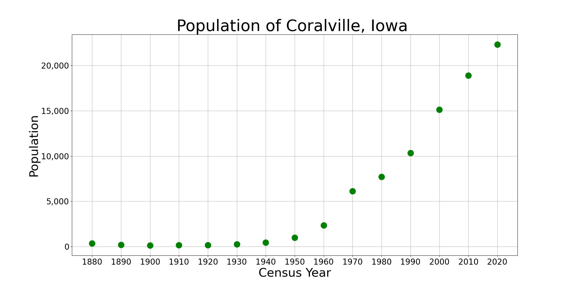
Coralville is a city in Johnson County, Iowa, Johnson County, Iowa, United States. It is a suburb of Iowa City, Iowa, Iowa City and part of the Iowa City metropolitan area, Iowa City Metropolitan Statistical Area. The population was 22,318 at the 2020 United States Census, 2020 census. History Coralville is the location of the Edgewater Park Site, a 3,800-year-old archaeological site along the Iowa River. Edgewater is the oldest site in Iowa with evidence of domesticated plant use. Coralville incorporated as a city on June 1, 1857. The city's name is derived from the fossils that are found in the limestone along the Iowa River. In 1864, Louis Agassiz, a Harvard University Zoology, zoologist, gave a lecture at the nearby University of Iowa titled “The Coral Reefs of Iowa City”. During the lecture, he presented local samples of fossilized Devonian period coral. The lecture was well received and helped raise public interest in the local fossils. In 1866, more corals were discove ... [...More Info...] [...Related Items...] OR: [Wikipedia] [Google] [Baidu] |
Cupertino, California
Cupertino ( ) is a city in Santa Clara County, California, United States, directly west of San Jose on the western edge of the Santa Clara Valley with portions extending into the foothills of the Santa Cruz Mountains. The population was 57,820 as of the 2020 census. It is known for being the home of Apple Inc., headquartered at Apple Park. Etymology Cupertino was named after '' Arroyo'' ''San José de Cupertino'' (now Stevens Creek). The creek had been named by Spanish explorer Juan Bautista de Anza's cartographer, who named it after Saint Joseph of Cupertino. Saint Joseph ( it, Giuseppe da Copertino) was born Giuseppe Maria Desa, and was later named after the town of Copertino, where he was born, in the Apulia region of Italy. The name ''Cupertino'' first became widely used when John T. Doyle, a San Francisco lawyer, and historian, named his winery on McClellan Road ''Cupertino''. After the turn of the 20th century, Cupertino displaced the former name for the region, which ... [...More Info...] [...Related Items...] OR: [Wikipedia] [Google] [Baidu] |
Palo Alto, California
Palo Alto (; Spanish language, Spanish for "tall stick") is a charter city in the northwestern corner of Santa Clara County, California, United States, in the San Francisco Bay Area, named after a Sequoia sempervirens, coastal redwood tree known as El Palo Alto. The city was established in 1894 by the American industrialist Leland Stanford when he founded Stanford University in memory of his son, Leland Stanford Jr. Palo Alto includes portions of Stanford University and borders East Palo Alto, California, East Palo Alto, Mountain View, California, Mountain View, Los Altos, California, Los Altos, Los Altos Hills, California, Los Altos Hills, Stanford, California, Stanford, Portola Valley, California, Portola Valley, and Menlo Park, California, Menlo Park. At the 2010 United States Census, 2020 census, the population was 68,572. Palo Alto is one of the most expensive cities in the United States in which to live, and its residents are among the most educated in the country. Howeve ... [...More Info...] [...Related Items...] OR: [Wikipedia] [Google] [Baidu] |
Denver, Colorado
Denver () is a consolidated city and county, the capital, and most populous city of the U.S. state of Colorado. Its population was 715,522 at the 2020 census, a 19.22% increase since 2010. It is the 19th-most populous city in the United States and the fifth most populous state capital. It is the principal city of the Denver–Aurora–Lakewood, CO Metropolitan Statistical Area and the first city of the Front Range Urban Corridor. Denver is located in the Western United States, in the South Platte River Valley on the western edge of the High Plains just east of the Front Range of the Rocky Mountains. Its downtown district is immediately east of the confluence of Cherry Creek and the South Platte River, approximately east of the foothills of the Rocky Mountains. It is named after James W. Denver, a governor of the Kansas Territory. It is nicknamed the ''Mile High City'' because its official elevation is exactly one mile () above sea level. The 105th meridian we ... [...More Info...] [...Related Items...] OR: [Wikipedia] [Google] [Baidu] |
Melbourne, Florida
Melbourne is a city in Brevard County, Florida, United States. It is located southeast of Orlando. As of th2020 Decennial Census there was a population of 84,678. The municipality is the second-largest in the county by both size and population. Melbourne is a principal city of the Palm Bay – Melbourne – Titusville, Florida Metropolitan Statistical Area. In 1969, the city was expanded by merging with nearby Eau Gallie. History Early human occupation Evidence for the presence of Paleo-Indians in the Melbourne area during the late Pleistocene epoch was uncovered during the 1920s. C. P. Singleton, a Harvard University zoologist, discovered the bones of a mammoth (''Mammuthus columbi'') on his property along Crane Creek, from Melbourne, and brought in Amherst College paleontologist Frederick B. Loomis to excavate the skeleton. Loomis found a second elephant, with a "large rough flint instrument" among fragments of the elephant's ribs. Loomis found in the same stratum mammo ... [...More Info...] [...Related Items...] OR: [Wikipedia] [Google] [Baidu] |
Mountain View, California
Mountain View is a city in Santa Clara County, California, United States. Named for its views of the Santa Cruz Mountains, it has a population of 82,376. Mountain View was integral to the early history and growth of Silicon Valley, and is the location of many high technology companies. In 1956, William Shockley established Shockley Semiconductor Laboratory in Mountain View, the first company to develop silicon semiconductor devices in Silicon Valley. Today, Mountain View houses the headquarters of many of the world's largest technology companies, including Google and Alphabet Inc., Unicode Consortium, Intuit, NASA Ames research center, and major headquarter offices for Microsoft, NortonLifeLock, Symantec, 23andMe, LinkedIn, Samsung, and Synopsys. History The Mexican land grant of Rancho Pastoria de las Borregas was given in 1842 by Alta California Governor Juan Bautista Alvarado, Juan Alvarado to Francisco Estrada. This grant was later passed on to Mariano Castro, who sold ... [...More Info...] [...Related Items...] OR: [Wikipedia] [Google] [Baidu] |


%2C_the_Indian_territories.jpg)

