|
Sobretta-Gavia Group
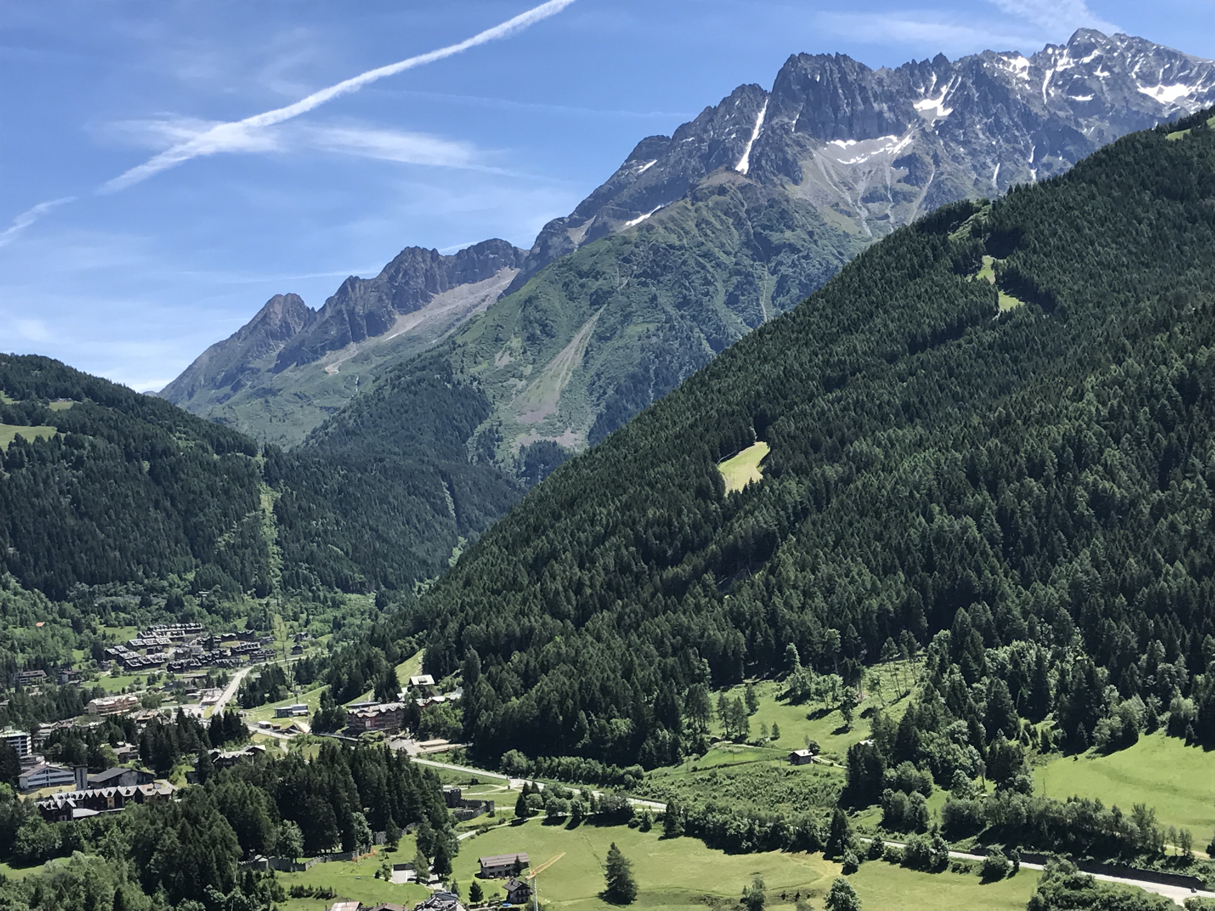
The Sobretta-Gavia Group (german: Sobretta-Gavia-Gruppe, it, Gruppo Sobretta-Gavia) is a mountain massif that extends between the upper Veltlin and the upper Valcamonica in the Italian provinces of Sondrio and Brescia. Location The Sobretta-Gavia Group is classified geologically with the Central Eastern Alps because it lies north of the geological fault of the Periadriatic Seam, but more regionally and geographically as part of the Southern Alps, because it lies south of the Veltlin (Adda)– Vintschgau (Etsch) longitudinal valley trough.Peter Holl: ''Alpenvereinsführer Ortleralpen'' According to the Alpine Club Classification of the Eastern Alps (AVE) the group is bounded as follows: * to the northeast by the Ortler Group and the Bormio–Gavia Pass–Ponte di Legno line * by the Adamello-Presanella Alps to the southeast with the lower reaches of the Oglio Narcanello (upper Valcamonica) between Ponte di Legno and Edolo as the boundary * to the south and west by the Bergamo ... [...More Info...] [...Related Items...] OR: [Wikipedia] [Google] [Baidu] |
Monte Sobretta
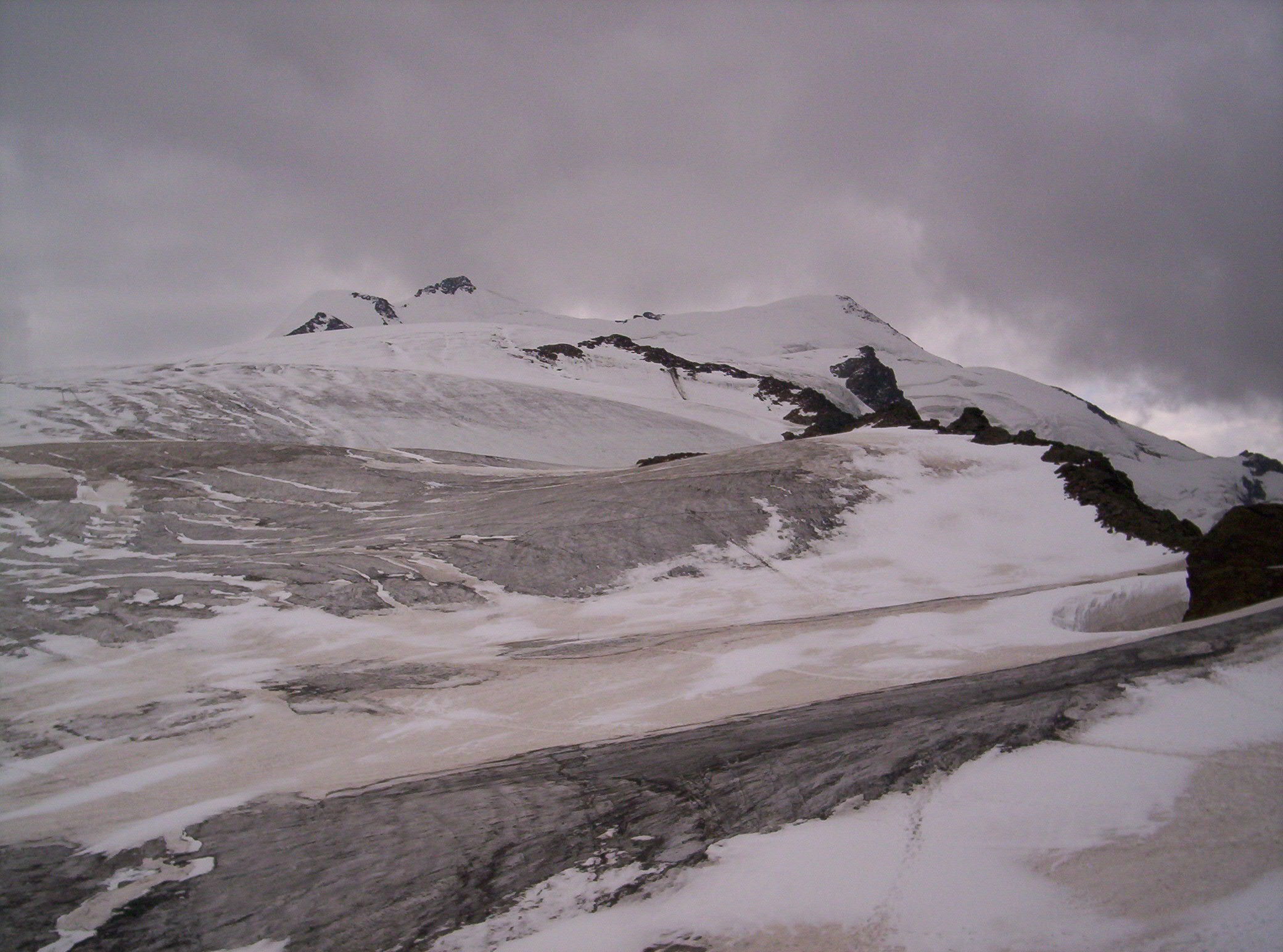
Monte Sobretta is the highest mountain of the Sobretta-Gavia Group in Lombardy, Italy Italy ( it, Italia ), officially the Italian Republic, ) or the Republic of Italy, is a country in Southern Europe. It is located in the middle of the Mediterranean Sea, and its territory largely coincides with the homonymous geographical .... It has an elevation of Access roads and normal climbing route To access the mountain you follow the road towards the Gavia pass, either from Ponte di Legno in the south or from Santa Caterina Valfurva in the north. There is a parking at around 2300 meters above the sea level on the north side of the mountain. From the parking to the summit you will need around four hours. No special equipment is needed. It is snow free in the summer time, a simple walk up. References External links Monte Sobrettain Mountains for Everybody. Mountains of Lombardy Mountains of the Alps Alpine three-thousanders {{Lombardy-geo-stub ... [...More Info...] [...Related Items...] OR: [Wikipedia] [Google] [Baidu] |
Ponte Di Legno
Ponte di Legno ( Camunian: ) is an Italian ''comune'' of 1,729 inhabitants in Val Camonica, province of Brescia, in Lombardy. Geography Situated at the confluence of the two source rivers of the Oglio, Ponte di Legno is the uppermost comune of Valle Camonica. History The territory of the municipality of Ponte di Legno was part of the ancient Dalaunia (Dalegno), which included also the comune of Temù. On September 27, 1917 the village was bombarded by Austrian cannons and razed to the ground in a short time. Monuments and places of interest Religious architectures The churches of Ponte di Legno are: * Parish of the Holy Trinity, dated 1685, though the wooden door is from 1929. Inside there are works from the workshop of Ramus. * Church St. Appollonio in Plampezzo. It is an ancient church dating from the twelfth century, with frescoes of the thirteenth century of the hand of the painter Johannes from Volpino. Society Demographic trends Colors= id:lightgrey value:gray(0. ... [...More Info...] [...Related Items...] OR: [Wikipedia] [Google] [Baidu] |
Punta Di Pietra Rossa
Punta is an Afro-indigenous dance and cultural music originating in the Caribbean Island of Saint Vincent And The Grenadines by the Garifuna people before being exiled from the island. Which is also known as Yurumei. It has African and Arawak elements which are also the characteristics of the Garifuna language. Punta is the best-known traditional dance belonging to the Garifuna community. It is also known as banguity or bunda, before the first arrival of the Garifuna people in Punta Gorda, Roatan, Honduras on April 12, 1797. The diaspora of Garifuna people, commonly called the "Garifuna Nation", dates back to the amalgamation of West African slaves and the Arawak and Carib Amerindians. Punta is used to reaffirm and express the struggle felt by the indigenous population's common heritage through cultural art forms, such as dance and music, and to highlight their strong sense of endurance as well as reconnecting back to the ancestors of the Garifuna people. Besides Honduras, pu ... [...More Info...] [...Related Items...] OR: [Wikipedia] [Google] [Baidu] |
Monte Gavia
Monte Gavia is a mountain of the Sobretta-Gavia Group in Lombardy, Italy. It has an elevation of 3,223 metres and towers above the Gavia Pass Gavia Pass ( it, Passo di Gavia) (el. 2621 m.) is a high mountain pass in the Italian Alps. It is the tenth highest paved road in the Alps. The pass lies in the Lombardy region and divides the province of Sondrio to the north and the p .... References Mountains of Lombardy Mountains of the Alps Alpine three-thousanders {{Lombardy-geo-stub ... [...More Info...] [...Related Items...] OR: [Wikipedia] [Google] [Baidu] |
Rhaetian Alps
The Rhaetian Alps ( it, Alpi Retiche; german: Rätische Alpen) are a mountain range of the Eastern Alps. The SOIUSA classification system divides them into the Western and Eastern Rhaetian Alps, while the Alpine Club classification of the Eastern Alps places most of the Rhaetian subranges within the Western Limestone Alps. They are located along the Italian–Swiss and Austrian–Swiss borders, in the canton of Graubünden in eastern Switzerland; in the state of Tyrol in Austria; and in the Italian regions of Trentino-Alto Adige and Lombardy. The name relates to a Roman province and the Rhaetian people subdued under Emperor Augustus in 15 BC. Geography The Rhaetian Alps contain these subranges: #Albula Range #Bernina Range # Brenta group # Bregaglia Range # Ortler Alps #Rätikon #Silvretta The highest peak in the range is Piz Bernina at , located in Grisons/Graubünden canton, Switzerland, adjacent to the Italian border. The Swiss National Park is located in the Western Rha ... [...More Info...] [...Related Items...] OR: [Wikipedia] [Google] [Baidu] |
Livigno Alps
The Livigno Alps are a mountain range in the Alps of eastern Switzerland and northern Italy, around the Italian village Livigno. They are considered to be part of the Central Eastern Alps. The Livigno Alps are separated from the Bernina Range in the south-west by the Bernina Pass; from the Albula Alps in the north-west by the Upper Engadin valley; from the Sesvenna Alps in the north-east by the Spöl valley; from the Ortler Alps in the east by the Passo di Fraéle and the upper Adda River valley (Valtellina). The Livigno Alps are drained by the rivers Adda River, Inn and Rom (tributary of the Adige). Peaks The main peaks of the Livigno Alps are: Passes The main passes of the Livigno Alps are: See also *Swiss Alps *List of mountains in Switzerland This article contains a sortable table of many of the major mountains and hills of Switzerland. The table only includes those summits that have a topographic prominence of at least above other points, and ranks them by height ... [...More Info...] [...Related Items...] OR: [Wikipedia] [Google] [Baidu] |
Tirano
Tirano ( lmo, Tiràn, german: Thiran) is a town in Valtellina, located in the province of Sondrio in northern Italy. It has 9,053 inhabitants (2016) and is adjacent to the Switzerland-Italy border. The river Adda flows through the town. Main sights Located nearby is the Catholic shrine of the Madonna di Tirano, a major tourist attraction. The shrine is dedicated to the appearance of the Blessed Mother to Mario Degli Omodei on September 29, 1504, an event religious pilgrims credit with ending a pestilence. The Museo Etnografico Tiranese (MET) is an ethnographic museum and located nearby the Basilica Madonna di Tirano in an 18th-century Palazzo, the Casa del Penitenziere (Penitent's House). The museum of Palazzo Salis in the old town of Tirano is an example of the use of trompe l'oeil to create the illusion of architectural features. Transportation Tirano has two neighboring railway stations. One, a standard gauge station, is operated by Trenitalia, the state railway compa ... [...More Info...] [...Related Items...] OR: [Wikipedia] [Google] [Baidu] |
Adda (river)
The Adda (Latin ''Abdua'', or ''Addua''; in Lombard ''Ada'' or, again, ''Adda'' in local dialects where the double consonants are marked) is a river in North Italy, a tributary of the Po. It rises in the Alps near the border with Switzerland and flows through Lake Como. The Adda joins the Po a few kilometres upstream of Cremona. It is long. The highest point of the drainage basin is the summit of la Spedla (a subpeak of Piz Bernina), at . Towns along the river Adda include Bormio, Tirano, Sondrio, Bellagio and Lecco (both on Lake Como), Brivio and Lodi. Course The Adda's true source is in Alpisella valley near the head of the Fraele glen, but its volume is increased by the union with several smaller streams, near the town of Bormio, at the Rhaetian Alps. Thence it flows first southwest, then due west, through the fertile Valtellina, passing Tirano, where the Poschiavino falls in on the right bank, and Sondrio, where the Mallero joins, also on the right. This first h ... [...More Info...] [...Related Items...] OR: [Wikipedia] [Google] [Baidu] |
Passo Dell'Aprica
Passo may refer to: Places * Passo, Missouri, United States * Passô, Porto, Portugal Other uses * Oscar Passo (born 1980), Colombian former footballer * Toyota Passo is a Japanese multinational automotive manufacturer headquartered in Toyota City, Aichi, Japan. It was founded by Kiichiro Toyoda and incorporated on . Toyota is one of the largest automobile manufacturers in the world, producing about 10 m ..., a Japanese subcompact car See also * ''Passo'', Italian for mountain pass and is a component in multiple place names (see ) * Passos (other) {{Disambiguation, geo, surname ... [...More Info...] [...Related Items...] OR: [Wikipedia] [Google] [Baidu] |
Oglio
The Oglio (; Latin ''Ollius'', or ''Olius''; Lombard ''Òi''; Cremonese ''Ùi'') is a left-side tributary of the river Po in Lombardy, Italy. It is long. In the hierarchy of the Po's tributaries, with its of length, it occupies the 2nd place per length (after the river Adda), while it is the 4th per basin surface (after Tanaro, Adda and Ticino), and the 3rd per average discharge at the mouth (after Ticino and Adda). Overview The Oglio is formed from the confluence of two mountain streams, the Narcanello branch from the Presena Glacier, in the Adamello group and the Frigidolfo branch, in the Corno dei Tre Signori, part of the Stelvio National Park. The streams merge near Pezzo di Ponte di Legno, both the streams have an average discharge of . The Frigidolfo branch, before merging with Narcanello branch, receives the Arcanello branch, which have an average discharge of , which receives a minor branch originating from Lake Ercavallo. The Ogliolo stream, with an average disc ... [...More Info...] [...Related Items...] OR: [Wikipedia] [Google] [Baidu] |
Bergamo Alps
The Bergamasque Alps or Bergamo Alps (Italian language, Italian: ''Alpi Orobie'', sometimes translated into English as Orobic Alps) are a mountain range in the Italy, Italian Alps. They are located in northern Lombardy and named after the city Bergamo, south of the mountains. Within the Eastern Alps, the Alpine Club classification of the Eastern Alps, Alpine Club or AVE system places them within the List of mountain groups in the Alpine Club classification of the Eastern Alps, Western Limestone Alps, while the SOIUSA system classifies them within the Southeastern Alps. Peaks The main peaks of the Bergamasque Alps are: Passes The main mountain passes of the Bergamasque Alps are: Gallery File:Lagobarbellino3.jpg, Barbellino Lake File:Cascatedelserio.JPG, Cascate del Serio, Serio Falls File:Vista su Valbondione 01.JPG, Valbondione, in the Park of the Bergamo Orobic Alps File:Going through Prà de'Lac.jpg, Prà de'Lac File:Pizzo Redorta 02.JPG, Redorta File:Recastello3.jpg, Re ... [...More Info...] [...Related Items...] OR: [Wikipedia] [Google] [Baidu] |


.jpg)