|
Snow Shoe, Pennsylvania
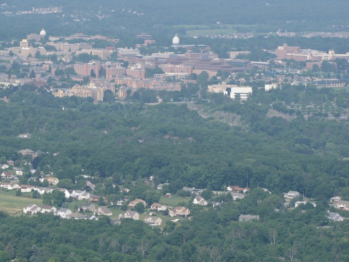
Snow Shoe is a borough in Centre County, Pennsylvania, United States. It is part of the State College, Pennsylvania Metropolitan Statistical Area. The population was 765 at the 2010 census. According to tradition, Snow Shoe was so named when a pair of snowshoes were found at an Indian village near the present town site. Geography Snow Shoe is located at (41.027821, -77.949099). According to the United States Census Bureau, the borough has a total area of , all land. Demographics At the 2010 census there were 765 people, 290 households, and 216 families residing in the borough. The population density was 1,286.9 people per square mile (496.9/km²). There were 333 housing units at an average density of 560.2 per square mile (216.3/km²). The racial makeup of the borough was 99.6% White, 0.1% Asian, and 0.3% of two or more races. Hispanic or Latino of any race were 0.1%. There were 290 households, 35.5% had children under the age of 18 living with them, 60.0% were married cou ... [...More Info...] [...Related Items...] OR: [Wikipedia] [Google] [Baidu] |
Borough (Pennsylvania)
In the U.S. Commonwealth of Pennsylvania, a borough (sometimes spelled boro) is a self-governing municipal entity, equivalent to a town in most jurisdictions, usually smaller than a city, but with a similar population density in its residential areas. Sometimes thought of as "junior cities", boroughs generally have fewer powers and responsibilities than full-fledged cities. Description All municipalities in Pennsylvania are classified as either cities, boroughs, or townships. The only exception is the town of Bloomsburg, recognized by the state government as the only incorporated town in Pennsylvania. Boroughs tend to have more developed business districts and concentrations of public and commercial office buildings, including court houses. Boroughs are larger, less spacious, and more developed than the relatively rural townships, which often have the greater territory and even surround boroughs of a related or even the same name. There are 956 boroughs and 56 cities in ... [...More Info...] [...Related Items...] OR: [Wikipedia] [Google] [Baidu] |
Federal Information Processing Standards
The Federal Information Processing Standards (FIPS) of the United States are a set of publicly announced standards that the National Institute of Standards and Technology (NIST) has developed for use in computer systems of non-military, American government agencies and contractors. FIPS standards establish requirements for ensuring computer security and interoperability, and are intended for cases in which suitable industry standards do not already exist. Many FIPS specifications are modified versions of standards the technical communities use, such as the American National Standards Institute (ANSI), the Institute of Electrical and Electronics Engineers (IEEE), and the International Organization for Standardization (ISO). Specific areas of FIPS standardization The U.S. government has developed various FIPS specifications to standardize a number of topics including: * Codes, e.g., FIPS county codes or codes to indicate weather conditions or emergency indications. In 1994, Nat ... [...More Info...] [...Related Items...] OR: [Wikipedia] [Google] [Baidu] |
Populated Places Established In 1850
Population typically refers to the number of people in a single area, whether it be a city or town, region, country, continent, or the world. Governments typically quantify the size of the resident population within their jurisdiction using a census, a process of collecting, analysing, compiling, and publishing data regarding a population. Perspectives of various disciplines Social sciences In sociology and population geography, population refers to a group of human beings with some predefined criterion in common, such as location, race, ethnicity, nationality, or religion. Demography is a social science which entails the statistical study of populations. Ecology In ecology, a population is a group of organisms of the same species who inhabit the same particular geographical area and are capable of interbreeding. The area of a sexual population is the area where inter-breeding is possible between any pair within the area and more probable than cross-breeding with ind ... [...More Info...] [...Related Items...] OR: [Wikipedia] [Google] [Baidu] |
Poverty Line
The poverty threshold, poverty limit, poverty line or breadline is the minimum level of income deemed adequate in a particular country. The poverty line is usually calculated by estimating the total cost of one year's worth of necessities for the average adult.Poverty Lines – Martin Ravallion, in The New Palgrave Dictionary of Economics, 2nd Edition, London: Palgrave Macmillan The cost of housing, such as the rent for an apartment, usually makes up the largest proportion of this estimate, so economists track the real estate market and other housing cost indicators as a major influence on the poverty line. Individual factors are often used to account for various circumstances, such as whether one is a parent, elderly, a child, married, etc. The poverty threshold may be adjusted annually. In practice, like the definition of poverty, the official or common understanding of the poverty line is significantly higher in developed countries than in developing countries. In October 20 ... [...More Info...] [...Related Items...] OR: [Wikipedia] [Google] [Baidu] |
United States Census Bureau
The United States Census Bureau (USCB), officially the Bureau of the Census, is a principal agency of the U.S. Federal Statistical System, responsible for producing data about the American people and economy. The Census Bureau is part of the U.S. Department of Commerce and its director is appointed by the President of the United States. The Census Bureau's primary mission is conducting the U.S. census every ten years, which allocates the seats of the U.S. House of Representatives to the states based on their population. The bureau's various censuses and surveys help allocate over $675 billion in federal funds every year and it assists states, local communities, and businesses make informed decisions. The information provided by the census informs decisions on where to build and maintain schools, hospitals, transportation infrastructure, and police and fire departments. In addition to the decennial census, the Census Bureau continually conducts over 130 surveys and programs ... [...More Info...] [...Related Items...] OR: [Wikipedia] [Google] [Baidu] |
Snowshoe
Snowshoes are specialized outdoor gear for walking over snow. Their large footprint spreads the user's weight out and allows them to travel largely on top of rather than through snow. Adjustable bindings attach them to appropriate winter footwear. Traditional snowshoes have a hardwood frame filled in with rawhide latticework. Modern snowshoes are made of lightweight metal, plastic, and other synthetic materials. In the past, snowshoes were essential equipment for anyone dependent on travel in deep and frequent snowfall, such as fur trappers. They retain that role in areas where motorized vehicles cannot reach or are inconvenient to use. However, their greatest contemporary use is for recreation. Snowshoeing is easy to learn and in appropriate conditions is a relatively safe and inexpensive recreational activity. However, doing so in icy, steep terrain requires both advanced skill and mountaineering-style pivoting-crampon snowshoes. Development Origins Before people built ... [...More Info...] [...Related Items...] OR: [Wikipedia] [Google] [Baidu] |
Metropolitan Statistical Area
In the United States, a metropolitan statistical area (MSA) is a geographical region with a relatively high population density at its core and close economic ties throughout the area. Such regions are neither legally Incorporated town, incorporated as a city or town would be, nor are they legal administrative divisions like County (United States), counties or separate entities such as U.S. state, states; because of this, the precise definition of any given metropolitan area can vary with the source. The statistical criteria for a standard metropolitan area were defined in 1949 and redefined as metropolitan statistical area in 1983. A typical metropolitan area is centered on a single large city that wields substantial influence over the region (e.g., New York City or Chicago). However, some metropolitan areas contain more than one large city with no single municipality holding a substantially dominant position (e.g., Dallas–Fort Worth metroplex, Hampton Roads, Virginia B ... [...More Info...] [...Related Items...] OR: [Wikipedia] [Google] [Baidu] |
State College, Pennsylvania
State College is a home rule municipality in Centre County in the Commonwealth of Pennsylvania. It is a college town, dominated economically, culturally and demographically by the presence of the University Park campus of the Pennsylvania State University (Penn State). State College is the largest designated borough in Pennsylvania. It is the principal borough of the six municipalities that make up the State College area, the largest settlement in Centre County and one of the principal cities of the greater State College-DuBois Combined Statistical Area with a combined population of 236,577 as of the 2010 U.S. census. In the 2010 census, the borough population was 42,034 with approximately 105,000 living in the borough plus the surrounding townships often referred to locally as the "Centre Region". Many of these Centre Region communities also carry a "State College, PA" address although they are not part of the borough of State College. "Happy Valley" and "Lion Country" are ... [...More Info...] [...Related Items...] OR: [Wikipedia] [Google] [Baidu] |
Area Code 814
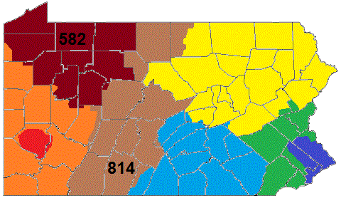
Area codes 814 and 582 are telephone area codes in the North American Numbering Plan (NANP) for the northwestern and central portions of the Commonwealth of Pennsylvania. Cities served by the area code include Altoona, Bradford, DuBois, Erie, Meadville, Oil City, Titusville, Johnstown, St. Marys, and Warren as well as the boroughs of State College, Brockway, Clearfield, Huntingdon, Mount Union, Bedford, Clarion, Punxsutawney, Tyrone, Ebensburg, Coudersport, Ridgway and Brookville. Area code 814 is the original area code assigned to the numbering plan area in 1947 and area code 582 was activated in the service area as an additional code to form an overlay plan with a starting date of October 3, 2020. History Area code 814 is one of the original North American area codes established in 1947. Its numbering plan area (NPA) is the largest in the state. It is the only one of Pennsylvania's original four NPAs that still has its original boundaries. The largest cities in the ... [...More Info...] [...Related Items...] OR: [Wikipedia] [Google] [Baidu] |
List Of Sovereign States
The following is a list providing an overview of sovereign states around the world with information on their status and recognition of their sovereignty. The 206 listed states can be divided into three categories based on membership within the United Nations System: 193 UN member states, 2 UN General Assembly non-member observer states, and 11 other states. The ''sovereignty dispute'' column indicates states having undisputed sovereignty (188 states, of which there are 187 UN member states and 1 UN General Assembly non-member observer state), states having disputed sovereignty (16 states, of which there are 6 UN member states, 1 UN General Assembly non-member observer state, and 9 de facto states), and states having a special political status (2 states, both in free association with New Zealand). Compiling a list such as this can be a complicated and controversial process, as there is no definition that is binding on all the members of the community of nations concerni ... [...More Info...] [...Related Items...] OR: [Wikipedia] [Google] [Baidu] |
Eastern Time Zone
The Eastern Time Zone (ET) is a time zone encompassing part or all of 23 states in the eastern part of the United States, parts of eastern Canada, the state of Quintana Roo in Mexico, Panama, Colombia, mainland Ecuador, Peru, and a small portion of westernmost Brazil in South America, along with certain Caribbean and Atlantic islands. Places that use: * Eastern Standard Time (EST), when observing standard time (autumn/winter), are five hours behind Coordinated Universal Time ( UTC−05:00). * Eastern Daylight Time (EDT), when observing daylight saving time (spring/summer), are four hours behind Coordinated Universal Time ( UTC−04:00). On the second Sunday in March, at 2:00 a.m. EST, clocks are advanced to 3:00 a.m. EDT leaving a one-hour "gap". On the first Sunday in November, at 2:00 a.m. EDT, clocks are moved back to 1:00 a.m. EST, thus "duplicating" one hour. Southern parts of the zone (Panama and the Caribbean) do not observe daylight saving time ... [...More Info...] [...Related Items...] OR: [Wikipedia] [Google] [Baidu] |


