|
Sleaford Bay
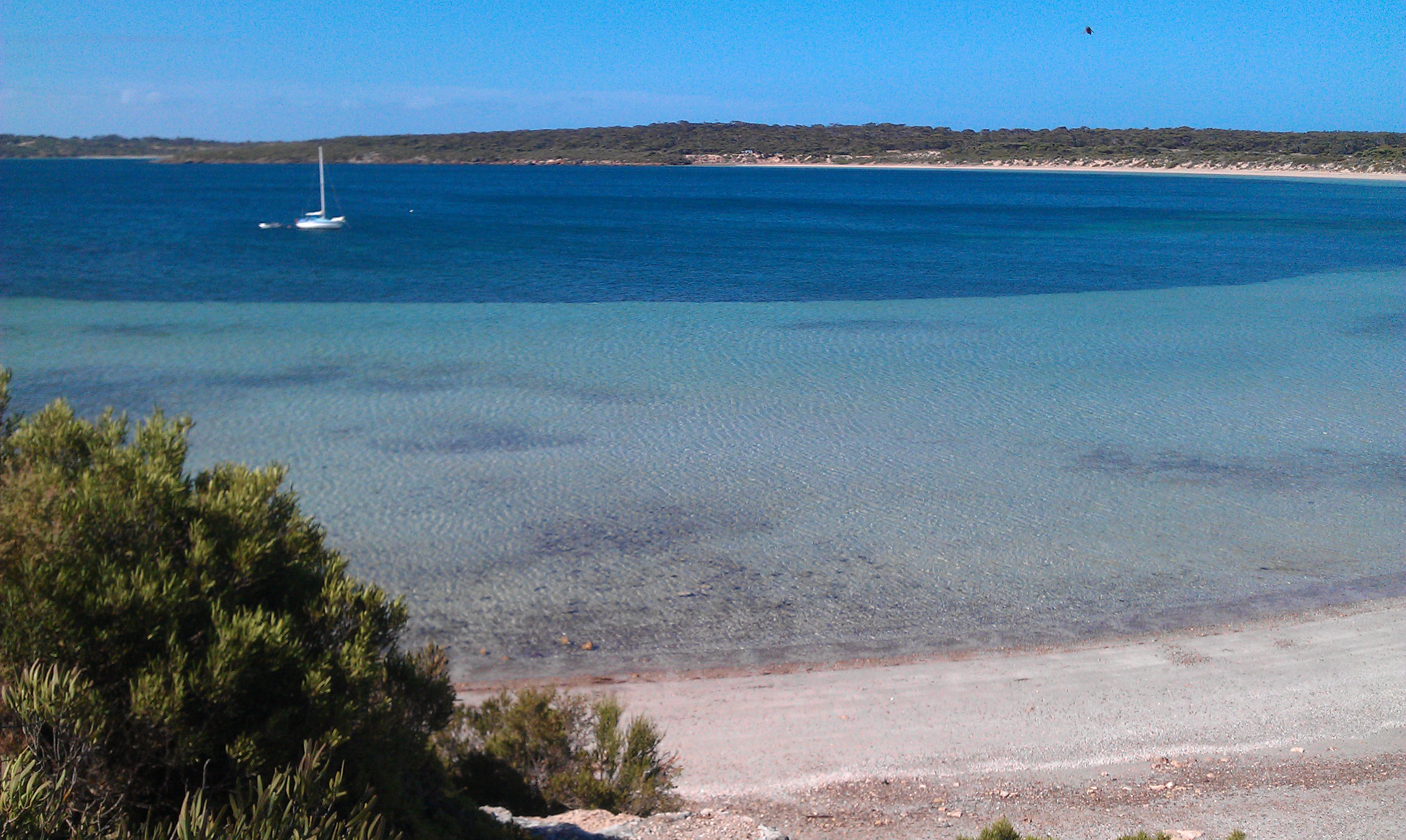
__NOTOC__ Sleaford Bay is a bay located in the Australian state of South Australia on the southern coast of Eyre Peninsula. It was named by the British navigator, Matthew Flinders in 1802. Extent & description Sleaford Bay is located on the south coast of Eyre Peninsula in South Australia about south-west of the municipal seat of Port Lincoln. It lies between the headland of Cape Wiles at its western extremity and headland of Cape Tournefort at its eastern extremity. A subsidiary bay named Fishery Bay is located on its west side about north of Cape Wiles. History The bay was named after the town of Sleaford in Lincolnshire, England by the British navigator, Matthew Flinders in 1802. The Barngarla name for Sleaford Bay is ''Dhanana''. Zuckermann, Ghil'ad and the Barngarla (2019)Manoo (Speaking Barngarla Together)'', Barngarla Language Advisory Committee.''Barngarlidhi Manoo'' – Part II The Baudin expedition who visited after Flinders gave it two names – Baudin ... [...More Info...] [...Related Items...] OR: [Wikipedia] [Google] [Baidu] |
South Australia
South Australia (commonly abbreviated as SA) is a state in the southern central part of Australia. It covers some of the most arid parts of the country. With a total land area of , it is the fourth-largest of Australia's states and territories by area, and second smallest state by population. It has a total of 1.8 million people. Its population is the second most highly centralised in Australia, after Western Australia, with more than 77 percent of South Australians living in the capital Adelaide, or its environs. Other population centres in the state are relatively small; Mount Gambier, the second-largest centre, has a population of 33,233. South Australia shares borders with all of the other mainland states, as well as the Northern Territory; it is bordered to the west by Western Australia, to the north by the Northern Territory, to the north-east by Queensland, to the east by New South Wales, to the south-east by Victoria, and to the south by the Great Australian Bight.M ... [...More Info...] [...Related Items...] OR: [Wikipedia] [Google] [Baidu] |
Barngarla Language
Barngarla, formerly known as Parnkalla, is an Aboriginal language of Eyre Peninsula, South Australia, Australia. The last native speaker of the language died in 1964. However, the language has been revived due to work of a German Lutheran pastor Clamor Wilhelm Schurmann who worked at a mission in 1844 and recorded 3,500 words to form a Barngarla dictionary. "In 2011 an Israeli linguist, working with Adelaide University and the chair of linguistics and endangered languages, Professor Ghil'ad Zuckermann, contacted the Barngarla community about helping to revive and reclaim the Barngarla language. This request was eagerly accepted by the Barngarla people and language reclamation workshops began in Port Lincoln, Whyalla and Port Augusta in 2012" (Barngarla man Stephen Atkinson, 2013). The reclamation is based on 170-year-old documents. In October 2016 a mobile app featuring a dictionary of over 3000 Barngarla words was publicly released. Orthography Barngarla is written phoneti ... [...More Info...] [...Related Items...] OR: [Wikipedia] [Google] [Baidu] |
Mean Low Water Spring
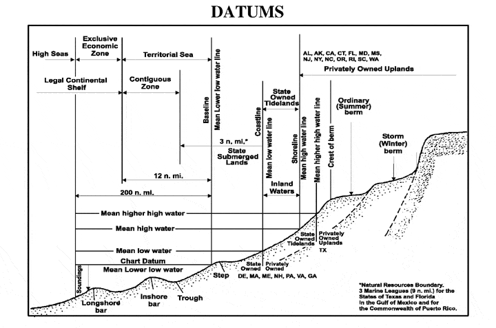
A chart datum is the water level surface serving as origin of depths displayed on a nautical chart. A chart datum is generally derived from some tidal phase, in which case it is also known as a tidal datum. Common chart datums are ''lowest astronomical tide'' (LAT)Australian Bureau of MeteorologNational Tide Centre Glossary(retrieved 30 April 2013) and ''mean lower low water'' (MLLW). In non-tidal areas, e.g. the Baltic Sea, mean sea level (MSL) is used. A chart datum is a type of vertical datum and must not be confused with the horizontal datum for the chart. Definitions The following tidal phases are commonly used in the definition of chart datums. Lowest astronomical tide ''Lowest astronomical tide'' (LAT) is defined as the lowest tide level which can be predicted to occur under average meteorological conditions and under any combination of astronomical conditions. Many national charting agencies, including the United Kingdom Hydrographic Office and the Australian Hydr ... [...More Info...] [...Related Items...] OR: [Wikipedia] [Google] [Baidu] |
Lincoln National Park
Lincoln National Park is a protected area in the Australian state of South Australia located about west of the state capital of Adelaide and about south of the municipal seat of Port Lincoln. It consists of a mainland area on the Jussieu Peninsula on the south eastern tip of Eyre Peninsula and a number of nearby islands. The national park contains significant sites of natural, indigenous and early European heritage. Description Lincoln National Park is located on the Jussieu Peninsula on the south-eastern tip of Eyre Peninsula in South Australia as well as an adjoining portion of Eyre Peninsula and a number of islands adjoining the coastline. The part of the national park located on Jussieu Peninsula is located within the gazetted localities of Lincoln National Park and Sleaford. Jussieu Peninsula Lincoln National Park occupies the majority of Jussieu Peninsula. The remainder of the Jussieu Peninsula is occupied by the Memory Cove Wilderness Protection Area. The western ... [...More Info...] [...Related Items...] OR: [Wikipedia] [Google] [Baidu] |


