|
Skole Beskids
The Skole Beskids ( uk, Сколівські Бескиди; pl, Beskidy Skolskie) is a mountain range in western Ukraine, belonging to the set of ranges called the Eastern Beskids, within the Outer Eastern Carpathians. The mountains are composed primary of Carpathian flysch. The northern section of the range is the location of the Skole Beskids National Nature Park, established in 1999; within the park is the highest peak in the range, Mount Parashka, at 1268 meters. Zwinin Mountain, at 992 meters above sea level, is also located within the park. The Skole Beskids is also the site of the sandstone fortresses of Tustan', built between the 9th century and 13th century, now a State Historical and Cultural Reserve. It's near the town of Boryslav. See also References Sources * Gallery File:Skole Beskids. View of the village Plav'ye.JPG, Skole Beskids. View of the village Plavie. File:Skole Beskids. Mountain road..JPG, Skole Beskids. Klymets Natural Preserve, Droho ... [...More Info...] [...Related Items...] OR: [Wikipedia] [Google] [Baidu] |
Ukrainian Carpathians
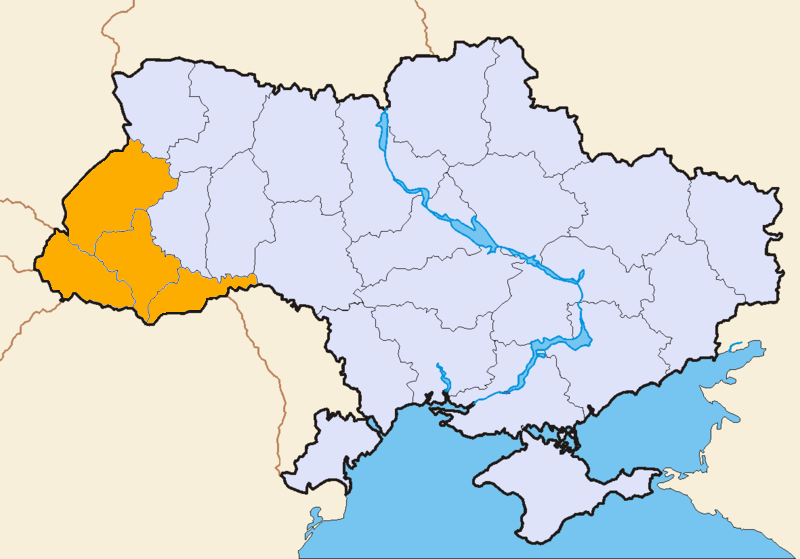
The Ukrainian Carpathians ( uk, Українські Карпати) are a section of the Eastern Carpathians, within the borders of modern Ukraine. They are located in the southwestern corner of Western Ukraine, within administrative territories of four Ukrainian regions (oblasts), covering northeastern part of Zakarpattia Oblast, southwestern part of Lviv Oblast, southern half of Ivano-Frankivsk Oblast and western half of Chernivtsi Oblast. They are stretching in general northwest–southeast direction, starting at the tripartite border point of Ukraine with Poland and Slovakia, and continuing towards Ukrainian border with Romania. In terms of geological classification, Ukrainian Carpathians belong to two distinctive categories, with major part belonging to the Outer Eastern Carpathians and minor part to the Inner Eastern Carpathians. Within different regional and national traditions, there are several overlapping variants of divisions and designations for various E ... [...More Info...] [...Related Items...] OR: [Wikipedia] [Google] [Baidu] |
Mountain Ranges Of The Eastern Carpathians
A mountain is an elevated portion of the Earth's crust, generally with steep sides that show significant exposed bedrock. Although definitions vary, a mountain may differ from a plateau in having a limited summit area, and is usually higher than a hill, typically rising at least 300 metres (1,000 feet) above the surrounding land. A few mountains are isolated summits, but most occur in mountain ranges. Mountains are formed through tectonic forces, erosion, or volcanism, which act on time scales of up to tens of millions of years. Once mountain building ceases, mountains are slowly leveled through the action of weathering, through slumping and other forms of mass wasting, as well as through erosion by rivers and glaciers. High elevations on mountains produce colder climates than at sea level at similar latitude. These colder climates strongly affect the ecosystems of mountains: different elevations have different plants and animals. Because of the less hospitable terrain and ... [...More Info...] [...Related Items...] OR: [Wikipedia] [Google] [Baidu] |
Mountain Ranges Of Ukraine
A mountain is an elevated portion of the Earth's crust, generally with steep sides that show significant exposed bedrock. Although definitions vary, a mountain may differ from a plateau in having a limited summit area, and is usually higher than a hill, typically rising at least 300 metres (1,000 feet) above the surrounding land. A few mountains are isolated summits, but most occur in mountain ranges. Mountains are formed through tectonic forces, erosion, or volcanism, which act on time scales of up to tens of millions of years. Once mountain building ceases, mountains are slowly leveled through the action of weathering, through slumping and other forms of mass wasting, as well as through erosion by rivers and glaciers. High elevations on mountains produce colder climates than at sea level at similar latitude. These colder climates strongly affect the ecosystems of mountains: different elevations have different plants and animals. Because of the less hospitable terrain and ... [...More Info...] [...Related Items...] OR: [Wikipedia] [Google] [Baidu] |
Stryi Raion
Stryi Raion ( uk, Стрийський район) is a raion in Lviv Oblast in western Ukraine. Its administrative center is Stryi. Population: . On 18 July 2020, as part of the administrative reform of Ukraine, the number of raions of Lviv Oblast was reduced to seven, and the area of Stryi Raion was significantly expanded. Three abolished raions, Mykolaiv, Skole, and Zhydachiv Raions, as well as the cities of Morshyn, Novyi Rozdil, and Stryi, which were previously incorporated as a cities of oblast significance, were merged into Stryi Raion. The January 2020 estimate of the raion population was It was established in 1939 as part of Drohobych Oblast. Subdivisions Current After the reform in July 2020, the raion consisted of 14 hromadas: * Hnizdychiv settlement hromada with the administration in the urban-type settlement of Hnizdychiv, transferred from Zhydachiv Raion; * Hrabovets-Duliby rural hromada with the administration in the selo of Hrabovets, retained from Stryi Ra ... [...More Info...] [...Related Items...] OR: [Wikipedia] [Google] [Baidu] |
Sambir Raion
Sambir Raion ( uk, Самбірський район) is a raion in Lviv Oblast in western Ukraine. Its administrative center is Sambir. Population: . It was established in 1965. On 18 July 2020, as part of the administrative reform of Ukraine, the number of raions of Lviv Oblast was reduced to seven, and the area of Sambir Raion was significantly expanded. Two abolished raions, Staryi Sambir and Turka Raions, as well as the city of Sambir, which was previously incorporated as a city of oblast significance and did not belong to the raion, were merged into Sambir Raion. The January 2020 estimate of the raion population was Subdivisions Current After the reform in July 2020, the raion consisted of 11 hromadas: * Biskovychi rural hromada with the administration in the selo of Biskovychi, retained from Sambir Raion; * Borynia settlement hromada with the administration in the urban-type settlement of Borynia, transferred from Turka Raion; * Dobromyl urban hromada with the adminis ... [...More Info...] [...Related Items...] OR: [Wikipedia] [Google] [Baidu] |
Drohobych Raion
Drohobych Raion ( uk, Дрогобицький район, translit: ''Drohobytskyi raion'') is a raion (district) of Lviv Oblast (region) of western Ukraine. Its administrative center is Drohobych. Population: . On 18 July 2020, as part of the administrative reform of Ukraine, the number of raions of Lviv Oblast was reduced to seven, and the area of Drohobych Raion was significantly expanded. Boryslav and Drohobych municipalities, as well as the city of Truskavets, which was previously incorporated as a city of oblast significance, were merged into Drohobych Raion. The January 2020 estimate of the raion population was Subdivisions Current After the reform in July 2020, the raion consisted of 5 hromadas: * Boryslav urban hromada with the administration in the city of Boryslav, transferred from Boryslav Municipality; * Drohobych urban hromada with the administration in the city of Drohobych, transferred from Drohobych Municipality; * Medenychi settlement hromada with the administ ... [...More Info...] [...Related Items...] OR: [Wikipedia] [Google] [Baidu] |
Plavie
Plavie ( ua, Плав'є, pl, Pławie) is a village (''selo'') in Stryi Raion, Lviv Oblast, in western Ukraine. The village is located in the Ukrainian Carpathians, within the limits of the Eastern Beskids (Skole Beskids) in southern Lviv Oblast. It belongs to Kozova rural hromada, one of the hromadas of Ukraine. Local government–Plavianska village council. The first written mention of the settlement dates back to 1523. Until 18 July 2020, Plavie belonged to Skole Raion. The raion was abolished in July 2020 as part of the administrative reform of Ukraine, which reduced the number of raions of Lviv Oblast to seven. The area of Skole Raion was merged into Stryi Raion. Geography Remotely from Lviv on 132 km, from Skole - 26 km. The village is located with the west side of the Mountain Ridge Dovzhky (998 – 1056 m), in the north - Ostrig (1003 m), in the east - the mountain Horby (863 m), and south the mountain Kolyska (867 m). This village is located on the altitu ... [...More Info...] [...Related Items...] OR: [Wikipedia] [Google] [Baidu] |
Divisions Of The Carpathians
Divisions of the Carpathians are a categorization of the Carpathian mountains system. Below is a detailed overview of the major subdivisions and ranges of the Carpathian Mountains. The Carpathians are a "subsystem" of a bigger Alps-Himalaya System that stretches from western Europe all the way to southern Asia, and are further divided into "provinces" and "subprovinces". The last level of the division, i.e. the actual mountain ranges and basins, is usually classified as "units". The main divisions are shown in the map on the right. To generalize, there are three major provinces (regions): Western Carpathians, Eastern Carpathians, and the Southern Carpathians. Naming conventions The division is largely (with many exceptions) undisputed at the lowest level (except for the Ukrainian part), but various divisions are given for the higher levels, especially for the penultimate level. A geomorphological division has been used as much as the data was available; other new physiogeo ... [...More Info...] [...Related Items...] OR: [Wikipedia] [Google] [Baidu] |
Bieszczady Mountains
Bieszczady Mountains ( pl, Bieszczady; sk, Beščady; uk, Бещади; hu, Besszádok) is a mountain range that runs from the extreme south-east of Poland and north-east of Slovakia through to western Ukraine. It forms the western part of the Eastern Beskids ( pl, Beskidy Wschodnie; uk, Східні Бескиди), and is more generally part of the Outer Eastern Carpathians. The mountain range is situated between the Łupków Pass (640 m) and the Vyshkovskyi Pass (933 m). The highest peak of Bieszczady is Mt Pikui (1405 m) in Ukraine. The highest peak of the Polish part is Tarnica (1346 m). Term The term ''Bieszczady'' has been introduced into English from Polish. In Poland, the term usually refers (in the narrower sense) to the Polish part of the Bieszczady region, while in the wider sense it can also refer to the entire region. In Slovakia, the Bieszczady region is known as ''Beščady'' ( sk, Beščady), while the Slovak part of the region is called Bukovec Mountains ( ... [...More Info...] [...Related Items...] OR: [Wikipedia] [Google] [Baidu] |
Wooded Carpathians
The term Wooded Carpathians ( uk, Лісисті Карпати; pl, Karpaty Lesiste; hu, Erdős-Kárpátok; german: Waldkarpaten) refers to a group of mountain ranges that constitute the central section of Eastern Carpathians, covering both ''inner'' and ''outer'' regions of that section. Geographical scope of the term varies, since it is often used in broader or narrower sense, according to different classifications and terminological conventions. It is traditionally and most commonly applied to a wider group of mountain ranges that encompasses all mountains within central section of Outer Eastern Carpathians, including Eastern Beskids with Polonynian Beskids, and also all mountains within northern section of Inner Eastern Carpathians, including Vihorlat-Gutin Area and Maramureș-Rodna Area. In that sense, Wooded Carpathians are stretching from the southeastern corner of Poland and far eastern corner of Slovakia, through western parts of Ukraine, encompassing all of the Ukrain ... [...More Info...] [...Related Items...] OR: [Wikipedia] [Google] [Baidu] |
Sanok-Turka Mountains
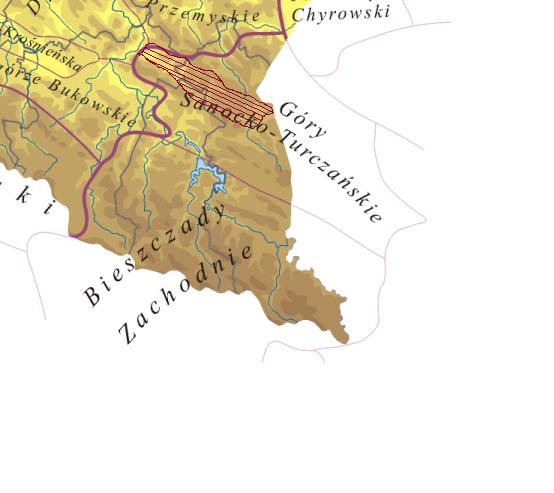
The Sanok-Turka Mountains ( pl, Góry Sanocko-Turczańskie; uk, Сяноцько-Турчанські гори) are a mountain range in the Eastern Beskids, within the Outer Eastern Carpathians. They are located in southern border section between Poland and Ukraine . The Sanok-Turka mountain range stretches on an area of 930 km² to the north of the Bieszczady Mountains, and to the south of the Przemyskie Upland, between the valleys of the middle San and Stryi River. They extend after the river Stryi by the Beskidy Brzeżne. The northern boundary is made by the rivers Wiar, Łomna, Stupnica, Leszczawka, Lachawka and Tyrawski, the western valley of the river San. Sometimes the territories to the East and South of the river Wiar, (like the Sucha Obycz Massif), and the east of the Lachawka river valley to the valley of the river San (Wysokiego mountain range) are added to Sanocko-Turczańskie mountains (there are also different variations of the northern border). The south ... [...More Info...] [...Related Items...] OR: [Wikipedia] [Google] [Baidu] |


