|
Skamneli
Skamneli ( el, Σκαμνέλι) is a village in the Zagori region ( Epirus region), 54 km north of Ioannina. It is built in the fringes of mountain Tymfi (Mt Tymphe), at a height of 1160 m. Name The name "Skamneli" is of uncertain origin. It may derive from the word "sycaminea" ( el, συκαμινέα, the sycamore of the Bible - the fig-mulberry tree). There are several villages and toponyms in Greece with the name Sycaminea or Sykamia. It is more likely, however, that the name is derived from the Greek "skamnos" (σκαμνός), "skamnon" (σκάμνον) or "skamni" (σκαμνί) ( la, scamnum, scannellum that means "seat" or "footstool") perhaps because the village itself seems like a seat and has an amphitheatric view. Skamneli is flanked by the steep cliff of Rhadio ( el, Ραδιό < ῥάδιον) meaning easy or accessible, (if so, either a euphemism or a reference to the road p ... [...More Info...] [...Related Items...] OR: [Wikipedia] [Google] [Baidu] |
Skamneli Palaiokastro
Skamneli ( el, Σκαμνέλι) is a village in the Zagori region ( Epirus region), 54 km north of Ioannina. It is built in the fringes of mountain Tymfi (Mt Tymphe), at a height of 1160 m. Name The name "Skamneli" is of uncertain origin. It may derive from the word "sycaminea" ( el, συκαμινέα, the sycamore of the Bible - the fig-mulberry tree). There are several villages and toponyms in Greece with the name Sycaminea or Sykamia. It is more likely, however, that the name is derived from the Greek "skamnos" (σκαμνός), "skamnon" (σκάμνον) or "skamni" (σκαμνί) ( la, scamnum, scannellum that means "seat" or "footstool") perhaps because the village itself seems like a seat and has an amphitheatric view. Skamneli is flanked by the steep cliff of Rhadio ( el, Ραδιό < ῥάδιον) meaning easy or accessible, (if so, either a |
Zagori
Zagori ( el, Ζαγόρι; rup, Zagori), is a region and a municipality in the Pindus mountains in Epirus, in northwestern Greece. The seat of the municipality is the village Asprangeloi. It has an area of some and contains 46 villages known as Zagori villages (or Zagorochoria or Zagorohoria), and is in the shape of an upturned equilateral triangle. Ioannina, the provincial capital, is at the southern point of the triangle, while the south-western side is formed by Mount Mitsikeli (1,810m). The Aoos river running north of Mt Tymphe forms the northern boundary, while the south-eastern side runs along the Varda river to Mount Mavrovouni (2,100m) near Metsovo. The municipality has an area of 989.796 km2. The population of the area is about 3,700, which gives a population density of 4 inhabitants per square kilometer, very sparse when compared to an average of 73.8 for Greece as a whole. Geography Zagori is an area of great natural beauty, with striking geology and two Natio ... [...More Info...] [...Related Items...] OR: [Wikipedia] [Google] [Baidu] |
Tymfi
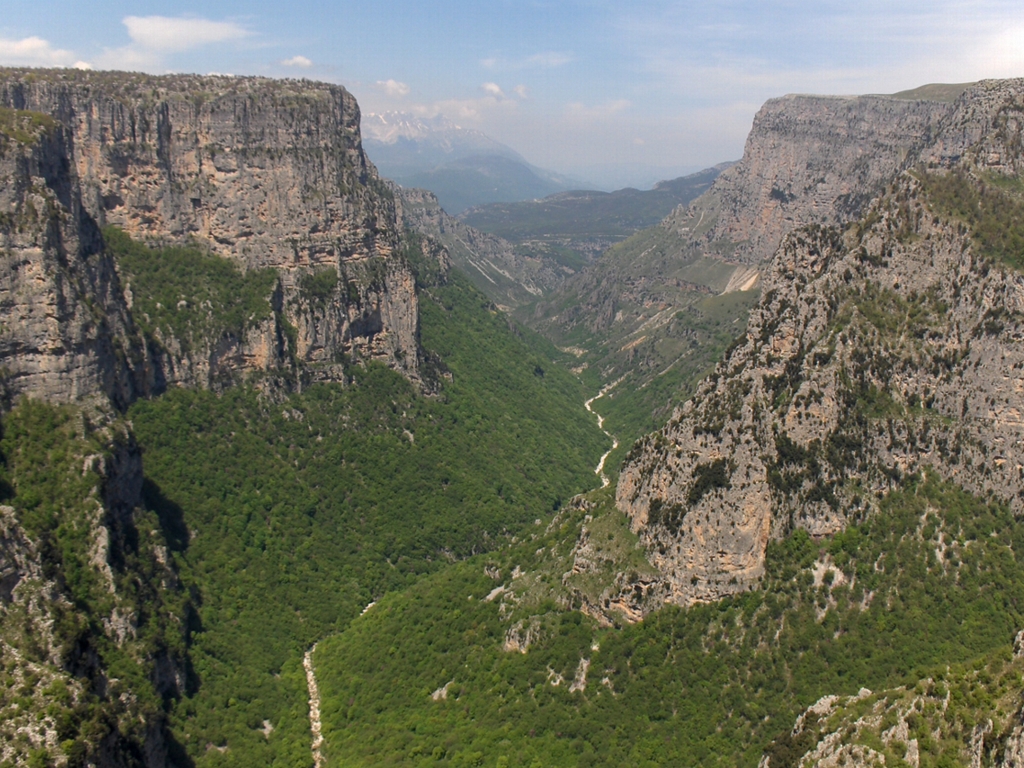
Tymphe (in Latin and English usage) or Tymfi (in the Greek government's preferred transliteration), Timfi, also Tymphi (, ) is a mountain in the northern Pindus mountain range, northwestern Greece. It is part of the regional unit of Ioannina and lies in the region of Zagori, just a few metres south of the 40° parallel. Tymphe forms a massif with its highest peak, Gamila, at . The massif of Tymphe includes in its southern part the Vikos Gorge, while they both form part of the Vikos–Aoös National Park which accepts over 100,000 visitors per year. The former municipality of the same name owed its name to the mountain. Etymology The exact meaning of the name is not known but has been in use since ancient times. The name "Tymphe" or "Stymphe" is mentioned by ancient geographer Strabo, Book 7, Ch. 7, and is associated with the ancient land of Tymphaea and the Tymphaeans, one of the tribes of Ancient Epirus. Despite its ancient use, the name does not appear in any descriptions of ... [...More Info...] [...Related Items...] OR: [Wikipedia] [Google] [Baidu] |
Vikos Doctors
Vikos doctors were folk healers or practical medical practitioners from the Greek area of Zagori in the 18-19th century. Etymology The Greek word ἰατρός (''iatrós'', doctor or healer) is often translated as physician. Vikos doctors ( el, βικογιατροί) were local doctors practicing a form of herbal medicine in the 18th and 19th century. History The Vikos doctorsΒασίλης Μηνακάκης ‘Ζαγοροχώρια’ (Vasilis Minakakis ‘Zagorochoria’) Explorer, Athens, 2006 hailed from the area of central Zagori and particularly from the villages of Tsepelovo, , Papingo, Skamneli, Koukouli, Monodendri and Kapesovo. They used local herbs to heal ailments of people as well as of livestock. These herbs and parts of some other plants were being collected from the Vikos Gorge, hence the attribution. They were descendants of an ancient craft who in the Ottoman period attained great fame. Some even served as advisors in the courts of the Ottoman Sult ... [...More Info...] [...Related Items...] OR: [Wikipedia] [Google] [Baidu] |
Gyftokampos
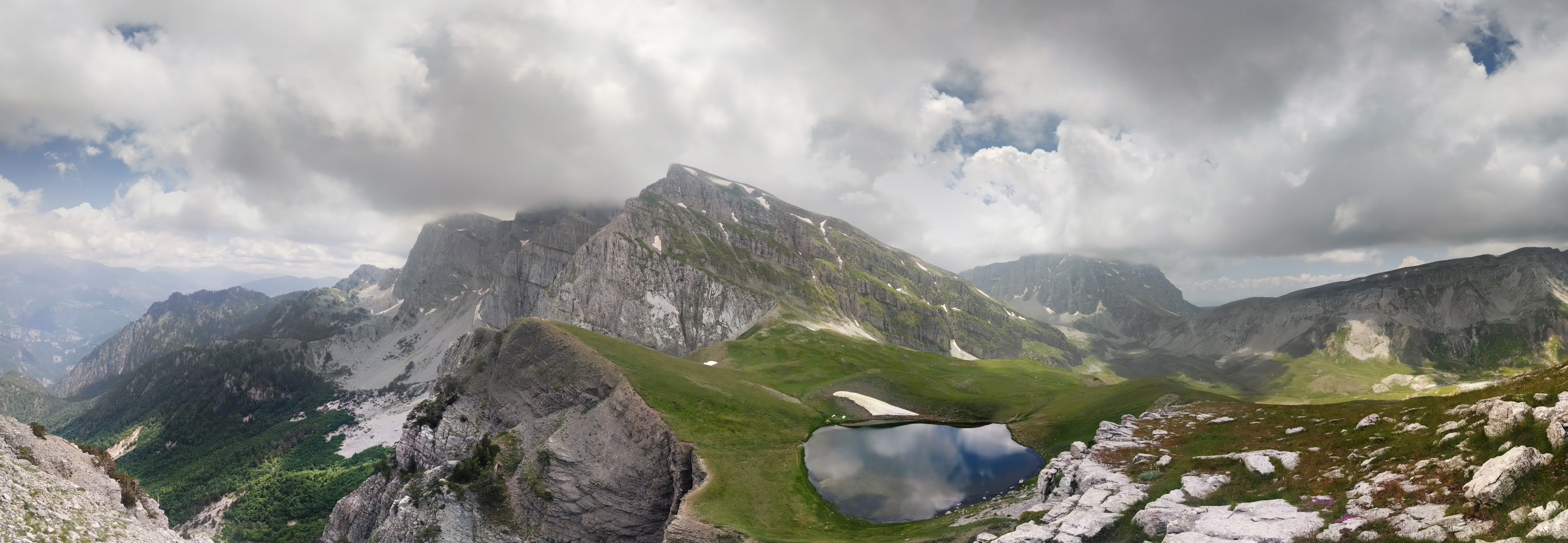
Gyftokampos ( el, Γυφτόκαμπος) is an area ιn the Zagori region ( Epirus region), 58 km north of Ioannina. Its name is derived from the Greek "gyftos" (γύφτος), gypsy and "kampos" ( la, campus) that means "field", and could be rendered in English translation as "gypsy lea". There used to be a hamlet called Nouka on this location which was also used by the Sarakatsani as pasture grounds. The area, located at the base of Mt Tymfi, has traditionally belonged to the village of Skamneli and it forms part of the municipality of Tymfi. History Until the early 20th century, the area was open and used as a grazing ground by the Sarakatsani . It has become gradually wooded by coniferous trees, including impressive Scots pines. Huts of Sarakatsani were in use until the 1990s. Today an open-air "museum" with typical Sarakatsani huts and animal enclosures has been built. The area is used for an annual Sarakatsani The Sarakatsani ( el, Σαρακατσάνοι, also wri ... [...More Info...] [...Related Items...] OR: [Wikipedia] [Google] [Baidu] |
Tymfi, Greece
Tymfi ( el, Τύμφη) is a former municipality in the Ioannina regional unit, Epirus, Greece. Since the 2011 local government reform it is part of the municipality Zagori, of which it is a municipal unit. The municipal unit has an area of 428.296 km2. Population 862 (2011). The seat of the municipality was in Tsepelovo. It took its name from the Tymfi mountain. Subdivisions The municipal unit Tymfi is subdivided into the following communities: *Tsepelovo *Vradeto * Vrysochori * Iliochori *Kapesovo * Kipoi * Koukouli * Laista *Leptokarya * Negades *Skamneli Skamneli ( el, Σκαμνέλι) is a village in the Zagori region ( Epirus region), 54 km north of Ioannina. It is built in the fringes of mountain Tymfi (Mt Tymphe), at a height of 1160 m. Name The name "Skamneli" is of uncertain origi ... * Fragkades References Zagori Populated places in Ioannina (regional unit) {{Epirus-geo-stub de:Tymfi ... [...More Info...] [...Related Items...] OR: [Wikipedia] [Google] [Baidu] |
Tsepelovo
Tsepelovo ( el, Τσεπέλοβο) is a village in the Zagori region (Epirus region). It stands at a height of 1,200 meters in a panoramic location on the mountain range of Tymfi. It is the biggest of the 45 villages of Zagori and it was the seat of Tymfi municipality. Its name is of Slavic origin. It lies in the middle of the Vikos–Aoös National Park, 48 km from Ioannina. Nearest places * Skamneli, east (distance: 4 km) * Vradeto, west (distance: 7 km) Population History Founded in the 16th century, Tsepelovo became from the 18th century onwards the administrative center of Zagori. It remained relatively prosperous until the end of the Ottoman occupation (1912). The village was a local trade center, and remains so especially because of the trade of timber. In 1820, before the outbreak of the Greek Revolution and the defeat of Ali Pasha, the poet Ioannis Vilaras and the famous Epirote scholar Athanasios Psalidas came from Ioannina to prepare the people ... [...More Info...] [...Related Items...] OR: [Wikipedia] [Google] [Baidu] |
Vradeto
Vradeto ( el, Βραδέτο) is a village in the Greek Zagori region ( Epirus region). It lies at a height of 1340m on Mt Tymphe in the Pindus mountain range. It is the highest of the 44 villages of Zagori. It is the middle of the Vikos–Aoös National Park and is about 50 km away from Ioannina. It is located only a few kilometers from the Vikos Gorge and near one of the best vantage points, Beloe (Beloi) (perhaps a Slavic word meaning "good view" or "balcony"). It is located also close to an alpine lake called Drakolimni (''Dragon’s Lake''), one of several such lakes. The lakes are named after the amphibian newts ('' Ichthyosaura alpestris'') that live in them, around which there are myths of dragons. The myths are echoes of ancient myths about the hero Pindus, son of Macedon, who either befriended or according to another myth killed a dragon. Nearest places *Tsepelovo, east (distance: 10 km) * Kapesovo, south (distance: 5 km) Population History Until t ... [...More Info...] [...Related Items...] OR: [Wikipedia] [Google] [Baidu] |
Apostles In The New Testament
In Christian theology and ecclesiology, the apostles, particularly the Twelve Apostles (also known as the Twelve Disciples or simply the Twelve), were the primary Disciple (Christianity), disciples of Jesus according to the New Testament. During the Life of Jesus in the New Testament, life and ministry of Jesus in the Christianity in the 1st century, 1st century AD, the apostles were his closest followers and became the primary teachers of the gospel message of Jesus. There is also an Eastern Christianity, Eastern Christian tradition derived from the Gospel of Luke of there having been as many as Seventy disciples, seventy apostles during the time of Jesus' ministry. The commissioning of the Twelve Apostles during the ministry of Jesus is described in the Synoptic Gospels. After his Resurrection of Jesus, resurrection, Jesus sent eleven of them (as Judas Iscariot by then had Judas Iscariot#Death, died) by the Great Commission to spread his teachings to all nations. This event ... [...More Info...] [...Related Items...] OR: [Wikipedia] [Google] [Baidu] |
Armatoloi
The armatoles ( el, αρματολοί, armatoloi; sq, armatolë; rup, armatoli; bs, armatoli), or armatole in singular ( el, αρματολός, armatolos; sq, armatol; rup, armatol; bs, armatola), were Christian irregular soldiers, or militia, commissioned by the Ottomans to enforce the Sultan's authority within an administrative district called an Armatoliki ( in singular, , in plural). In Greek regions of the Ottoman Empire, they were composed of Greeks who were either former klephts or village stalwarts who had taken up arms against the klephts in the defense of their district. The Greek armatoles had a semi-independent status all over the Greek peninsula, and armatolikia were created in areas that had high levels of brigandage (i.e. klephts), or in regions that were difficult for Ottoman authorities to govern due to the inaccessible terrain, such as the Agrafa mountains of Thessaly, where the first armatoliki was established in the 15th century. Over time, the role ... [...More Info...] [...Related Items...] OR: [Wikipedia] [Google] [Baidu] |
Doliani
Doliani ( el, Δόλιανη, rup, Doljani) is a village and a community of the Zagori municipality in Ioannina Regional Unit, Greece. Before the 2011 local government reform it was part of the municipality of East Zagori, of which it was a municipal district. The 2011 census recorded 55 inhabitants in the village. The community of Doliani covers an area of 17.276 km2. Doliani is a traditional Aromanian (Vlach) settlement. See also * List of settlements in the Ioannina regional unit This is a list of settlements in the Ioannina regional unit, Greece. * Achladies * Aetomilitsa * Aetopetra, Konitsa * Aetopetra, Zitsa * Aetorrachi * Agia Anastasia * Agia Marina * Agia Paraskevi, Konitsa * Agia Paraskevi, Zagori * Agia ... References Populated places in Ioannina (regional unit) Aromanian settlements in Greece {{Epirus-geo-stub ... [...More Info...] [...Related Items...] OR: [Wikipedia] [Google] [Baidu] |


