|
Sinus Roris
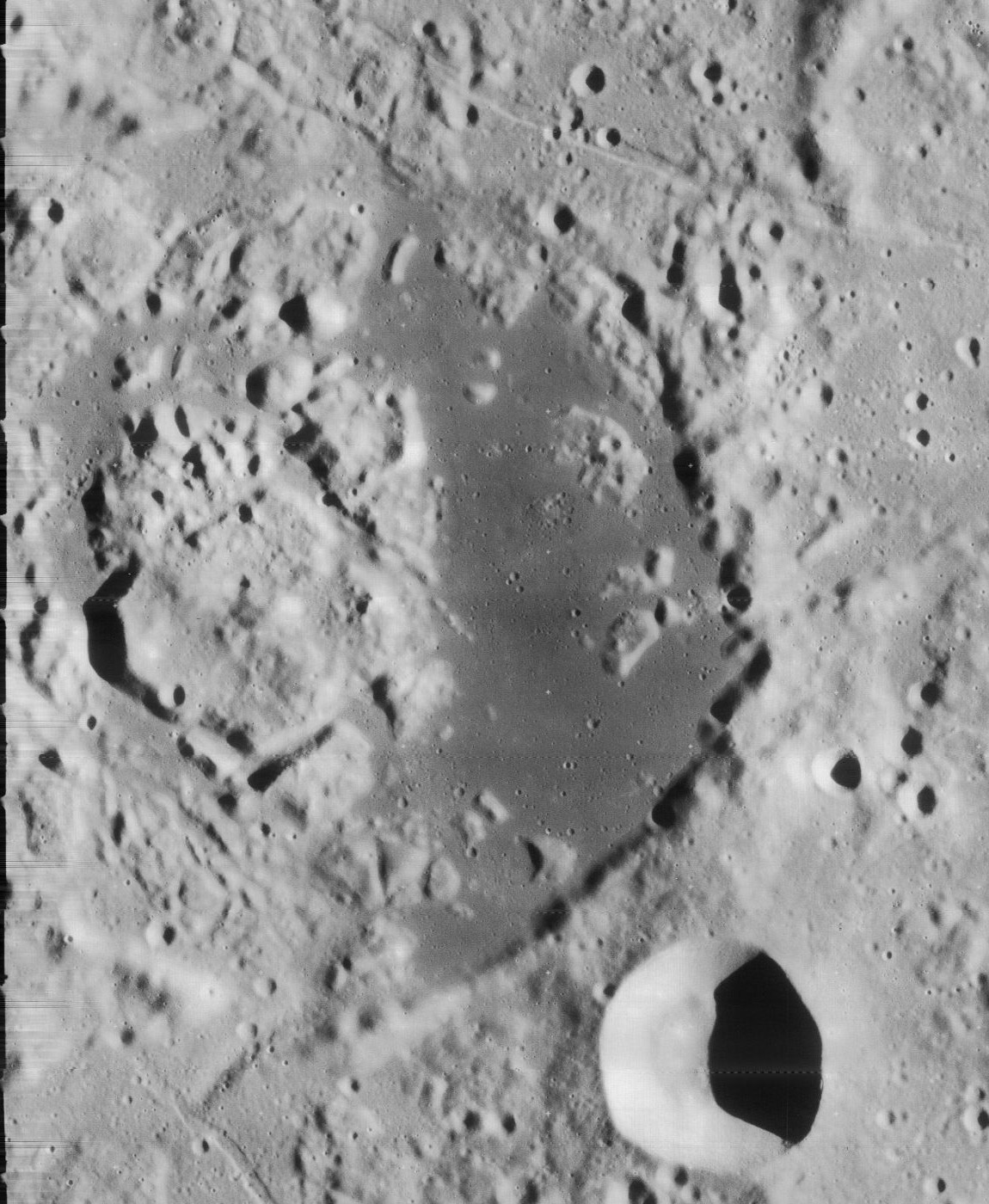
Sinus Roris (Latin ''sinus rōris'' "Bay of Dew") is a dark, basaltic plain on the near side of the Moon that forms an extension of the northern edge of Oceanus Procellarum. The IAU-defined selenographic coordinates of this bay are 54.0° N, 56.6° W, and the diameter is 202 km. Characteristics Following traditional nomenclature for the moon, this feature was named sinus (bay) because of its small size, but it possesses many of the same characteristics as a lunar mare (sea). Like other maria (including Oceanus Procellarum), it is a dark, basaltic area on the near side of the moon believed to be formed by impact craters that later filled with magma, which then hardened into smooth, dark plains. The borders of this feature are somewhat indistinct. The bay proper is framed along the western edge by the craters Markov and Oenopides, and to the north by Babbage and South. At the eastern edge it joins the Mare Frigoris. Many selenographers have taken liberties with the dimen ... [...More Info...] [...Related Items...] OR: [Wikipedia] [Google] [Baidu] |
Gerard (crater)
Gerard is a lunar impact crater that lies along the western edge of the Oceanus Procellarum near the northwest limb of the Moon's near side. It is located to the north-northwest of the crater von Braun, and northeast of Bunsen. Because of its location, Gerard appears strongly foreshortened when viewed from the Earth, hindering observation. This is a worn and eroded formation with a rim that has been nearly obliterated in some locations and distorted in others. The northern half of the rim has outward bulges to the northeast, north, and northwest. The interior floor is rough in places, with several small and tiny craters along the floor and the eastern rim. To the northwest of this formation is the unusual Gerard Q Inner (eastern floor covered in dark- hued basaltic lava Lava is molten or partially molten rock (magma) that has been expelled from the interior of a terrestrial planet (such as Earth) or a moon onto its surface. Lava may be erupted at a volcano or through a ... [...More Info...] [...Related Items...] OR: [Wikipedia] [Google] [Baidu] |
A Fall Of Moondust
''A Fall of Moondust'' is a hard science fiction novel by British writer Arthur C. Clarke, first published in 1961. It was nominated for a Hugo Award for Best Novel, and was the first science fiction novel selected to become a ''Reader's Digest'' Condensed Book. Plot By the 21st century, the Moon has been colonized, and although still very much a research establishment, it is visited by tourists who can afford the trip. One of its attractions is a cruise across one of the lunar seas, named the ''Sea of Thirst'', (located within the Sinus Roris) filled with an extremely fine dust, a fine powder far drier than the contents of a terrestrial desert and which almost flows like water, instead of the common regolith which covers most of the lunar surface. A specially designed "boat" named the ''Selene'' skims over the surface of the dust in the same manner as a jetski. But on one cruise, a moonquake causes a cavern to collapse, upsetting the equilibrium. As the dust-cruiser Se ... [...More Info...] [...Related Items...] OR: [Wikipedia] [Google] [Baidu] |
Arthur C
Arthur is a common male given name of Brythonic origin. Its popularity derives from it being the name of the legendary hero King Arthur. The etymology is disputed. It may derive from the Celtic ''Artos'' meaning “Bear”. Another theory, more widely believed, is that the name is derived from the Roman clan '' Artorius'' who lived in Roman Britain for centuries. A common spelling variant used in many Slavic, Romance, and Germanic languages is Artur. In Spanish and Italian it is Arturo. Etymology The earliest datable attestation of the name Arthur is in the early 9th century Welsh-Latin text ''Historia Brittonum'', where it refers to a circa 5th to 6th-century Briton general who fought against the invading Saxons, and who later gave rise to the famous King Arthur of medieval legend and literature. A possible earlier mention of the same man is to be found in the epic Welsh poem ''Y Gododdin'' by Aneirin, which some scholars assign to the late 6th century, though this is still a ... [...More Info...] [...Related Items...] OR: [Wikipedia] [Google] [Baidu] |
Wernher Von Braun
Wernher Magnus Maximilian Freiherr von Braun ( , ; 23 March 191216 June 1977) was a German and American aerospace engineer and space architect. He was a member of the Nazi Party and Allgemeine SS, as well as the leading figure in the development of rocket technology in Nazi Germany and later a pioneer of rocket and space technology in the United States. As a young man, von Braun worked in Nazi Germany's rocket development program. He helped design and co-developed the V-2 rocket at Peenemünde during World War II. Following the war, he was secretly moved to the United States, along with about 1,600 other German scientists, engineers, and technicians, as part of Operation Paperclip. He worked for the United States Army on an intermediate-range ballistic missile program, and he developed the rockets that launched the United States' first space satellite Explorer 1 in 1958. He worked with Walt Disney on a series of films, which popularized the idea of human space travel in ... [...More Info...] [...Related Items...] OR: [Wikipedia] [Google] [Baidu] |
Albedo
Albedo (; ) is the measure of the diffuse reflection of sunlight, solar radiation out of the total solar radiation and measured on a scale from 0, corresponding to a black body that absorbs all incident radiation, to 1, corresponding to a body that reflects all incident radiation. Surface albedo is defined as the ratio of Radiosity (radiometry), radiosity ''J''e to the irradiance ''E''e (flux per unit area) received by a surface. The proportion reflected is not only determined by properties of the surface itself, but also by the spectral and angular distribution of solar radiation reaching the Earth's surface. These factors vary with atmospheric composition, geographic location, and time (see position of the Sun). While bi-hemispherical reflectance is calculated for a single angle of incidence (i.e., for a given position of the Sun), albedo is the directional integration of reflectance over all solar angles in a given period. The temporal resolution may range from seconds (as ob ... [...More Info...] [...Related Items...] OR: [Wikipedia] [Google] [Baidu] |
Mons Rümker
Mons Rümker is an isolated volcanic formation that is located in the northwest part of the Moon's near side, at selenographic coordinates 40.8° N, 58.1° W. The feature forms a large, elevated mound in the northern part of the Oceanus Procellarum. The mound has a diameter of 70 kilometres, and climbs to a maximum elevation of about 1,300 metres above the surrounding plain. It was named after Karl L. C. Rümker. Mons Rümker has a concentration of 22 lunar domes—rounded bulges across the top, some of which contain a small craterlet at the peak. These are wide, circular features with a gentle slope rising in elevation a few hundred meters to the midpoint. Lunar domes are similar to shield volcanoes, and are the result of lava erupting from localized vents followed by relatively slow cooling. Mons Rümker is surrounded by a scarp that separates it from the adjacent mare. The plateau rises to an altitude of 900 m in the west, 1,100 m in the south and 650 m in t ... [...More Info...] [...Related Items...] OR: [Wikipedia] [Google] [Baidu] |
Latitude
In geography, latitude is a coordinate that specifies the north– south position of a point on the surface of the Earth or another celestial body. Latitude is given as an angle that ranges from –90° at the south pole to 90° at the north pole, with 0° at the Equator. Lines of constant latitude, or ''parallels'', run east–west as circles parallel to the equator. Latitude and ''longitude'' are used together as a coordinate pair to specify a location on the surface of the Earth. On its own, the term "latitude" normally refers to the ''geodetic latitude'' as defined below. Briefly, the geodetic latitude of a point is the angle formed between the vector perpendicular (or ''normal'') to the ellipsoidal surface from the point, and the plane of the equator. Background Two levels of abstraction are employed in the definitions of latitude and longitude. In the first step the physical surface is modeled by the geoid, a surface which approximates the mean sea level over the ocean ... [...More Info...] [...Related Items...] OR: [Wikipedia] [Google] [Baidu] |
Harpalus (crater)
Harpalus is a young lunar impact crater that lies on the Mare Frigoris, at the eastern edge of the Sinus Roris. To the southeast at the edge of the mare is the small crater Foucault, and to the northwest on the opposite edge is the walled plain named South. The rim of Harpalus is sharp-edged with little sign of wear or erosion. The wall is not perfectly circular, and has a few outward notches and protrusions, especially along the eastern half. It is surrounded by an outer rampart of ejecta, most notably towards the north, and is at the center of a small ray system. Due to its rays, Harpalus is mapped as part of the Copernican System.The geologic history of the Moon, 1987, Wilhelms, Don E.; with sections by McCauley, John F.; Trask, Newell J. USGS Professional Paper: 1348. Plate 11: Copernican Systemonline The inner surface is terraced, and flows down to the floor. The interior wall is the least wide along the northern face, making the floor slightly offset in that direction. ... [...More Info...] [...Related Items...] OR: [Wikipedia] [Google] [Baidu] |
Repsold (crater)
Repsold is a lunar impact crater that is located at the western end of the Oceanus Procellarum. It lies to the northeast of the crater Galvani and southeast of the walled plain Volta. Due to its proximity to the northwestern limb of the Moon, this crater appears highly foreshortened when viewed from the Earth. It is named after Johann Georg Repsold (1770 – 1830), a German astronomer. This crater has been heavily damaged by impacts and much of the rim has disintegrated, leaving a rugged region of small craters. The most intact section of the rim is in the southeastern part, which separates this formation from the adjacent mare. The satellite crater Repsold G overlies the southwestern part of the crater. The interior floor of Repsold contains a system of rilles named the Rimae Repsold. The most prominent of these rifts begins in the northeastern part of the floor and crosses to the southwest. The cleft then traverses Repsold G, dividing it into two, and continues west-southwest u ... [...More Info...] [...Related Items...] OR: [Wikipedia] [Google] [Baidu] |
Selenography
Selenography is the study of the surface and physical features of the Moon (also known as geography of the Moon, or selenodesy). Like geography and areography, selenography is a subdiscipline within the field of planetary science. Historically, the principal concern of selenographists was the mapping and naming of the lunar terrane identifying maria, craters, mountain ranges, and other various features. This task was largely finished when high resolution images of the near and far sides of the Moon were obtained by orbiting spacecraft during the early space era. Nevertheless, some regions of the Moon remain poorly imaged (especially near the poles) and the exact locations of many features (like crater depths) are uncertain by several kilometers. Today, selenography is considered to be a subdiscipline of selenology, which itself is most often referred to as simply "lunar science." The word selenography is derived from the Greek lunar deity Σελήνη ''Selene'' and γράφ ... [...More Info...] [...Related Items...] OR: [Wikipedia] [Google] [Baidu] |


