|
Sima (river)
The Sima is a river in the municipality of Eidfjord in Hordaland, Norway. The river is long, and it has a drainage basin of and an average discharge of . The river has its source on the west side of the Hardanger Glacier, at a proglacial lake called ''Demmevatn'' at an elevation of . The river then flows west from Lake Rembesdal (''Rembesdalsvatn''), with an elevation of , into the deep Sima Valley and past the former high Rembesdal Falls (''Rembesdalsfossen''), which is now dry because of hydroelectric plant infrastructure. In the Sima Valley the river is joined by the Skytjedal River (''Skytjedalselva''), a left tributary known for ''Skytjefossen'', a high waterfall. The river continues west until its mouth at the head of the Simadal Fjord. Together with the nearby Bjoreio River to the south, the Sima River has been developed for power production at the Sima Hydroelectric Power Station. The power station is located in the mountains below Kjeåsen Kjeåsen is a mountain ... [...More Info...] [...Related Items...] OR: [Wikipedia] [Google] [Baidu] |
Hardangerjøkulen
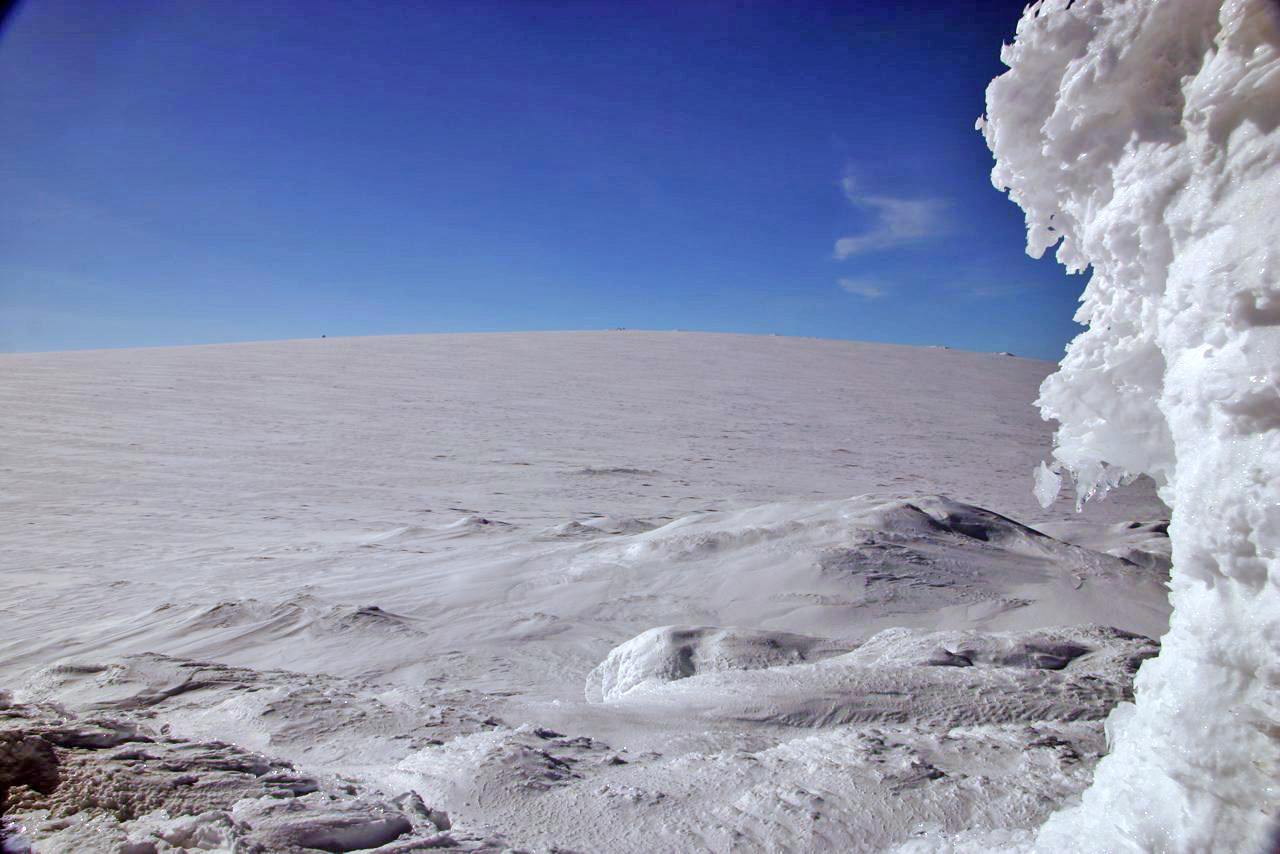
Hardangerjøkulen ( en, Hardanger Glacier) is the sixth largest glacier in mainland Norway. It is located in the municipalities of Eidfjord and Ulvik in Vestland county. It is located about northeast of the village of Eidfjord (village), Eidfjord, about south of the village of Finse, and about west of the village of Haugastøl. Hardangerjøkulen's highest point is above sea level, and is the highest point in Hordaland county. Its lowest point is above sea level. The thickest measurement of the glacier was thick, but it has been getting thinner during the 20th century. Accessibility The glacier can be easily accessed by skis from the north in the winter, from the village of Finse, which is only accessible by stopping at Finse Station on the Bergen Line railway. Recent history The 1980 movie ''The Empire Strikes Back, Star Wars: Episode V – The Empire Strikes Back'' used Hardangerjøkulen as a filming location, for scenes of the ice planet Hoth, although in the battle s ... [...More Info...] [...Related Items...] OR: [Wikipedia] [Google] [Baidu] |
Eidfjord
Eidfjord is a municipality in Vestland county, Norway. The municipality is located in the traditional district of Hardanger. The administrative centre of the municipality is the village of Eidfjord, where the majority of the municipal population lives. The other major population centre in the municipality is the village of Øvre Eidfjord. Eidfjord is situated at the end of the Eid Fjord, an inner branch of the large Hardangerfjorden. The village of Eidfjord is a major cruise ship port of call. Eidfjord has several tourist sites, like the Sima Power Plant which is built into the mountain itself, the Måbødalen valley, and the Vøringsfossen waterfall which has a free fall of . Large parts of the Hardangervidda (Europe's largest mountain plateau) are located in Eidfjord. The Hardangervidda Natursenter, a visitors centre and museum for Hardangervidda National Park, is located in Øvre Eidfjord. The municipality is the 57th largest by area out of the 356 municipalities in Nor ... [...More Info...] [...Related Items...] OR: [Wikipedia] [Google] [Baidu] |
Kjeåsen
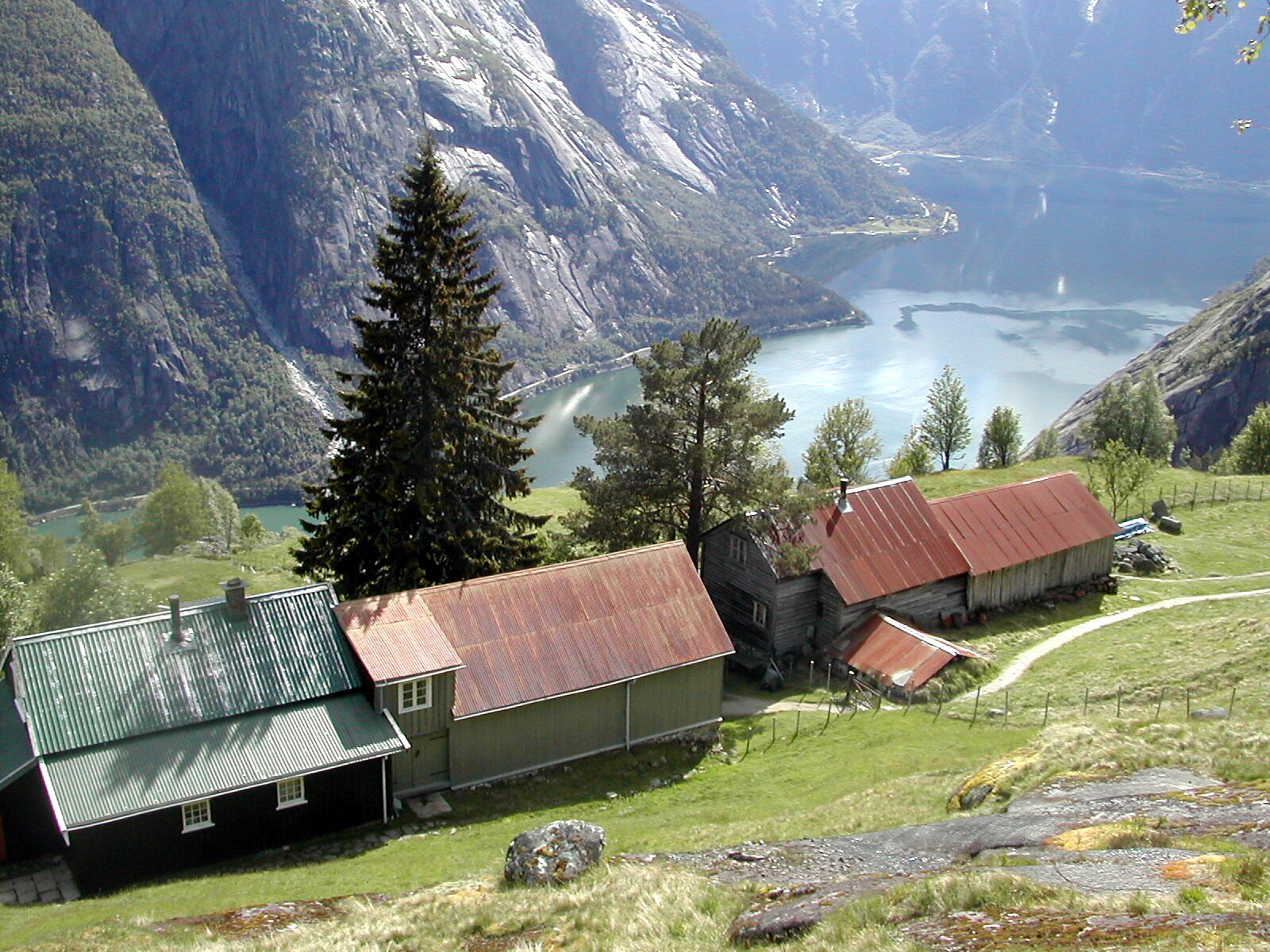
Kjeåsen is a mountain farm (with two farmsteads) in the municipality of Eidfjord in Norway's Hardanger district, in Vestland county. The farm lies at an elevation of at the innermost point of the Simadal Fjord. The farm is no longer being worked, and one person lives there during the summer. The site is popular with tourists, especially Swedes. The farm has been referred to as "the world's most inaccessible farm." Kjeåsen can be reached on foot up the steep path from the Sima Hydroelectric Power Station. This was the farm's road until 1974, and the trip takes about 1½ to 2 hours each way. Kjeåsen also has what is known as "the world's most expensive farm road"; it is long, of which approximately consists of a tunnel from the Sima Valley to the farm. The tunnel has a single lane, with driving directions scheduled up on the hour and down every half hour. The road and tunnel to Kjeåsen were built in 1974 in connection with hydroelectric development works in the Sima Valley. Th ... [...More Info...] [...Related Items...] OR: [Wikipedia] [Google] [Baidu] |
Norway
Norway, officially the Kingdom of Norway, is a Nordic country in Northern Europe, the mainland territory of which comprises the western and northernmost portion of the Scandinavian Peninsula. The remote Arctic island of Jan Mayen and the archipelago of Svalbard also form part of Norway. Bouvet Island, located in the Subantarctic, is a dependency of Norway; it also lays claims to the Antarctic territories of Peter I Island and Queen Maud Land. The capital and largest city in Norway is Oslo. Norway has a total area of and had a population of 5,425,270 in January 2022. The country shares a long eastern border with Sweden at a length of . It is bordered by Finland and Russia to the northeast and the Skagerrak strait to the south, on the other side of which are Denmark and the United Kingdom. Norway has an extensive coastline, facing the North Atlantic Ocean and the Barents Sea. The maritime influence dominates Norway's climate, with mild lowland temperatures on the se ... [...More Info...] [...Related Items...] OR: [Wikipedia] [Google] [Baidu] |
Hordaland
Hordaland () was a county in Norway, bordering Sogn og Fjordane, Buskerud, Telemark, and Rogaland counties. Hordaland was the third largest county, after Akershus and Oslo, by population. The county government was the Hordaland County Municipality, which is located in Bergen. Before 1972, the city of Bergen was its own separate county, apart from Hordaland. On 1 January 2020, the county was merged with neighbouring Sogn og Fjordane county, to form the new Vestland county. Name and symbols Name Hordaland (Old Norse: ''Hǫrðaland'') is the old name of the region which was revived in 1919. The first element is the plural genitive case of ''hǫrðar'', the name of an old Germanic tribe (see Charudes). The last element is ''land'' which means "land" or "region" in the Norwegian language. Until 1919 the name of the county was ''Søndre Bergenhus amt'' which meant "(the) southern (part of) Bergenhus amt". (The old ''Bergenhus amt'' was created in 1662 and was divided into North ... [...More Info...] [...Related Items...] OR: [Wikipedia] [Google] [Baidu] |
Drainage Basin
A drainage basin is an area of land where all flowing surface water converges to a single point, such as a river mouth, or flows into another body of water, such as a lake or ocean. A basin is separated from adjacent basins by a perimeter, the '' drainage divide'', made up of a succession of elevated features, such as ridges and hills. A basin may consist of smaller basins that merge at river confluences, forming a hierarchical pattern. Other terms for a drainage basin are catchment area, catchment basin, drainage area, river basin, water basin, and impluvium. In North America, they are commonly called a watershed, though in other English-speaking places, "watershed" is used only in its original sense, that of a drainage divide. In a closed drainage basin, or endorheic basin, the water converges to a single point inside the basin, known as a sink, which may be a permanent lake, a dry lake, or a point where surface water is lost underground. Drainage basins are similar ... [...More Info...] [...Related Items...] OR: [Wikipedia] [Google] [Baidu] |
Discharge (hydrology)
In hydrology, discharge is the volumetric flow rate of water that is transported through a given cross-sectional area. It includes any suspended solids (e.g. sediment), dissolved chemicals (e.g. CaCO3(aq)), or biologic material (e.g. diatoms) in addition to the water itself. Terms may vary between disciplines. For example, a fluvial hydrologist studying natural river systems may define discharge as streamflow, whereas an engineer operating a reservoir system may equate it with outflow, contrasted with inflow. Theory and calculation A discharge is a measure of the quantity of any fluid flow over unit time. The quantity may be either volume or mass. Thus the water discharge of a tap (faucet) can be measured with a measuring jug and a stopwatch. Here the discharge might be 1 litre per 15 seconds, equivalent to 67 ml/second or 4 litres/minute. This is an average measure. For measuring the discharge of a river we need a different method and the most common is the 'area-velocity' method. ... [...More Info...] [...Related Items...] OR: [Wikipedia] [Google] [Baidu] |
Proglacial Lake
In geology, a proglacial lake is a lake formed either by the damming action of a moraine during the retreat of a melting glacier, a glacial ice dam, or by meltwater trapped against an ice sheet due to isostatic depression of the crust around the ice. At the end of the last ice age about 10,000 years ago, large proglacial lakes were a widespread feature in the northern hemisphere. Moraine-dammed The receding glaciers of the tropical Andes have formed a number of proglacial lakes, especially in the Cordillera Blanca of Peru, where 70% of all tropical glaciers are. Several such lakes have formed rapidly during the 20th century. These lakes may burst, creating a hazard for zones below. Many natural dams (usually moraines) containing the lake water have been reinforced with safety dams. Some 34 such dams have been built in the Cordillera Blanca to contain proglacial lakes. Several proglacial lakes have also formed in recent decades at the end of glaciers on the eastern side of Ne ... [...More Info...] [...Related Items...] OR: [Wikipedia] [Google] [Baidu] |
Sima Valley
The Sima Valley ( no, Simadal) is a river valley in the municipality of Eidfjord in Vestland county, Norway. The long valley begins below Lake Rembesdal, with an elevation of , which is one of the sources of the Sima River. The valley then runs west along the river to the Sima Hydroelectric Power Station at the head of the Simadal Fjord, where the river empties into the fjord. Norwegian County Road 103 County Road 5096 ( no, Fylkesvei 5096) is a long county road in Eidfjord Municipality in Vestland county, Norway. The road heads northeast from the village of Eidfjord. Prior to 2020, the road was called County Road 103. It was changed in 2020 ... runs through part of the valley and then continues along the south side of the fjord. The Sima Valley is known for its waterfalls, including Rembesdal Falls (''Rembesdalsfossen'') and Skykkjedal Falls (''Skykkjedalsfossen''). It suffered catastrophic floods in 1893 and 1937. The valley had a population of 10 in 2017. References ... [...More Info...] [...Related Items...] OR: [Wikipedia] [Google] [Baidu] |
Simadal Fjord
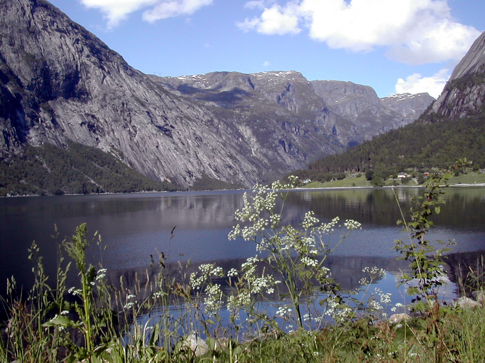
The Simadal Fjord ( no, Simadalsfjorden) is a branch of the Eid Fjord in the municipality of Eidfjord in Vestland, Norway. The Simadal Fjord is the innermost branch of the Hardangerfjorden, Hardanger Fjord. It is long and extends east from its mouth between Blurnes and Eikenes to the head of the fjord at the Sima Valley. The fjord is surrounded by high and steep mountains reaching elevations up to . The Kjeåsen mountain farm lies on the mountain slope north of the mouth of the fjord. Below Kjeåsen is the Sima Hydroelectric Power Station, which has its outlet into the fjord. Norwegian County Road 103 runs along the south side of the fjord and continues into the Sima Valley. References {{coord, 60, 29, 14.410, N, 7, 5, 32.500, E, type:waterbody, display=title Fjords of Vestland Eidfjord ... [...More Info...] [...Related Items...] OR: [Wikipedia] [Google] [Baidu] |
Bjoreio
The Bjoreio, also known as the Bjoreia, is a river in the municipality of Eidfjord in Vestland, Norway. The river is long, and it has a drainage basin of . Its natural average discharge is , but this is considerably less today because of hydroelectric infrastructure along the watercourse. The Bjoreio has its origin on the northwest side of Sildabunutane, a mountain in Hardangervidda National Park. The river, which is called the ''Eitro'' here, then runs southeast through Sildabudalen, a wide valley, and into Langavatnet, a lake at an elevation of . Under the name ''Snero'' the river continues the short distance to Tinnhølen, a lake at . When it flows out of Tinnhølen the river is now named Bjoreio, and it runs to the northwest out of the national park and down through the Bjorei Valley (''Bjoreidalen''). At the Nybu tourist lodge it is joined by the Svinto from the east. Here the river runs through the Bjorei Valley Nature Reserve (''Bjoreidalen naturreservat''). In the natur ... [...More Info...] [...Related Items...] OR: [Wikipedia] [Google] [Baidu] |
Sima Hydroelectric Power Station
The Sima Power Station is a hydroelectric power station located in the municipality Eidfjord in Vestland Vestland is a county in Norway established on 1 January 2020. The county is located in Western Norway and it is centred around the city of Bergen, Norway's second largest city. The administrative centre of the county is the city of Bergen, where t ..., Norway. It stands at the mouth of the Sima River. The facility Lang-Sima operates at an installed capacity of , and has an average annual production of 1,212 GWh. The facility Sy-Sima has an installed capacity of , and an average annual production of 1,640 GWh. Operator is Statkraft. See also References Hydroelectric power stations in Norway Statkraft Buildings and structures in Vestland Dams in Norway Eidfjord {{hydroelectric-power-plant-stub ... [...More Info...] [...Related Items...] OR: [Wikipedia] [Google] [Baidu] |


