|
Shimosuwa
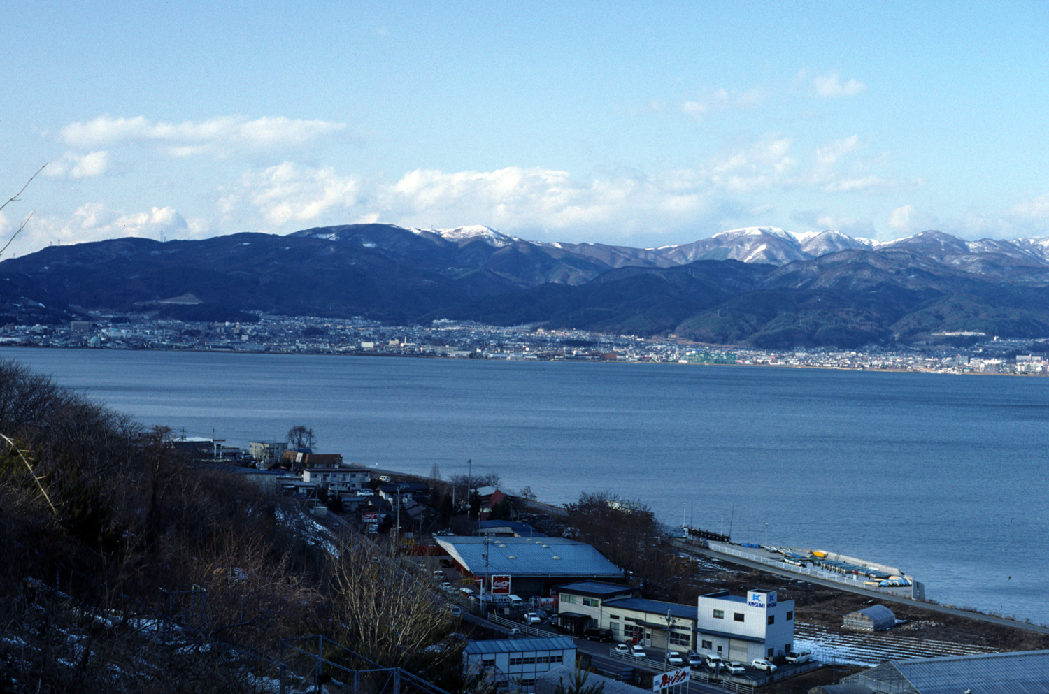
is a Towns of Japan, town located in Nagano Prefecture, Japan. , the town had an estimated population of 20,055 in 8864 households, and a population density of 300 persons per km². The total area of the town is . Geography Shimosuwa is located in central Nagano Prefecture, approximately 50 kilometers from the prefectural capital of Nagano city and 200 kilometers from Tokyo. The town is bordered on the south by Lake Suwa. The town has an altitude of 760 meters at the town center, and is 82% forested. Surrounding municipalities *Nagano Prefecture ** Matsumoto, Nagano, Matsumoto ** Suwa, Nagano, Suwa ** Okaya, Nagano, Okaya ** Nagawa, Nagano, Nagawa Climate The town has a humid continental climate characterized by warm and humid summers, and cold winters (Köppen climate classification ''Dfb''). The average annual temperature in Shimosuwa is 7.3 °C. The average annual rainfall is 1540 mm with September as the wettest month. The temperatures are highest on average in A ... [...More Info...] [...Related Items...] OR: [Wikipedia] [Google] [Baidu] |
Shimosuwa-shuku
was the twenty-ninth of the sixty-nine stations of the Nakasendō, as well as being the ending location of the Kōshū Kaidō. It is located in the present-day town of Shimosuwa, Suwa District, Nagano Prefecture, Japan. History First built around 1601, Shimosawa-shuku flourished as a post town because it was located between two difficult mountain passes, Wada Pass and Shiojiri Pass. The town's onsens made it a heavily used rest area.Shimosuwa-shuku Aruki-net . Shimosuwa Chamber of Commerce. Accessed July 16, 2007. It also served as the entrance to the . Records show that in 1843, Shimosuwa-juku had 1,345 residents and 315 buildings. Among the building, there was one '' |
Lake Suwa
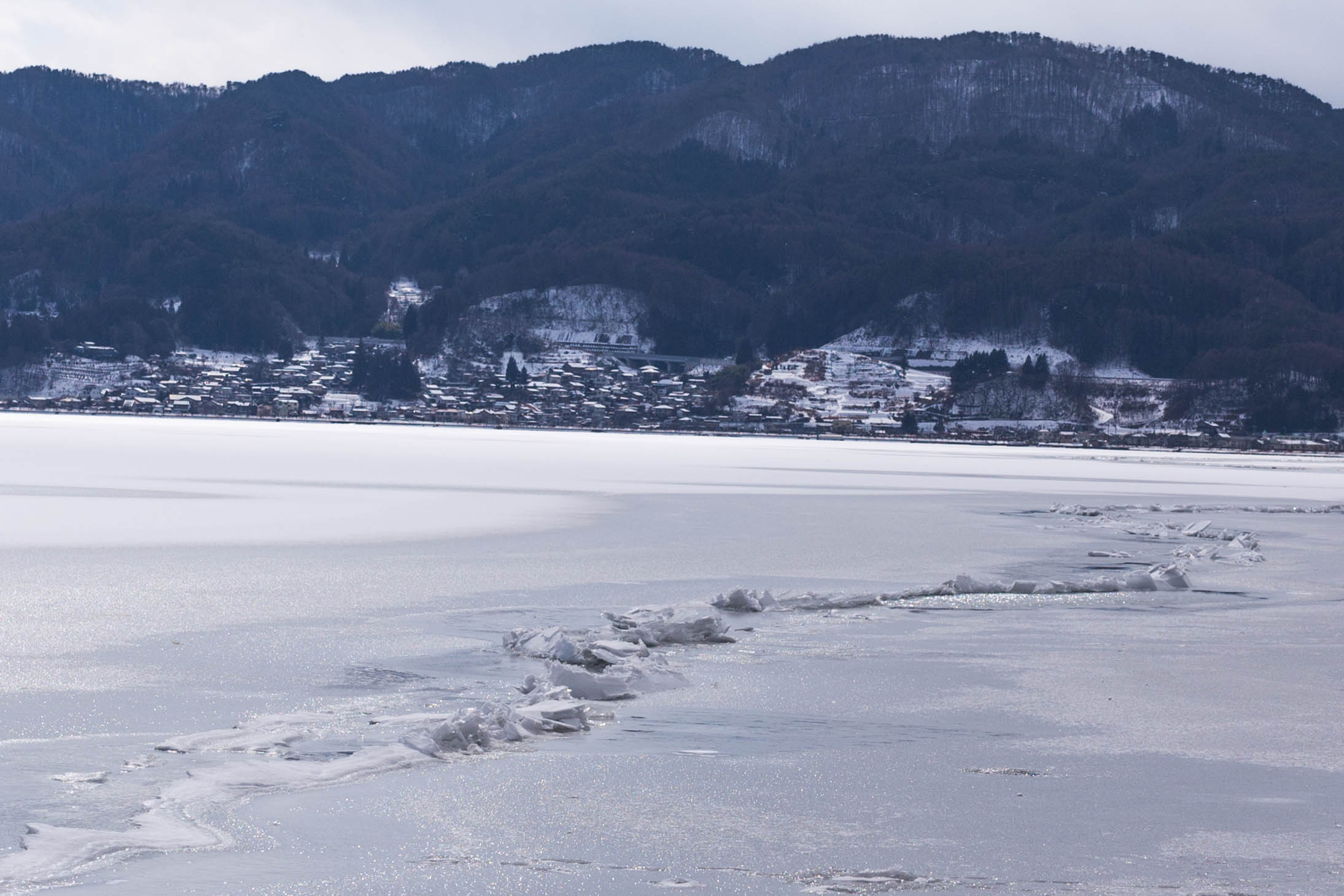
is a lake in the Kiso Mountains, in the central region of Nagano Prefecture, Japan. Geography The lake is the source of the Tenryū River. It ranks 24th in lake water surface area in Japan. The cities of Suwa and Okaya and the town of Shimosuwa are located on the shores of Lake Suwa. Omiwatari Lake Suwa is the site of a natural phenomenon known as the , large cracks that form in the winter across the surface of the frozen lake. A vertical temperature gradient results in ice pressure ridges forming in the surface ice, reaching heights of or more. Local Shinto tradition holds that the ridges are formed by the gods crossing the lake when traveling between the various buildings of the Suwa Grand Shrine. Folklore says it is the guardian god of Suwa, Takeminakata-no-kami, leaving his sanctuary to meet with his wife, the goddess , joining the opposite bank by walking on frozen water. The record of this crossing is the oldest-known human-observed climate record. This record has ... [...More Info...] [...Related Items...] OR: [Wikipedia] [Google] [Baidu] |
Okaya, Nagano
is a city located in Nagano Prefecture, Japan. , the city had an estimated population of 48,616 in 19,257 households, and a population density of 570 persons per km². The total area of the city is . Geography Okaya is located in central Nagano Prefecture at the western shores of Lake Suwa and the headwaters of the Tenryū River. Surrounding municipalities *Nagano Prefecture ** Matsumoto ** Shiojiri ** Suwa ** Shimosuwa ** Tatsuno Climate The city has a climate characterized by characterized by hot and humid summers, and relatively mild winters (Köppen climate classification ''Cfa''). The average annual temperature in Okaya is 10.6 °C. The average annual rainfall is 1281 mm with September as the wettest month. The temperatures are highest on average in August, at around 23.6 °C, and lowest in January, at around -1.9 °C. Demographics Per Japanese census data, the population of Okaya has declined over the past 50 years. History The area of presen ... [...More Info...] [...Related Items...] OR: [Wikipedia] [Google] [Baidu] |
Nagano Prefecture
is a landlocked prefecture of Japan located in the Chūbu region of Honshū. Nagano Prefecture has a population of 2,052,493 () and has a geographic area of . Nagano Prefecture borders Niigata Prefecture to the north, Gunma Prefecture to the northeast, Saitama Prefecture to the east, Yamanashi Prefecture to the southeast, Shizuoka Prefecture and Aichi Prefecture to the south, and Gifu Prefecture and Toyama Prefecture to the west. Nagano is the capital and largest city of Nagano Prefecture, with other major cities including Matsumoto, Ueda, and Iida. Nagano Prefecture has impressive highland areas of the Japanese Alps, including most of the Hida Mountains, Kiso Mountains, and Akaishi Mountains which extend into the neighbouring prefectures. The abundance of mountain ranges, natural scenic beauty, and rich history has gained Nagano Prefecture international recognition as a world-class winter sports tourist destination, including hosting the 1998 Winter Olympics and a new ... [...More Info...] [...Related Items...] OR: [Wikipedia] [Google] [Baidu] |
Nakasendō
The , also called the ,Richard Lane, ''Images from the Floating World'' (1978) Chartwell, Secaucus ; pg. 285 was one of the five routes of the Edo period, and one of the two that connected Edo (modern-day Tokyo) to Kyoto in Japan. There were 69 stations (staging-posts) between Edo and Kyoto, crossing through Musashi, Kōzuke, Shinano, Mino and Ōmi provinces.Nakasendou Jouhou . NEC Corporation. Retrieved August 18, 2007. In addition to Tokyo and Kyoto, the Nakasendō runs through the modern-day prefectures of Saitama, , |
Towns Of Japan
A town (町; ''chō'' or ''machi'') is a local administrative unit in Japan. It is a local public body along with prefecture (''ken'' or other equivalents), city (''shi''), and village (''mura''). Geographically, a town is contained within a district. Note that the same word (町; ''machi'' or ''chō'') is also used in names of smaller regions, usually a part of a ward in a city. This is a legacy of when smaller towns were formed on the outskirts of a city, only to eventually merge into it. Towns See also * Municipalities of Japan * Japanese addressing system The Japanese addressing system is used to identify a specific location in Japan. When written in Japanese characters, addresses start with the largest geographical entity and proceed to the most specific one. When written in Latin characters, ad ... References {{reflist External links "Large_City_System_of_Japan";_graphic_shows_towns_compared_with_other_Japanese_city_types_at_p._1_[PDF_7_of_40/nowiki>">DF_7_of_4 ... [...More Info...] [...Related Items...] OR: [Wikipedia] [Google] [Baidu] |
Suwa, Nagano
is a city located in Nagano Prefecture, Japan. , the city had an estimated population of 48,972 in 20698 households, and a population density of 452 persons per km². The total area of the city is . History The shores of Lake Suwa have been inhabited since at least the Japanese Paleolithic period. The Suwa clan ruled the area since the Nara period, and the area developed as a castle town for Suwa Domain under the Edo period Tokugawa shogunate and as a post station on the Kōshū Kaidō highway. In the post-Meiji restoration cadastral reforms of April 1, 1889, the village of Kamisuwa was established. Kawasuwa was elevated to town status on April 20, 1891. After merger with the villages of Shiga and Toyoda (from Suwa District), Kamisuwa was elevated to city status on August 10, 1941, changing its name to Suwa. Geography Suwa is located in central Nagano Prefecture, bordered on the north and west by Lake Suwa, approximately 100 kilometers south of the prefectural capital of N ... [...More Info...] [...Related Items...] OR: [Wikipedia] [Google] [Baidu] |
Nagawa, Nagano
is a town located in Nagano Prefecture, Japan. , the town had an estimated population of 6,088 in 2650 households, and a population density of 32.6 persons per km². The total area of the town is . Geography Nagawa is located in the center of Nagano Prefecture. Surrounding municipalities *Nagano Prefecture ** Matsumoto ** Ueda ** Suwa ** Chino ** Shimosuwa ** Tateshina Climate The town has a climate characterized by characterized by warm and humid summers, and cold, very snowy winters (Köppen climate classification ''Dfb''). The average annual temperature in Nagawa is 8.9 °C. The average annual rainfall is 1388 mm with September as the wettest month. The temperatures are highest on average in August, at around 21.9 °C, and lowest in January, at around -3.6 °C. Demographics Per Japanese census data, the population of Nagawa has declined my more than half over the past 70 years. History The area of present-day Nagawa was part of ancient Shinano Pr ... [...More Info...] [...Related Items...] OR: [Wikipedia] [Google] [Baidu] |
Suwa District, Nagano
is a district located in Nagano Prefecture, Japan. As of 2003, the district has an estimated population of 46,162 and a density of 181.18 persons per km2. The total area is 254.79 km2. Towns and villages * Hara * Fujimi *Shimosuwa is a town located in Nagano Prefecture, Japan. , the town had an estimated population of 20,055 in 8864 households, and a population density of 300 persons per km². The total area of the town is . Geography Shimosuwa is located in central Na ... Districts in Nagano Prefecture {{Nagano-geo-stub ... [...More Info...] [...Related Items...] OR: [Wikipedia] [Google] [Baidu] |
Matsumoto, Nagano
is a city located in Nagano Prefecture, Japan. Matsumoto is designated as a core city since 1 April 2021. , the city had a population of 239,466 in 105,207 households and a population density of 240 persons per km2. The total area of the city is . Geography Matsumoto is located in the Matsumoto Basin of central Nagano Prefecture surrounded by mountains and is acclaimed for its beautiful views. It is approximately 75 kilometers south of the prefectural capital at Nagano City, and 167 kilometers from central Tokyo. The 3000 meter Hida Mountains are to the west of the city, with 3190 meter Mount Hotakadake on the border of Matsumoto with Takayama, Gifu as the highest point within the city limits. Surrounding municipalities *Nagano Prefecture ** Okaya ** Shiojiri **Azumino ** Yamagata **Asahi ** Ōmachi ** Chikuhoku ** Ueda ** Nagawa **Aoki **Shimosuwa ** Kiso-mura ** Kiso-machi *Gifu Prefecture ** Takayama Climate Matsumoto has a humid continental climate (Köppen climate cla ... [...More Info...] [...Related Items...] OR: [Wikipedia] [Google] [Baidu] |
Suwa Domain
Takashima Castle, administrative centre of Suwa Domain was a feudal domain under the Tokugawa shogunate of Edo period Japan. It was located in Shinano Province, Honshū. The domain was centered at Takashima Castle, located in what is now part of the town of Suwa in Nagano Prefecture. It was also known as . History The Suwa clan had ruled the area around Lake Suwa in Shinano Province since ancient times. The clan was defeated by Takeda Shingen in 1542. The final Suwa ruler, Suwa Yorishige was forced to commit '' seppuku''; however, his nephew, Suwa Yoritada was spared as hereditary ''kannushi'' of Suwa Shrine. After the Takeda clan was destroyed by an alliance of Oda Nobunaga and Tokugawa Ieyasu, Suwa Yoritada went into the service of the Tokugawa. Following the Siege of Odawara (1590), he was elevated to the status of ''daimyō'' with Sōja Domain, a 10,000 ''koku'' holding in Kōzuke Province. This was subsequently raised to 27,000 ''koku''. In the meanwhile, Toyotomi Hidey ... [...More Info...] [...Related Items...] OR: [Wikipedia] [Google] [Baidu] |
Shinano Province
or is an old province of Japan that is now Nagano Prefecture. Shinano bordered on Echigo, Etchū, Hida, Kai, Kōzuke, Mikawa, Mino, Musashi, Suruga, and Tōtōmi Provinces. The ancient capital was located near modern-day Matsumoto, which became an important city of the province. The World War II–era Japanese aircraft carrier ''Shinano'' was named after this old province. Historical record In 713, the road that traverses Mino and Shinano provinces was widened to accommodate increasing numbers of travelers through the Kiso District of modern Nagano Prefecture. In the Sengoku period, Shinano Province was often split among fiefs and castle towns developed, including Komoro, Ina, and Ueda. Shinano was one of the major centers of Takeda Shingen's power during his wars with Uesugi Kenshin and others. Suwa taisha was designated as the chief Shinto shrine (''ichinomiya'') for the province. [...More Info...] [...Related Items...] OR: [Wikipedia] [Google] [Baidu] |


