|
Shanshan
Shanshan (; ug, پىچان, Pichan, Piqan) was a kingdom located at the north-eastern end of the Taklamakan Desert near the great, but now mostly dry, salt lake known as Lop Nur. The kingdom was originally an independent city-state, known in the almost undocumented language of its inhabitants as '' Kröran'' or ''Kroraina'' – which is commonly rendered in Chinese as ''Loulan''. The Western Han dynasty took direct control of the kingdom some time after 77 BCE, and it was later known in Chinese as Shanshan. The archaeologist J. P. Mallory has suggested that the name Shanshan may be derived from the name of another city in the area, ''Cherchen'' (later known in Chinese as ''Qiemo''). Location The kingdom of Kröran (Loulan), later Shanshan, was probably founded at a strategically located walled town, near the north-west corner of Lop Nur, next to the then outflow of the Tarim River into Lop Nur (40° 9’ N, 89° 5’ E). The site of Kröran covered about with a Buddhist pago ... [...More Info...] [...Related Items...] OR: [Wikipedia] [Google] [Baidu] |
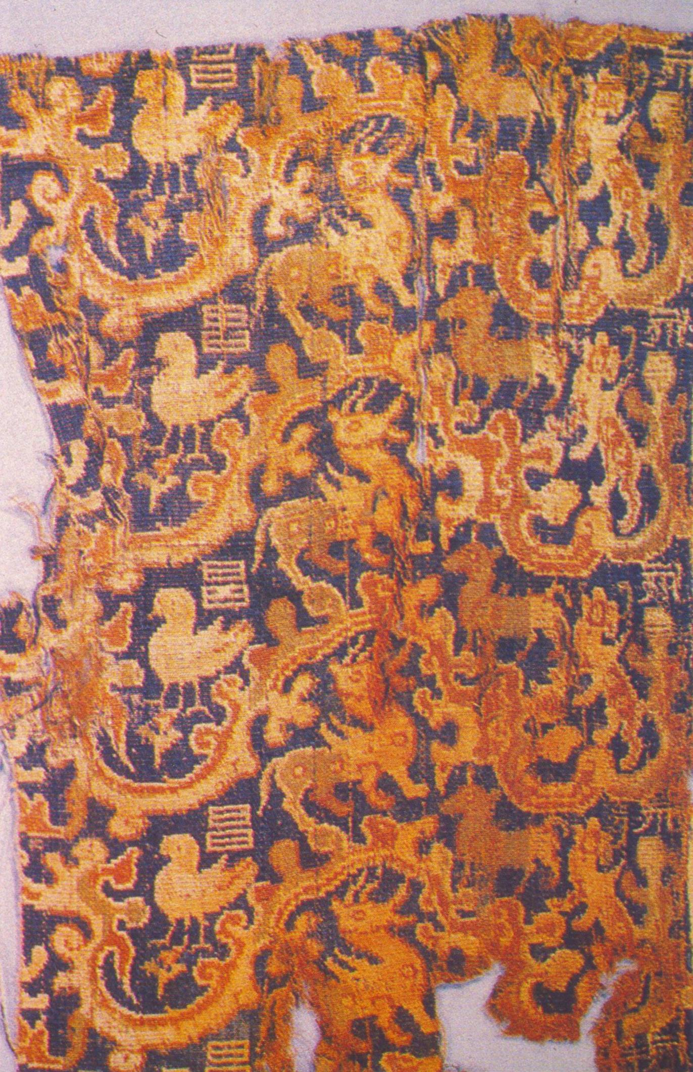
Loulan Silk Fragment
Loulan, also called Krorän or Kroraina ( zh, s=, t=, p=Lóulán < ''lo-lɑn'' < ''rô-rân''; ug, كروران, Kroran, USY: Кроран), was an ancient kingdom based around an important oasis city along the Silk Road already known in the 2nd century BCE on the northeastern edge of the . The term Loulan is the ... [...More Info...] [...Related Items...] OR: [Wikipedia] [Google] [Baidu] |
Loulan Kingdom
Loulan, also called Krorän or Kroraina ( zh, s=, t=, p=Lóulán < ''lo-lɑn'' < ''rô-rân''; ug, كروران, Kroran, USY: Кроран), was an ancient kingdom based around an important city along the already known in the 2nd century BCE on the northeastern edge of the |
Kashgar
Kashgar ( ug, قەشقەر, Qeshqer) or Kashi ( zh, c=喀什) is an oasis city in the Tarim Basin region of Southern Xinjiang. It is one of the westernmost cities of China, near the border with Afghanistan, Kyrgyzstan, Tajikistan and Pakistan. With a population of over 500,000, Kashgar has served as a trading post and strategically important city on the Silk Road between China, the Middle East and Europe for over 2,000 years, making it one of the oldest continuously inhabited cities in the World. At the convergence point of widely varying cultures and empires, Kashgar has been under the rule of the Chinese, Turkic, Mongol and Tibetan empires. The city has also been the site of a number of battles between various groups of people on the steppes. Now administered as a county-level unit, Kashgar is the administrative center of Kashgar Prefecture, which has an area of and a population of approximately 4 million as of 2010. The city itself has a population of 506,640, and its ... [...More Info...] [...Related Items...] OR: [Wikipedia] [Google] [Baidu] |
Qiemo
Qiemo County () as the official romanized name, also transliterated from Uyghur as Qarqan County ( Uyghur: ; ), is a county under the administration of the Bayin'gholin Mongol Autonomous Prefecture in the Xinjiang Uyghur Autonomous Region of the People's Republic of China, bordering the Tibet Autonomous Region to the south. Its area is and, according to the 2002 census, it has a population of 60,000. The county seat is at Qiemo Town. Name "Qiemo (W-G: Ch'ieh-mo) 且末 = modern Cherchen or Charchan (Uyghur: ''Qarqan''). There has been uncertainty about this name as Chavannes (1907), p. 156, and then Stein (1921a), Vol. I, 296 ff., gave an incorrect romanization for the first character. Chavannes, using the French EFEO romanization system, gave ''tsiu'', and Stein used the Wade-Giles equivalent, ''chü''. In fact, the character is correctly rendered ''k’ie'' in EFEO, ch’ieh in Wade-Giles and qie in pinyin. Nevertheless, there has never been any serious dispute about its ... [...More Info...] [...Related Items...] OR: [Wikipedia] [Google] [Baidu] |
Cherchen
Qiemo County () as the official romanized name, also transliterated from Uyghur as Qarqan County ( Uyghur: ; ), is a county under the administration of the Bayin'gholin Mongol Autonomous Prefecture in the Xinjiang Uyghur Autonomous Region of the People's Republic of China, bordering the Tibet Autonomous Region to the south. Its area is and, according to the 2002 census, it has a population of 60,000. The county seat is at Qiemo Town. Name "Qiemo (W-G: Ch'ieh-mo) 且末 = modern Cherchen or Charchan (Uyghur: ''Qarqan''). There has been uncertainty about this name as Chavannes (1907), p. 156, and then Stein (1921a), Vol. I, 296 ff., gave an incorrect romanization for the first character. Chavannes, using the French EFEO romanization system, gave ''tsiu'', and Stein used the Wade-Giles equivalent, ''chü''. In fact, the character is correctly rendered ''k’ie'' in EFEO, ch’ieh in Wade-Giles and qie in pinyin. Nevertheless, there has never been any serious dispute about its ... [...More Info...] [...Related Items...] OR: [Wikipedia] [Google] [Baidu] |
Charklik (ancient Settlement)
Charklik or Charkhlik () is an archeology site named after the town of Charkhlik (Qakilik), in Ruoqiang (Qakilik) County, Xinjiang Uyghur Autonomous Region of the People's Republic of China. Together with the nearby Miran site, they correspond to two ancient capitals of Shanshan, Wuni () and Yixun (). However, it is as yet unclear which site correspond to which capital. History Charklik was the name for an ancient settlement that was located in modern Ruoqiang County in Xinjiang. It was part of the kingdom of Loulan (later renamed Shanshan) from at least the 1st century BCE. During the latter part of the Former Han and throughout the Later Han the capital of the kingdom of Shanshan was known as Yüni (), which is thought to be located near the present town of Ruoqiang at Charklik. The explorer and archaeologist Aurel Stein visited the small oasis of Charklik in 1906, where he found a little village that was the official headquarters of a very large district, almost all de ... [...More Info...] [...Related Items...] OR: [Wikipedia] [Google] [Baidu] |
Ruoqiang Town
Ruoqiang Town (; Uyghur: Чакилик: Qakilik or Charkliq) is a town in Ruoqiang County, Bayin'gholin Mongol Autonomous Prefecture in southeastern Xinjiang, People's Republic of China. Ruoqiang Town is the county seat of the Ruoqiang County, and therefore is the place that less detailed maps label as "Ruoqiang County" or just "Ruoqiang". The postal code is 841 800. There is a two-laned asphalt highway to Korla, north, and west to Hotan. There is no motorable road east to Dunhuang in Gansu, but one can now drive southeast through the Altun Shan range and then north through part of the Tsaidam to Dunhuang. Names Lionel Giles has recorded the following names for Ruoqiang Town (with his Wade-Giles forms of the Chinese names converted to pinyin): :"''Yixun'', or Yixiu, capital of Shanshan after 77 B.C. (Note: This is an incorrect identification, the capital's name was, in fact, Yüni 扜泥.) :Shanshan Zhen ui :Nafubo (纳缚波) uanzang :Dianhe ang :Shicheng Zhen ang afte ... [...More Info...] [...Related Items...] OR: [Wikipedia] [Google] [Baidu] |
Lop Nur
Lop Nur or Lop Nor (from a Mongolian name meaning "Lop Lake", where "Lop" is a toponym of unknown origin) is a former salt lake, now largely dried up, located in the eastern fringe of the Tarim Basin, between the Taklamakan and Kumtag deserts in the southeastern portion of the Xinjiang (Xinjiang Uygur Autonomous Region). Administratively, the lake is in Lop Nur town (), also known as Luozhong () of Ruoqiang County, which in its turn is part of the Bayingolin Mongol Autonomous Prefecture. The lake system into which the Tarim River and Shule River empty is the last remnant of the historical post-glacial Tarim Lake, which once covered more than in the Tarim Basin. Lop Nur is hydrologically endorheic – it is landbound and there is no outlet. The lake measured in 1928, but has dried up due to construction of dams which blocked the flow of water feeding into the lake system, and only small seasonal lakes and marshes may form. The dried-up Lop Nur Basin is covered with a salt cru ... [...More Info...] [...Related Items...] OR: [Wikipedia] [Google] [Baidu] |
Fu Jiezi
Fu Jiezi (), born in Qingyang, Gansu, was responsible for the assassination of the Loulan king Angui in 77 BC. Career Although fond of study, at fourteen years of age he threw his writing-tablets aside, saying with a sigh, “Tis in foreign lands that a hero must seek renown; how can I let my life pass away as an old bookworm?” The rulers of the Loulan countries had killed some Chinese envoys; and in 77 BC, with a view to punishing them, supreme general Huo Guang laid before the Emperor Zhao of Han a plan for sending Fu, then inspector of the stables at P'ing-lo Palace, to go out and stab the king to death. Fu volunteered to proceed as envoy to Ferghana or Khokand. He carried with him gold and silk, and claimed it was a gift for the King of Loulan. The king was delighted; and he became intoxicated while drinking with Fu, who now took the king aside for a private word. Two of his guards followed and stabbed the king to death, and all his noblemen and attendants fled in confusion ... [...More Info...] [...Related Items...] OR: [Wikipedia] [Google] [Baidu] |
Mahāyāna Buddhism
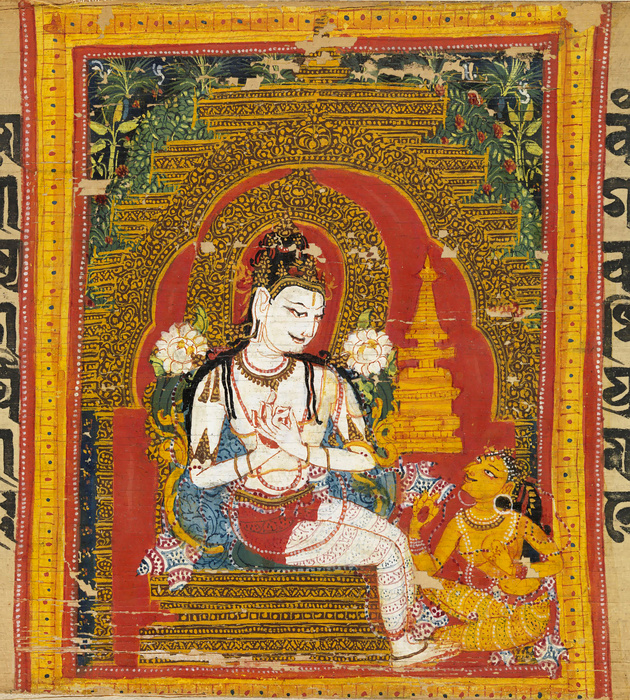
''Mahāyāna'' (; "Great Vehicle") is a term for a broad group of Buddhist traditions, texts, philosophies, and practices. Mahāyāna Buddhism developed in India (c. 1st century BCE onwards) and is considered one of the three main existing branches of Buddhism (the other being ''Theravāda'' and Vajrayana).Harvey (2013), p. 189. Mahāyāna accepts the main scriptures and teachings of early Buddhism but also recognizes various doctrines and texts that are not accepted by Theravada Buddhism as original. These include the Mahāyāna Sūtras and their emphasis on the ''bodhisattva'' path and ''Prajñāpāramitā''. ''Vajrayāna'' or Mantra traditions are a subset of Mahāyāna, which make use of numerous tantric methods considered to be faster and more powerful at achieving Buddhahood by Vajrayānists. "Mahāyāna" also refers to the path of the bodhisattva striving to become a fully awakened Buddha ('' samyaksaṃbuddha'') for the benefit of all sentient beings, and is thus als ... [...More Info...] [...Related Items...] OR: [Wikipedia] [Google] [Baidu] |
Korla
Korla,The official spelling according to also known as Kurla, United States National Geospatial-Intelligence Agency or from Mandarin Chinese as Ku'erle or Kuerle, is the second largest city in Xinjiang. It is a county-level city and the seat of the Bayingolin Mongol Autonomous Prefecture, the largest prefecture of China. Korla has existed since at least the Han Dynasty. Korla is known for its production of fragrant pears and is a production center for the Tarim oil fields. History Han Dynasty Korla was known as Yuli () (reconstructed pronunciation of first character: *i̯wəd) during the Han Dynasty. Yuli is said in the Hanshu or 'History of the Former Han' (covering the period 125 BCE to 23 CE), to have had 1,200 households, 9,600 individuals and 2,000 people able to bear arms. It also mentions that it adjoined Shanshan and Qiemo (Charchan) to the south. In 61 CE, the Xiongnu led some 30,000 troops from 15 kingdoms including Korla, Karashahr, and Kucha in a successful attac ... [...More Info...] [...Related Items...] OR: [Wikipedia] [Google] [Baidu] |


_of_Kashgar%2C_73_CE.jpg)


