|
Sfakia
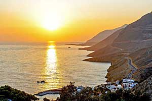
Sfakiá ( el, Σφακιά) is a mountainous area in the southwestern part of the island of Crete, in the Chania regional unit. It is considered to be one of the few places in Greece that have never been fully occupied by foreign powers. With a 2011 census population of 1,889 inhabitants living on a land area of , Sfakia is one of the largest and least densely populated municipalities on the island of Crete. The etymology of its name is disputed. According to the prevailing theory, it relates to its rugged terrain, deriving from the ancient Greek word ''σφαξ'', meaning land chasm or gorge. Description The road from Chania to Sfakiá crosses the island from north to south, through the village of Vryses. From this village the route crosses the White Mountains ( Lefká Óri) to Hóra Sfakíon () by the Libyan Sea. Halfway from Vrisses to Hóra Sfakíon is the fertile plateau of Askifou, surrounded by high mountain peaks. From here to Hóra Sfakíon the road is particularly s ... [...More Info...] [...Related Items...] OR: [Wikipedia] [Google] [Baidu] |
Chania (regional Unit)
Chania ( el, Περιφερειακή ενότητα Χανίων) is one of the four regional units of Greece, regional units of Crete; it covers the westernmost quarter of the island. Its capital is the city of Chania. Chania borders only one other regional unit: that of Rethymno (regional unit), Rethymno to the east. The western part of Crete is bounded to the north by the Sea of Crete, Cretan Sea, and to the west and south by the Mediterranean Sea. The regional unit also includes the southernmost island of Europe, Gavdos. Geography Chania regional unit, often informally termed 'Western Crete', is a part of the island which includes the districts of Apokoronas, Sfakia, and Selino in the far South West corner. Other towns in the Chania prefecture include Sfakia#Hora Sfakion, Hora Sfakion, Kastelli-Kissamos, Kissamos, Palaiochora, Maleme, Vryses, Vamos, Georgioupolis and Kalives. The natural park of Samariá Gorge, a tourist attraction and a refuge for the rare Cretan wild goat ... [...More Info...] [...Related Items...] OR: [Wikipedia] [Google] [Baidu] |
Crete
Crete ( el, Κρήτη, translit=, Modern: , Ancient: ) is the largest and most populous of the Greek islands, the 88th largest island in the world and the fifth largest island in the Mediterranean Sea, after Sicily, Sardinia, Cyprus, and Corsica. Crete rests about south of the Greek mainland, and about southwest of Anatolia. Crete has an area of and a coastline of 1,046 km (650 mi). It bounds the southern border of the Aegean Sea, with the Sea of Crete (or North Cretan Sea) to the north and the Libyan Sea (or South Cretan Sea) to the south. Crete and a number of islands and islets that surround it constitute the Region of Crete ( el, Περιφέρεια Κρήτης, links=no), which is the southernmost of the 13 top-level administrative units of Greece, and the fifth most populous of Greece's regions. Its capital and largest city is Heraklion, on the north shore of the island. , the region had a population of 636,504. The Dodecanese are located to the no ... [...More Info...] [...Related Items...] OR: [Wikipedia] [Google] [Baidu] |
Daskalogiannis
Ioannis Vlachos (), better known as Daskalogiannis (; 1722/30 – 17 June 1771) was a wealthy shipbuilder and shipowner who led a Cretan revolt against Ottoman rule in the 18th century.Detorakis, Turkish rule in Crete, p. 357 Life and career Ioannis Vlachos was born in Anopolis village in Sfakia, a semi-autonomous region of Crete, in 1722 or 1730. His father, who was also a wealthy shipowner, sent him to be educated abroad. Due to his education, his compatriots called him "''Daskalos''" (teacher), hence his nickname ''Daskalogiannis'', literally "John the Teacher." He is referred to as a town clerk in 1750, as chairman of the region of Sfakia in 1765, and as the owner of four, three-mast merchant ships.Detorakis, Turkish rule in Crete, p. 358 These would have sailed from Prosyalo and the gulf of Loutro. Daskalogiannis knew Emmanouil Benakis at Mani and it is likely that Benakis introduced him to Count Orlov who Catherine the Great had sent to the Peloponnese in 1769 to instig ... [...More Info...] [...Related Items...] OR: [Wikipedia] [Google] [Baidu] |
Battle Of Crete
The Battle of Crete (german: Luftlandeschlacht um Kreta, el, Μάχη της Κρήτης), codenamed Operation Mercury (german: Unternehmen Merkur), was a major Axis airborne and amphibious operation during World War II to capture the island of Crete. It began on the morning of 20 May 1941, with a multiple German airborne landings on Crete. Greek and other Allied forces, along with Cretan civilians, defended the island. After only one day of fighting, the Germans had suffered heavy casualties and the Allied troops were confident that they would defeat the invasion. The next day, through communication failures, Allied tactical hesitation, and German offensive operations, Maleme Airfield in western Crete fell, enabling the Germans to land reinforcements and overwhelm the defensive positions on the north of the island. Allied forces withdrew to the south coast. More than half were evacuated by the British Royal Navy and the remainder surrendered or joined the Cretan resistance. T ... [...More Info...] [...Related Items...] OR: [Wikipedia] [Google] [Baidu] |
Kallikratis
Kallikratis ( el, Καλλικράτης) is a small village belonging to the municipality of Sfakia, in southwest Crete, Greece. According to tradition, it was named after the admiral (droungarios) Manoussos Kallikratis, who in March 1453 led a campaign to reinforce the defense of Constantinople with 5 ships and 1500 Cretan volunteers. As reported by George Sphrantzes, Sphrantzes in his ''Chronicle'', these volunteers manned three towers on the walls of Constantinople and continued to fight bravely even after the city had Fall of Constantinople, fallen. In recognition of their gallantry, sultan Mehmed II, Mehmed allowed them to safely sail back to Crete, retaining their weapons. Geography Kallikratis is situated off the beaten tourist path and is made up of four widely separated neighborhoods that are scattered on a small plateau in Lefka Ori with an average altitude of 540m. It can be reached via Myriokefala, Asi Gonia or Asfendos, or via a recently paved road with more than ... [...More Info...] [...Related Items...] OR: [Wikipedia] [Google] [Baidu] |
Hora Sfakion
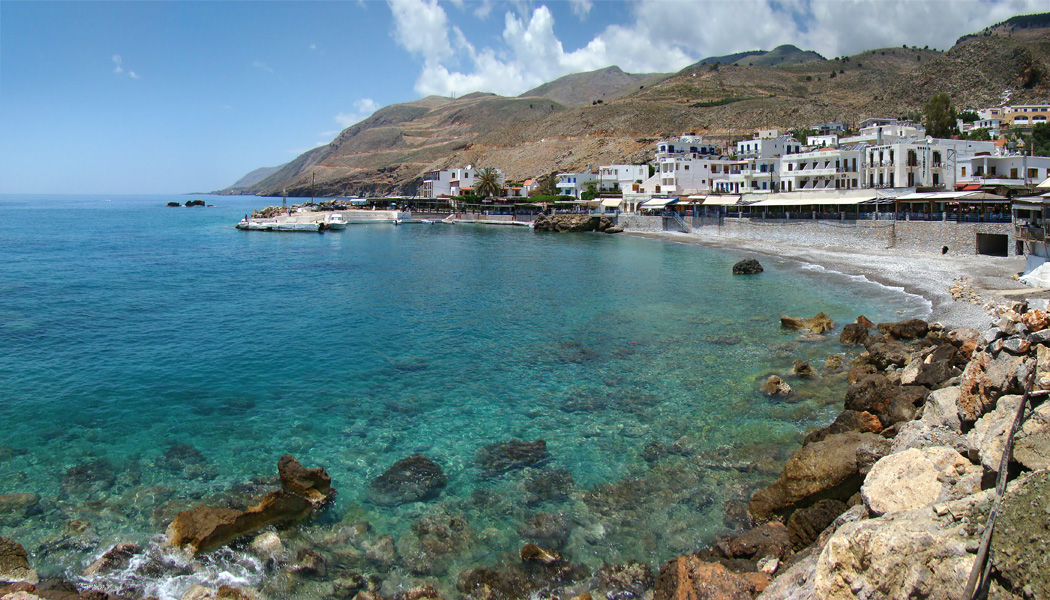
Image:Chora Sfakion 1941 evacuation monument.jpg, 200px, Monument commemorating the evacuation during WW2 of British and ANZAC forces from Hora Sfakion in May 1941. ''Click on the left plaque for a closer view'' rect 198 536 320 1082 rect 0 0 900 1200 desc bottom-left Hóra Sfakíon ( el, Χώρα Σφακίων) or Sfakia (Σφακιά ) is a town on the south coast of Crete, Greece. It is the capital of the remote and mountainous region of Sfakiá, and is a small town of just 265 inhabitants (2011 census). It lies on the south coast near the end of the Imbros Gorge, 74 km south of Chania. It has two small harbours, where the ferry boats from Agia Roumeli dock, which in the summer bring the hikers from the Samaria Gorge to take buses back to the northern coast. From Hóra Sfakíon ferries also go to the nearby coastal town of Loutro and the island Gavdos. Hóra Sfakíon is a small village with a main harbourfront of tavernas, two minimarkets, a butcher, and a bakery. Th ... [...More Info...] [...Related Items...] OR: [Wikipedia] [Google] [Baidu] |
Loutro (Chania), Greece
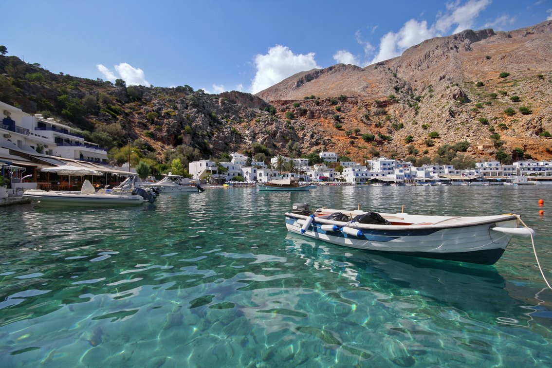
Loutro ( el, Λουτρό) (Greek: "Bath") lies on the south coast of Chania regional unit in west Crete, between Chora Sfakion and Agia Roumeli, the exit to the Samaria Gorge. The whole area is known as Sfakia. The village got its name from the Greek word for "bath," for the many ancient baths found in the area. History Loutro is the site of the ancient city of Phoenix (Finikas), which was the port town of ancient Anopolis, and an important harbour in Hellenistic and Roman times. It later became the wintertime port of the town of Sfakia because of its natural protection during harsh weather. Today nothing remains of ancient Phoenix except the name preserved by the small village in the bay west of Loutro. Later the Saracen pirates used Loutro as a lair from which to attack the ships sailing south of Crete. The Venetians managed to drive out the Saracens and fortified Loutro with a small fortress whose ruins are still visible today. Another fortress preserved in better condition ... [...More Info...] [...Related Items...] OR: [Wikipedia] [Google] [Baidu] |
Frangokastello
Frangokastello ( el, Φραγκοκάστελλο) is the location of a castle and scattered settlement on the south coast of Crete, Greece, about east of Chora Sfakion and within the prefecture of Chania. Frangokastello has an extensive, sheltered and gently shelving sandy beach, which has provided the basis for a low key tourist industry in recent years. Tourist accommodation is scattered over the flat plain around the castle, but the area's relative remoteness has discouraged major development. History The castle was built by the Venetians in 1371–1374 as a garrison to impose order on the rebellious Sfakia region, to deter pirates, and to protect Venetian nobles and their properties. The Venetians named it the Castle of St. Nikitas after the nearby church. The locals, however, who never saw it in a positive light, contemptuously dubbed it Frangokastello, meaning the Castle of the Franks (i.e. Catholic foreigners), Castelfranco or Franco Castello. The name eventually ... [...More Info...] [...Related Items...] OR: [Wikipedia] [Google] [Baidu] |
Chania
Chania ( el, Χανιά ; vec, La Canea), also spelled Hania, is a city in Greece and the capital of the Chania regional unit. It lies along the north west coast of the island Crete, about west of Rethymno and west of Heraklion. The municipality has 108,642 inhabitants (2011). This consists of the city of Chania and several nearby areas, including Kounoupidiana (pop. 8,620), Mournies (pop. 7,614), Souda (pop. 6,418), Nerokouros (pop. 5,531), Daratsos (pop. 4,732), Perivolia (pop. 3,986), Galatas (pop. 3,166) and Aroni (pop. 3,003). History Early history Chania is the site of the Minoan settlement the Greeks called Kydonia, the source of the word quince. It appears on Linear B as ''ku-do-ni-ja''. Some notable archaeological evidence for the existence of this Minoan city below some parts of today's Chania was found by excavations in the district of Kasteli in the Old Town. This area appears to have been inhabited since the Neolithic era. The city reemerged after the end ... [...More Info...] [...Related Items...] OR: [Wikipedia] [Google] [Baidu] |
Mizithra
Mizithra or myzithra ( ) is a Greek whey cheese or mixed milk- whey cheese from sheep or goats, or both. Barron, Rosemary (1991). ''Flavors of Greece.'' William Morrow, It is sold both as a fresh cheese, similar to Italian ''ricotta'', and as a salt-dried grating cheese, similar to Italian ''ricotta salata''. The ratio of milk to whey usually is 7 to 3. It is primarily produced on the island of Crete but is widespread throughout Greece. It is essentially the same as Anthotyros though the latter may contain some cow's milk. In Cyprus a similar cheese is known as "Anari" (Αναρή in Greek, ''Nor'' in Cypriot Turkish, ''Lor'' in Turkish). Production Mizithra is made from raw, whole ewe's or goat's milk in the simplest way possible: milk is brought to a slow boil for a few minutes and then curdled by adding rennet or whey from a previous batch (see below) or else some acidic substance such as lemon juice, vinegar or even a fresh broken fig tree sprig. As soon as curds have form ... [...More Info...] [...Related Items...] OR: [Wikipedia] [Google] [Baidu] |
Drosoulites
The term Drosoulites ( el, Δροσουλίτες) refers to a long procession of visions, seen by residents around Frangokastello castle in Sfakia region of Crete (Greece). The phenomenon is rumored to be visible every year, on the anniversary of the Battle of Frangokastello or even in early June near a small village in southern Crete. The visions, as described by witnesses, consist of a group of human-like shadows dressed in black, walking or riding, armed with weapons, moving from the monastery of Agios Charalambos and advancing towards the old fort, Frangokastello, a 14th-century Venetian fortification. Legend has it that this group of people are Greek fighters that died during the Battle of Frangokastello (17 May 1828) and since then they appear as supernatural beings in the area. The ghost army is led by Hatzimichalis Dalianis, from Delvinaki in Epirus, the chief of the Greek men, 350 of whom were lost, in the battle.Detorakis, Turkish rule in Crete, p. 383 The army took r ... [...More Info...] [...Related Items...] OR: [Wikipedia] [Google] [Baidu] |
Greece
Greece,, or , romanized: ', officially the Hellenic Republic, is a country in Southeast Europe. It is situated on the southern tip of the Balkans, and is located at the crossroads of Europe, Asia, and Africa. Greece shares land borders with Albania to the northwest, North Macedonia and Bulgaria to the north, and Turkey to the northeast. The Aegean Sea lies to the east of the Geography of Greece, mainland, the Ionian Sea to the west, and the Sea of Crete and the Mediterranean Sea to the south. Greece has the longest coastline on the Mediterranean Basin, featuring List of islands of Greece, thousands of islands. The country consists of nine Geographic regions of Greece, traditional geographic regions, and has a population of approximately 10.4 million. Athens is the nation's capital and List of cities and towns in Greece, largest city, followed by Thessaloniki and Patras. Greece is considered the cradle of Western culture, Western civilization, being the birthplace of Athenian ... [...More Info...] [...Related Items...] OR: [Wikipedia] [Google] [Baidu] |


