|
Sevoke Railway Bridge
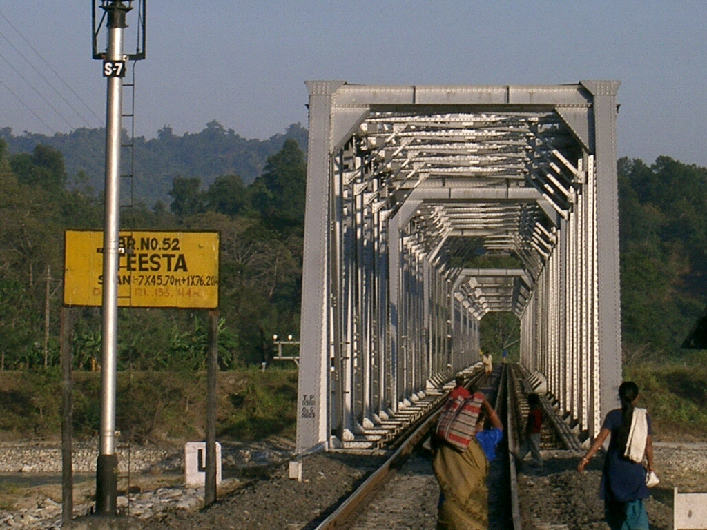
Sevoke Railway Bridge is the railway bridge on River Teesta near Mahananda Wildlife Sanctuary at Sevoke, West Bengal, India. The railway bridge is about 1 kilometre long and connects Darjeeling district with Jalpaiguri district of West Bengal. The bridge lies on New Jalpaiguri–Alipurduar–Samuktala Road line of Northeast Frontier Railway, Alipurduar Division. It is very important railway bridge that connects Siliguri - Sevoke to the beautiful Doars region of North Bengal. Sevoke Railway Bridge runs parallel to Coronation Road Bridge over Teesta. This bridge is located just ahead of Sivok railway station towards New Malbazar Station. In June 2016 there were some cracks in the pillar of this bridge due to heavy rainfall in Sikkim Sikkim (; ) is a state in Northeastern India. It borders the Tibet Autonomous Region of China in the north and northeast, Bhutan in the east, Province No. 1 of Nepal in the west and West Bengal in the south. Sikkim is also close to the Sili ... [...More Info...] [...Related Items...] OR: [Wikipedia] [Google] [Baidu] |
Teesta
Teesta River is a long river that rises in the Pauhunri Mountain of eastern Himalayas, flows through the Indian states of Sikkim and West Bengal through Rangpur, and enters the Bay of Bengal. It drains an area of . In India, it flows through Mangan District, Gangtok District, Pakyong District, Kalimpong district, Darjeeling District, Jalpaiguri District, Cooch Behar districts and the cities of Rangpo, Jalpaiguri and Mekhliganj, Rangpur. It joins the Brahmaputra River at Phulchhari Upazila in Bangladesh. of the river lies in India and in Bangladesh. Teesta is the largest river of Sikkim and second largest river of West Bengal after the Ganges. Course The Teesta River originates from Teesta Khangtse Glacier, west of Pahunri (or Teesta Kangse) glacier above , and flows southward through gorges and rapids in the Sikkim Himalaya. It is fed by streams from Tso Lhamo Lake, Gurudongmar Lake and rivulets arising in the Thangu Valley, Yumthang Valley of Flowers, Dikchu and ... [...More Info...] [...Related Items...] OR: [Wikipedia] [Google] [Baidu] |
North Bengal
North Bengal ( bn, উত্তরবঙ্গ/উত্তর বাংলা) is a term used for the north-western part of Bangladesh and northern part of West Bengal. The Bangladesh part denotes the Rajshahi Division and Rangpur Division. Generally, it is the area lying west of Jamuna River and north of Padma River and includes the Barind Tract. The West Bengal part denotes Jalpaiguri Division (Alipurduar, Cooch Behar, Darjeeling, Jalpaiguri, and Kalimpong) and the Malda division (Uttar Dinajpur, Dakshin Dinajpur, and Malda) together. The Bihar parts include the Kishanganj district. It also includes parts of Darjeeling Hills. Traditionally, the Ganga River divides Bengal into South Bengal and North Bengal, divided again into Terai and Dooars regions. Jalpesh and jatileswar are some of the most popular sacred places. Regions of Bangladesh In Bangladesh Religion The population of the region is 30,201,873 as per the 2011 census. In sports The North Zone cricket team in ... [...More Info...] [...Related Items...] OR: [Wikipedia] [Google] [Baidu] |
Railway Bridges In West Bengal
Rail transport (also known as train transport) is a means of transport that transfers passengers and goods on wheeled vehicles running on rails, which are incorporated in tracks. In contrast to road transport, where the vehicles run on a prepared flat surface, rail vehicles (rolling stock) are directionally guided by the tracks on which they run. Tracks usually consist of steel rails, installed on sleepers (ties) set in ballast, on which the rolling stock, usually fitted with metal wheels, moves. Other variations are also possible, such as "slab track", in which the rails are fastened to a concrete foundation resting on a prepared subsurface. Rolling stock in a rail transport system generally encounters lower frictional resistance than rubber-tyred road vehicles, so passenger and freight cars (carriages and wagons) can be coupled into longer trains. The operation is carried out by a railway company, providing transport between train stations or freight customer facili ... [...More Info...] [...Related Items...] OR: [Wikipedia] [Google] [Baidu] |
Railway Bridges In India
Rail transport (also known as train transport) is a means of transport that transfers passengers and goods on wheeled vehicles running on rails, which are incorporated in tracks. In contrast to road transport, where the vehicles run on a prepared flat surface, rail vehicles (rolling stock) are directionally guided by the tracks on which they run. Tracks usually consist of steel rails, installed on sleepers (ties) set in ballast, on which the rolling stock, usually fitted with metal wheels, moves. Other variations are also possible, such as "slab track", in which the rails are fastened to a concrete foundation resting on a prepared subsurface. Rolling stock in a rail transport system generally encounters lower frictional resistance than rubber-tyred road vehicles, so passenger and freight cars (carriages and wagons) can be coupled into longer trains. The operation is carried out by a railway company, providing transport between train stations or freight customer faciliti ... [...More Info...] [...Related Items...] OR: [Wikipedia] [Google] [Baidu] |
Sikkim
Sikkim (; ) is a state in Northeastern India. It borders the Tibet Autonomous Region of China in the north and northeast, Bhutan in the east, Province No. 1 of Nepal in the west and West Bengal in the south. Sikkim is also close to the Siliguri Corridor, which borders Bangladesh. Sikkim is the least populous and second smallest among the Indian states. Situated in the Eastern Himalaya, Sikkim is notable for its biodiversity, including alpine and subtropical climates, as well as being a host to Kangchenjunga, the highest peak in India and third highest on Earth. Sikkim's capital and largest city is Gangtok. Almost 35% of the state is covered by Khangchendzonga National Park – a UNESCO World Heritage Site. The Kingdom of Sikkim was founded by the Namgyal dynasty in the 17th century. It was ruled by Buddhist priest-kings known as the Chogyal. It became a princely state of British India in 1890. Following Indian independence, Sikkim continued its protectorate status with ... [...More Info...] [...Related Items...] OR: [Wikipedia] [Google] [Baidu] |
Beauty Of Sevoke 01
Beauty is commonly described as a feature of objects that makes these objects pleasurable to perceive. Such objects include landscapes, sunsets, humans and works of art. Beauty, together with art and taste, is the main subject of aesthetics, one of the major branches of philosophy. As a positive aesthetic value, it is contrasted with ugliness as its negative counterpart. Along with truth and goodness it is one of the transcendentals, which are often considered the three fundamental concepts of human understanding. One difficulty in understanding beauty is because it has both objective and subjective aspects: it is seen as a property of things but also as depending on the emotional response of observers. Because of its subjective side, beauty is said to be "in the eye of the beholder". It has been argued that the ability on the side of the subject needed to perceive and judge beauty, sometimes referred to as the "sense of taste", can be trained and that the verdicts of experts ... [...More Info...] [...Related Items...] OR: [Wikipedia] [Google] [Baidu] |
Kalimpong Teesta
Kalimpong (Hindi: कलिम्पोंग) is a town and the headquarters of an eponymous district in the Indian state of West Bengal. It is located at an average elevation of . The town is the headquarters of the Kalimpong district. The region comes under Gorkhaland Territorial Administration which is an autonomous governing body within the state of West Bengal. The Indian Army's 27 Mountain Division is located on the outskirts of the city. Kalimpong is known for its educational institutions, many of which were established during the British colonial period. It used to be a gateway in the trade between Tibet and India before China's annexation of Tibet and the Sino-Indian War. Kalimpong and neighbouring Darjeeling were major centres calling for a separate Gorkhaland state in the 1980s, and more recently in 2010. The municipality sits on a ridge overlooking the Teesta River and is a tourist destination owing to its temperate climate, natural environment and proximity to p ... [...More Info...] [...Related Items...] OR: [Wikipedia] [Google] [Baidu] |
New Mal Junction Railway Station
New Mal Junction (station code NMZ) is the major and very important among two railway stations which serves Malbazar town, the other being Malbazar Railway Station (code MLBZ). This station is commonly known as Mal, It lies in Jalpaiguri district of West Bengal. New Mal Junction lies on two railway line New Jalpaiguri–Alipurduar–Samuktala Road line and is the originating point of New Mal–Changrabandha–New Cooch Behar line. New Mal is the headquarter station of Sub-Divisional Railway officer designated as Assistant Divisional Engineer. Trains Trains serving this station are listed below: Major trains *New Jalpaiguri–Alipurduar Tourist Special. * Delhi Junction - Alipurduar Mahananda Express * Sealdah - Alipurduar Kanchan Kanya Express * Kamakhya-Patna Capital Express * Jhajha–Dibrugarh Express *Ranchi–Kamakhya Express * Puri–Kamakhya Express via Howrah * Alipurduar - Secunderabad Express * Siliguri Junction - Alipurduar Intercity Express * Siliguri Junction - D ... [...More Info...] [...Related Items...] OR: [Wikipedia] [Google] [Baidu] |
Sivok Railway Station
Sivok railway station is a junction railway station in Darjeeling district, West Bengal. Its code is SVQ. It serves Sevoke town. The station consists of two platforms. The station lies on New Jalpaiguri–Siliguri– New Mal Junction–Hasimara–Alipurduar Junction route under Alipurduar division of Northeast Frontier Railway. It is also the originating point of the Sevoke-Rangpo Railway Line which is under construction. This railway station is a scenic railway station as it falls under Mahananda Wildlife Sanctuary just ahead of Sevoke Railway Bridge over river Teesta. Trains Some of the trains that has stoppages in Sevoke are: * New Jalpaiguri–Alipurduar Tourist Special * Siliguri Bamanhat Intercity Express * Siliguri–Alipurduar Intercity Express * Alipurduar–New Jalpaiguri Passenger * Bamanhat–Siliguri Passenger * Siliguri-New Bongaigaon DEMU * Dinhata–Siliguri DEMU * New Cooch Behar–Siliguri Jn DEMU (via Changrabandha) * New Jalpaiguri–Alipurduar Passen ... [...More Info...] [...Related Items...] OR: [Wikipedia] [Google] [Baidu] |
Coronation Bridge
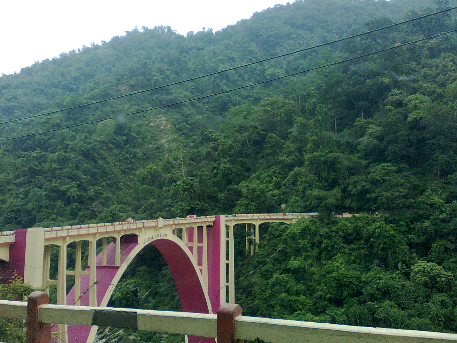
The Coronation Bridge, also known as the Sevoke Roadway Bridge, in West Bengal, India, spans across the Teesta River, connecting the districts of Darjeeling and Kalimpong. The bridge is a part of the National Highway 17 '' H 31 (old)'' This bridge runs parallel to Sevoke Railway Bridge which is around 2 Kms away from coronation bridge in River Teesta. It was named to commemorate the coronation of King George VI and Queen Elizabeth in 1937 and was completed in 1941 at a cost of Rs 6 lakhs. The foundation stone of the bridge was laid by John Anderson, the-then Governor of Bengal in 1937. Locals call the bridge ''Baghpool'', meaning ''tiger bridge'', because of the two tiger statues (bagh actually means tiger) at one entrance of the bridge. John Chambers, the last British executive Engineer of the Darjeeling Division Public works department (PWD), carried out the design, drawing and planning of the bridge. Messrs J.C. Gammon, from Bombay Mumbai (, ; also known as Bom ... [...More Info...] [...Related Items...] OR: [Wikipedia] [Google] [Baidu] |
Doars
The Dooars or Duars ( as, দুৱাৰ, duar, rkt, দুৱাৰ, duar, bn, দুয়ার, duyar) () are the alluvial floodplains in eastern-northeastern India that lie south of the outer foothills of the Himalayas and north of the Brahmaputra River basin. This region is about wide and stretches over about from the Teesta River in West Bengal to the Dhansiri River in Assam. The region forms the gateway to Bhutan. It is part of the Terai-Duar savanna and grasslands ecoregion.Dinerstein, E., Loucks, C. (2001). ''Dooars'' means 'doors' in Assamese, Bengali, Maithili, Bhojpuri, and Magahi languages. There are 18 passages or gateways between the hills in Bhutan and the plains in India. This region is divided by the Sankosh River into Eastern and Western Dooars, consisting of an area of . The Western Dooars are also known as the Bengal Dooars, and the Eastern Dooars also as the Assam Dooars. Dooars is analogous with the Terai in northern India and southern Nepal. H ... [...More Info...] [...Related Items...] OR: [Wikipedia] [Google] [Baidu] |
Mahananda Wildlife Sanctuary
Mahananda Wildlife Sanctuary (Pron: móhɑ́nɑ́ndaa) is located on the foothills of the Himalayas, between the Teesta and Mahananda rivers. Situated in the Darjeeling district of West Bengal, India; it comes under Darjeeling Wildlife division and can be reached from Siliguri in 30 minutes. Sukna, the gateway to the sanctuary, is only 13 km from Siliguri and 28 km from Bagdogra airport. The sanctuary sprawls over 159 km2 of reserve forest and was started as a game sanctuary in 1955. In 1959, it got the status of a sanctuary mainly to protect the Indian bison and royal Bengal tiger, which were facing the threat of extinction. Geography The forest type in Mahananda WLS varies from riverain forests like Khayer-Sisoo to dense mixed-wet forest in the higher elevation in Latpanchar area of Kurseong hills. The variation in elevation and forest types helps the existence of a large number of species of mammals, birds and reptiles. Varying elevation from 166 metres ... [...More Info...] [...Related Items...] OR: [Wikipedia] [Google] [Baidu] |


.jpg)


