|
Seventeen Mile Rocks, Queensland
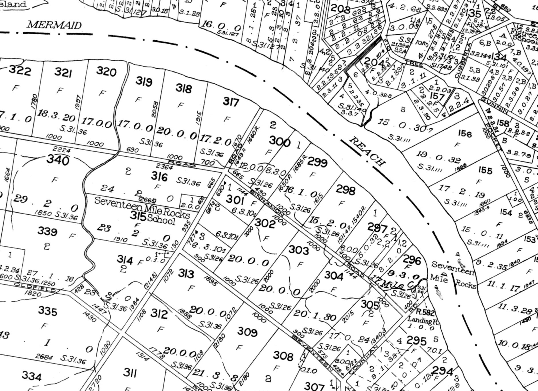
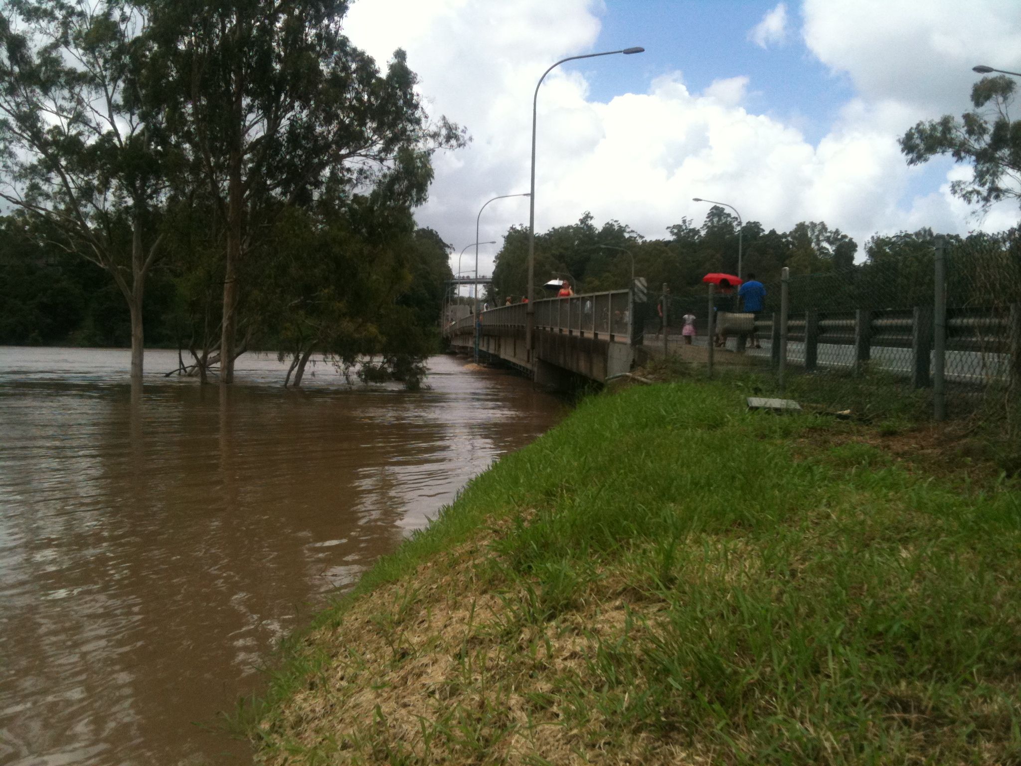
Seventeen Mile Rocks is a suburb in the City of Brisbane, Queensland, Australia. In the , Seventeen Mile Rocks had a population of 2,720 people. Geography Seventeen Mile Rocks is located south-west of the Brisbane CBD on the Brisbane River. It is bounded to the north-east by the median of the Brisbane River and partly bounded to the west by the riparian zone on the western bank of Jindalee Creek. The north-west of the suburb is an industrial area () while the north-east is the Rocks Riverside Park (). The remainder of the suburb is residential apart from another industrial area in the south-west of the locality (). History The suburb Seventeen Mile Rocks is named after a collection of rocks of the same name () that marked a distance of from the mouth of the Brisbane River, as noted by John Oxley on 3 December 1823. They ran diagonally across the river from Counihan Road (see map). These rocks were partially removed in the 1860s to make the river more navigable. Howev ... [...More Info...] [...Related Items...] OR: [Wikipedia] [Google] [Baidu] |
AEST
Australia uses three main time zones: Australian Western Standard Time (AWST; UTC+08:00), Australian Central Standard Time (ACST; UTC+09:30), and Australian Eastern Standard Time (AEST; UTC+10:00). Time is regulated by the individual state governments, some of which observe daylight saving time (DST). Australia's external territories observe different time zones. Standard time was introduced in the 1890s when all of the Australian colonies adopted it. Before the switch to standard time zones, each local city or town was free to determine its local time, called local mean time. Now, Western Australia uses Western Standard Time; South Australia and the Northern Territory use Central Standard Time; while New South Wales, Queensland, Tasmania, Victoria (Australia), Victoria, Jervis Bay Territory, and the Australian Capital Territory use Eastern Standard Time. Daylight saving time (+1 hour) is used in jurisdictions in the south and south-east: South Australia, New South Wales, Vict ... [...More Info...] [...Related Items...] OR: [Wikipedia] [Google] [Baidu] |
John Oxley
John Joseph William Molesworth Oxley (1784 – 25 May 1828) was an explorer and surveyor of Australia in the early period of British colonisation. He served as Surveyor General of New South Wales and is perhaps best known for his two expeditions into the interior of New South Wales and his exploration of the Tweed River and the Brisbane River in what is now the state of Queensland. Early life John Oxley was born at Kirkham Abbey near Westow in Yorkshire, Great Britain. He was baptised at Bulmer on 6 July 1784, his parents recorded as John and Arabella Oxley. Naval career In 1799 (aged 15), he entered the Royal Navy as a midshipman on the . He travelled to Australia in October 1802 as master's mate of the naval vessel , which carried out coastal surveying (including the survey of Western Port), and this first stay in the Colonies would last for five years. In 1805, Oxley became acting lieutenant of the ''Buffalo'' and traveled to Van Diemen's Land the following yea ... [...More Info...] [...Related Items...] OR: [Wikipedia] [Google] [Baidu] |
Centenary State High School
Centenary State High School is a government secondary (7–12) school at 1 Moolanda Street, Jindalee, City of Brisbane, Queensland, Australia. It is a co-curricular, co-educational school that opened in 1999. At that time, it catered for students in Grades 8 to 12. As of 2020, the school's enrolment stood at just over 2000 students. In January 2015, it opened its doors to students in Grade 7, which are a part of a Junior School, along with Grades 8 and 9 (with Grades 10–12 becoming the Senior School). As well, throughout 2014, the school brought Sixth Graders to the premises, who—along with Seventh Graders, participated in special faculty-based activities. Located in Jindalee, in Brisbane's western Centenary Suburbs. History The school's name "Centenary" comes from the Centenary suburbs in which it is located. In 1960, a year after the celebrations of the Centenary of Queensland, LJ Hooker announced POG that it was to create ''"a major satellite residential development ... [...More Info...] [...Related Items...] OR: [Wikipedia] [Google] [Baidu] |
Corinda State High School
, motto_translation = Not only for today but for tomorrow also , established = 1960 , principal = Helen Jamieson , type = Public, co-educational, secondary, day school , city = Brisbane , state = Queensland , country = Australia , campus = Urban ( Corinda) , enrolment = 1,829 , colours = Green and yellow , website = http://www.corindashs.eq.edu.au Corinda State High School (CSHS) is a non-selective, co-educational, state secondary school, located in Corinda, Queensland, Australia. The school was established in 1960. Campus The school is located on one campus in the western suburbs of Brisbane. The school has extensive outdoor as well as indoor sporting facilities, a performing arts centre and an agricultural farm as part of the "outdoor classroom". The agricultural farm is a unique resource for a large school in close proximity to the city centre of Brisba ... [...More Info...] [...Related Items...] OR: [Wikipedia] [Google] [Baidu] |
Corinda, Queensland
Corinda is a suburb in the City of Brisbane, Queensland, Australia. In the , Corinda had a population of 5,064 people. History The suburb takes its name from the Corinda railway station, which in turn was likely named after a local cattle station owned by Sir Arthur Palmer, which he named after his Corinda pastoral station near Aramac. Corinda was first settled in the 1860s as a small farming community. Among the original settlers was the Francis family who in 1862 purchased 21 acres, which extended from the Brisbane River to Francis Lookout, a local heritage listed landmark on Dewar Terrace. Francis Lookout survives to this day, and includes a small burial ground opened in 1862. Its ten graves include those of some of the pioneer settlers. The oldest of the graves is of Clement Francis who died in 1863. The lychgate, erected by Angela Francis, dates to 1902. Most of the original older-style Queenslander homes date back to the colonial period and were built high on the hi ... [...More Info...] [...Related Items...] OR: [Wikipedia] [Google] [Baidu] |
Drive-in Theater
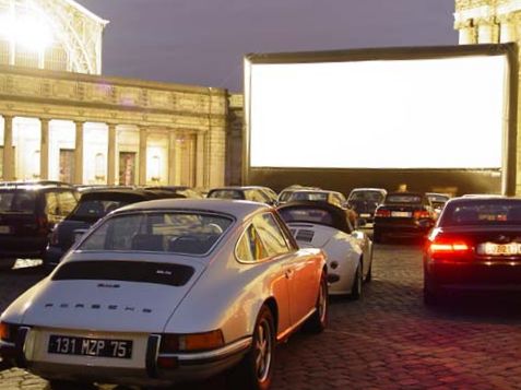
A drive-in theater or drive-in cinema is a form of movie theater, cinema structure consisting of a large outdoor movie screen, a projection booth, a concession stand, and a large parking area for automobiles. Within this enclosed area, customers can view movies from the privacy and comfort of their cars. Some drive-ins have small playgrounds for children and a few picnic tables or benches. The screen can be as simple as a painted white wall, or it can be a steel truss, truss structure with a complex finish. Originally, the movie's Sound recording and reproduction, sound was provided by Loudspeaker, speakers on the screen and later by individual speakers hung from the window of each car, which was attached to a small pole by a wire. These speaker systems were superseded by the more practical method of microbroadcasting the soundtrack to car radios. This also has the advantage of the film soundtrack to be heard in stereophonic sound, stereo on car stereo systems, which are typically ... [...More Info...] [...Related Items...] OR: [Wikipedia] [Google] [Baidu] |
Western Freeway, Brisbane
The Western Freeway is a freeway in western Brisbane that runs from Milton Road in Toowong to the western side of Indooroopilly where the freeway becomes the M5 Centenary Motorway. The freeway bears the symbol and forms part of Metroad 5. There is one interchange, at Indooroopilly onto Moggill Road. A bicycle path runs the length of the freeway, allowing commuting to Toowong and onto Brisbane by bicycle. Options are currently being investigated in to a possible Kenmore Bypass. This would connect with the M5 along the existing preserved corridor to Chuwar, Queensland. This preserved corridor was identified in the 1960s for a future freeway. History The Western Freeway was constructed in two stages. The first stretched from Milton Road at Toowong south to Taringa Parade at Taringa, and was opened to traffic on 31 August 1970. Construction of the second stage (Taringa Parade to Moggill Road) commenced in 1975 and was opened on 24 May 1979. Later construction began on a direct lin ... [...More Info...] [...Related Items...] OR: [Wikipedia] [Google] [Baidu] |
Jindalee, Queensland
Jindalee is a south-western residential suburb in the City of Brisbane, Queensland, Australia. In the , Jindalee had a population of 5,320 people. Geography Jindalee is by road south-west of the Brisbane CBD, and is a part of the Centenary suburbs. It is bordered by the Brisbane River to the north. The Centenary Motorway enters the suburb from the north (Kenmore), crossing the river on the Centenary Bridge (), and forms the south-eastern boundary of the suburb before exiting on the south-east corner of the suburb into Mount Ommaney / Sinnamon Park. The older part of the suburb is to the west of the motorway and is predominantly residential in character with individual houses. The Jindalee Golf Course is immediately west of the motorway (). To the east of the motorway are two large retail centres, separated by Sinnamon Road (). Also to the east of the motorway is a more recent townhouse estate between the retail precinct and the river (). The north-western boundary with ... [...More Info...] [...Related Items...] OR: [Wikipedia] [Google] [Baidu] |
The Queenslander
''The Queenslander'' was the weekly summary and literary edition of the '' Brisbane Courier'', the leading journal in the colony—and later, federal state—of Queensland since the 1850s. ''The Queenslander'' was launched by the Brisbane Newspaper Company in 1866, and discontinued in 1939. History ''The Queenslander'' was first published on 3 February 1866 in Brisbane by Thomas Blacket Stephens. The last edition was printed on 22 February 1939. In a country the size of Australia, a daily newspaper of some prominence could only reach the bush and outlying districts if it also published a weekly edition. Yet ''The Queenslander'', under the managing editorship of Gresley Lukin—managing editor from November 1873 until December 1880—also came to find additional use as a literary magazine. In September 1919, a series of aerial photographs of Brisbane and its surrounding suburbs were published under the title, ''Brisbane By Air''. The photographs were taken by the newspaper' ... [...More Info...] [...Related Items...] OR: [Wikipedia] [Google] [Baidu] |
Queensland Government
The Queensland Government is the democratic administrative authority of the Australian state of Queensland. The Government of Queensland, a parliamentary constitutional monarchy was formed in 1859 as prescribed in its Constitution, as amended from time to time. Since the Federation of Australia in 1901, Queensland has been a State of Australia, with the Constitution of Australia regulating the relationships between all state and territory governments and the Australian Government. Under the Australian Constitution, all states and territories (including Queensland) ceded powers relating to certain matters to the federal government. The government is influenced by the Westminster system and Australia's federal system of government. The Governor of Queensland, as the representative of Charles III, King of Australia, holds nominal executive power, although in practice only performs ceremonial duties. In practice executive power lies with the Premier and Cabinet. The Cabinet of ... [...More Info...] [...Related Items...] OR: [Wikipedia] [Google] [Baidu] |
Queensland Family History Society
The Queensland Family History Society (QFHS) is an incorporated association formed in Brisbane, Queensland, Australia. History The society was established in 1979 as a non-profit, non-sectarian, non-political organisation. They aim to promote the study of family history local history, genealogy, and heraldry, and encourage the collection and preservation of records relating to the history of Queensland families. At the end of 2022, the society relocated from 58 Bellevue Avenue, Gaythorne Gaythorne is a suburb in the City of Brisbane, Queensland, Australia. In the , Gaythorne had a population of 3,023 people. Geography Gaythorne is located seven kilometres north-west of the Brisbane central business district. It is bounded to ... () to its new QFHS Family History Research Centre at 46 Delaware Street, Chermside (). References External links * Non-profit organisations based in Queensland Historical societies of Australia Libraries in Brisbane Family hist ... [...More Info...] [...Related Items...] OR: [Wikipedia] [Google] [Baidu] |


