|
Seocheon-gun
Seocheon County () is a Administrative divisions of South Korea, county in Chungcheongnam-do, South Korea. It is famous for its seafood and location near the mouth of the Geum River. Administrative divisions Seocheon county has two major centers, Janghang-eup and Seocheon-eup. Seocheon-eup, the larger center, serves as the educational center of the district. It has an economy built on agriculture and education. Janghang has a more industrial economy that includes factories, processing, and ship building. Janghang and Seocheon are connected to Yongsan (Seoul), Iksan, and the rest of the country via Korail's Janghang Line which formerly terminated in Janghang but has since been connected to Iksan via Gunsan. In total under Seocheon-gun there are two ''eup (administrative division), eup'' and eleven ''myeon (administrative division), myeon'': *Janghang-eup (장항읍/長項邑) *Seocheon-eup (서천읍/舒川邑) *Maseo-myeon (마서면/馬西面) *Hwayang-myeon, Seocheon, Hwayang-my ... [...More Info...] [...Related Items...] OR: [Wikipedia] [Google] [Baidu] |
Janghang Line
The Janghang Line is a railway line serving South Chungcheong Province in South Korea. The line connects Cheonan (on the Gyeongbu Line) to the railway junction city of Iksan. The Janghang Line is served by frequent Saemaeul-ho and Mugunghwa-ho passenger train services between Seoul and Iksan. There is also a link from Asan station to the KTX network at Cheonan-Asan station. History The original Janghang Line was opened along its full length between Cheonan and Janghang by the Chosen Gyeongnam Railway on June 1, 1922. Upgrade The entire Janghang Line is being electrified and double-tracked and upgraded for higher speeds with a straighter alignment. Work started in 1997 from Cheonan. By the end of 2008, the new alignment was in service from Cheonan via Asan and Hongseong to Sinseong, from Jupo to Nampo, and from Ganchi to Janghang, and electrification was put in service on the first 19.4 km between Cheonan and Sinchang, after Asan, on December 15, 2008. The 17.1&n ... [...More Info...] [...Related Items...] OR: [Wikipedia] [Google] [Baidu] |
Maryang-ri Camellia Forest
Maryang-ri Camellia Forest (hangul:마량리 동백나무 숲) is a colony of camellia plant located in Maryang-ri, Seocheon-gun, Chungcheongnam-do. It is one of the 8 Scenic Spots of Seocheon (서천팔경:舒川八景) and was designated as Natural Monument No.169 in 1965. There are about 85 aerials of camellia trees over 500 years old in this area and has a dense forest of 8,265 m2. Located in Maryang-ri, the forest is situated on a low hill about 4.5 kilometers away from the coast of Seodo Elementary School. At the top of the hill there is a small pavilion called Dongbaekjeong. 'Dongbaekjeong' means a pavilion with camellia blossoms. From late March to early May, you can enjoy the camellia blossom from here. The scenery of the West Sea in the 'Dongbaekjeong' is beautiful. Especially, there is an 'Oryeokdo' island in the front of the pavilion, and the scenery of the island and the sea looks great. The western forest of Maryang-ri has a strong wind, and there are only a few left ... [...More Info...] [...Related Items...] OR: [Wikipedia] [Google] [Baidu] |
Korea Meteorological Administration
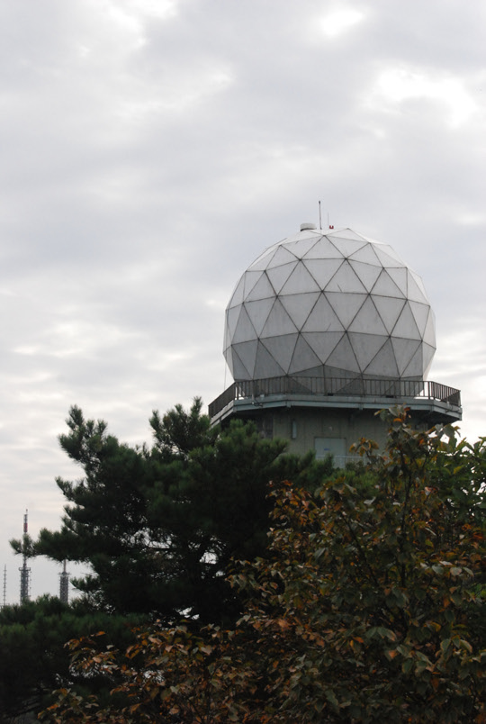
The Korea Meteorological Administration () (KMA) is the national meteorological service of the Republic of Korea. The service started in 1904 joining the WMO in 1956. Numerical Weather Prediction is performed using the Unified Model software suite. History The current Administration was established in 1990. Temporary observatories set up in 1904 in Busan, Incheon, Mokpo and elsewhere were precursors to the current KMA. The Central Meteorological Office (CMO) was established in August 1949. In April 1978, CMO was renamed the Korea Meteorological Service(KMS). In 1999, the Administration introduced a meteorological supercomputer for forecasting. As of November 2021, supercomputers ''Guru'' and ''Maru'' ranked 27th and 28th respectively in the world. In 2010, the KMA launched South Korea’s first geostationary meteorological satellite, the Communication, Ocean and Meteorological Satellite (COMS), also known as Chollian. Chollian started its official operation in 2011. The Seoul an ... [...More Info...] [...Related Items...] OR: [Wikipedia] [Google] [Baidu] |
Munsan-myeon
Munsan-myeon (문산면, 文山面) is a '' myeon'' (township) in the northern part of Seocheon-gun, Chungcheongnam-do, South Korea. It is bordered by Masan-myeon to the east, Buyeo-gun Buyeo County (''Buyeo-gun'') is a county in South Chungcheong Province, South Korea. Buyeo-eup, the county's capital, was the site of the capital of Baekje from 538-660 AD, during which it was called Sabi Fortress. Famous people associated with ...'s Oksan-myeon to the north, Pangyeon-myeon to the west, and Seocheon-eup's Sicho-myeon to the south. As of 2006 it had a population of 1,590. Munsan-myeon was created in 1914 by the merger of Munjang-myeon (문장면, 文章面) and Dusan-myeon (두산면, 豆山面) in part of a wider reorganisation of Korea's administrative districts. It took taking one character from each of its parts to come up with the new name. Administratively subordinate to Munsan-myeon are eighteen ''ri'' (villages). Among these are: *Sinnong-ri (신농리, 神農里) *Ge ... [...More Info...] [...Related Items...] OR: [Wikipedia] [Google] [Baidu] |

