|
Sellicks Beach
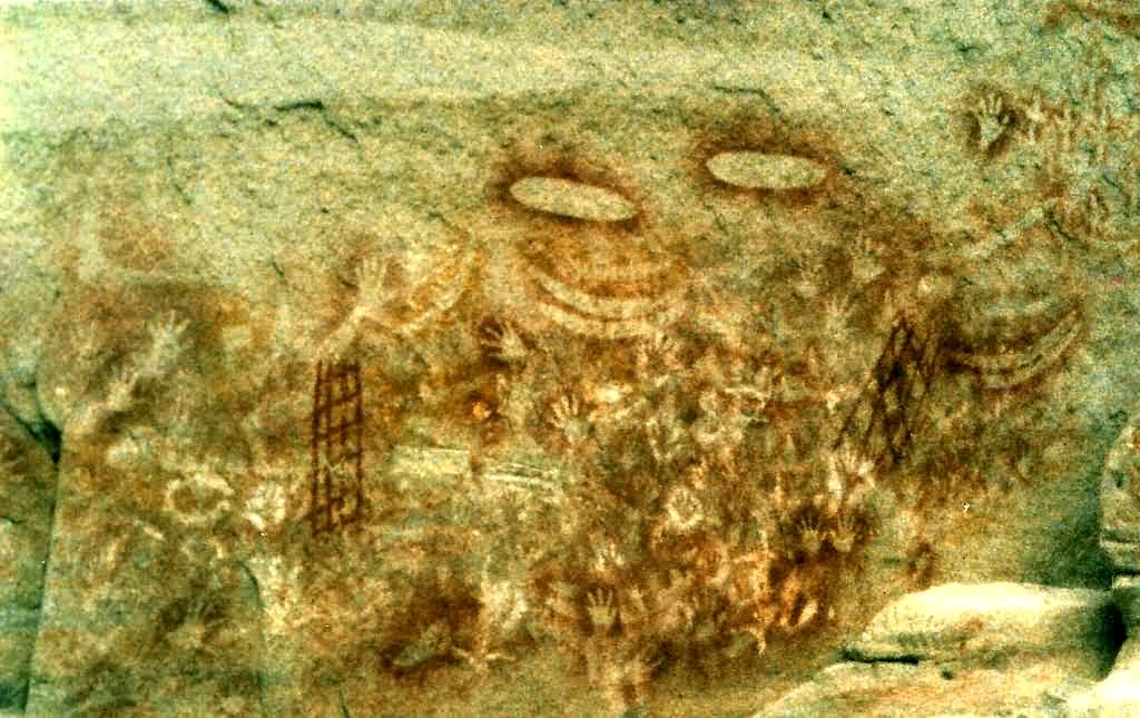
__NOTOC__ Sellicks Beach, formerly spelt Sellick's Beach, is a suburb in the Australian state of South Australia located within Adelaide metropolitan area about from the Adelaide city centre. It is an outer southern suburb of Adelaide and is located in the local government area of the City of Onkaparinga at the southern boundary of the metropolitan area. It is known as Witawali or Witawodli by the Traditional Owners, the Kaurna people, and is of significance as being the site of a freshwater spring said to be created by the tears of Tjilbruke, the creator being. The beach lies within Aldinga Bay. The suburb consists of land bounded in the north by Button Road, in the east by the Main South Road, to the south by the boundary of the cadastral unit of the Hundred of Willunga and to the west by the coastline with Aldinga Bay. The 2016 Australian census reported that Sellicks Beach had 2,616 people living within its boundaries. History Before the British colonisation of South Au ... [...More Info...] [...Related Items...] OR: [Wikipedia] [Google] [Baidu] |
Adelaide City Centre
Adelaide city centre (Kaurna: Tarndanya) is the inner city locality of Greater Adelaide, the capital city of South Australia. It is known by locals simply as "the City" or "Town" to distinguish it from Greater Adelaide and from the City of Adelaide local government area (which also includes North Adelaide and from the Park Lands around the whole city centre). The population was 15,115 in the . Adelaide city centre was planned in 1837 on a greenfield site following a grid layout, with streets running at right angles to each other. It covers an area of and is surrounded by of park lands.The area of the park lands quoted is based, in the absence of an official boundary between the City and North Adelaide, on an east–west line past the front entrance of Adelaide Oval. Within the city are five parks: Victoria Square in the exact centre and four other, smaller parks. Names for elements of the city centre are as follows: *The "city square mile" (in reality 1.67 square miles ... [...More Info...] [...Related Items...] OR: [Wikipedia] [Google] [Baidu] |
Aldinga Bay
Aldinga Bay is a bay located on the east coast of Gulf St Vincent in South Australia about south-southwest of Adelaide city centre. Extent & description Aldinga Bay lies between Snapper Point in the suburb of Aldinga Beach at its northern extremity and the remains of Myponga Jetty at Myponga Beach at its southern extremity. Ports and other settlements The bay has no infrastructure for maritime use apart from access to the beach from the road network to launch and retrieve small boats at specific locations permitted by the local government authority, the City of Onkaparinga. The following settlements are located along its coastline from north to south: Aldinga Beach and Sellicks Beach in the City of Onkaparinga and Myponga Beach in the District Council of Yankalilla. Protected areas The waters of Aldinga Bay are within the Encounter Marine Park Encounter Marine Park is a marine park in South Australia. It is in the Fleurieu Peninsula in state of South Australia Sout ... [...More Info...] [...Related Items...] OR: [Wikipedia] [Google] [Baidu] |
Cadastral
A cadastre or cadaster is a comprehensive recording of the real estate or real property's metes-and-bounds of a country.Jo Henssen, ''Basic Principles of the Main Cadastral Systems in the World,'/ref> Often it is represented graphically in a cadastral map. In most countries, legal systems have developed around the original administrative systems and use the cadastre to define the dimensions and location of land parcels described in legal documentation. A land parcel or cadastral parcel is defined as "a continuous area, or more appropriately volume, that is identified by a unique set of homogeneous property rights". Cadastral surveys document the Boundary (real estate), boundaries of land ownership, by the production of documents, diagrams, sketches, plans (''plats'' in the US), charts, and maps. They were originally used to ensure reliable facts for land valuation and taxation. An example from early England is the Domesday Book in 1086. Napoleon established a comprehensive c ... [...More Info...] [...Related Items...] OR: [Wikipedia] [Google] [Baidu] |
Subdivision (land)
Subdivisions are the act of dividing land into pieces that are easier to sell or otherwise develop, usually via a plat. The former single piece as a whole is then known as a subdivision. Subdivisions may be simple, involving only a single seller and buyer, or complex, involving large tracts of land divided into many smaller parcels. If it is used for housing it is typically known as a ''housing subdivision'' or ''housing development,'' although some developers tend to call these areas communities. Subdivisions may also be for the purpose of commercial or industrial development, and the results vary from retail shopping malls with independently owned ''out parcels'' to industrial parks. United States History In the United States, the creation of a subdivision was often the first step toward the creation of a new incorporated township or city. Contemporary notions of subdivisions rely on the Lot and Block survey system, which became widely used in the 19th century as a means ... [...More Info...] [...Related Items...] OR: [Wikipedia] [Google] [Baidu] |
Sesquicentenary
An anniversary is the date on which an event took place or an institution was founded in a previous year, and may also refer to the commemoration or celebration of that event. The word was first used for Catholic feasts to commemorate saints. Most countries celebrate national anniversaries, typically called national days. These could be the date of independence of the nation or the adoption of a new constitution or form of government. There is no definite method for determining the date of establishment of an institution, and it is generally decided within the institution by convention. The important dates in a sitting monarch's reign may also be commemorated, an event often referred to as a "jubilee". Names * Birthdays are the most common type of anniversary, on which someone's birthdate is commemorated each year. The actual celebration is sometimes moved for practical reasons, as in the case of an official birthday or one falling on February 29. * Wedding anniversaries ... [...More Info...] [...Related Items...] OR: [Wikipedia] [Google] [Baidu] |
Commemorative Plaque
A commemorative plaque, or simply plaque, or in other places referred to as a historical marker, historic marker, or historic plaque, is a plate of metal, ceramic, stone, wood, or other material, typically attached to a wall, stone, or other vertical surface, and bearing text or an image in relief, or both, to commemorate one or more persons, an event, a former use of the place, or some other thing. Many modern plaques and markers are used to associate the location where the plaque or marker is installed with the person, event, or item commemorated as a place worthy of visit. A monumental plaque or tablet commemorating a deceased person or persons, can be a simple form of church monument. Most modern plaques affixed in this way are commemorative of something, but this is not always the case, and there are purely religious plaques, or those signifying ownership or affiliation of some sort. A plaquette is a small plaque, but in English, unlike many European languages, the term is ... [...More Info...] [...Related Items...] OR: [Wikipedia] [Google] [Baidu] |
Dreamtime
The Dreaming, also referred to as Dreamtime, is a term devised by early anthropologists to refer to a religio-cultural worldview attributed to Australian Aboriginal mythology, Australian Aboriginal beliefs. It was originally used by Francis James Gillen, Francis Gillen, quickly adopted by his colleague Walter Baldwin Spencer, Baldwin Spencer and thereafter popularised by A. P. Elkin, who, however, later revised his views. The Dreaming is used to represent Aboriginal concepts of ''Everywhen'', during which the land was inhabited by ancestral figures, often of heroic proportions or with supernatural abilities. These figures were often distinct from gods, as they did not control the material world and were not worshipped but only reverence (emotion), revered. The concept of the Dreamtime has subsequently become widely adopted beyond its original Australian context and is now part of global popular culture. The term is based on a rendition of the Arandic languages, Arandic word '' ... [...More Info...] [...Related Items...] OR: [Wikipedia] [Google] [Baidu] |
Aboriginal Australian Sacred Site
An Australian Aboriginal sacred site is a place deemed significant and meaningful by Aboriginal Australians based on their beliefs. It may include any feature in the landscape, and in coastal areas, these may lie underwater. The site's status is derived from an association with some aspect of social and cultural tradition, which is related to ancestral beings, collectively known as Dreamtime (or the Dreaming/s), who created both physical and social aspects of the world. The site may have its access restricted based on gender, clan or other Aboriginal grouping, or other factors. The sites are protected by various state- and territory-based legislation as part of Australian heritage laws, and the federal ''Aboriginal and Torres Strait Islander Heritage Protection Act 1984'' can be invoked as a "last resort" if the site is not considered adequately covered by legislation in the jurisdiction. The legislation also protects sites of archaeological, historical and cultural significa ... [...More Info...] [...Related Items...] OR: [Wikipedia] [Google] [Baidu] |
Kaurna People
The Kaurna people (, ; also Coorna, Kaura, Gaurna and other variations) are a group of Aboriginal people whose traditional lands include the Adelaide Plains of South Australia. They were known as the Adelaide tribe by the early settlers. Kaurna culture and language were almost completely destroyed within a few decades of the British colonisation of South Australia in 1836. However, extensive documentation by early missionaries and other researchers has enabled a modern revival of both language and culture. The phrase ''Kaurna meyunna'' means "Kaurna people". Etymology The early settlers of South Australia referred to the various indigenous tribes of the Adelaide Plains and Fleurieu Peninsula as "Rapid Bay tribe", "the Encounter Bay tribe", "the Adelaide tribe", the Kouwandilla tribe, "the Wirra tribe", "the Noarlunga tribe" (the Ngurlonnga band) and the Willunga tribe (the Willangga band). The extended family groups of the Adelaide Plains, who spoke dialects of a common langu ... [...More Info...] [...Related Items...] OR: [Wikipedia] [Google] [Baidu] |
Fleurieu Peninsula
The Fleurieu Peninsula () is a peninsula in the Australian state of South Australia located south of the state capital of Adelaide. History Before British colonisation of South Australia, the western side of the peninsula was occupied by the Kaurna people, while several clans of the Ngarrindjeri lived on the eastern side. The people were sustained by the flora and fauna of the peninsula, for food and bush medicine. The bulrushes, reeds and sedges were used for basket-weaving or making rope, trees provided wood for spears, and stones were fashioned into tools. The Fleurieu Peninsula was named after Charles Pierre Claret de Fleurieu, the French explorer and hydrographer, by the French explorer Nicolas Baudin as he explored the south coast of Australia in 1802. The name came into official use in 1911 after Fleurieu's great-nephew, Count Alphonse de Fleurieu, visited Adelaide and met with the Council of the Royal Geographical Society of South Australia, which recommended to t ... [...More Info...] [...Related Items...] OR: [Wikipedia] [Google] [Baidu] |
Adelaide Plains
The Adelaide Plains (Kaurna name Tarndanya) is a plain in South Australia lying between the coast (Gulf St Vincent) on the west and the Mount Lofty Ranges on the east. The southernmost tip of the plain is in the southern seaside suburbs of Adelaide around Brighton at the foot of the O'Halloran Hill escarpment with the south Hummocks Range and Wakefield River roughly approximating the northern boundary. Traditionally entirely occupied by the Kaurna (indigenous) people, the Adelaide Plains are crossed by a number of rivers and creeks, but several dry up during summer. The rivers (from south to north) include: the Onkaparinga/Ngangki, Sturt/Warri Torrens/Karra Wirra, Little Para, Gawler, Light/Yarralinka and Wakefield/Undalya. The plains are generally fertile with annual rainfall of about per year. The plain can be roughly divided into three parts. The southern area is now covered by the city of Adelaide, the capital of South Australia. The central area is considered the ... [...More Info...] [...Related Items...] OR: [Wikipedia] [Google] [Baidu] |
British Colonisation Of South Australia
British colonisation of South Australia describes the planning and establishment of the colony of South Australia by the British government, covering the period from 1829, when the idea was raised by the then-imprisoned Edward Gibbon Wakefield, to 1842, when the ''South Australia Act 1842'' changed the form of government to a Crown colony. Ideas espoused and promulgated by Wakefield since 1829 led to the formation of the South Australian Land Company in 1831, but this first attempt failed to achieve its goals, and the company folded. The South Australian Association was formed in 1833 by Wakefield, Robert Gouger and other supporters, which put forward a proposal less radical than previous ones, which was finally supported and a Bill proposed in Parliament. The British Province of South Australia was established by the ''South Australia Act 1834'' in August 1834, and the South Australian Company formed on 9 October 1835 to fulfil the purposes of the Act by forming a new colony ... [...More Info...] [...Related Items...] OR: [Wikipedia] [Google] [Baidu] |


