|
Segura Basin
Segura (Spanish and Valencian: ; la, Thader; ar, شقورة, Shaqūrah, or ) is a medium-sized river in southeastern Spain. It has its source in the Sierra de Segura. Course The 325-km (202 mi) long river begins at Santiago Pontones ( province of Jaén), passes Calasparra, Cieza, Blanca, Murcia, Beniaján ( Region of Murcia), Orihuela, Rojales, and flows into the Mediterranean Sea near Guardamar del Segura in the province of Alicante. Some of its tributaries are the Mundo (which starts near Riópar), the Alhárabe (which starts in Moratalla), the Mula, and the Guadalentín. The alluvial plain is called the ''Vega del Segura'' and is a very productive agricultural region growing a wide variety of fruit, vegetables, and flowers. The ''Vegas'' are divided into three areas: ''Alta'', ''Media'', and ''Baja'' (upper, medium, and lower). Tributaries The Segura's main tributaries are: Recovery By the 1990s, the Segura had become one of the most polluted rivers in Eur ... [...More Info...] [...Related Items...] OR: [Wikipedia] [Google] [Baidu] |
Puente De Los Peligros
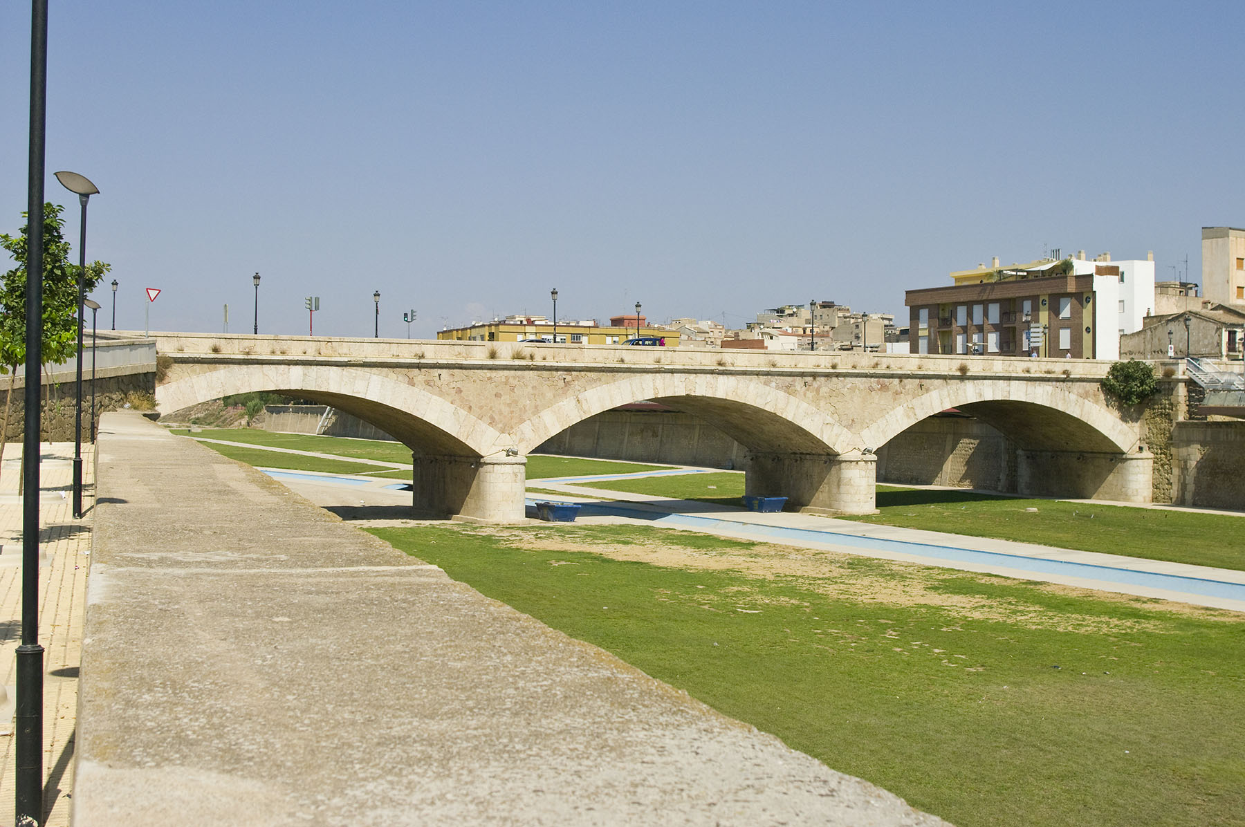
The Puente de los Peligros (Spanish for bridge of the hazards) or also known as the Puente Viejo (Spanish for old bridge) is an arched stone bridge, completed in 1742, that spans the River Segura in the city of Murcia (Region of Murcia, Spain). As this is the oldest bridge of the city, it is known as ''old bridge'' as opposed to the Puente Nuevo (Spanish for new bridge) built in 1903. The popular name of ''Puente de los Peligros'' is due to the presence on the south side of the bridge of a niche that keeps a wooden statue of Our Lady of the Hazards, work of Francisco Sánchez Araciel. History On 26 September 1701, an extreme flood event destroyed the 16th-century bridge that used to link the city centre with the right bank of the river and the starting point of the royal road to Cartagena. In 1717, after many delays and after Luis Salas y Sandoval was appointed Mayor of the city, the order to start the works was eventually given. In the same year Toribio Martínez de la ... [...More Info...] [...Related Items...] OR: [Wikipedia] [Google] [Baidu] |
Rojales
Rojales is a village in the province of Alicante and autonomous community of Valencia, Spain , image_flag = Bandera de España.svg , image_coat = Escudo de España (mazonado).svg , national_motto = ''Plus ultra'' (Latin)(English: "Further Beyond") , national_anthem = (English: "Royal March") , i .... The municipality covers an area of and as of 2011 had a population of 21583 people. References Populated places in the Province of Alicante {{Valencia-geo-stub ... [...More Info...] [...Related Items...] OR: [Wikipedia] [Google] [Baidu] |
Río Argos
The Argos is a river in the region of Murcia, Spain. It is a tributary of the river Segura. It starts in Caravaca de la Cruz, runs through Cehegín, Valentin Valentin is a male given name meaning "strong, healthy, power, rule, terco". It comes from the Latin name ''Valentinus'', as in Saint Valentin. Commonly found in Spain, Romania, Bulgaria, France, Italy, Russia, Ukraine, Scandinavia, Latin America ..., and joins the Segura in Calasparra. Rivers of Spain Rivers of the Region of Murcia {{Spain-river-stub ... [...More Info...] [...Related Items...] OR: [Wikipedia] [Google] [Baidu] |
Alhárabe
Alhárabe is a river in Spain. It is a tributary of Segura. See also * List of rivers of Spain This is an incomplete list of rivers that are at least partially in Spain. The rivers flowing into the sea are sorted along the coast. Rivers flowing into other rivers are listed by the rivers they flow into. Rivers in the mainland Iberian Peninsu ... Rivers of Spain Rivers of the Valencian Community {{Spain-river-stub ... [...More Info...] [...Related Items...] OR: [Wikipedia] [Google] [Baidu] |
Taibilla
Taibilla is a river of the Province of Albacete, Spain , image_flag = Bandera de España.svg , image_coat = Escudo de España (mazonado).svg , national_motto = ''Plus ultra'' (Latin)(English: "Further Beyond") , national_anthem = (English: "Royal March") , i .... Rivers of Spain Rivers of the Province of Albacete Rivers of Castilla–La Mancha {{Spain-river-stub ... [...More Info...] [...Related Items...] OR: [Wikipedia] [Google] [Baidu] |
Zumeta
Zumeta or Rio Zumeta is a river of the Province of Albacete, Spain , image_flag = Bandera de España.svg , image_coat = Escudo de España (mazonado).svg , national_motto = ''Plus ultra'' (Latin)(English: "Further Beyond") , national_anthem = (English: "Royal March") , i ....Google Maps See also * List of rivers of Spain References Rivers of Spain Rivers of the Province of Albacete Rivers of Castilla–La Mancha {{Spain-river-stub ... [...More Info...] [...Related Items...] OR: [Wikipedia] [Google] [Baidu] |
Alluvial Plain
An alluvial plain is a largely flat landform created by the deposition of sediment over a long period of time by one or more rivers coming from highland regions, from which alluvial soil forms. A floodplain is part of the process, being the smaller area over which the rivers flood at a particular period of time, whereas the alluvial plain is the larger area representing the region over which the floodplains have shifted over geological time. As the highlands erode due to weathering and water flow, the sediment from the hills is transported to the lower plain. Various creeks will carry the water further to a river, lake, bay, or ocean. As the sediments are deposited during flood conditions in the floodplain of a creek, the elevation of the floodplain will be raised. As this reduces the channel floodwater capacity, the creek will, over time, seek new, lower paths, forming a meander (a curving sinuous path). The leftover higher locations, typically natural levees at the margins ... [...More Info...] [...Related Items...] OR: [Wikipedia] [Google] [Baidu] |
Guadalentín River
Guadalentín is a river in Spain. It is a tributary of the Segura Segura (, ; la, Thader; ar, شقورة, Shaqūrah, or ) is a medium-sized river in southeastern Spain. It has its source in the Sierra de Segura. Course The river begins at Santiago Pontones ( province of Jaén), passes Calasparra, C .... The Guadalentín River flows in the southeastern region of Spain. The Guadalentín River Basin is one of the largest in Spain. The Guadalentín Basin is a flat valley, and comprises the Alto Guadalentín aquifer. The valley is contiguous in the northeast and on the south-east with fault systems. See also * List of rivers of Spain References Rivers of Spain Rivers of the Region of Murcia {{Spain-river-stub ... [...More Info...] [...Related Items...] OR: [Wikipedia] [Google] [Baidu] |
Mula (Spain)
The Mula is a river in Murcia, Spain. The river's source is located in Bullas.page 5 in: Joan Subirats, Nuria Font, Meritxell Costejà and Anna RigolCase Study 2: Mula River Basin/ Universitat Autònoma de Barcelona, Euwareness Spain, April 2002. - 67 p., tributary of the River Segura on its right bank. See also * List of rivers of Spain * Mula River (India), a river in India * Mula River (Pakistan) Mula River is located in Balochistan, Pakistan. It is located at an elevation of 45 meters above sea level. A dam, namely Naulong Dam, is currently under-construction on this river at Jhal Magsi, Pakistan. Farmers grow wheat Wheat is a gra ..., a river in Pakistan References Rivers of the Region of Murcia Eutrophication Ecocide {{Spain-river-stub ... [...More Info...] [...Related Items...] OR: [Wikipedia] [Google] [Baidu] |
Moratalla, Murcia
Moratalla is a small town and the center of a large municipality of the same name in the Autonomous Community of the Region of Murcia in southeastern Spain. In 2018, the population of Moratalla was 7,944: some 5,600 in the town of Moratalla itself and the rest in districts such as Otos, Benizar, El Sabinar or Casa Requena. Its main economic resources are tourism and agriculture (apricots, almonds, olives and olive oil, wood, barley). Geography It is chiefly a mountainous and comparatively cool territory (with regard to the region), snow being frequent in the highest zones (Revolcadores, ) and cold valleys (Campo de San Juan, El Sabinar). It is crossed by minor rivers (Alhárabe, Benamor) which flow into the Segura. There is a main reservoir of the Segura at El Cenajo. Main representatives of the local fauna are wild boars, Spanish Ibex, short-toed eagles and Moorish turtles. Wide portions of the municipality are protected in ''ZEPAs'' (Special Protection Areas) or ''LICs'' (Site ... [...More Info...] [...Related Items...] OR: [Wikipedia] [Google] [Baidu] |
Alhárabe River
Alhárabe is a river in Spain. It is a tributary of Segura Segura (, ; la, Thader; ar, شقورة, Shaqūrah, or ) is a medium-sized river in southeastern Spain. It has its source in the Sierra de Segura. Course The river begins at Santiago Pontones ( province of Jaén), passes Calasparra, C .... See also * List of rivers of Spain Rivers of Spain Rivers of the Valencian Community {{Spain-river-stub ... [...More Info...] [...Related Items...] OR: [Wikipedia] [Google] [Baidu] |
Riópar
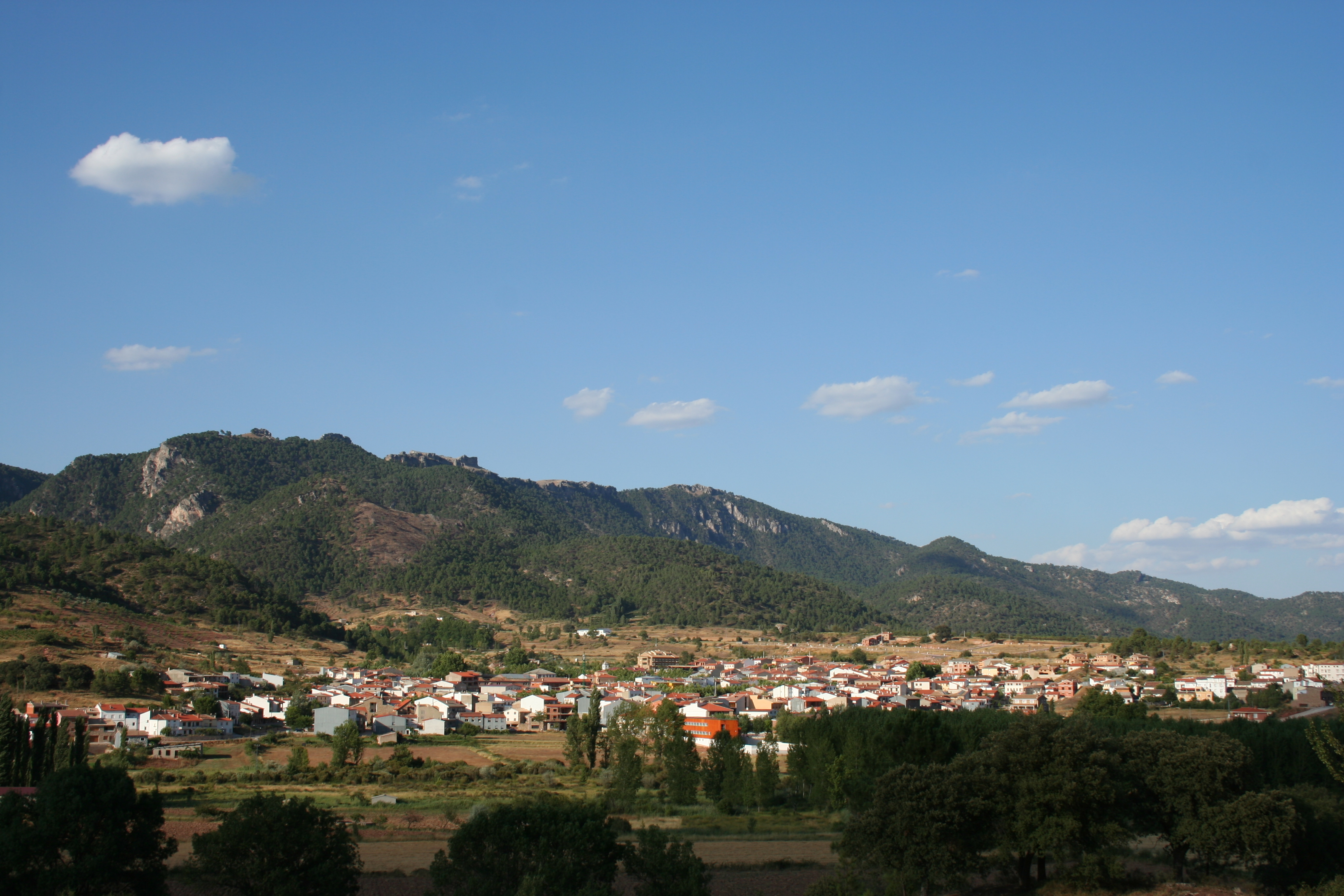
Riópar is a municipality in Albacete, Castile-La Mancha, Spain. It has a population of 1,498. References See also *Church of Espíritu Santo Church may refer to: Religion * Church (building), a building for Christian religious activities * Church (congregation), a local congregation of a Christian denomination * Church service, a formalized period of Christian communal worship * Chris ... Municipalities of the Province of Albacete {{Albacete-geo-stub ... [...More Info...] [...Related Items...] OR: [Wikipedia] [Google] [Baidu] |


