|
Segbwema
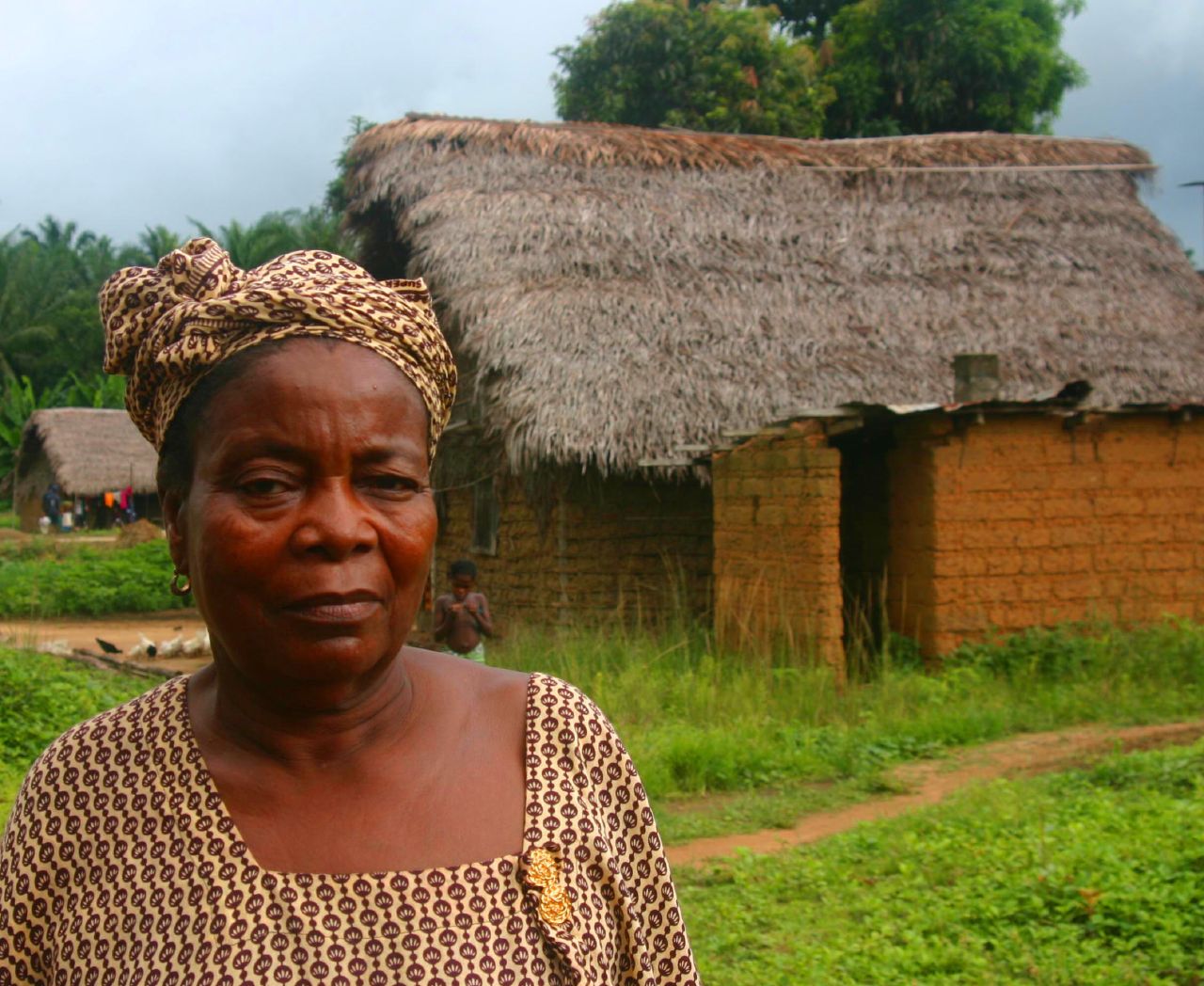
Segbwema is a town in Kailahun District in the Eastern Province, Sierra Leone, Eastern Province of Sierra Leone. The town is a major business and agricultural centre. Segbwema lies approximately 20 miles northeast of Kenema and about 225 miles south-east of Freetown (further by road). The population of Segbwema was 7,961 in the 2004 censusRepublic of Sierra Leone: 2004 Population and Housing Census: Analytical Report on Population Distribution, Migration and Urbanisation in Sierra Leone. ''Ibrahim Mohamed Sesay, Andrew A. Karam, Jinnah J. Ngobeh.'' Published November 2006. with a current estimate of 16,53 The population of Segbwema is ethnically diverse, though the Mende people make up the majority of the population. Segbwema is home to the Nixon Memorial Hospitahttp://friendsofnixon.org.uk/], one of the main hospitals in Kailahun District. The hospital serves Segbwema and its surrounding areas Geography Segbwema is a hilly town that is divided roughly in two by the small river ... [...More Info...] [...Related Items...] OR: [Wikipedia] [Google] [Baidu] |
Kailahun District
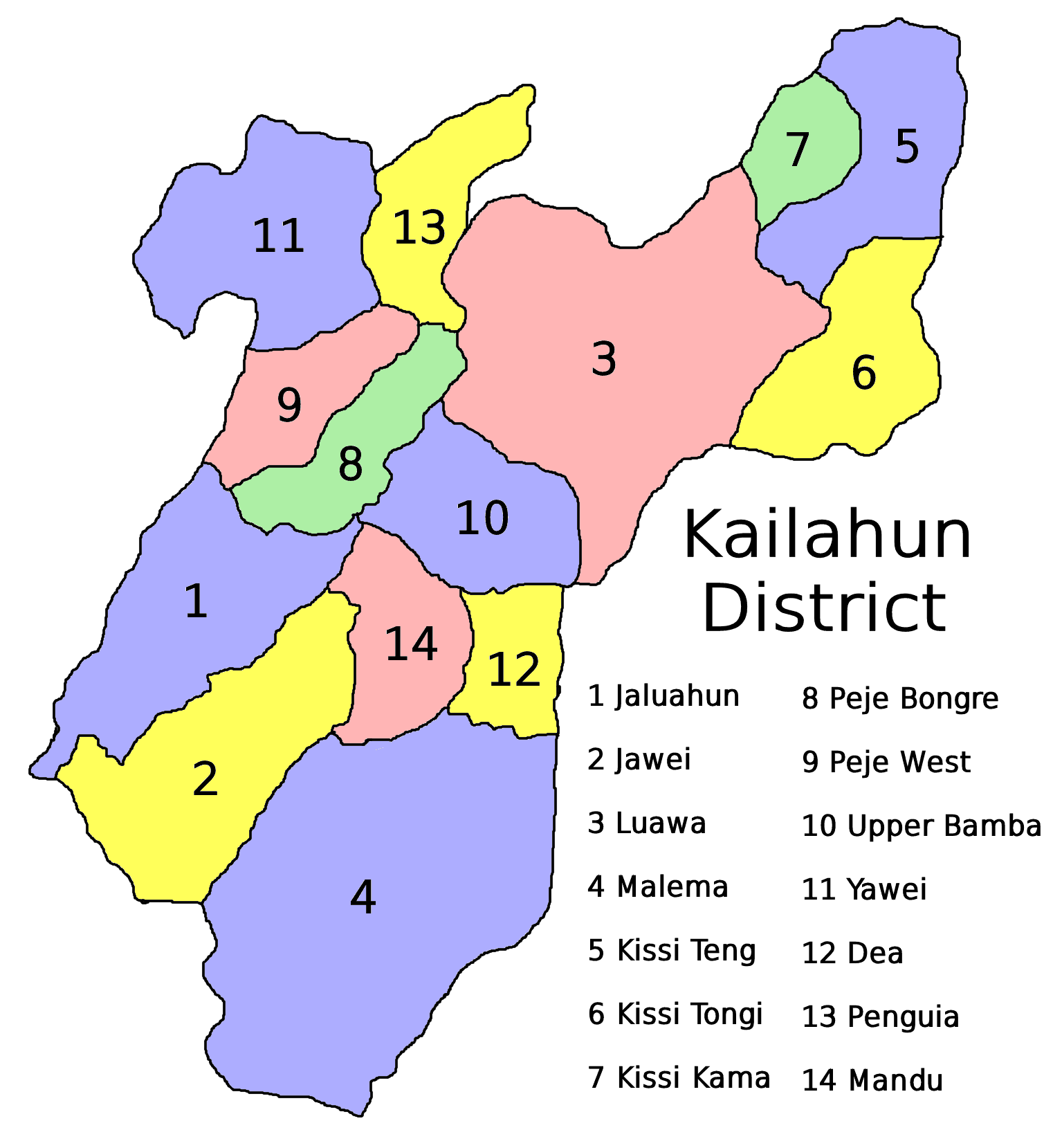
Kailahun District is a district in the Eastern Province of Sierra Leone. Its capital city, capital and largest city is the town of Kailahun. The second most populous city in the district is Segbwema. Other major towns in Kailahun District include Koindu, Pendembu and Daru. As of the 2015 census, the district had a population of 525,372. Kailahun District is subdivided into fourteen chiefdoms. The District of Kailahun borders Kenema District to the west, Kono District to the north, the Republic of Liberia to the east, and the Republic of Guinea to the north. The border of the district with Guinea is formed by a section of the Moa River., page 275. The total area of the district is . The population of Kailahun District is largely from the Mende ethnic group, though there are other ethnic groups with significant population in the district, including among them the Kissi, Mandingo and the Fula. The major economic activities in the district are farming, diamond mining and trade. ... [...More Info...] [...Related Items...] OR: [Wikipedia] [Google] [Baidu] |
Sierra Leone
Sierra Leone,)]. officially the Republic of Sierra Leone, is a country on the southwest coast of West Africa. It is bordered by Liberia to the southeast and Guinea surrounds the northern half of the nation. Covering a total area of , Sierra Leone has a tropical climate, with diverse environments ranging from savanna to rainforests. The country has a population of 7,092,113 as of the 2015 census. The capital and largest city is Freetown. The country is divided into five administrative regions, which are subdivided into Districts of Sierra Leone, 16 districts. Sierra Leone is a constitutional republic with a unicameral parliament and a directly elected executive president, president serving a five-year term with a maximum of two terms. The current president is Julius Maada Bio. Sierra Leone is a Secular state, secular nation with Constitution of Sierra Leone, the constitution providing for the separation of state and religion and freedom of conscience (which includes freedom of ... [...More Info...] [...Related Items...] OR: [Wikipedia] [Google] [Baidu] |
Provinces Of Sierra Leone
Sierra Leone is divided into four provinces (until 2017, three) and one Western Area; these are further divided into 16 districts (previously 14), and the districts are further divided into 190 (previously 149) chiefdoms. Provinces * Eastern Province * Northern Province * Southern Province *North West Province Areas *Western Area See also * ISO 3166-2:SL *Administrative divisions of Sierra Leone The subdivisions of Sierra Leone are as follows: ;First level: * 4 provinces * 1 area ;Second level: * 16 districts ;Third level: * 186 chiefdoms Provinces Sierra Leone is divided into 4 provinces and a Western Area for the capital Freeto ... References External links * {{DEFAULTSORT:Provinces Of Sierra Leone Subdivisions of Sierra Leone Sierra Leone, Provinces Sierra Leone 1 Provinces, Sierra Leone Sierra Leone geography-related lists ... [...More Info...] [...Related Items...] OR: [Wikipedia] [Google] [Baidu] |
Eastern Province, Sierra Leone
The Eastern Province is one of the four provinces of Sierra Leone. It covers an area of 15,553 km² and has a population of 1,641,012 (2015 census). Its capital and administrative centre is Kenema. Eastern Province, the centre of the country's diamond mining industry, is very mountainous and has two ranges, the Gola Hills and the Loma Mountains. Economy The Eastern Province is the heart of Sierra Leone's diamond mining activity. The precious stone was first discovered in around the 1930s, and has played a major part in the region's history ever since. Most diamonds are mined and exported by small local enterprises, numbering around 200,000 to 300,000; some of these are illegal, while many are officially sanctioned. Additionally, there are a handful of foreign countries carrying out larger scale diamond mining. Geography The Eastern Province borders the Nzérékoré Region of Guinea to the northeast, the Liberian counties of Lofa, Gbarpolu and Grand Cape Mount to the east an ... [...More Info...] [...Related Items...] OR: [Wikipedia] [Google] [Baidu] |
Districts Of Sierra Leone
The provinces of Sierra Leone are divided into 16 districts, as of July 2017. Previously, the country was divided into 14 districts. The Western Area is divided into two districts. Sierra Leone's capital Freetown is located in the Western Area of the country and its makes up the Western Area Urban District. One traditional leader from each district occupies a seat in Sierra Leone's parliament. Each one of Sierra Leone's sixteen administrative districts (with the exception of the Western Area Urban District) is governed by a directly elected district council headed by a council chairman. The national capital Freetown, which makes up the Western Area Urban District, and the other is the Western Area Rural with a main town known as Waterloo, is governed by a directly elected city council headed by a mayor. The districts are further divided into a total of 190 (prior to 2017, 149) chiefdoms, whose elected leaders provided most of local government from 1896 to 2004, when they were suppl ... [...More Info...] [...Related Items...] OR: [Wikipedia] [Google] [Baidu] |
Kenema
Kenema is the third largest city in Sierra Leone (after Freetown and Bo, Sierra Leone, Bo), and the largest city in the country's Eastern Province, Sierra Leone, Eastern Province. It is the capital of Kenema District and a major economic center of the Eastern Province. At the 2015 national census, Kenema had a population of 200,354. Kenema is located approximately 200 miles from Freetown, and south of Bo. Kenema is one of Sierra Leone's most ethnically diverse cities. Like most parts of Sierra Leone, the Krio language of the Sierra Leone Creole people is by far the most widely spoken language in Kenema. Kenema is governed by a directly elected city council, headed by a mayor in whom executive authority is vested, and who is responsible for the city's general management. The mayor and council members are elected every four years. Kenema's current mayor is Thomas Karimu Baio of the Sierra Leone People's Party Karimu Baio was elected mayor with 79.4% of the vote in the 2018 Kenema ... [...More Info...] [...Related Items...] OR: [Wikipedia] [Google] [Baidu] |
Freetown
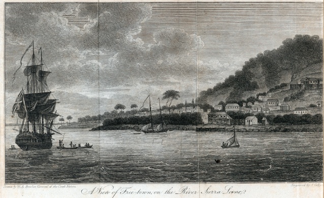
Freetown is the capital and largest city of Sierra Leone. It is a major port city on the Atlantic Ocean and is located in the Western Area of the country. Freetown is Sierra Leone's major urban, economic, financial, cultural, educational and political centre, as it is the seat of the Government of Sierra Leone. The population of Freetown was 1,055,964 at the 2015 census. The city's economy revolves largely around its harbour, which occupies a part of the estuary of the Sierra Leone River in one of the world's largest natural deep water harbours. Although the city has traditionally been the homeland of the Sierra Leone Creole people, the population of Freetown is ethnically, culturally, and religiously diverse. The city is home to a significant population of all of Sierra Leone's ethnic groups, with no single ethnic group forming more than 27% of the city's population. As in virtually all parts of Sierra Leone, the Krio language of the Sierra Leone Creole people is Freetown's ... [...More Info...] [...Related Items...] OR: [Wikipedia] [Google] [Baidu] |
Ethnically
An ethnic group or an ethnicity is a grouping of people who identify with each other on the basis of shared attributes that distinguish them from other groups. Those attributes can include common sets of traditions, ancestry, language, history, society, culture, nation, religion, or social treatment within their residing area. The term ethnicity is often times used interchangeably with the term nation, particularly in cases of ethnic nationalism, and is separate from the related concept of races. Ethnicity may be construed as an inherited or as a societally imposed construct. Ethnic membership tends to be defined by a shared cultural heritage, ancestry, origin myth, history, homeland, language, or dialect, symbolic systems such as religion, mythology and ritual, cuisine, dressing style, art, or physical appearance. Ethnic groups may share a narrow or broad spectrum of genetic ancestry, depending on group identification, with many groups having mixed genetic ancestry. Ethnic gr ... [...More Info...] [...Related Items...] OR: [Wikipedia] [Google] [Baidu] |
Mende People
The Mende are one of the two largest ethnic groups in Sierra Leone; their neighbours, the Temne people, constitute the largest ethnic group at 35.5% of the total population, which is slightly larger than the Mende at 31.2%. The Mende are predominantly found in the Southern Province and the Eastern Province. The Mende are mostly farmers and hunters. Some of the major cities with significant Mende populations include Bo, Kenema, Kailahun, and Moyamba. Like a majority of African nations, Sierra Leone's political parties are often tied to specific ethnic groups and have been dominated by the Mende, on the one hand, and the Temne and their long-time political allies, the Limba people (Sierra Leone), Limba, on the other. The Mende are known to typically support the Sierra Leone People's Party (SLPP), while the Temnes and Limbas are associated with the All People's Congress party (APC). History Regional warfare throughout the 19th century led to the capture and sale of many M ... [...More Info...] [...Related Items...] OR: [Wikipedia] [Google] [Baidu] |
Krio Language
Sierra Leonean Creole or Krio is an English-based creole language that is lingua franca and de facto national language spoken throughout the West African nation of Sierra Leone. Krio is spoken by 96 percent of the country's population, and it unites the different ethnic groups in the country, especially in their trade and social interaction with each other. Krio is the primary language of communication among Sierra Leoneans at home and abroad, and has also heavily influenced Sierra Leonean English. The language is native to the Sierra Leone Creole people, or Krios, a community of about 104,311 descendants of freed slaves from the West Indies, Canada, United States and the British Empire, and is spoken as a second language by millions of other Sierra Leoneans belonging to the country's indigenous tribes. English is Sierra Leone's official language, and Krio, despite its common use throughout the country, has no official status. Overview The Krio language is an offshoot of the lan ... [...More Info...] [...Related Items...] OR: [Wikipedia] [Google] [Baidu] |
Sierra Leone Creole People
The Sierra Leone Creole people ( kri, Krio people) are an ethnic group of Sierra Leone. The Sierra Leone Creole people are lineal descendant, descendants of freed African-American, Afro-Caribbean, and Liberated African slaves who settled in the Western Area of Sierra Leone between 1787 and about 1885. The colony was established by the British, supported by abolitionists, under the Sierra Leone Company as a place for freedmen. The settlers called their new settlement Freetown. Originally published by Longman & Dalhousie University Press (1976). Today, the Sierra Leone Creoles are 1.2 percent of the population of Sierra Leone. Like their Americo-Liberian neighbours and sister ethnic group in Liberia, the Creoles of Sierra Leone have varying degrees of European ancestry.Colonial Office Brief: CO554/2884, Note on the Attorney General's 'Note of the Supreme Court Judgement', 10 August 1960, ''op.cit.'' In Sierra Leone, some of the settlers intermarried with English colonial re ... [...More Info...] [...Related Items...] OR: [Wikipedia] [Google] [Baidu] |
Southern Province, Sierra Leone
The Southern Province is one of the four provinces of Sierra Leone. It covers an area of 19,694 km² and has a population of 1,438,572 (2015 census). It consists of four districts ( Bo District, Bo, Bonthe, Moyamba, and Pujehun). Its capital and administrative center is Bo, which is also the second largest and second most populated city in Sierra Leone after the nation's capital Freetown. The population of the southern province is largely from the Mende ethnic group. Geography Districts The province is divided into 4 districts. *Bo District, capital Bo *Bonthe District, capital Mattru Jong *Moyamba District, capital Moyamba *Pujehun District, capital Pujehun Borders Southern Province has the following borders: *Western Area: far northwest *North West Province: northwest * Northern Province: northeast * Eastern Province: east * Grand Cape Mount County, Liberia: southeast To the south and west of Southern Province is the Atlantic Ocean The Atlantic Ocean is the sec ... [...More Info...] [...Related Items...] OR: [Wikipedia] [Google] [Baidu] |


