|
Sebastián Vizcaíno Bay
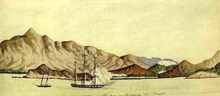
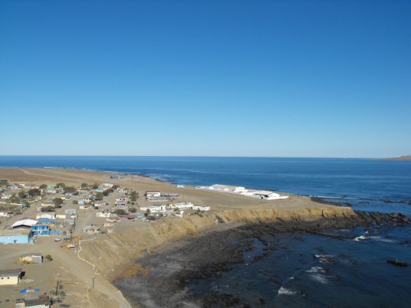
Sebastián Vizcaíno Bay (Spanish: ''Bahía de Sebastián Vizcaíno'') is a prominent bay along the west coast of the Baja California Peninsula in northwestern Mexico. It is named after explorer Sebastián Vizcaíno. Geography The bay lies on the Pacific Ocean coast of Baja California state in San Quintín Municipality, and of Baja California Sur state in Mulegé Municipality. Cedros Island and Isla Natividad are located within the bay, and west of the mainland Vizcaíno Peninsula. Sebastián Vizcaíno Bay is protected within the El Vizcaíno Biosphere Reserve The El Vizcaíno Biosphere Reserve, created in 1988, is located in Mulegé Municipality in northern Baja California Sur, at the center of the Baja California Peninsula between the Pacific Ocean and the Gulf of California. With an area of over ), .... See also * * ---- Bays of Mexico on the Pacific Ocean Landforms of Baja California Landforms of Baja California Sur Mulegé Municipality Cedros Island Prot ... [...More Info...] [...Related Items...] OR: [Wikipedia] [Google] [Baidu] |
Spanish Language
Spanish ( or , Castilian) is a Romance languages, Romance language of the Indo-European language family that evolved from colloquial Latin spoken on the Iberian peninsula. Today, it is a world language, global language with more than 500 million native speakers, mainly in the Americas and Spain. Spanish is the official language of List of countries where Spanish is an official language, 20 countries. It is the world's list of languages by number of native speakers, second-most spoken native language after Mandarin Chinese; the world's list of languages by total number of speakers, fourth-most spoken language overall after English language, English, Mandarin Chinese, and Hindustani language, Hindustani (Hindi-Urdu); and the world's most widely spoken Romance languages, Romance language. The largest population of native speakers is in Mexico. Spanish is part of the Iberian Romance languages, Ibero-Romance group of languages, which evolved from several dialects of Vulgar Latin in I ... [...More Info...] [...Related Items...] OR: [Wikipedia] [Google] [Baidu] |
Sebastián Vizcaíno
Sebastián Vizcaíno (1548–1624) was a Spanish soldier, entrepreneur, explorer, and diplomat whose varied roles took him to New Spain, the Baja California peninsula, the California coast and Asia. Early career Vizcaíno was born in 1548, in Extremadura, Crown of Castile (Spain). He saw military service in the Spanish invasion of Portugal during 1580–1583. Coming to New Spain in 1583, he sailed as a merchant on a Manila galleon to the Spanish East Indies in 1586–1589. In 1587, he was on board the ''Santa Ana'' as one of the merchants when Thomas Cavendish captured it, robbing him and others of their personal cargoes of gold. The Californias In 1593, the disputed concession for pearl fishing on the western shores of the Gulf of California was transferred to Vizcaíno. He succeeded in sailing with three ships to La Paz, Baja California Sur, in 1596. He gave this site (known to Hernándo Cortés as Santa Cruz) its modern name and attempted to establish a settlement. H ... [...More Info...] [...Related Items...] OR: [Wikipedia] [Google] [Baidu] |
Pacific Ocean
The Pacific Ocean is the largest and deepest of Earth's five oceanic divisions. It extends from the Arctic Ocean in the north to the Southern Ocean (or, depending on definition, to Antarctica) in the south, and is bounded by the continents of Asia and Oceania in the west and the Americas in the east. At in area (as defined with a southern Antarctic border), this largest division of the World Ocean—and, in turn, the hydrosphere—covers about 46% of Earth's water surface and about 32% of its total surface area, larger than Earth's entire land area combined .Pacific Ocean . '' Britannica Concise.'' 2008: Encyclopædia Britannica, Inc. The centers of both the |
Baja California
Baja California (; 'Lower California'), officially the Free and Sovereign State of Baja California ( es, Estado Libre y Soberano de Baja California), is a state in Mexico. It is the northernmost and westernmost of the 32 federal entities of Mexico. Before becoming a state in 1952, the area was known as the North Territory of Baja California (). It has an area of (3.57% of the land mass of Mexico) and comprises the northern half of the Baja California Peninsula, north of the 28th parallel, plus oceanic Guadalupe Island. The mainland portion of the state is bordered on the west by the Pacific Ocean; on the east by Sonora, the U.S. state of Arizona, and the Gulf of California; on the north by the U.S. state of California; and on the south by Baja California Sur. The state has an estimated population of 3,769,020 as of 2020, significantly higher than the sparsely populated Baja California Sur to the south, and similar to San Diego County, California, to its north. Over 75% of ... [...More Info...] [...Related Items...] OR: [Wikipedia] [Google] [Baidu] |
San Quintín Municipality
San Quintín is a municipality in the Mexican state of Baja California. Its municipal seat is located in the city of San Quintín, Baja California. According to the 2020 census, it had a population of 117,568 inhabitants. The municipality has an area of 32,883.93 km2 (12,696.55 sq mi). There are a few National Parks and a World Heritage Site at Bahia de Los Angeles. History On 27 February 2020 San Quintin separated from the municipality of Ensenada, and became Baja California's sixth municipality. Administrative divisions The municipality is divided into 8 delegations: # Camalú # Vicente Guerrero # San Quintín # El Rosario # El Marmol # Punta Prieta, Baja California, Punta Prieta # Bahía de los Ángeles # Villa Jesús María. Localities The municipality is made up of many localities. Its urban localities in 2010 were: * Lázaro Cárdenas, Baja California, Lázaro Cárdenas (16,294) * Vicente Guerrero Vicente Ramón Guerrero (; baptized August 10, 1 ... [...More Info...] [...Related Items...] OR: [Wikipedia] [Google] [Baidu] |
Baja California Sur
Baja California Sur (; 'South Lower California'), officially the Free and Sovereign State of Baja California Sur ( es, Estado Libre y Soberano de Baja California Sur), is the least populated state and the 31st admitted state of the 32 federal entities which comprise the 31 States of Mexico. It is also the ninth-largest Mexican state in terms of area. Before becoming a state on 8 October 1974, the area was known as the ''El Territorio Sur de Baja California'' ("South Territory of Lower California"). It has an area of , or 3.57% of the land mass of Mexico, and occupies the southern half of the Baja California Peninsula, south of the 28th parallel, plus the uninhabited Rocas Alijos in the Pacific Ocean. It is bordered to the north by the state of Baja California, to the west by the Pacific Ocean, and to the east by the Gulf of California. The state has maritime borders with Sonora and Sinaloa to the east, across the Gulf of California. The state is home to the tourist resorts ... [...More Info...] [...Related Items...] OR: [Wikipedia] [Google] [Baidu] |
Mulegé Municipality
Mulegé is a city in Mulegé Municipality, Baja California Sur, situated on the Gulf of California. Located on the Gulf of California, the population was 3,821 according to the Mexican census of 2010. History Indigenous peoples had lived in this area for thousands of years due to the abundance of water in the river valley. Extensive ancient cave paintings can be found in the nearby Sierra de Guadalupe mountains. In 1702, Jesuit Father Juan Maria de Salvatierra identified the valley of today's Mulegé as a place for a mission to the Indians. It was not until 1754 that Father Francisco Escalante started the construction of the mission, called Misión Santa Rosalía de Mulegé. Years later, many other Jesuit fathers came into today's area of Mulegé to bring the Catholic faith and convert the natives to Catholicism. The official name of the town is "Heroica Mulegé." This title is based on incidents during the Mexican-American War of 1846–1848. The Americans tried to occupy l ... [...More Info...] [...Related Items...] OR: [Wikipedia] [Google] [Baidu] |
Cedros Island
Cedros Island (''Isla de Cedros'', "island of cedars" in Spanish) is an island in the Pacific Ocean belonging to the state of Baja California, Mexico. The dry and rocky island had a population of 1,350 in 2005 and has an area of which includes the area of several small nearby islands. Cedros Island is mountainous, reaching a maximum elevation of . The economy is based on commercial fishing and salt production. Cedros has a distinctive flora and the traces of some of the earliest human beings in the New World. The ocean around the island is popular with sport fishermen. There was human presence of the island already about 11,000 years ago. The American Indian inhabitants when the island was first visited by Spanish explorers in the 16th century called it Huamalgua, the "Island of Fogs." The Indian inhabitants have been given the name Huamalgueños by modern day scholars. They were relocated to the mainland of Baja California by Jesuit missionaries in 1732 and ceased to exist a ... [...More Info...] [...Related Items...] OR: [Wikipedia] [Google] [Baidu] |
Isla Natividad
Isla Natividad is an island in the Pacific Ocean 6 km west off Punta Eugenia, the northwestern headland of the Mexican state of Baja California Sur. 200 meters off its northwestern end lies Roca María at , with an area of 0.074 km2. Isla Natividad is separated from the mainland at Punta Eugenia by Canal de Dewey (Dewey's Channel), and from Cedros Island (Baja California), which is 15 km to the north, by Canal de Keller (Canal Kellett). The island is part of Bahía Tortugas ''delegación'' of Mulegé municipality. It is 8.655 km2 in area. At the 2001 census, the island had a population of 384, centered in Natividad, a community of abalone, lobster, and clam fishermen, at the southeastern end (). Connection to the mainland is facilitated by an airstrip. There is a lighthouse in the northern part. Geography and ecology It has steep rocky shores fringed by rocks and kelp except for a small sandy beach towards the mainland. The island is barren and hilly wi ... [...More Info...] [...Related Items...] OR: [Wikipedia] [Google] [Baidu] |
El Vizcaíno Biosphere Reserve
The El Vizcaíno Biosphere Reserve, created in 1988, is located in Mulegé Municipality in northern Baja California Sur, at the center of the Baja California Peninsula between the Pacific Ocean and the Gulf of California. With an area of over ), . Retrieved 01-03-2015. it is the largest wildlife refuge in and borders the northern edge of the Protected Area of Flora and Fauna. History Native groups first inhabited this region over eleven thousand years ago. They may have been nomads who came overland from the north of the ...[...More Info...] [...Related Items...] OR: [Wikipedia] [Google] [Baidu] |
Bays Of Mexico On The Pacific Ocean
A bay is a recessed, coastal body of water that directly connects to a larger main body of water, such as an ocean, a lake, or another bay. A large bay is usually called a Gulf (geography), gulf, sea, sound (geography), sound, or bight (geography), bight. A cove is a small, circular bay with a narrow entrance. A fjord is an elongated bay formed by glacial action. A bay can be the estuary of a river, such as the Chesapeake Bay, an estuary of the Susquehanna River. Bays may also be nested within each other; for example, James Bay is an arm of Hudson Bay in Atlantic Canada, northeastern Canada. Some large bays, such as the Bay of Bengal and Hudson Bay, have varied marine geology. The land surrounding a bay often reduces the strength of winds and blocks waves. Bays may have as wide a variety of shoreline characteristics as other shorelines. In some cases, bays have Beaches in estuaries and bays, beaches, which "are usually characterized by a steep upper foreshore with a broad, fla ... [...More Info...] [...Related Items...] OR: [Wikipedia] [Google] [Baidu] |


.jpg)


_(20423086215).jpg)


