|
Seale And Sands
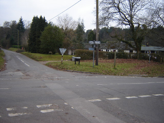
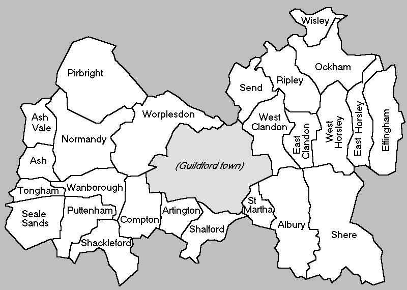
Seale and Sands is a civil parish in the Guildford District Council area of Surrey, England with a population of 887. The principal settlement is Seale; other places include Sandy Cross and The Sands. The Sands, including Sandy Cross forms the rest of the local government rural unit that provides certain minor services. Major services are provided by Guildford Borough Council and Surrey County Council. Across the old nucleus and mostly below the North Downs passes a short stretch of the long-distance footpath, the Pilgrims' Way (North Downs Way). Littleworth Cross is the southern sparsely inhabited junction settlement on minor woodland lanes, which has a heritage-listed park and garden which played host to an important event in the evolution of the work of international early 20th century homes and gardens designer Gertrude Jekyll. The west of the parish contains Farnham Golf Club. The parish is almost square, 2 miles east to west and north to south. It covers [...More Info...] [...Related Items...] OR: [Wikipedia] [Google] [Baidu] |
Civil Parish
In England, a civil parish is a type of administrative parish used for local government. It is a territorial designation which is the lowest tier of local government below districts and counties, or their combined form, the unitary authority. Civil parishes can trace their origin to the ancient system of ecclesiastical parishes, which historically played a role in both secular and religious administration. Civil and religious parishes were formally differentiated in the 19th century and are now entirely separate. Civil parishes in their modern form came into being through the Local Government Act 1894, which established elected parish councils to take on the secular functions of the parish vestry. A civil parish can range in size from a sparsely populated rural area with fewer than a hundred inhabitants, to a large town with a population in the tens of thousands. This scope is similar to that of municipalities in Continental Europe, such as the communes of France. However, ... [...More Info...] [...Related Items...] OR: [Wikipedia] [Google] [Baidu] |
North Downs Way
The North Downs Way National Trail is a long-distance path in southern England, opened in 1978. It runs from Farnham to Dover, past Guildford, Dorking, Merstham, Otford and Rochester, along the Surrey Hills Area of Outstanding Natural Beauty (AONB) and Kent Downs AONB. History Planning for a new Long Distance Path, as they were classified in 1949, began in Kent in 1950. After an extensive survey, it was agreed that a route on "a line which offers the best scenic qualities for the walker" along the ridge of the North Downs, rather than the Pilgrim's Way (which even in the 1960s was predominantly metalled road), was preferred. Working alongside Surrey County Council, plans were eventually submitted in 1966. The North Downs Way was officially designated by the then Minister of Housing and Local Government, Anthony Greenwood, on 14 July 1969, and opened in parts shortly afterwards, becoming fully open in 1978. At that time, it was long, of which were newly created public righ ... [...More Info...] [...Related Items...] OR: [Wikipedia] [Google] [Baidu] |
Pubs
A pub (short for public house) is a kind of drinking establishment which is licensed to serve alcoholic drinks for consumption on the premises. The term ''public house'' first appeared in the United Kingdom in late 17th century, and was used to differentiate private houses from those which were, quite literally, open to the public as "alehouses", "taverns" and "inns". By Georgian times, the term had become common parlance, although taverns, as a distinct establishment, had largely ceased to exist by the beginning of the 19th century. Today, there is no strict definition, but CAMRA states a pub has four characteristics:GLA Economics, Closing time: London's public houses, 2017 # is open to the public without membership or residency # serves draught beer or cider without requiring food be consumed # has at least one indoor area not laid out for meals # allows drinks to be bought at a bar (i.e., not only table service) The history of pubs can be traced to Roman taverns in B ... [...More Info...] [...Related Items...] OR: [Wikipedia] [Google] [Baidu] |
Buffer Zone
A buffer zone is a neutral zonal area that lies between two or more bodies of land, usually pertaining to countries. Depending on the type of buffer zone, it may serve to separate regions or conjoin them. Common types of buffer zones are demilitarized zones, border zones and certain restrictive easement zones and green belts. Such zones may be comprised by a sovereign state, forming a buffer state. Buffer zones have various purposes, politically or otherwise. They can be set up for a multitude of reasons, such as to prevent violence, protect the environment, shield residential and commercial zones from industrial accidents or natural disasters, or even isolate prisons. Buffer zones often result in large uninhabited regions that are themselves noteworthy in many increasingly developed or crowded parts of the world. Conservation For use in nature conservation, a buffer zone is often created to enhance the protection of areas under management for their biodiversity importance ... [...More Info...] [...Related Items...] OR: [Wikipedia] [Google] [Baidu] |
Office For National Statistics
The Office for National Statistics (ONS; cy, Swyddfa Ystadegau Gwladol) is the executive office of the UK Statistics Authority, a non-ministerial department which reports directly to the UK Parliament. Overview The ONS is responsible for the collection and publication of statistics related to the economy, population and society of the UK; responsibility for some areas of statistics in Scotland, Northern Ireland and Wales is devolved to the devolved governments for those areas. The ONS functions as the executive office of the National Statistician, who is also the UK Statistics Authority's Chief Executive and principal statistical adviser to the UK's National Statistics Institute, and the 'Head Office' of the Government Statistical Service (GSS). Its main office is in Newport near the United Kingdom Intellectual Property Office and Tredegar House, but another significant office is in Titchfield in Hampshire, and a small office is in London. ONS co-ordinates data collection wi ... [...More Info...] [...Related Items...] OR: [Wikipedia] [Google] [Baidu] |
United Kingdom Census 2011
A Census in the United Kingdom, census of the population of the United Kingdom is taken every ten years. The 2011 census was held in all countries of the UK on 27 March 2011. It was the first UK census which could be completed online via the Internet. The Office for National Statistics (ONS) is responsible for the census in England and Wales, the General Register Office for Scotland (GROS) is responsible for the census in Scotland, and the Northern Ireland Statistics and Research Agency (NISRA) is responsible for the census in Northern Ireland. The Office for National Statistics is the executive office of the UK Statistics Authority, a non-ministerial department formed in 2008 and which reports directly to Parliament. ONS is the UK Government's single largest statistical producer of independent statistics on the UK's economy and society, used to assist the planning and allocation of resources, policy-making and decision-making. ONS designs, manages and runs the census in England an ... [...More Info...] [...Related Items...] OR: [Wikipedia] [Google] [Baidu] |
Ordnance Survey
, nativename_a = , nativename_r = , logo = Ordnance Survey 2015 Logo.svg , logo_width = 240px , logo_caption = , seal = , seal_width = , seal_caption = , picture = , picture_width = , picture_caption = , formed = , preceding1 = , dissolved = , superseding = , jurisdiction = Great BritainThe Ordnance Survey deals only with maps of Great Britain, and, to an extent, the Isle of Man, but not Northern Ireland, which has its own, separate government agency, the Ordnance Survey of Northern Ireland. , headquarters = Southampton, England, UK , region_code = GB , coordinates = , employees = 1,244 , budget = , minister1_name = , minister1_pfo = , chief1_name = Steve Blair , chief1_position = CEO , agency_type = , parent_agency = , child1_agency = , keydocument1 = , website = , footnotes = , map = , map_width = , map_caption = Ordnance Survey (OS) is the national mapping agency for Great Britain. The agency's name indicates its original military purpose (se ... [...More Info...] [...Related Items...] OR: [Wikipedia] [Google] [Baidu] |
Gertrude Jekyll
Gertrude Jekyll ( ; 29 November 1843 – 8 December 1932) was a British horticulturist, garden designer, craftswoman, photographer, writer and artist. She created over 400 gardens in the United Kingdom, Europe and the United States, and wrote over 1000 articles for magazines such as ''Country Life'' and William Robinson's ''The Garden''. Jekyll has been described as "a premier influence in garden design" by British and American gardening enthusiasts. Early life Jekyll was born at 2 Grafton Street, Mayfair, London, the fifth of the seven children of Captain Edward Joseph Hill Jekyll, an officer in the Grenadier Guards, and his wife Julia, ''née'' Hammersley. In 1848 her family left London and moved to Bramley House in Surrey Surrey () is a ceremonial and non-metropolitan county in South East England, bordering Greater London to the south west. Surrey has a large rural area, and several significant urban areas which form part of the Greater London Built-up Area. . ... [...More Info...] [...Related Items...] OR: [Wikipedia] [Google] [Baidu] |
Listed Building
In the United Kingdom, a listed building or listed structure is one that has been placed on one of the four statutory lists maintained by Historic England in England, Historic Environment Scotland in Scotland, in Wales, and the Northern Ireland Environment Agency in Northern Ireland. The term has also been used in the Republic of Ireland, where buildings are protected under the Planning and Development Act 2000. The statutory term in Ireland is " protected structure". A listed building may not be demolished, extended, or altered without special permission from the local planning authority, which typically consults the relevant central government agency, particularly for significant alterations to the more notable listed buildings. In England and Wales, a national amenity society must be notified of any work to a listed building which involves any element of demolition. Exemption from secular listed building control is provided for some buildings in current use for worship, ... [...More Info...] [...Related Items...] OR: [Wikipedia] [Google] [Baidu] |
Pilgrims' Way
The Pilgrims' Way (also Pilgrim's Way or Pilgrims Way) is the historical route supposedly taken by pilgrims from Winchester, Hampshire, Winchester in Hampshire, England, to the shrine of Thomas Becket at Canterbury in Kent. This name, of comparatively recent coinage, is applied to a pre-existing ancient trackway dated by archaeological finds to 600–450 BC, but probably in existence since the Stone Age. The prehistoric route followed the "natural causeway" east to west on the southern slopes of the North Downs. The course was dictated by the natural geography: it took advantage of the contours, avoided the sticky clay of the land below but also the thinner, overlying "clay with flints" of the summits.Wright, Christopher John (1971). ''A Guide to the Pilgrims' Way.'' Constable and Co, London. In places a coexisting ridgeway (track), ridgeway and terrace way can be identified; the route followed would have varied with the season, but it would not drop below the upper ... [...More Info...] [...Related Items...] OR: [Wikipedia] [Google] [Baidu] |
Guildford (borough)
The Borough of Guildford is a local government district with borough status in Surrey, England. With around half of the borough's population, Guildford is its largest settlement and only town, and is the location of the council. The district was formed on 1 April 1974, under the Local Government Act 1972 by an amalgamation of the municipal borough of Guildford and Guildford Rural District. Functions Borough councillors and officers work on devolved issues such as parks, leisure, older residents' services, youth services, streetscene, refuse collection, planning and aspects of business and tourism; Surrey County Council deal with transport, publicly owned infrastructure planning and maintenance, education, social services and overall waste management. The Borough owns significant heritage assets that include monuments such as Guildford Castle, as well museums, art collections and civic regalia. Population Guildford has the second largest population of Surrey's eleven distri ... [...More Info...] [...Related Items...] OR: [Wikipedia] [Google] [Baidu] |
Nucleated Village
A nucleated village, or clustered settlement, is one of the main types of settlement pattern. It is one of the terms used by geographers and landscape historians to classify settlements. It is most accurate with regard to planned settlements: its concept is one in which the houses, even most farmhouses within the entire associated area of land, such as a parish, cluster around a central church, which is close to the village green. Other focal points can be substituted depending on cultures and location, such as a commercial square, circus, crescent, a railway station, park or a sports stadium. A clustered settlement contrasts with these: *dispersed settlement *linear settlement *polyfocal settlement, two (or more) adjacent nucleated villages that have expanded and merged to form a cohesive overall community A sub-category of clustered settlement is a planned village or community, deliberately established by landowners or the stated and enforced planning policy of local authoriti ... [...More Info...] [...Related Items...] OR: [Wikipedia] [Google] [Baidu] |


