|
Scotts Run
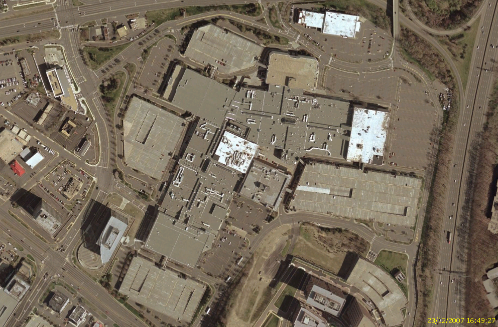
Scotts Run, formerly Scotts Run Station, is a mixed-use development featuring offices, apartments, hotels, retail stores, and restaurants in Tysons, Virginia being developed by Cityline Partners, LLC. Description Scotts Run is split into two sections, Scotts Run South and Scotts Run North, on both sides of Dolley Madison Boulevard between the interchanges with I-495 and SR 267 in the Tysons East section of Tysons, Virginia. It is adjacent to the Washington Metro McLean station on the south and east sides of the station. The development is also split from north to south by the Scotts Run Stream Valley Park. Expected square footage of the developments are on in Scotts Run North and on in Scotts Run South. Scotts Run Station will include up to two dozen buildings, seven in the north. and 17 in the south. Several of these building will be over in height History Originally proposed in 2011 as "Scotts Run Station", Scotts Run was intended to leverage the Tysons Comprehe ... [...More Info...] [...Related Items...] OR: [Wikipedia] [Google] [Baidu] |
Tysons, Virginia
Tysons, also known as Tysons Corner, is a census-designated place (CDP) in Fairfax County, Virginia, United States, developed from the corner of Chain Bridge Road ( SR 123) and the Leesburg Pike ( SR 7). Located in Northern Virginia between the community of McLean and the town of Vienna along the Capital Beltway (I-495), it lies within the Washington metropolitan area. Tysons is home to two super-regional shopping malls—Tysons Corner Center and Tysons Galleria—and the corporate and administrative headquarters of numerous companies such as Intelsat, Alarm.com, Booz Allen Hamilton, Capital One, DXC Technology, Freddie Mac, Gannett, Hilton Worldwide, ID.me and Tegna. As an unincorporated community, Tysons is Fairfax County's central business district and a regional commercial center. It has been characterized as a quintessential example of an edge city. The population was 26,374 as of the 2020 census. History Known originally as Peach Grove, the area received the designation Ty ... [...More Info...] [...Related Items...] OR: [Wikipedia] [Google] [Baidu] |
United States
The United States of America (U.S.A. or USA), commonly known as the United States (U.S. or US) or America, is a country primarily located in North America. It consists of 50 states, a federal district, five major unincorporated territories, nine Minor Outlying Islands, and 326 Indian reservations. The United States is also in free association with three Pacific Island sovereign states: the Federated States of Micronesia, the Marshall Islands, and the Republic of Palau. It is the world's third-largest country by both land and total area. It shares land borders with Canada to its north and with Mexico to its south and has maritime borders with the Bahamas, Cuba, Russia, and other nations. With a population of over 333 million, it is the most populous country in the Americas and the third most populous in the world. The national capital of the United States is Washington, D.C. and its most populous city and principal financial center is New York City. Paleo-Americ ... [...More Info...] [...Related Items...] OR: [Wikipedia] [Google] [Baidu] |
Mixed-use Development
Mixed-use is a kind of urban development, urban design, urban planning and/or a zoning type that blends multiple uses, such as residential, commercial, cultural, institutional, or entertainment, into one space, where those functions are to some degree physically and functionally integrated, and that provides pedestrian connections. Mixed-use development may be applied to a single building, a block or neighborhood, or in zoning policy across an entire city or other administrative unit. These projects may be completed by a private developer, (quasi-) governmental agency, or a combination thereof. A mixed-use development may be a new construction, reuse of an existing building or brownfield site, or a combination. Use in North America vs. Europe Traditionally, human settlements have developed in mixed-use patterns. However, with industrialization, governmental zoning regulations were introduced to separate different functions, such as manufacturing, from residential areas. Public ... [...More Info...] [...Related Items...] OR: [Wikipedia] [Google] [Baidu] |
Virginia State Route 123
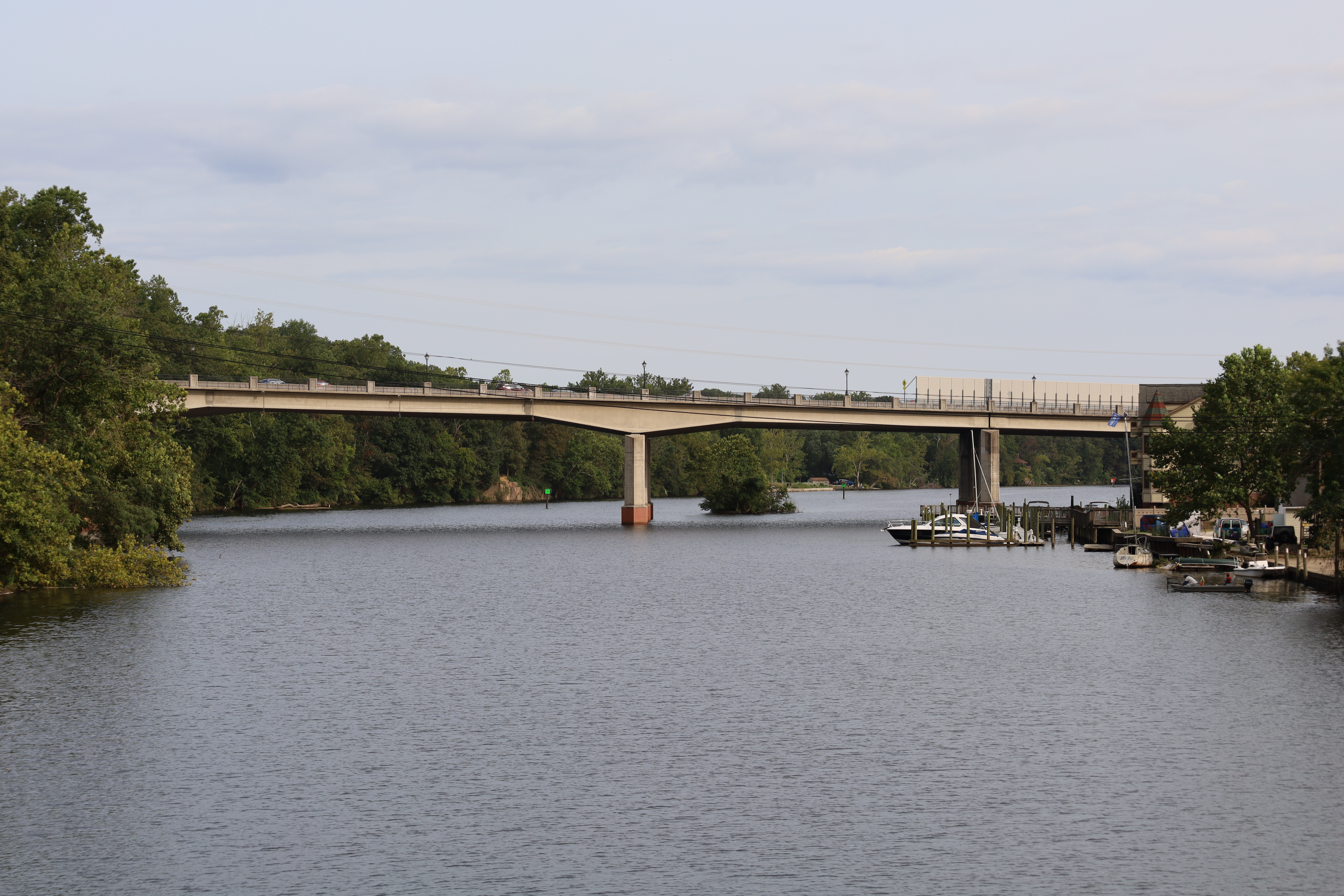
State Route 123 (SR 123) is a primary state highway in the U.S. state of Virginia. The state highway runs from U.S. Route 1 in Virginia, U.S. Route 1 (US 1) in Woodbridge, Virginia, Woodbridge north to the Chain Bridge (Potomac River), Chain Bridge across the Potomac River into Washington, D.C., Washington from Arlington, Virginia, Arlington. It goes by four local names. From its southern terminus to the Occoquan River Bridge, it is known as Gordon Boulevard. From the Occoquan River Bridge to the city of Fairfax, Virginia, Fairfax it is known as Ox Road. From Fairfax until it enters the Town of Vienna, it is known as Chain Bridge Road. Then, as it passes through the Town of Vienna, it is known as Maple Avenue. After leaving the Town of Vienna, the name reverts to Chain Bridge Road, and continues this way until the intersection with Interstate 495 (Capital Beltway), I-495 in Tysons, Virginia, Tysons. Between Tysons and the George Washington Memorial Parkway, it is known as Do ... [...More Info...] [...Related Items...] OR: [Wikipedia] [Google] [Baidu] |
Interstate 495 (Capital Beltway)
The Capital Beltway is a Interstate Highway in the Washington metropolitan area that surrounds Washington, D.C., the capital of the United States, and its inner suburbs in adjacent Maryland and Virginia. It is the basis of the phrase "inside the Beltway", used when referring to issues dealing with U.S. federal government and politics. The highway is signed as Interstate 495 (I-495) for its entire length, and its southern and eastern half runs concurrently with I-95. This circumferential roadway is located not only in the states of Maryland and Virginia, but also crosses briefly (for about ) through the District of Columbia, near the western end of the Woodrow Wilson Bridge over the Potomac River. The Beltway passes through Prince George's County and Montgomery County in Maryland, and Fairfax County and the independent city of Alexandria in Virginia. The Cabin John Parkway, a short connector between I-495 and the Clara Barton Parkway near the Potomac River along the Maryland� ... [...More Info...] [...Related Items...] OR: [Wikipedia] [Google] [Baidu] |
Virginia State Route 267
State Route 267 (SR 267) is a primary state highway in the US state of Virginia. It consists of two end-to-end toll roads – the Dulles Toll Road and Dulles Greenway – as well as the non-tolled Dulles Access Road, which lies in the median of Dulles Toll Road and then extends east to Falls Church. The combined roadway provides a toll road for commuting and a free road for access to Washington Dulles International Airport. The three sections are operated and maintained by separate agencies: Dulles Toll Road and Dulles Access Road are maintained by the Metropolitan Washington Airports Authority (MWAA); the Dulles Greenway is owned by TRIP II, a limited partnership, but is maintained by Atlas Arteria, an Australian company which owns the majority stake in the partnership. The Dulles Access Road's median hosts the Silver Line of the Washington Metro between the airport and Tysons. Dulles Access Road The Dulles Access Road is a four-lane, highway that runs between ... [...More Info...] [...Related Items...] OR: [Wikipedia] [Google] [Baidu] |
McLean Station
McLean station (preliminary names Tysons East, Tysons–McLean) is a Washington Metro station in Fairfax County, Virginia, on the Silver Line. The station is located in Tysons, with a McLean postal address. It began operation on July 26, 2014. Station layout Access to McLean station is provided by two entrances, one on each side of SR 123. The southern entrance connects to the northern entrance and mezzanine with a pedestrian bridge about above SR 123, with the mezzanine containing ticket machines and faregates. McLean has a simple island platform setup with two tracks. While there was some controversy about whether to build the rail through Tysons below ground or on elevated tracks, McLean is also elevated. No permanent car parking is planned at the station. A bus station and kiss-and-ride lot are on the southern side of SR 123. Bike parking is also available. The main platform has a height of at its east end and at its west end. History This station was one of 19 WMA ... [...More Info...] [...Related Items...] OR: [Wikipedia] [Google] [Baidu] |
Scotts Run, Tysons, Virginia Rendering From North
Scotts or Scott's may refer to: Businesses and brands * Scott's (restaurant), in London * Scott's Food & Pharmacy, an American supermarket chain * Scotts Miracle-Gro Company, an American multinational corporation * Scott's Porage Oats, a Scottish breakfast cereal * Scotts Shipbuilding and Engineering Company, a Scottish shipbuilding company 1711–1993 Places * Scotts, Michigan, U.S. * Scotts, North Carolina, U.S. * Scotts Valley, California, U.S. Other uses * Scotts (band), a Swedish music group * " The Scotts", a 2020 song by The Scotts (Travis Scott and Kid Cudi) See also * * * Scots (other) * Scotch (other) Scotch most commonly refers to: * Scotch (adjective), a largely obsolescent adjective meaning "of or from Scotland" **Scotch, old-fashioned name for the indigenous languages of the Scottish people: ***Scots language ("Broad Scotch") *** Scottish G ... * Scottish (other) * Scotts Bluff National Monument, in Nebraska, U.S. {{dab, geo ... [...More Info...] [...Related Items...] OR: [Wikipedia] [Google] [Baidu] |
Reston Town Center
Reston Town Center (also known as RTC and locally as simply, Town Center) is a mixed-use development featuring offices, apartments, retail stores, and restaurants in Reston, Virginia owned and managed primarily by Boston Properties. __NOTOC__ Description Reston Town Center is located east of Washington Dulles International Airport and west of Washington, D.C., just north of Exit 12 (Reston Parkway) of the Dulles Toll Road (VA-267). The Reston Town Center station of the Washington Metro Silver Line, which opened on November 15, 2022, serves the south end of the center. Reston Town Center is designed with open avenues and wide sidewalks. It is built around Fountain Square, a medium-sized open area between the surrounding shops. The main landmark in Fountain Square is Mercury Fountain, designed by Saint Clair Cemin. Directly in front of Mercury Fountain is Market Street, and across the street is the Pavilion. The Pavilion doubles as a covered open-air ice rink during the winter ... [...More Info...] [...Related Items...] OR: [Wikipedia] [Google] [Baidu] |
Fairfax County Board Of Supervisors
The Fairfax County Board of Supervisors, sometimes abbreviated as FCBOS, is the governing body of Fairfax County; a county of over a million in Northern Virginia. The board has nine districts, and one at-large district which is always occupied by the Chair. Members may serve unlimited number of four-year terms, as there are no term limits. The Board usually meets two Tuesdays every month in the Board Auditorium at the Fairfax County Government Center near Fairfax, Virginia. Members of the public are invited to attend these meetings. The chair presides at all meetings, and has all of the powers of a member, including one vote. The chair, however, does not have the power to veto legislation. The Vice Chair is elected amongst the members annually at the first meeting of the year in January. Powers and responsibilities Within the limits set forth by the Virginia General Assembly, the Board is responsible for setting local tax policy, approving land use plans and appointing officials ... [...More Info...] [...Related Items...] OR: [Wikipedia] [Google] [Baidu] |
MITRE
The mitre (Commonwealth English) (; Greek: μίτρα, "headband" or "turban") or miter (American English; see spelling differences), is a type of headgear now known as the traditional, ceremonial headdress of bishops and certain abbots in traditional Christianity. Mitres are worn in the Catholic Church, Eastern Orthodox Church, Oriental Orthodox Churches, the Anglican Communion, some Lutheran churches, for important ceremonies, by the Metropolitan of the Malankara Mar Thoma Syrian Church, and also, in the Catholic Church, all cardinals, whether or not bishops, and some Eastern Orthodox archpriests. Etymology μίτρα, ''mítra'' ( Ionic μίτρη, ''mítrē'') is Greek, and means a piece of armour, usually a metal guard worn around the waist and under a cuirass, as mentioned in Homer's Iliad. In later poems, it was used to refer to a headband used by women for their hair; and a sort of formal Babylonian headdress, as mentioned by Herodotus ('' Histories'' 1.195 and 7.90 ... [...More Info...] [...Related Items...] OR: [Wikipedia] [Google] [Baidu] |
Skanska
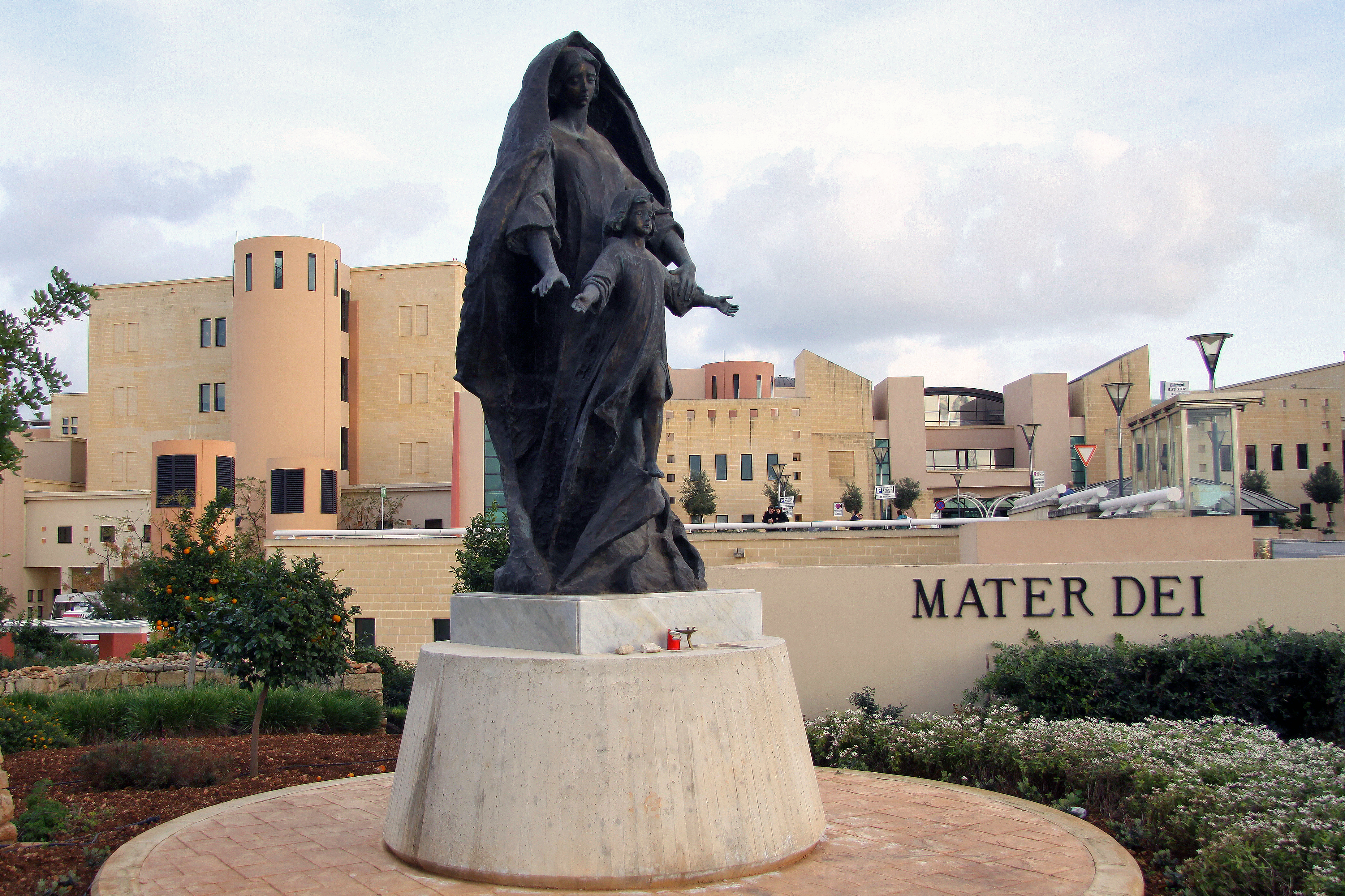
Skanska AB () is a multinational construction and development company based in Sweden. Skanska is the fifth-largest construction company in the world according to ''Construction Global'' magazine. Notable Skanska projects include renovation of the United Nations Headquarters, the World Trade Center Transportation Hub project, Moynihan Train Hall, 30 St Mary Axe, MetLife Stadium, Mater Dei Hospital, among others. History Aktiebolaget Skånska Cementgjuteriet (Scanian Cement Casting Ltd) was established in Malmö, Sweden, in 1887 by Rudolf Fredrik Berg and started by manufacturing concrete products.Skanska: History It quickly diversified into a construction company and within ten years the company received its first international order. The company played an important role in building Sweden's infrastructure i ... [...More Info...] [...Related Items...] OR: [Wikipedia] [Google] [Baidu] |

.jpg)

.jpg)

