|
Schwarzhäusern
Schwarzhäusern is a municipality in the Oberaargau administrative district in the canton of Bern in Switzerland. History Originally it was known as ''Rufshausen'' and that name was first recorded in 1100 as ''Rudolfshausen''. It was first mentioned in 1677 as ''Schwartzenheüßeren'', a name that would become Schwarzhäusern. Several mesolithic or neolithic flint tools have been found in sites around the municipality. There are several early medieval graves at Klebenrain. By the 13th century, a bridge was built over the Aare river, which connected the village to regional center of power in Aarwangen. In 1432, Aarwangen came under Bernese power and brought neighboring Schwarzhäusern with it. For a few decades, Bern and Solothurn shared authority over the parish of Niederbipp, which included Schwarzhäusern. However, in 1463, it came completely under Bern's control. Following the 1798 French invasion, under the Helvetic Republic it became part of the District of Wangen. ... [...More Info...] [...Related Items...] OR: [Wikipedia] [Google] [Baidu] |
Oberaargau (administrative District)
The Oberaargau is the region that encompasses the upper watershed of the Aar River in the canton of Bern (canton), Bern in Switzerland. On the north, lie the Jura Mountains, and on the south the hills leading to the Emmental. Administratively, the Oberaargau forms a district within the ''region'' Emmental-Oberaargau of the canton of Bern. Historically (until 2009), the Oberaargau comprised the two administrative districts of Switzerland, districts of Wangen (district), Wangen and Aarwangen (district), Aarwangen. Geography It lies in the extreme northeast corner of the canton and includes the districts of Aarwangen (district), Aarwangen and Wangen (district), Wangen, and part of the district of Trachselwald (district), Trachselwald. It is surrounded by the cantons of Solothurn (canton), Solothurn, Aargau, and Lucerne (canton), Lucerne. It is connected to the rest of the canton of Bern only in the south, where it borders on the Emmenthal. The Oberaargau lies on the Swiss Plateau b ... [...More Info...] [...Related Items...] OR: [Wikipedia] [Google] [Baidu] |
Oberaargau
The Oberaargau is the region that encompasses the upper watershed of the Aar River in the canton of Bern in Switzerland. On the north, lie the Jura Mountains, and on the south the hills leading to the Emmental. Administratively, the Oberaargau forms a district within the ''region'' Emmental-Oberaargau of the canton of Bern. Historically (until 2009), the Oberaargau comprised the two administrative districts of Wangen and Aarwangen. Geography It lies in the extreme northeast corner of the canton and includes the districts of Aarwangen and Wangen, and part of the district of Trachselwald. It is surrounded by the cantons of Solothurn, Aargau, and Lucerne. It is connected to the rest of the canton of Bern only in the south, where it borders on the Emmenthal. The Oberaargau lies on the Swiss Plateau between the large population centers of Bern and Zürich and has therefore become a major thoroughfare for traffic running both east and west and north and south. The Aar River travers ... [...More Info...] [...Related Items...] OR: [Wikipedia] [Google] [Baidu] |
Wynau
Wynau is a municipality in the Oberaargau administrative district in the canton of Bern in Switzerland. History Wynau is first mentioned in 1201 as ''Wimenouwe''. Evidence of prehistoric settlements at Wynau include; individual Bronze Age items along the Aare river, the remains of a Roman manor at Hoferrain-Birchi and a sunken Roman ship with a rudder in the Aare. Possibly medieval graves have been found on the Höchi along with clearly medieval graves at Aegerten. During the 13th and 14th centuries, the main landholders were the local nobles, the Lord of Bechburg, the Count of Falkenstein and the Knight of Aarwangen. Over time St. Urban's Abbey acquired these nobles' land in Wynau. In 1406, Bern acquired land and rights in the region from the Counts of Kyburg. With that foothold, in 1413 Bern negotiated an agreement with St. Urban's which brought Wynau and the upper Murgenthal (Murg valley) under Bernese control. Following the 1798 French invasion, under the Helvetic ... [...More Info...] [...Related Items...] OR: [Wikipedia] [Google] [Baidu] |
Aarwangen
Aarwangen is a village and a municipality in the Oberaargau administrative district in the canton of Bern in Switzerland. History Aarwangen is first mentioned in 1255 as ''villa Arwangen''. Aarwangen grew from a fortified toll crossing over the river Aare, in a region where there were few realistic crossing places. The first bridge was built in the early years of the 13th century, and by the 16th century this had developed into a covered wooden bridge and customs post, defended by a castle. During the 18th century, by road, and the 19th century, by rail, this became a busy and important trade route for the movement of goods between the western and eastern parts of Switzerland. The municipal coat of arms is black and silver. It represents the seal of the Aarwangen family, who built the first Aarwangen Castle on the southern riverbank, though the present structure dates back only to the Landvögte, or Bailiffs, of Bern in the 16th and 17th centuries. When the Aarwangen family d ... [...More Info...] [...Related Items...] OR: [Wikipedia] [Google] [Baidu] |
Bannwil
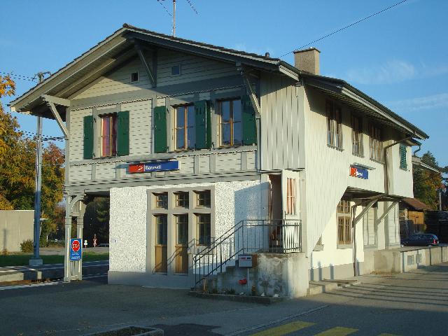
Bannwil is a municipality in the Oberaargau administrative district in the canton of Bern in Switzerland. History Bannwil is first mentioned in 1262 as ''Benwile''. The area around Bannwil was inhabited during the Hallstatt era and the Early Middle Ages. During the Middle Ages, Bannwil was part of the low court of Aarwangen and the district court of Buchsgau. These two courts began to come under Bernese control in 1432 and by 1463 were completely part of Bern. Over the following centuries, Bannwil alternated between the bailiwicks of Bipp and Aarwangen. Finally in the 17th century it was finally assigned to Aarwangen. The village church was first mentioned in 1304. The current building was built in 1522 and rebuilt in 1679. In 1320 the church was given by the Count of Frohburg to the monastery of Schöntal. In 1528 control of the church was given to Bern. In 1904 a hydroelectric power plant opened in Bannwil. It was replaced in 1970 by the Aarekraftwerk-Bannwil hydr ... [...More Info...] [...Related Items...] OR: [Wikipedia] [Google] [Baidu] |
Niederbipp
Niederbipp is a municipality in the Oberaargau administrative district in the canton of Bern in Switzerland. On 1 January 2020 the former municipality of Wolfisberg merged into Niederbipp. History Niederbipp is first mentioned in 968 as ''Pippa''. In 1302 it was mentioned as ''Nider-Bippe''. Geography Niederbipp has an area, , of . Of this area, or 47.2% is used for agricultural purposes, while or 37.7% is forested. Of the rest of the land, or 15.2% is settled (buildings or roads) and or 0.3% is unproductive land.Swiss Federal Statistical Office-Land Use Statistics 2009 data accessed 25 March 2010 Of the built up area, industrial buildings made up 1.9% of the total area while housing and buildings made up 5.9% and transportation infrastructu ... [...More Info...] [...Related Items...] OR: [Wikipedia] [Google] [Baidu] |
Kestenholz
Kestenholz is a municipality in the district of Gäu in the canton of Solothurn in Switzerland. History Kestenholz is first mentioned around 1280-1340 as ''Im Kestenholtz''. In 1323 it was mentioned as ''ze obern Kappellon''. Geography Kestenholz has an area, , of . Of this area, or 52.4% is used for agricultural purposes, while or 38.1% is forested. Of the rest of the land, or 9.4% is settled (buildings or roads), or 0.2% is either rivers or lakes.Swiss Federal Statistical Office-Land Use Statistics 2009 data accessed 25 March 2010 Of the built up area, housing and buildings made up 4.7% and transportation infrastructure made up 2.9%. Out of the forested land, all of the forested land area is covered with heavy forests. Of the agricultural l ... [...More Info...] [...Related Items...] OR: [Wikipedia] [Google] [Baidu] |
Wolfwil
Wolfwil is a municipality in the district of Gäu in the canton of Solothurn in Switzerland. History Wolfwil is first mentioned in 1266 as ''Wolfwiler''. Geography Wolfwil has an area, , of . Of this area, or 54.2% is used for agricultural purposes, while or 28.3% is forested. Of the rest of the land, or 13.4% is settled (buildings or roads), or 3.9% is either rivers or lakes and or 0.1% is unproductive land.Swiss Federal Statistical Office-Land Use Statistics 2009 data accessed 25 March 2010 Of the built up area, industrial buildings made up 1.5% of the total area while housing and buildings made up 7.4% and transportation infrastructure made up 3.3%. Out of the forested land, 27.0% of the total land area is heavily forested and 1.3% is cover ... [...More Info...] [...Related Items...] OR: [Wikipedia] [Google] [Baidu] |
Education In Switzerland
The education system in Switzerland is very diverse, because the constitution of Switzerland delegates the authority for the school system mainly to the cantons. The Swiss constitution sets the foundations, namely that primary school is obligatory for every child and is free in state schools and that the confederation can run or support universities. The minimum age for primary school is about six years in all cantons but Obwalden, where it is five years and three months. After primary schools, the pupils split up according to their abilities and intentions of career paths. Roughly 25% of all students attend lower and upper secondary schools leading, normally after 12 school years in total to the federal recognized matura or an academic Baccalaureate which grants access to all universities. The other students split in two or more school-types, depending on the canton, differing in the balance between theoretical and practical education. It is obligatory for all children to atte ... [...More Info...] [...Related Items...] OR: [Wikipedia] [Google] [Baidu] |
Gymnasium (school)
''Gymnasium'' (and variations of the word) is a term in various European languages for a secondary school that prepares students for higher education at a university. It is comparable to the US English term '' preparatory high school''. Before the 20th century, the gymnasium system was a widespread feature of educational systems throughout many European countries. The word (), from Greek () 'naked' or 'nude', was first used in Ancient Greece, in the sense of a place for both physical and intellectual education of young men. The latter meaning of a place of intellectual education persisted in many European languages (including Albanian, Bulgarian, Estonian, Greek, German, Hungarian, the Scandinavian languages, Dutch, Polish, Czech, Serbo-Croatian, Macedonian, Slovak, Slovenian and Russian), whereas in other languages, like English (''gymnasium'', ''gym'') and Spanish (''gimnasio''), the former meaning of a place for physical education was retained. School structure Be ... [...More Info...] [...Related Items...] OR: [Wikipedia] [Google] [Baidu] |
Hamlet (place)
A hamlet is a human settlement that is smaller than a town or village. Its size relative to a Parish (administrative division), parish can depend on the administration and region. A hamlet may be considered to be a smaller settlement or subdivision or satellite entity to a larger settlement. The word and concept of a hamlet has roots in the Anglo-Norman settlement of England, where the old French ' came to apply to small human settlements. Etymology The word comes from Anglo-Norman language, Anglo-Norman ', corresponding to Old French ', the diminutive of Old French ' meaning a little village. This, in turn, is a diminutive of Old French ', possibly borrowed from (West Germanic languages, West Germanic) Franconian languages. Compare with modern French ', Dutch language, Dutch ', Frisian languages, Frisian ', German ', Old English ' and Modern English ''home''. By country Afghanistan In Afghanistan, the counterpart of the hamlet is the Qila, qala (Dari language, Dari: ... [...More Info...] [...Related Items...] OR: [Wikipedia] [Google] [Baidu] |
_050.jpg)
_029.jpg)


