|
Scar Peak
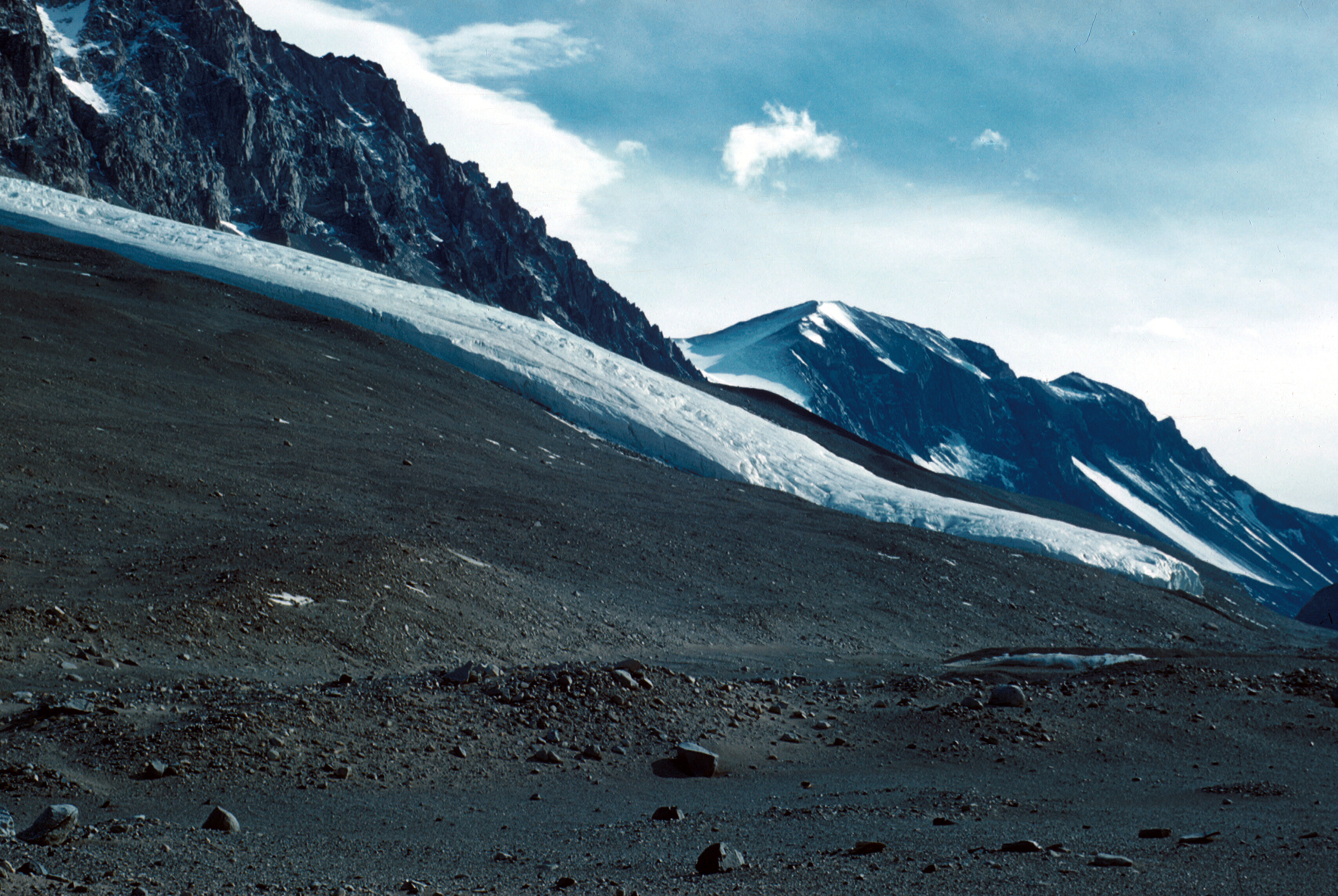
Scar Peak () is a peak ( high) surmounting the northern wall of Taylor Valley immediately east of the Lacroix Glacier in Victoria Land. It was named by the New Zealand Geographic Board in 1998 after the Scientific Committee on Antarctic Research The Scientific Committee on Antarctic Research (SCAR) is an interdisciplinary body of the International Science Council (ISC). SCAR coordinates international scientific research efforts in Antarctica, including the Southern Ocean. SCAR's scien ... (SCAR). References Mountains of Victoria Land {{VictoriaLand-geo-stub ... [...More Info...] [...Related Items...] OR: [Wikipedia] [Google] [Baidu] |
Taylor Valley
Taylor Valley is the southernmost of the three large McMurdo Dry Valleys in the Transantarctic Mountains, Victoria Land, Antarctica, located west of McMurdo Sound at approximately . The valley extends from Taylor Glacier in the west to McMurdo Sound at Explorers Cove at the northwest head of New Harbour in the east and is about long. It was once occupied by the receding Taylor Glacier, from which it derives its name. Taylor Valley contains Lake Bonney in the west (inward), and Lake Fryxell in the east (coastward), and Lake Hoare, Lake Chad, Lake Popplewell, Mummy Pond and Parera Pond close together between the two. Further east of Lake Bonney is Pearse Valley. Taylor Valley is separated from Wright Valley in the north by Asgard Range, and from Ferrar Glacier in the south by Kukri Hills. At its southernmost end, Taylor Valley becomes Quinn Gully, a mainly ice-free gully, which descends between MacDonald Hills and Hjorth Hill to Explorers Cove in New Harbour. It was named by ... [...More Info...] [...Related Items...] OR: [Wikipedia] [Google] [Baidu] |
Lacroix Glacier
Lacroix Glacier () is a glacier between Suess Glacier and Matterhorn Glacier, which flows southeast into Taylor Valley in Victoria Land, Antarctica. It was mapped by the British Antarctic Expedition, 1910–13, under Robert Falcon Scott Captain Robert Falcon Scott, , (6 June 1868 – c. 29 March 1912) was a British Royal Navy officer and explorer who led two expeditions to the Antarctic regions: the ''Discovery'' expedition of 1901–1904 and the ill-fated ''Terra Nov ..., and named after Alfred Lacroix, as was Mount Lacroix. References Glaciers of McMurdo Dry Valleys {{McMurdoDryValleys-glacier-stub ... [...More Info...] [...Related Items...] OR: [Wikipedia] [Google] [Baidu] |
Victoria Land
Victoria Land is a region in eastern Antarctica which fronts the western side of the Ross Sea and the Ross Ice Shelf, extending southward from about 70°30'S to 78°00'S, and westward from the Ross Sea to the edge of the Antarctic Plateau. It was discovered by Captain James Clark Ross in January 1841 and named after Queen Victoria. The rocky promontory of Minna Bluff is often regarded as the southernmost point of Victoria Land, and separates the Scott Coast to the north from the Hillary Coast of the Ross Dependency to the south. The region includes ranges of the Transantarctic Mountains and the McMurdo Dry Valleys (the highest point being Mount Abbott in the Northern Foothills), and the flatlands known as the Labyrinth. The Mount Melbourne is an active volcano in Victoria Land. Early explorers of Victoria Land include James Clark Ross and Douglas Mawson. In 1979, scientists discovered a group of 309 meteorites in Antarctica, some of which were found near the Allan Hills in ... [...More Info...] [...Related Items...] OR: [Wikipedia] [Google] [Baidu] |
New Zealand Geographic Board
The New Zealand Geographic Board Ngā Pou Taunaha o Aotearoa (NZGB) was established by the New Zealand Geographic Board Act 1946, which has since been replaced by the New Zealand Geographic Board (Ngā Pou Taunaha o Aotearoa) Act 2008. Although an independent institution, it is responsible to the Minister for Land Information. The board has authority over geographical and hydrographic names within New Zealand and its territorial waters. This includes the naming of small urban settlements, localities, mountains, lakes, rivers, waterfalls, harbours and natural features and may include researching local Māori names. It has named many geographical features in the Ross Sea region of Antarctica. It has no authority to alter street names (a local body responsibility) or the name of any country. The NZGB secretariat is part of Toitū Te Whenua Land Information New Zealand (LINZ) and provides the board with administrative and research assistance and advice. The New Zealand Geograph ... [...More Info...] [...Related Items...] OR: [Wikipedia] [Google] [Baidu] |
Scientific Committee On Antarctic Research
The Scientific Committee on Antarctic Research (SCAR) is an interdisciplinary body of the International Science Council (ISC). SCAR coordinates international scientific research efforts in Antarctica, including the Southern Ocean. SCAR's scientific work is administered through several discipline-themed ''science groups''. The organisation has observer status at, and provides independent advice to Antarctic Treaty Consultative Meetings, and also provides information to other international bodies such as the Intergovernmental Panel on Climate Change (IPCC) and the United Nations Framework Convention on Climate Change (UNFCCC). History At the International Council of Scientific Unions (ICSU)’s Antarctic meeting held in Stockholm from 9–11 September 1957, it was agreed that a committee should be created to oversee scientific research in Antarctica. At the time there were 12 nations actively conducting Antarctic research and they were each invited to nominate one delegate to ... [...More Info...] [...Related Items...] OR: [Wikipedia] [Google] [Baidu] |


