|
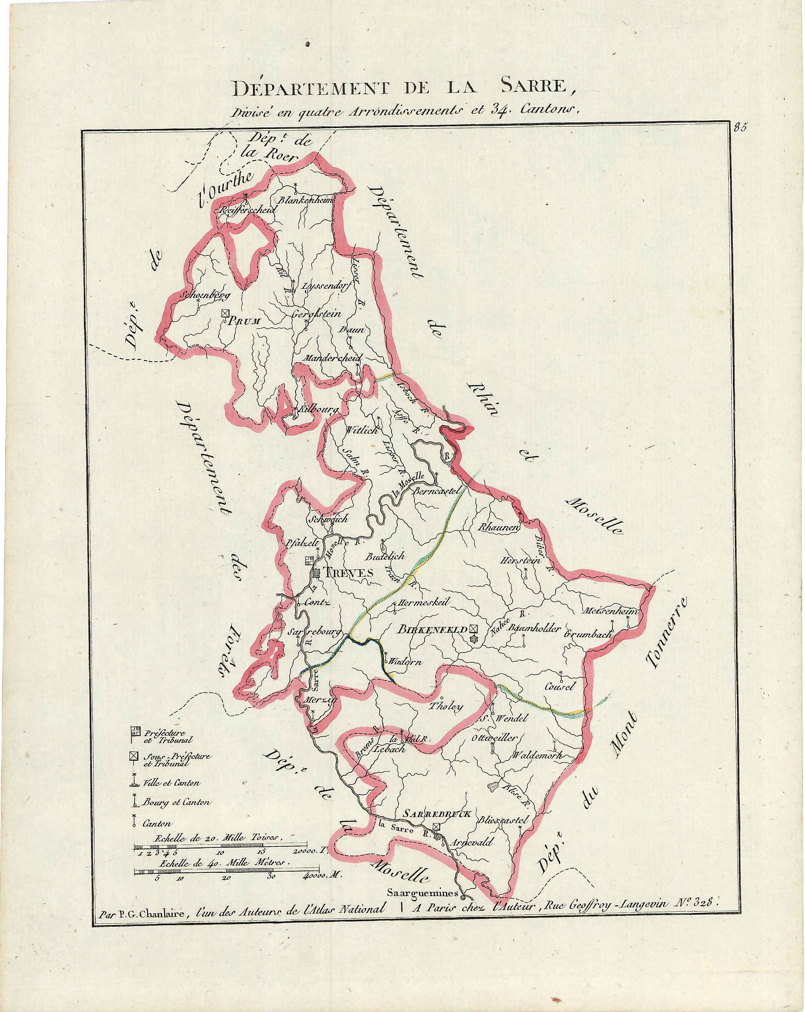
Sarre (department)
Sarre was a department in the First French Republic and First French Empire. Its territory is now part of Germany and Belgium. Named after the river Saar (french: Sarre), it was created in 1798 in the aftermath of the Treaty of Campo Formio of 18 October 1797 which ceded the left bank of the Rhine to France. Despite its name it covered a much larger area than the historical area known as the Saarland. Prior to the French occupation of the area from 1793 onward, its territory had been divided between the Electorate of Trier, Nassau-Saarbrücken and the Electorate of the Palatinate (the Duchy of Zweibrücken and the County of Veldenz). Its territory is now part of the German states Rhineland-Palatinate and Saarland as well as a tiny adjacent section of the Belgian province of Liège. Its capital was Trier. The department was subdivided into the following arrondissements and cantons (situation in 1812): [...More Info...] [...Related Items...] OR: [Wikipedia] [Google] [Baidu] |
Liège (province)
Liège ( , , ; wa, Lîdje ; nl, Luik ; german: Lüttich ) is a major city and municipality of Wallonia and the capital of the Belgian province of Liège. The city is situated in the valley of the Meuse, in the east of Belgium, not far from borders with the Netherlands (Maastricht is about to the north) and with Germany (Aachen is about north-east). In Liège, the Meuse meets the river Ourthe. The city is part of the '' sillon industriel'', the former industrial backbone of Wallonia. It still is the principal economic and cultural centre of the region. The municipality consists of the following districts: Angleur, , Chênée, , Grivegnée, Jupille-sur-Meuse, Liège, Rocourt, and Wandre. In November 2012, Liège had 198,280 inhabitants. The metropolitan area, including the outer commuter zone, covers an area of 1,879 km2 (725 sq mi) and had a total population of 749,110 on 1 January 2008. [...More Info...] [...Related Items...] OR: [Wikipedia] [Google] [Baidu] |
Grumbach
Grumbach is an ''Ortsgemeinde'' – a municipality belonging to a ''Verbandsgemeinde'', a kind of collective municipality – in the Kusel district in Rhineland-Palatinate, Germany. It belongs to the ''Verbandsgemeinde'' of Lauterecken-Wolfstein. Geography Location The municipality lies in the Western Palatinate on the river Glan’s left bank, roughly 2 km up the Schwinzbach, which empties into the Glan at the biggest valley cut on the reach of the Glan between Niederalben and Meisenheim. Here, the valley broadens out, and the mountain spur being formed by the mouth of the Hundsgraben affords the site some solid ground. The settled centre is found exclusively on the south slope at an elevation of 235 m above sea level. The valley is bordered in the south by the 354 m-high so-called Hellenwald (forest) and in the north by the 338 m-high Roman road. The outlying centre of Windhof, lying 3 km to the northeast an elevation of 340 m above sea level of ... [...More Info...] [...Related Items...] OR: [Wikipedia] [Google] [Baidu] |
Baumholder
Baumholder () is a town in the Birkenfeld district in Rhineland-Palatinate, Germany, in the Westrich, an historic region that encompasses areas in both Germany and France. The town of Baumholder is the administrative seat of the like-named ''Verbandsgemeinde'', a state-recognised tourism resort and, according to state planning, a middle centre. Geography Location Baumholder lies between the Hunsrück to the north and the North Palatine Uplands to the south, right on a height that marks the latter's northern boundary. This area is also known as the Westrich. Baumholder lies roughly 10 km south of Idar-Oberstein. The countryside around Baumholder is marked by many meadows, fields and woodlands, both broadleaf and mixed. A great part of the Baumholder Troop Drilling Ground abutting the town serves as a refuge for many plant and animal species that have become rare, for example the common kingfisher, the lynx and the badger, some of which are on the IUCN Red List. Climat ... [...More Info...] [...Related Items...] OR: [Wikipedia] [Google] [Baidu] |
Birkenfeld
Birkenfeld () is a town and the district seat of the Birkenfeld district in southwest Rhineland-Palatinate, Germany. It is also the seat of the like-named ''Verbandsgemeinde''. The town itself has approximately 7,000 inhabitants. Geography Location The town lies in the Nahegebiet (Nahe area), to the north of the namesake river, on the edge of the ''Naturpark Saar-Hunsrück''. Birkenfeld lies roughly 13 km southwest of Idar-Oberstein and 12 km northwest of Baumholder. Neighbouring municipalities Clockwise from the north, these are Gollenberg, Elchweiler, Schmißberg, Rimsberg, Dienstweiler, Ellweiler, Dambach, Brücken, Buhlenberg and Ellenberg. History The name Birkenfeld has its origin in an old German dialect, Old Frankish. It means something rather like “at the field with the birches” (it is directly cognate with the English words “birch field”). From the name's Frankish roots it can be inferred that today's town arose on a spot where there was qu ... [...More Info...] [...Related Items...] OR: [Wikipedia] [Google] [Baidu] |
Wittlich
The town of Wittlich (; Moselle Franconian: ''Wittlech'') is the seat of the Bernkastel-Wittlich district in Rhineland-Palatinate, Germany. Its historic town centre and the beauty of the surrounding countryside make the town a centre for tourism in southwest Germany. Wittlich is the middle centre for a feeder area of 56 municipalities in the Eifel and Moselle area with a population of roughly 64,000. With some 18,000 inhabitants, Wittlich is the biggest town between Trier and Koblenz and the fourth biggest between Mainz and the Belgian border. Geography Location The town lies in the South Eifel on the River Lieser in a side valley of the Moselle on the northern edge of the Wittlich Depression. This stretch of country is bounded in the west by the low mountains of the Moselle Eifel and in the east by the Moselle valley. Constituent communities Wittlich's '' Stadtteile'' or ''Ortsbezirke'' (districts or suburbs), besides the main centre, also called Wittlich, are Bombogen, ... [...More Info...] [...Related Items...] OR: [Wikipedia] [Google] [Baidu] |
Schweich
Schweich is a town in the Trier-Saarburg district, in Rhineland-Palatinate, Germany. It is situated on the river Moselle, approx. northeast of Trier. Schweich is the seat of the ''Verbandsgemeinde'' ("collective municipality") Schweich an der Römischen Weinstraße. Twin towns — sister cities Schweich is town twinning, twinned with: * Marsannay-la-Côte, France * Portishead, Somerset, United Kingdom * Krokowa, Poland * Renesse, Netherlands * Murialdo, Italy Personalities * Stefan Andres (1906–1970), writer, see also Stefan Andres Society, Stefan Andres Prize * Gabriele Pauli (born 1957), former politician * Katarina Barley (born 1968), politician (SPD) References External links Trier-Saarburg {{TrierSaarburg-geo-stub ... [...More Info...] [...Related Items...] OR: [Wikipedia] [Google] [Baidu] |
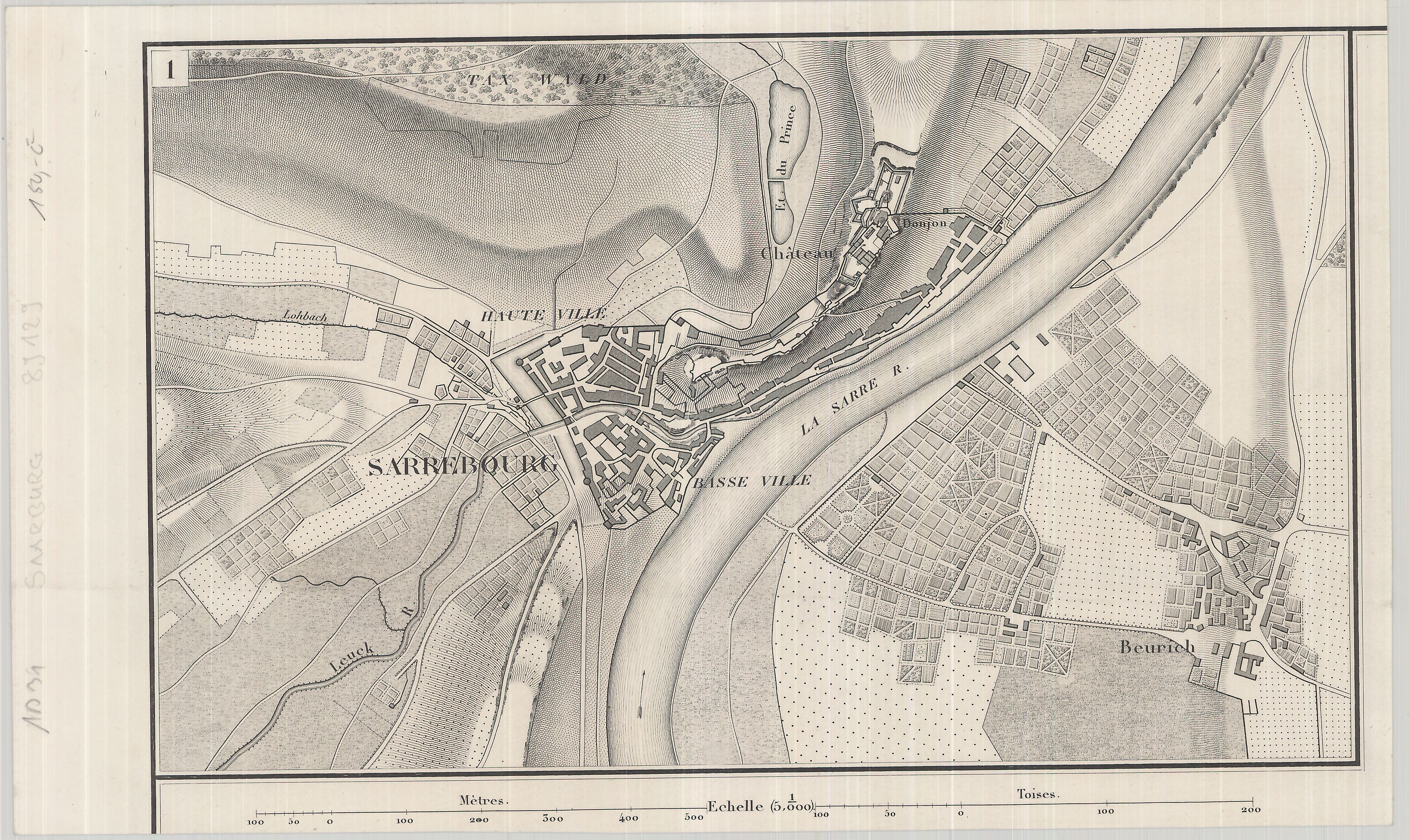
Saarburg
Saarburg (, ) is a city of the Trier-Saarburg district, in the state of Rhineland-Palatinate, Germany, on the banks of the river Saar in the hilly country a few kilometers upstream from the Saar's junction with the Moselle. Now known as a tourist attraction, the river Leuk flows into the town center and makes a spectacular drop of some 60 feet before joining the larger Saar that bisects the town. The waterfall is the result of a 13th-century project to redirect the Leuk through the city center. Saarburg is the seat of the ''Verbandsgemeinde'' ("collective municipality") Saarburg-Kell. The area around Saarburg is noted for the cultivation of Riesling grapes. History The history of the city begins with the construction of the now-ruined castle by Graf Siegfried of Luxembourg in 964. It received its town charter in 1291. The city has a bell foundry, the Glockengießerei Mabilion, which has been in operation since the 1770s, and the only one in Germany that produces bronze bells. ... [...More Info...] [...Related Items...] OR: [Wikipedia] [Google] [Baidu] |
Konz
Konz ( la, link=no, Contionacum) is a city in the Trier-Saarburg district, in Rhineland-Palatinate, Germany. It is situated at the confluence of the rivers Saar and Moselle, approx. 8 km southwest of Trier. Konz is the seat of the ''Verbandsgemeinde'' ("collective municipality") Konz. The following villages are part of the municipality Konz: *Canet *Filzen *Hamm *Karthaus *Könen *Krettnach *Kommlingen *Niedermennig *Oberemmel *Obermennig *Roscheid *Windah History From 18 July 1946 until 6 June 1947 Konz, in its then municipal boundary, formed part of the Saar Protectorate. Population Museums * Roscheider Hof Open Air Museum The Roscheider Hof Open Air Museum is the open-air museum and Folklore Museum of the Greater SaarLorLux Region. The museum is situated in Konz, Germany, on the Saar and Mosel rivers, 8 km west of Trier and 30 km east of Luxembourg. It ... References External links Websites in Konz Towns in Rhineland-Palatinate Trier ... [...More Info...] [...Related Items...] OR: [Wikipedia] [Google] [Baidu] |
Büdlich
Büdlich is an ''Ortsgemeinde'' – a municipality belonging to a ''Verbandsgemeinde'', a kind of collective municipality – in the Bernkastel-Wittlich district in Rhineland-Palatinate, Germany. Geography Location The municipality, one of the district's smaller ones, lies in the Hunsrück. It belongs to the ''Verbandsgemeinde'' of Thalfang am Erbeskopf, whose seat is in the municipality of Thalfang. Constituent communities Büdlich's ''Ortsteile'' are Büdlich and Büdlicherbrück. History After the French Revolution, the Rhine’s left bank, and thereby Büdlich too, were ceded to France. Through a law from 26 March 1798, the French abolished feudal rights in their zone of occupation. After French rule ended, the village passed in 1814 to the Kingdom of Prussia. North of Büdlich, the Dhron Valley Dam (''Dhrontalsperre'') was built in 1911. Since 1947, it has been part of the then newly founded state of Rhineland-Palatinate. Politics Municipal council The mun ... [...More Info...] [...Related Items...] OR: [Wikipedia] [Google] [Baidu] |
Bernkastel-Kues
Bernkastel-Kues () is a town on the Middle Moselle in the Bernkastel-Wittlich district in Rhineland-Palatinate, Germany. It is a well-known winegrowing centre. The town is a state-recognized health resort (''Erholungsort''), seat of the ''Verbandsgemeinde'' of Bernkastel-Kues and birthplace of one of the most famous German polymaths, the mediaeval churchman and philosopher Nikolaus von Kues (Cusanus). Geography Location Bernkastel-Kues lies in the Moselle valley, roughly from Trier. The greatest elevation is the ''Olymp'' (415 m above sea level), and the lowest point (107 m above sea level) lies on the Moselle's banks. The municipal area totals 23 657 101 m2, of which 7 815 899 m2 is used for agriculture, thereby making Bernkastel-Kues one of the Middle Moselle's biggest towns by land area. Neighbouring municipalities Clockwise from the north, these are Graach, Longkamp, Monzelfeld, Veldenz, Mülheim, Lieser, Maring-Noviand, Pl ... [...More Info...] [...Related Items...] OR: [Wikipedia] [Google] [Baidu] |


