|
Sans Souci Valley
Sans Souci Valley was the name of a valley in San Francisco, California, in the area corresponding to present day's Lower Haight and Duboce Triangle neighborhoods. This valley once allowed excess storm water to flow from Buena Vista Hill and Lone Mountain (where the University of San Francisco is today), through the Panhandle, to the area located near Duboce Park, along the path today known to cyclists as The Wiggle. The creek was not a surface creek in the dune region except as overflow. The valley’s name, French for "without worry," comes from the Sanssouci Palace built by the Prussian monarch Frederick the Great in Potsdam, Germany. Background Sans Souci Valley used to be the easiest walking route connecting Mission Dolores and the Presidio. Hubert Howe Bancroft's ''History of California'', evaluates an assertion by Mariano Vallejo (in Vallejo's ''Discurso Histórico'' of October 8, 1876) that the former "Lake Dolores" (or "Laguna de los Dolores") was located "in Sans So ... [...More Info...] [...Related Items...] OR: [Wikipedia] [Google] [Baidu] |
San Francisco
San Francisco (; Spanish language, Spanish for "Francis of Assisi, Saint Francis"), officially the City and County of San Francisco, is the commercial, financial, and cultural center of Northern California. The city proper is the List of California cities by population, fourth most populous in California and List of United States cities by population, 17th most populous in the United States, with 815,201 residents as of 2021. It covers a land area of , at the end of the San Francisco Peninsula, making it the second most densely populated large U.S. city after New York City, and the County statistics of the United States, fifth most densely populated U.S. county, behind only four of the five New York City boroughs. Among the 91 U.S. cities proper with over 250,000 residents, San Francisco was ranked first by per capita income (at $160,749) and sixth by aggregate income as of 2021. Colloquial nicknames for San Francisco include ''SF'', ''San Fran'', ''The '', ''Frisco'', and '' ... [...More Info...] [...Related Items...] OR: [Wikipedia] [Google] [Baidu] |
Frederick The Great
Frederick II (german: Friedrich II.; 24 January 171217 August 1786) was King in Prussia from 1740 until 1772, and King of Prussia from 1772 until his death in 1786. His most significant accomplishments include his military successes in the Silesian wars, his re-organisation of the Prussian Army, the First Partition of Poland, and his patronage of the arts and the Enlightenment. Frederick was the last Hohenzollern monarch titled King in Prussia, declaring himself King of Prussia after annexing Polish Prussia from the Polish–Lithuanian Commonwealth in 1772. Prussia greatly increased its territories and became a major military power in Europe under his rule. He became known as Frederick the Great (german: links=no, Friedrich der Große) and was nicknamed "Old Fritz" (german: links=no, "Der Alte Fritz"). In his youth, Frederick was more interested in music and philosophy than in the art of war, which led to clashes with his authoritarian father, Frederick William I of Prussia. ... [...More Info...] [...Related Items...] OR: [Wikipedia] [Google] [Baidu] |
Hydrography Of The San Francisco Bay Area
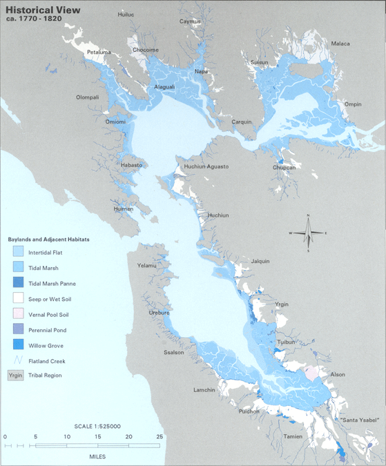
The Hydrography of the San Francisco Bay Area is a complex network of watersheds, marshes, rivers, creeks, reservoirs, and bays predominantly draining into the San Francisco Bay and Pacific Ocean. Bays The largest bodies of water in the Bay Area are the San Francisco Bay, San Pablo Bay, and Suisun Bay. The San Francisco Bay is one of the largest bays in the world. Many inlets on the edges of the three major bays are designated as bays in their own right, such as Richardson Bay, San Rafael Bay, Grizzly Bay, and San Leandro Bay. Nearby bays along the Pacific Coast include Bodega Bay, Tomales Bay, Drakes Bay, Bolinas Bay, and Half Moon Bay. Rivers The largest rivers are the Sacramento and San Joaquin Rivers, which drain into the Sacramento-San Joaquin River Delta and thence to Suisun Bay. Other major rivers of the North Bay are the Napa River, the Petaluma River, the Gualala River, and the Russian River; the former two drain into San Pablo Bay, the latter two into the Pac ... [...More Info...] [...Related Items...] OR: [Wikipedia] [Google] [Baidu] |
Mission Creek
Mission Creek (from Spanish: ''misión'') is a river in San Francisco, California. Once navigable from the Mission Bay inland to the vicinity of Mission Dolores, where several smaller creeks converged to form it, Mission Creek has long since been largely culverted. Its only remaining portion above-ground is the Mission Creek Channel which drains into China Basin.Museum of California Watershed map, access date December 31, 2008 The two Indian villages of Chutchui and Sitlintac were located on Mission Creek. Background Declared by the state legislature in 1854 to be a navigable stream, it retains the designation today, even t ...[...More Info...] [...Related Items...] OR: [Wikipedia] [Google] [Baidu] |
Hubert Howe Bancroft
Hubert Howe Bancroft (May 5, 1832 – March 2, 1918) was an American historian and ethnologist who wrote, published and collected works concerning the western United States, Texas, California, Alaska, Mexico, Central America and British Columbia. Early life He was born on May 5, 1832, in Granville, Ohio, to Azariah Ashley Bancroft and Lucy Howe Bancroft. The Howe and Bancroft families originally hailed from the New England states of Vermont and Massachusetts, respectively.Men and Women of America: A Biographical Dictionary of Contemporaries'' New York: L.R. Hamersly and Co., 1910; p. 87. Bancroft's parents were staunch abolitionists and the family home was a station on the Underground Railroad. Bancroft attended the Doane Academy in Granville for a year, and he then became a clerk in his brother-in-law's bookstore in Buffalo, New York. Move to California In March 1852, Bancroft was provided with an inventory of books to sell and was sent to the booming California city of San ... [...More Info...] [...Related Items...] OR: [Wikipedia] [Google] [Baidu] |
Presidio Of San Francisco
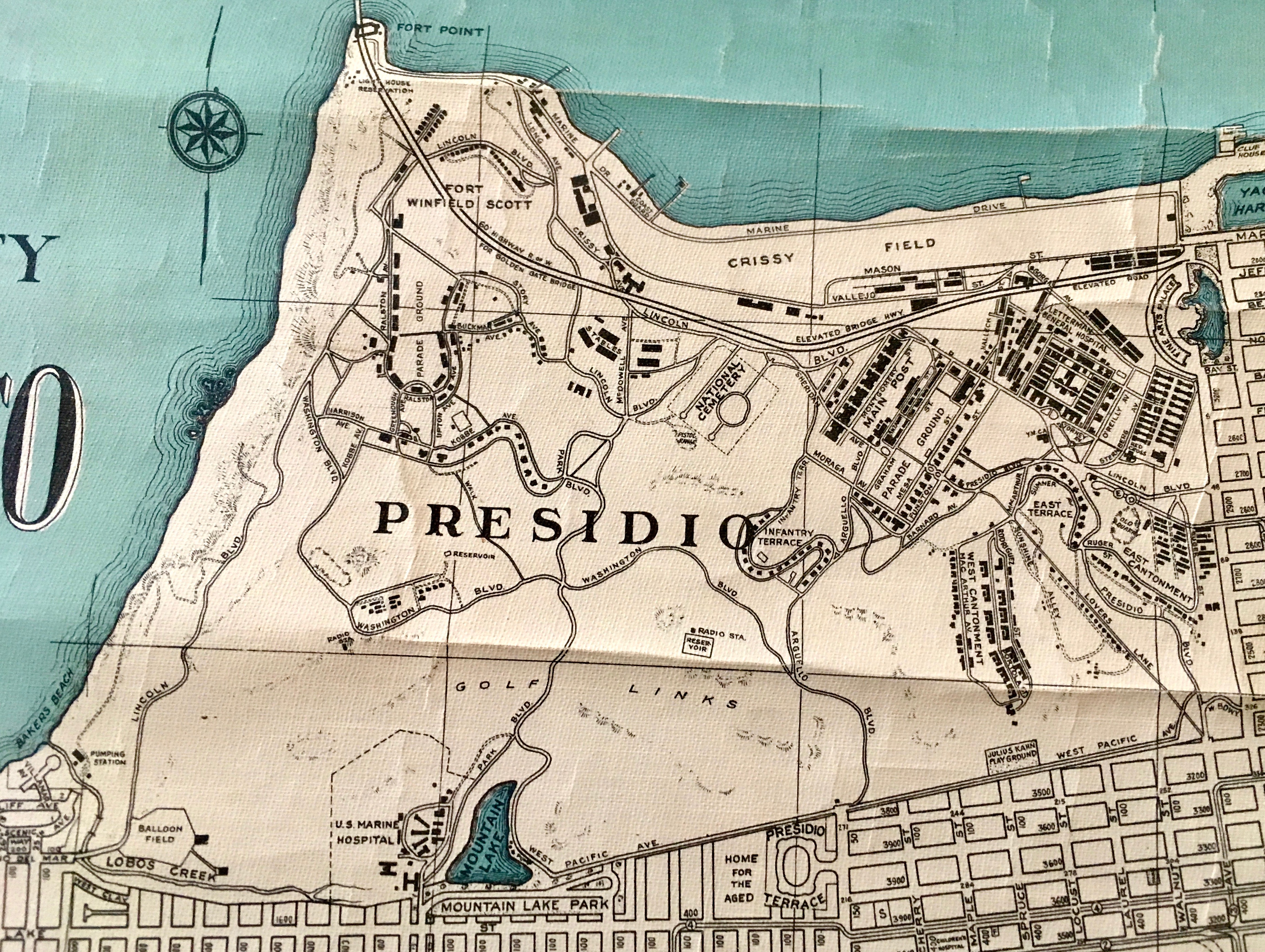
The Presidio of San Francisco (originally, El Presidio Real de San Francisco or The Royal Fortress of Saint Francis) is a park and former U.S. Army post on the northern tip of the San Francisco Peninsula in San Francisco, California, and is part of the Golden Gate National Recreation Area. It had been a fortified location since September 17, 1776, when New Spain established the presidio to gain a foothold in Alta California and the San Francisco Bay. It passed to Mexico in 1820, which in turn passed it to the United States in 1848. As part of a 1989 military reduction program under the Base Realignment and Closure ( BRAC) process, Congress voted to end the Presidio's status as an active military installation of the U.S. Army. On October 1, 1994, it was transferred to the National Park Service, ending 219 years of military use and beginning its next phase of mixed commercial and public use. In 1996, the United States Congress created the Presidio Trust to oversee and manage the in ... [...More Info...] [...Related Items...] OR: [Wikipedia] [Google] [Baidu] |
Mission Dolores Park
Mission Dolores Park, often abbreviated to Dolores Park, is a city park in San Francisco, California. It is located two blocks south of Mission Dolores at the western edge of the Mission District. Dolores Park is bounded by 18th Street on the north, 20th Street on the south, Dolores Street on the east and Church Street on the west. The northern end of Dolores Park is located directly across the street from Mission High School (San Francisco), Mission High School. On its eastern, southern and western sides, the park is surrounded by residential buildings of two to four stories, in various architectural styles. South of the park is a hillside area known as "Dolores Heights," while The Castro, San Francisco, The Castro neighborhood is located a short distance to the west. The park's topography is characterized by a strong slope from the southwest down to the northeast, offering an unobstructed northeast-looking view of downtown San Francisco, in particular from the southwest corner. D ... [...More Info...] [...Related Items...] OR: [Wikipedia] [Google] [Baidu] |
Potsdam, Germany
Potsdam () is the capital and, with around 183,000 inhabitants, largest city of the German state of Brandenburg. It is part of the Berlin/Brandenburg Metropolitan Region. Potsdam sits on the River Havel, a tributary of the Elbe, downstream of Berlin, and lies embedded in a hilly morainic landscape dotted with many lakes, around 20 of which are located within Potsdam's city limits. It lies some southwest of Berlin's city centre. The name of the city and of many of its boroughs are of Slavic origin. Potsdam was a residence of the Prussian kings and the German Kaiser until 1918. Its planning embodied ideas of the Age of Enlightenment: through a careful balance of architecture and landscape, Potsdam was intended as "a picturesque, pastoral dream" which would remind its residents of their relationship with nature and reason. The city, which is over 1000 years old, is widely known for its palaces, its lakes, and its overall historical and cultural significance. Landmarks include ... [...More Info...] [...Related Items...] OR: [Wikipedia] [Google] [Baidu] |
Sanssouci
Sanssouci () is a historical building in Potsdam, near Berlin. Built by Prussian King Frederick the Great as his summer palace, it is often counted among the German rivals of Versailles. While Sanssouci is in the more intimate Rococo style and is far smaller than its French Baroque counterpart, it, too, is notable for the numerous temples and follies in the surrounding park. The palace was designed and built by Georg Wenzeslaus von Knobelsdorff between 1745 and 1747 to meet Frederick's need for a private residence where he could escape the pomp and ceremony of the royal court. The palace's name is a French phrase (''sans souci'') that translates as "without concerns", meaning "without worries" or "carefree", emphasising that the palace was meant as a place of relaxation, rather than a seat of power. Sanssouci is little more than a large, single-story villa—more like the Château de Marly than Versailles. Containing just ten principal rooms, it was built on the brow of a ter ... [...More Info...] [...Related Items...] OR: [Wikipedia] [Google] [Baidu] |
Lower Haight, San Francisco
The Lower Haight is a neighborhood, sometimes referred to as Haight–Fillmore, in San Francisco, California. Location Referred to as "Pine Valley" in the 70s because of all the pine trees, the Lower Haight lies generally along Haight Street east of Divisadero Street, and between Oak Street (or Fell Street) on the north, and Duboce Avenue (or Waller Street) on south. The eastern boundary is variously placed at Webster Street, Laguna Street, or even Market Street. It is east of the more famous Haight-Ashbury, which is also known as the Upper Haight. The name derives from the significant elevation change as Haight Street climbs steeply from Scott Street to Buena Vista Park. The area straddles a shallow valley between Mint Hill and Upper Haight, sloping down from Oak Street (north) toward Duboce (south). Duboce Park, toward the corner of Duboce and Scott, is a grassy park containing a children's playground, dog park, and the Harvey Milk Recreational Arts Building. Adjacent neighbo ... [...More Info...] [...Related Items...] OR: [Wikipedia] [Google] [Baidu] |
The Wiggle
The Wiggle is a zig-zagging bicycle route from Market Street to Golden Gate Park in San Francisco, California, that minimizes hilly inclines for bicycle riders. Rising , The Wiggle inclines average 3% and never exceed 6%. The path generally follows the historical route of the long since paved-over Sans Souci Valley watercourse, winding through the Lower Haight neighborhood toward the Panhandle section of Golden Gate Park. The lower end of the route begins at either end of the Duboce Bikeway in the block of Duboce Avenue just west of Market Street. The elevation is approximately above sea level. It then moves in a zig-zag toward the northwest along Duboce Avenue, Steiner, Waller, Pierce, Haight, Scott, and Fell Streets to the Panhandle Bikeway, above sea level. After climbing 50 more feet, the peak of The Wiggle is reached near Stanyan Street at the peninsular drainage divide, i.e., the dividing point between surface water flowing to the San Francisco Bay on the east ... [...More Info...] [...Related Items...] OR: [Wikipedia] [Google] [Baidu] |
Duboce Park
Duboce Park (\du-'BŌS\) is a small urban park located between the Duboce Triangle and Lower Haight neighborhoods of San Francisco, California. The park is less than one block wide from north to south and two blocks wide from west to east. Its western boundary is Scott Street, and its eastern boundary is Steiner Street. The park is part of the Duboce Park Landmark District. The N Judah Muni Metro streetcar line runs along Duboce Avenue, which forms the southern boundary of the park. As such, the park is served directly by the Duboce and Noe Street MUNI station. The train tracks veer away from Duboce Avenue at the western end of the park and enter the Sunset Tunnel. Location and overview Off leash area Duboce Park is a popular site for dog walkers, and off-leash dog play is permitted in the Multi-Use Area (the southeastern section of the park), which officially opened for use on March 8, 2008. West of the Multi-Use area is a fence-enclosed area with a children's play structure. ... [...More Info...] [...Related Items...] OR: [Wikipedia] [Google] [Baidu] |


