Sannohe District, Aomori
   HOME
*


picture info

Sannohe District, Aomori
is a district located in Aomori Prefecture, Japan. It occupies the southeast corner of the prefecture, bordering Iwate Prefecture. As of 1 June 2019, the district has an estimated population of 63,205 and a density of 65.2 persons per km2. The total area was 969.34 km2. In terms of national politics, the district is represented in the Diet of Japan's House of Representatives as a part of the Aomori 2nd district. Towns and villages The district currently consists of five towns and one village. The city of Hachinohe was formerly part of the district. *Gonohe * Hashikami * Nanbu * Sannohe * Takko * Shingō History During the Edo period, the area was part of the Morioka han feudal domain of the Nanbu clan, with portions belonging to Hachinohe Domain and Shichinohe Domain. The Nanbu clan sided with the Ōuetsu Reppan Dōmei during the Boshin War of the Meiji Restoration and were punished by the new Meiji government by loss of their northern territories. In November 186 ...
[...More Info...]      
[...Related Items...]     OR:     [Wikipedia]   [Google]   [Baidu]  


picture info

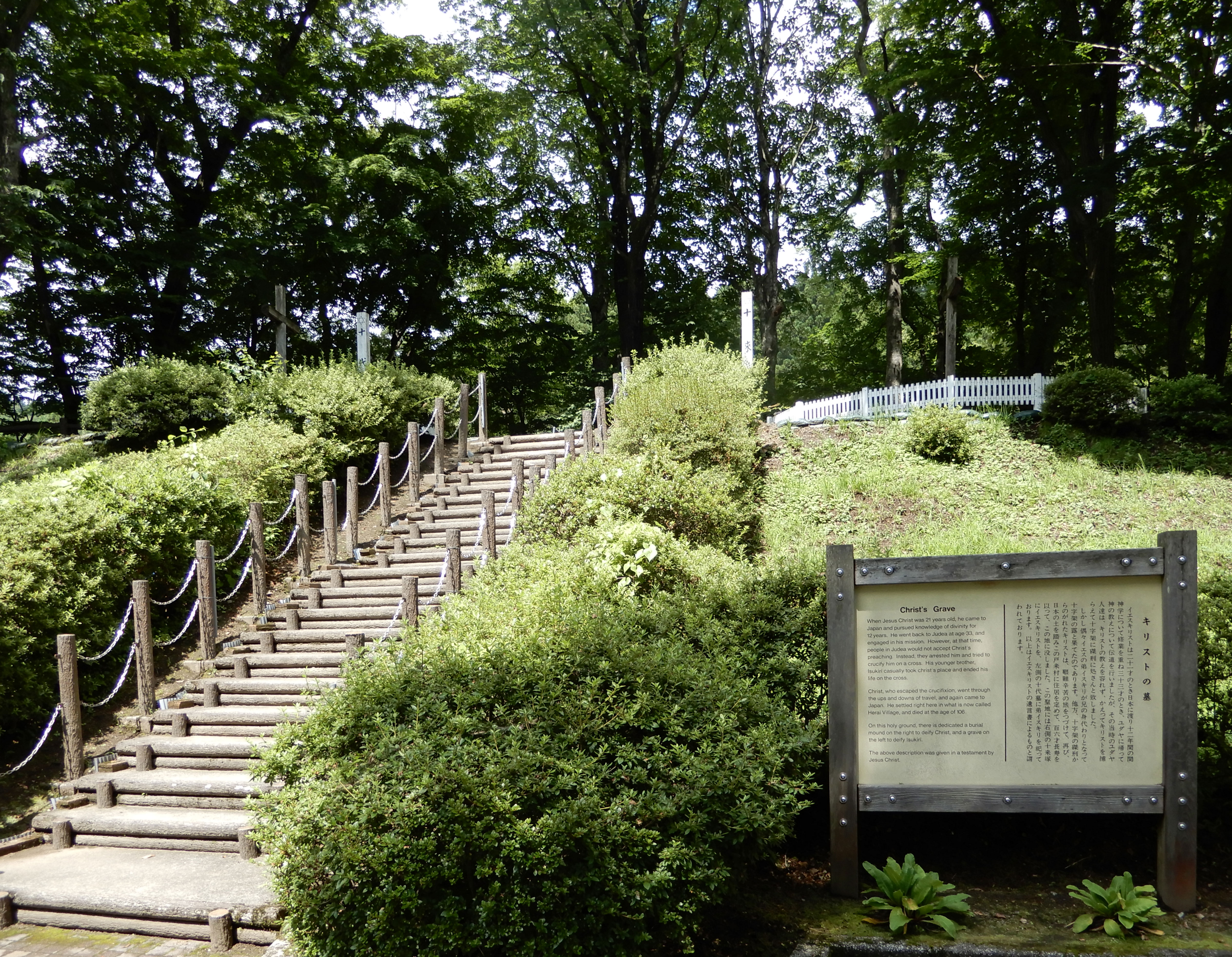
Shingō, Aomori
is a village located in Aomori Prefecture, Japan. , the village has an estimated population of 2,408 in 922 households and a population density of 16 persons per km² (42 people per square mile). The total area of the village is . Geography Shingō is in south-central Aomori Prefecture, east of Lake Towada. The western edge of the village borders Akita Prefecture. Much of the village is mountainous with the outer ring mountains of Lake Towada, including Mt. Okomagatake () and Mt. Toraidake (). The village area extends along National Route 454, which connects Hachinohe, Aomori Prefecture and Lake Towada. Neighboring municipalities *Aomori Prefecture **Towada ** Sannohe District ***Gonohe *** Nanbu ***Sannohe *Akita Prefecture **Kazuno Climate The village has a cold humid continental climate characterized by cool short summers and long cold winters with very heavy snowfall (Köppen climate classification ''Dfa''). The average annual temperature in Shingō is . The average annual ...
[...More Info...]      
[...Related Items...]     OR:     [Wikipedia]   [Google]   [Baidu]  


Koku
The is a Chinese-based Japanese unit of volume. 1 koku is equivalent to 10 or approximately , or about . It converts, in turn, to 100 shō and 1000 gō. One ''gō'' is the volume of the "rice cup", the plastic measuring cup that is supplied with commercial Japanese rice cookers. The ''koku'' in Japan was typically used as a dry measure. The amount of rice production measured in ''koku'' was the metric by which the magnitude of a feudal domain (''han'') was evaluated. A feudal lord was only considered ''daimyō'' class when his domain amounted to at least 10,000 ''koku''. As a rule of thumb, one ''koku'' was considered a sufficient quantity of rice to feed one person for one year. The Chinese equivalent or cognate unit for capacity is the ''shi'' or ''dan'' ( also known as ''hu'' (), now approximately 103 litres but historically about . Chinese equivalent The Chinese ''shi'' or ''dan'' is equal to 10 ''dou'' () " pecks", 100 ''sheng'' () "pints". While the current ''shi' ...
[...More Info...]      
[...Related Items...]     OR:     [Wikipedia]   [Google]   [Baidu]  


Kamikita District, Aomori
is a Districts of Japan, district located in Aomori Prefecture, Japan. It occupies the east-central portion of the prefecture, south of Shimokita Peninsula. As of 2010, the district has an estimated population of 100,526 and a population density, density of 78.5 persons per km2. The total area was 1281.05 km2. In terms of national politics, the district is represented in the Diet of Japan's House of Representatives of Japan, House of Representatives as a part of the Aomori 1st district and the Aomori 2nd district. Towns and villages The district currently consists of six towns and one village. The cities of Towada, Aomori, Towada and Misawa, Aomori, Misawa were formerly part of the district. *Noheji, Aomori, Noheji *Oirase, Aomori, Oirase *Rokunohe, Aomori, Rokunohe *Shichinohe, Aomori, Shichinohe *Tōhoku, Aomori, Tōhoku *Yokohama, Aomori, Yokohama *Rokkasho, Aomori, Rokkasho History Kamikita District was part of ancient , established by the Northern Fujiwara. During the ...
[...More Info...]      
[...Related Items...]     OR:     [Wikipedia]   [Google]   [Baidu]  


Shimokita District, Aomori
is a district located in Aomori Prefecture, Japan. It occupies most of the northern handle of Shimokita Peninsula with the exception of Mutsu City and contains the most northern point on the island of Honshū. It is also home to the Japanese macaque, making it the northernmost natural habitat for monkeys anywhere in the world. As of 2009, the district has an estimated population of 18,297 and a density of 33.2 persons per km2. The total area was 551.08 km2. In terms of national politics, the district is represented in the Diet of Japan's House of Representatives as a part of the Aomori 1st district. Towns and villages The district currently consists of one town and three villages. The city of Mutsu was formerly part of the district. *Ōma * Higashidōri * Kazamaura * Sai History Shimokita District was part of ancient , established by the Northern Fujiwara. During the Edo period, the area was part of the Morioka han feudal domain of the Nanbu clan, with a daika ...
[...More Info...]      
[...Related Items...]     OR:     [Wikipedia]   [Google]   [Baidu]  


Meiji Government
The was the government that was formed by politicians of the Satsuma Domain and Chōshū Domain in the 1860s. The Meiji government was the early government of the Empire of Japan. Politicians of the Meiji government were known as the Meiji oligarchy, who overthrew the Tokugawa shogunate. Early developments After the Meiji Restoration, the leaders of the ''samurai'' who overthrew the Tokugawa shogunate had no clear agenda or pre-developed plan on how to run Japan. They did have a number of things in common; according to Andrew Gordon, “It was precisely their intermediate status and their insecure salaried position, coupled with their sense of frustrated ambition and entitlement to rule, that account for the revolutionary energy of the Meiji insurgents and their far-reaching program of reform”. most were in their mid-40s, and most were from the four '' tozama'' domains of western Japan (Chōshū, Satsuma, Tosa and Hizen). Although from lower-ranked ''samurai'' families, th ...
[...More Info...]      
[...Related Items...]     OR:     [Wikipedia]   [Google]   [Baidu]  


picture info

Meiji Restoration
The , referred to at the time as the , and also known as the Meiji Renovation, Revolution, Regeneration, Reform, or Renewal, was a political event that restored practical imperial rule to Japan in 1868 under Emperor Meiji. Although there were ruling emperors before the Meiji Restoration, the events restored practical abilities and consolidated the political system under the Emperor of Japan. The goals of the restored government were expressed by the new emperor in the Charter Oath. The Restoration led to enormous changes in Japan's political and social structure and spanned both the late Edo period (often called the Bakumatsu) and the beginning of the Meiji era, during which time Japan rapidly Industrialisation, industrialized and adopted Western culture, Western ideas and production methods. Foreign influence The Japanese knew they were behind the Western powers when US Commodore (United States), Commodore Matthew C. Perry came to Japan in 1853 in Black Ships, large warshi ...
[...More Info...]      
[...Related Items...]     OR:     [Wikipedia]   [Google]   [Baidu]  


picture info

Boshin War
The , sometimes known as the Japanese Revolution or Japanese Civil War, was a civil war in Japan fought from 1868 to 1869 between forces of the ruling Tokugawa shogunate and a clique seeking to seize political power in the name of the Imperial Court. The war stemmed from dissatisfaction among many nobles and young samurai with the shogunate's handling of foreigners following the opening of Japan during the prior decade. Increasing Western influence in the economy led to a decline similar to that of other Asian countries at the time. An alliance of western samurai, particularly the domains of Chōshū, Satsuma, and Tosa, and court officials secured control of the Imperial Court and influenced the young Emperor Meiji. Tokugawa Yoshinobu, the sitting ''shōgun'', realizing the futility of his situation, abdicated and handed over political power to the emperor. Yoshinobu had hoped that by doing this the House of Tokugawa could be preserved and participate in the future gover ...
[...More Info...]      
[...Related Items...]     OR:     [Wikipedia]   [Google]   [Baidu]  


picture info

Ōuetsu Reppan Dōmei
The was a Japanese military-political coalition established and disestablished over the course of several months in early to mid-1868 during the Boshin War. Its flag was either a white interwoven five-pointed star on a black field, or a black interwoven five-pointed star on a white field. It is also known as the . History The Alliance centered on the Sendai, Yonezawa, and Nihonmatsu domains, and drew together nearly all domains from the provinces of Mutsu and Dewa, several domains of northern Echigo Province, and even the Matsumae Domain of Ezo (modern-day Hokkaidō). Headquartered at Shiroishi Castle, the alliance's nominal head was Prince Kitashirakawa Yoshihisa, the onetime abbot of Kan'eiji Temple in Edo who fled north following the Satsuma–Chōshū takeover of the city, who declared himself "Emperor Tobu" (東武天皇), with Date Yoshikuni of Sendai and Uesugi Narinori of Yonezawa as the head of the Alliance. Although heteroclite in nature, the Alliance formed of a c ...
[...More Info...]      
[...Related Items...]     OR:     [Wikipedia]   [Google]   [Baidu]  


picture info

Shichinohe Domain
was a '' tozama'' feudal domain of Edo period Japan, located in Mutsu Province, Honshū. It was centered at Shichinohe Castle in what is now the modern town of Shichinohe, Aomori in the Kamikita District of Aomori Prefecture, in the Tōhoku region of far northern Japan. History The Nanbu clan controlled this region of northern Japan from the Muromachi period, and Shichinohe Castle was occupied by a branch of the clan on this site until the end of the Sengoku period. However, in 1591 the Shichinohe-branch of the Nanbu clan opposed the forces of clan chieftain Nanbu Nobunao and Toyotomi Hideyoshi during the Kunohe Rebellion and were defeated. The castle was abandoned in 1592 and allowed to fall into ruins. The Shichinohe Nanbu clan was allowed to survive as 2300 ''koku'' ''hatamoto'' serving Morioka Domain under the Tokugawa shogunate. Their revenues were increased to 5000 ''koku'' in 1694, and they were given charge of a ''daikansho'' erected on the site of their old castle in 18 ...
[...More Info...]      
[...Related Items...]     OR:     [Wikipedia]   [Google]   [Baidu]  


picture info

Hachinohe Domain
was a '' tozama'' feudal domain of Edo period Japan It is located in Mutsu Province, in northern Honshū. The domain was centered at Hachinohe Castle, located in the center of what is now the city of Hachinohe in Aomori Prefecture. History On the death of the 2nd ''daimyō'' of Morioka Domain, Nanbu Shigenao while under house arrest in Edo, the Tokugawa shogunate intervened in the succession and by order of Shōgun Tokugawa Ietsuna divided the 100,000 koku domain into Morioka Domain (80,000 koku) and Hachinohe Domain (20,000 koku). Hachinohe Domain thus had a somewhat ambiguous status in that it is sometimes regarded as a sub-domain of Morioka Domain although it had not been created by the Nanbu clan. It was also subject to the normal '' sankin kotai'' regulations, and was allowed to maintain a castle (which was normally permitted only to independent domains). During official investigations into the untimely deaths of its first two ''daimyō''. Morioka Domain insisted that Ha ...
[...More Info...]      
[...Related Items...]     OR:     [Wikipedia]   [Google]   [Baidu]  


picture info

Nanbu Clan
The was a Japanese samurai clan who ruled most of northeastern Honshū in the Tōhoku region of Japan for over 700 years, from the Kamakura period through the Meiji Restoration of 1868. The Nanbu claimed descent from the Seiwa Genji of Kai Province and were thus related to the Takeda clan. The clan moved its seat from Kai to Mutsu Province in the early Muromachi period, and were confirmed as ''daimyō'' of Morioka Domain under the Edo-period Tokugawa shogunate. The domain was in constant conflict with neighboring Hirosaki Domain, whose ruling Tsugaru clan were once Nanbu retainers. During the Boshin War of 1868–69, the Nanbu clan fought on the side of the Ōuetsu Reppan Dōmei, supporting the Tokugawa regime. After Meiji Restoration, the Nanbu clan had much of its land confiscated, and in 1871, the heads of its branches were relieved of office. In the Meiji period, the former ''daimyō'' became part of the ''kazoku'' peerage, with Nanbu Toshiyuki receiving the title of ''ha ...
[...More Info...]      
[...Related Items...]     OR:     [Wikipedia]   [Google]   [Baidu]