|
San Luis Pass (Galveston Island)
San Luis Pass is a strait of water at the south-western end of Galveston Island off the Texas Gulf Coast of the U.S. state of Texas. It connects the sheltered waters of West Bay to the open Gulf of Mexico. Fishermen and swimmers have been killed in the Pass' treacherous waters, largely due to the aggressive oceanic currents of Gulf Stream, fluctuating tides in marginal sea, marine sediment, and uncertainties of continental margin. The San Luis Pass-Vacek Toll Bridge spans San Luis Pass from Galveston County to Brazoria County. Characteristics Tide levels can vary by almost 2 feet in height, although the tidal effects seem more pronounced along straits than other barrier island zones. Water current dangers are prominent up to about one mile away from the pass along either island. A high amount of drownings occur in the vicinity of the San Luis Pass compared to other areas off of nearby beaches. Until June 2013, about 10 people drowned near San Luis pass on the Galveston side s ... [...More Info...] [...Related Items...] OR: [Wikipedia] [Google] [Baidu] |
Follet's Island
Follet's Island is a barrier island on the Texas Gulf Coast in Brazoria County, Texas, immediately southwest of Galveston Island. Follet's Island separates the Christmas Bay system from the Gulf of Mexico, making it one of a chain of barrier islands running along most of the Texas coast. The island is roughly long and has a maximum elevation of about above mean sea level. Many historians believe that Cabeza de Vaca and his companions from the Narváez expedition landed at what is now Follet's Island. The southwestern tip of the island is occupied by the city of Surfside Beach, Texas Surfside Beach, also known locally as Surfside, is a city in Brazoria County, Texas, United States, that is situated on Follet's Island by the Gulf of Mexico near the city of Freeport. The population was 482 at the 2010 census. The city has clai .... References External links * Barrier islands of Texas Landforms of Brazoria County, Texas {{BrazoriaCountyTX-geo-stub ... [...More Info...] [...Related Items...] OR: [Wikipedia] [Google] [Baidu] |
Continental Margin
A continental margin is the outer edge of continental crust abutting oceanic crust under coastal waters. It is one of the three major zones of the ocean floor, the other two being deep-ocean basins and mid-ocean ridges. The continental margin consists of three different features: the continental rise, the continental slope, and the continental shelf. The continental shelf is the relatively shallow water area found in proximity to continents. Continental margins constitute about 28% of the oceanic area. Zones of the continental margin The continental shelf is the portion of the continental margin that transitions from the shore out towards to ocean. Continental shelves are believed to make up 7% of the sea floor. The width of continental shelves worldwide varies in the range of 0.03–1500 km. The continental shelf is generally flat, and ends at the shelf break, where there is a drastic increase in slope angle: The mean angle of continental shelves worldwide is 0° 07′, an ... [...More Info...] [...Related Items...] OR: [Wikipedia] [Google] [Baidu] |
Landforms Of Brazoria County, Texas
A landform is a natural or anthropogenic land feature on the solid surface of the Earth or other planetary body. Landforms together make up a given terrain, and their arrangement in the landscape is known as topography. Landforms include hills, mountains, canyons, and valleys, as well as shoreline features such as bays, peninsulas, and seas, including submerged features such as mid-ocean ridges, volcanoes, and the great ocean basins. Physical characteristics Landforms are categorized by characteristic physical attributes such as elevation, slope, orientation, stratification, rock exposure and soil type. Gross physical features or landforms include intuitive elements such as berms, mounds, hills, ridges, cliffs, valleys, rivers, peninsulas, volcanoes, and numerous other structural and size-scaled (e.g. ponds vs. lakes, hills vs. mountains) elements including various kinds of inland and oceanic waterbodies and sub-surface features. Mountains, hills, plateaux, and plains are the fou ... [...More Info...] [...Related Items...] OR: [Wikipedia] [Google] [Baidu] |
United States Life-Saving Service
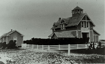
The United States Life-Saving ServiceDespite the lack of hyphen in its insignia, the agency itself is hyphenated in government documents including: and was a United States government agency that grew out of private and local humanitarian efforts to save the lives of shipwrecked mariners and passengers. It began in 1848 and ultimately merged with the Revenue Cutter Service to form the United States Coast Guard in 1915. Early years The concept of assistance to shipwrecked mariners from shore-based stations began with volunteer lifesaving services, spearheaded by the Massachusetts Humane Society. It was recognized that only small boats stood a chance of assisting those close to the beach. A sailing ship trying to help near to the shore stood a good chance of also running aground, especially if there were heavy onshore winds. The Massachusetts Humane Society founded the first lifeboat station at Cohasset, Massachusetts. The stations were small shed-like structures, holding rescue e ... [...More Info...] [...Related Items...] OR: [Wikipedia] [Google] [Baidu] |
Storm Surge
A storm surge, storm flood, tidal surge, or storm tide is a coastal flood or tsunami-like phenomenon of rising water commonly associated with low-pressure weather systems, such as cyclones. It is measured as the rise in water level above the normal tidal level, and does not include waves. The main meteorological factor contributing to a storm surge is high-speed wind pushing water towards the coast over a long fetch. Other factors affecting storm surge severity include the shallowness and orientation of the water body in the storm path, the timing of tides, and the atmospheric pressure drop due to the storm. There is a suggestion that climate change may be increasing the hazard of storm surges. Some theorize that as extreme weather becomes more intense and sea level rises due to climate change, storm surge is expected to cause more risk to coastal populations. Communities and governments can adapt by building hard infrastructure, like surge barriers, soft infrastructure, ... [...More Info...] [...Related Items...] OR: [Wikipedia] [Google] [Baidu] |
Gale
A gale is a strong wind; the word is typically used as a descriptor in nautical contexts. The U.S. National Weather Service defines a gale as sustained surface winds moving at a speed of between 34 and 47 knots (, or ).National Weather Service Glossary s.v "gale" Forecasters typically issue s when winds of this strength are expected. In the , a gale warning is specifically a maritime warning; the land-based equivalent in N ... [...More Info...] [...Related Items...] OR: [Wikipedia] [Google] [Baidu] |
Tropical Cyclone
A tropical cyclone is a rapidly rotating storm system characterized by a low-pressure center, a closed low-level atmospheric circulation, strong winds, and a spiral arrangement of thunderstorms that produce heavy rain and squalls. Depending on its location and strength, a tropical cyclone is referred to by different names, including hurricane (), typhoon (), tropical storm, cyclonic storm, tropical depression, or simply cyclone. A hurricane is a strong tropical cyclone that occurs in the Atlantic Ocean or northeastern Pacific Ocean, and a typhoon occurs in the northwestern Pacific Ocean. In the Indian Ocean, South Pacific, or (rarely) South Atlantic, comparable storms are referred to simply as "tropical cyclones", and such storms in the Indian Ocean can also be called "severe cyclonic storms". "Tropical" refers to the geographical origin of these systems, which form almost exclusively over tropical seas. "Cyclone" refers to their winds moving in a circle, whirling round ... [...More Info...] [...Related Items...] OR: [Wikipedia] [Google] [Baidu] |
1949 Texas Hurricane
The 1949 Texas hurricane was a tropical cyclone of the 1949 Atlantic hurricane season. Forming in the Pacific Ocean on September 27, the storm crossed into the Gulf of Mexico—one of only a handful of known storms to do so—and began to intensify. It ultimately peaked with winds corresponding to high-end Category 2 status on the modern-day Saffir–Simpson hurricane scale and made landfall near Freeport, Texas, on the morning of October 4. It rapidly weakened after moving inland and dissipated several days later. Damage from the storm was moderate, although the hurricane temporarily cut off the city of Galveston from the mainland. Rice crops suffered extensive damage, with losses estimated at up to $10 million (1949 USD$, USD). Two people died due to the hurricane. Meteorological history According to modern-day analysis, a tropical depression developed in the Pacific Ocean, south of El Salvador, early on September 27. It drifted northward across Central Amer ... [...More Info...] [...Related Items...] OR: [Wikipedia] [Google] [Baidu] |
Surfside Beach, Texas
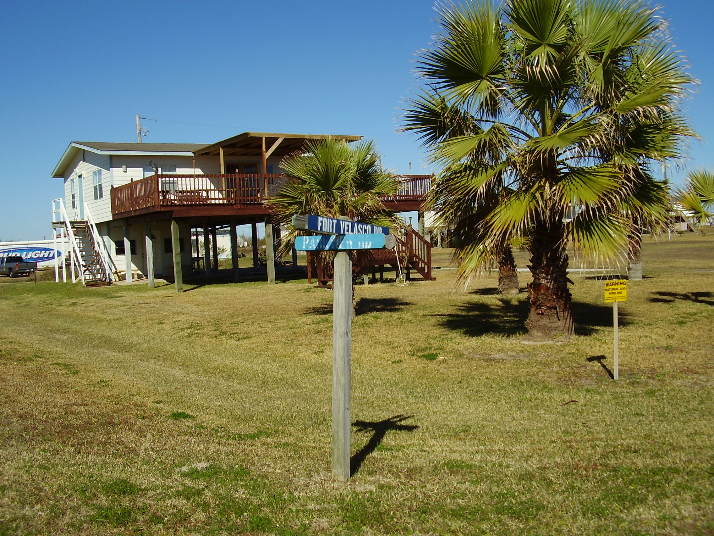
Surfside Beach, also known locally as Surfside, is a city in Brazoria County, Texas, United States, that is situated on Follet's Island by the Gulf of Mexico near the city of Freeport. The population was 482 at the 2010 census. The city has claimed the "Cradle of Texas Liberty" title due to the fact that the Treaty of Velasco which ended hostilities between Texas and Mexico was signed at Fort Velasco, which was located near the city's current City Hall. Former Congressman Ron Paul maintains a home in Surfside. Geography Surfside Beach is located in southern Brazoria County on the southwestern tip of Follet's Island at . It is bordered to the southeast by the Gulf of Mexico and to the southwest by the entrance to Freeport Harbor, across which is the village of Quintana. The Intracoastal Waterway runs through the northwest part of the city, forming the northwest boundary in some places. The Bluewater Highway runs the length of Surfside Beach and continues northeast on Follet' ... [...More Info...] [...Related Items...] OR: [Wikipedia] [Google] [Baidu] |


.jpg)


