|
San Cristóbal Lighthouse
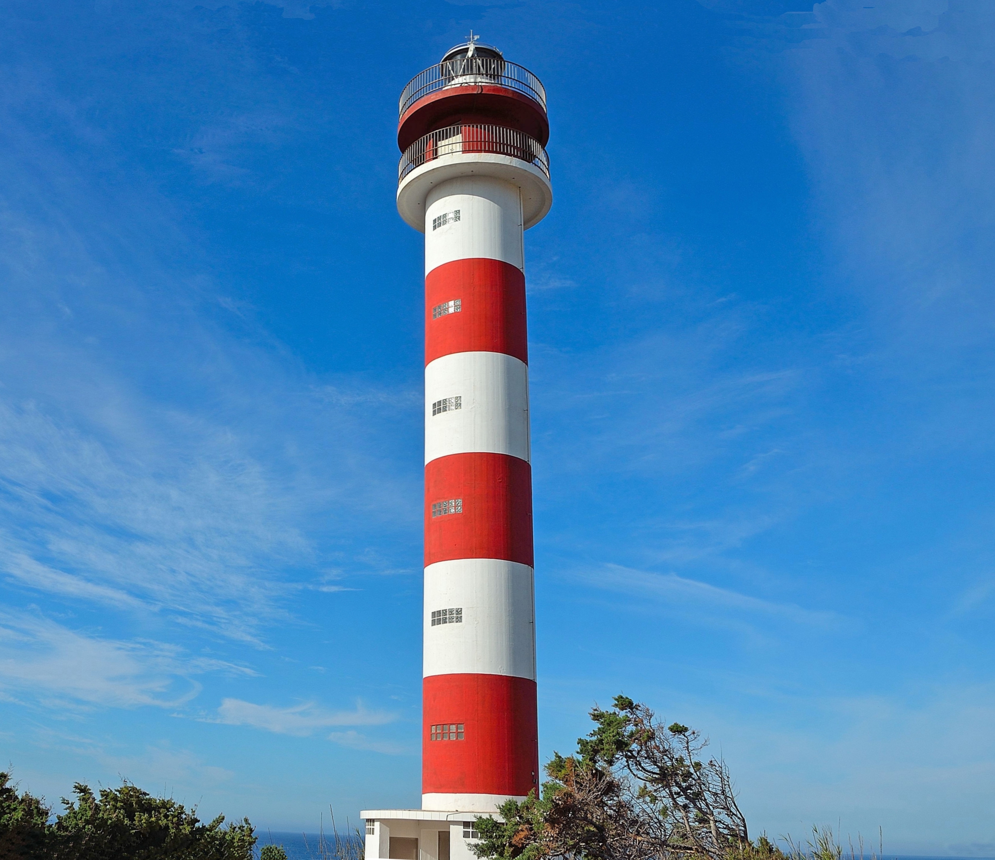
__NOTOC__ The San Cristóbal Lighthouse ( es, Faro de San Cristóbal) is an active lighthouse on the Spanish island of La Gomera in the Canary islands. The current lighthouse is the second to have been constructed on the rocky headland of Punta de San Cristóbal (Saint Christopher's Point), on the eastern side of the island, overlooking the approaches to San Sebastián de La Gomera, the main port and capital of La Gomera. Description San Cristóbal was commissioned as part of the second maritime lighting plan for the Canaries, and is the oldest and principal lighthouse of La Gomera. Construction of the first lighthouse began in 1900 and it became operational in 1903. Designed by the engineer by Juan de León y Castillo, it was built in a similar style to other early Canarian lights, consisting of a whitewashed single-storey keeper's house, with dark volcanic rock used for the masonry detailing. The light was shown from a lantern room at the top of a six-metre-high () masonry ... [...More Info...] [...Related Items...] OR: [Wikipedia] [Google] [Baidu] |
San Sebastián De La Gomera
San Sebastián de La Gomera is the capital and a municipality of La Gomera in the Canary Islands, Spain. It also hosts the main harbour. The population was 8,699 in 2013,Instituto Canario de Estadística , population and the area is . The port serves ferry routes to the islands of Tenerife, La Palma and El Hierro. Streets include Calle Real and F. Olsen. A bus station named ''Estación de Guaguas'' is used for bus lines throughout the island; it is located on Avenida Del Quinto Centenario. History The area was inhabited by the Guanches before the arrival of the Spanish. Hernán Peraza arrived in 1440. Christopher Columbus stopped at the harbour on 6 September 1492 before heading to India but arrived in The Americas, America ...[...More Info...] [...Related Items...] OR: [Wikipedia] [Google] [Baidu] |
Light Characteristic
A light characteristic is all of the properties that make a particular navigational light identifiable. Graphical and textual descriptions of navigational light sequences and colours are displayed on nautical charts and in Light Lists with the chart symbol for a lighthouse, lightvessel, buoy or sea mark with a light on it. Different lights use different colours, frequencies and light patterns, so mariners can identify which light they are seeing. Abbreviations While light characteristics can be described in prose, e.g. "Flashing white every three seconds", lists of lights and navigation chart annotations use abbreviations. The abbreviation notation is slightly different from one light list to another, with dots added or removed, but it usually follows a pattern similar to the following (see the chart to the right for examples). * An abbreviation of the type of light, e.g. "Fl." for flashing, "F." for fixed. * The color of the light, e.g. "W" for white, "G" for green, "R" for red, ... [...More Info...] [...Related Items...] OR: [Wikipedia] [Google] [Baidu] |
Lighthouses In The Canary Islands
A lighthouse is a tower, building, or other type of physical structure designed to emit light from a system of lamps and lenses and to serve as a beacon for navigational aid, for maritime pilots at sea or on inland waterways. Lighthouses mark dangerous coastlines, hazardous shoals, reefs, rocks, and safe entries to harbors; they also assist in aerial navigation. Once widely used, the number of operational lighthouses has declined due to the expense of maintenance and has become uneconomical since the advent of much cheaper, more sophisticated and effective electronic navigational systems. History Ancient lighthouses Before the development of clearly defined ports, mariners were guided by fires built on hilltops. Since elevating the fire would improve the visibility, placing the fire on a platform became a practice that led to the development of the lighthouse. In antiquity, the lighthouse functioned more as an entrance marker to ports than as a warning signal for reefs an ... [...More Info...] [...Related Items...] OR: [Wikipedia] [Google] [Baidu] |
List Of Lighthouses In The Canary Islands ...
This is a list of lighthouses in the Canary Islands. The Spanish archipelago lies to the west of Africa, in the Atlantic Ocean. Lighthouses Map See also * List of lighthouses in Spain * List of lighthouses in the Balearic Islands References External links * {{DEFAULTSORT:Canary Islands * Lists of lighthouses in Spain Lighthouses A lighthouse is a tower, building, or other type of physical structure designed to emit light from a system of lamps and lenses and to serve as a beacon for navigational aid, for maritime pilots at sea or on inland waterways. Lighthouses mar ... [...More Info...] [...Related Items...] OR: [Wikipedia] [Google] [Baidu] |
List Of Lighthouses In Spain
This is a list of lighthouses in Spain. Lighthouses By autonomous communities * List of lighthouses in the Balearic Islands * List of lighthouses in the Canary Islands See also * Lists of lighthouses and lightvessels * List of tallest lighthouses References External links {{Architecture of Spain Lists of lighthouses in Spain, ... [...More Info...] [...Related Items...] OR: [Wikipedia] [Google] [Baidu] |
Santa Cruz De Tenerife
Santa Cruz de Tenerife, commonly abbreviated as Santa Cruz (), is a city, the capital of the island of Tenerife, Province of Santa Cruz de Tenerife, and capital of the Canary Islands. Santa Cruz has a population of 206,593 (2013) within its administrative limits.Instituto Canario de Estadística , population The urban zone of Santa Cruz extends beyond the city limits with a population of 507,306 and 538,000 within urban area. It is the second largest city in the Canary Islands and the main city on the island of , with n ... [...More Info...] [...Related Items...] OR: [Wikipedia] [Google] [Baidu] |
Port Authority
In Canada and the United States, a port authority (less commonly a port district) is a governmental or quasi-governmental public authority for a special-purpose district usually formed by a legislative body (or bodies) to operate ports and other transportation infrastructure. In Canada, the federal Minister of Transport selects the local chief executive board member and the rest of the board is appointed at the recommendation of port users to the federal Minister; while all Canadian port authorities have a federal or Crown charter called '' Letters Patent''. Numerous Caribbean nations have port authorities, including those of Aruba, British Virgin Islands, Bahamas, Jamaica, Cayman Islands, Trinidad and Tobago, St. Lucia, St. Maarten, St. Vincent and the Grenadines. Central and South America also have port agencies such as ''autoridad'' and ''consorcio'' (authority and consortium). In Mexico, the federal government created sixteen port administrations in 1994–1995 called ''Admin ... [...More Info...] [...Related Items...] OR: [Wikipedia] [Google] [Baidu] |
National Geospatial-Intelligence Agency
The National Geospatial-Intelligence Agency (NGA) is a combat support agency within the United States Department of Defense whose primary mission is collecting, analyzing, and distributing geospatial intelligence (GEOINT) in support of national security. Initially known as the National Imagery and Mapping Agency (NIMA) from 1996 to 2003, it is a member of the United States Intelligence Community. NGA headquarters, also known as NGA Campus East or NCE, is located at Fort Belvoir North Area in Springfield, Virginia. The agency also operates major facilities in the St. Louis, Missouri area (referred to as NGA Campus West or NCW), as well as support and liaison offices worldwide. The NGA headquarters, at , is the third-largest government building in the Washington metropolitan area after The Pentagon and the Ronald Reagan Building. In addition to using GEOINT for U.S. military and intelligence efforts, NGA provides assistance during natural and man-made disasters, aids in security ... [...More Info...] [...Related Items...] OR: [Wikipedia] [Google] [Baidu] |
Fresnel Lens
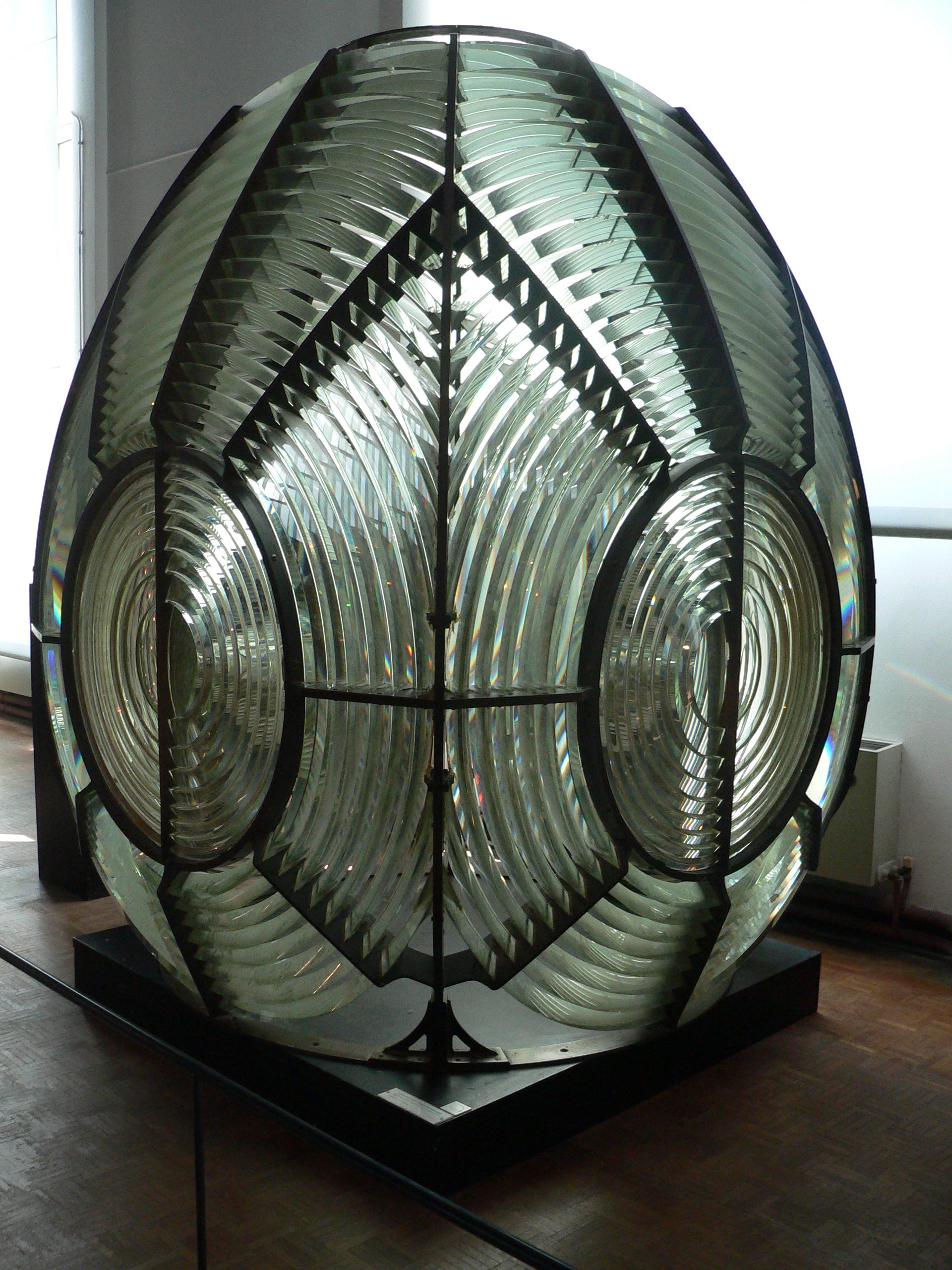
A Fresnel lens ( ; ; or ) is a type of composite compact lens developed by the French physicist Augustin-Jean Fresnel (1788–1827) for use in lighthouses. It has been called "the invention that saved a million ships." The design allows the construction of lenses of large aperture and short focal length without the mass and volume of material that would be required by a lens of conventional design. A Fresnel lens can be made much thinner than a comparable conventional lens, in some cases taking the form of a flat sheet. The simpler dioptric (purely refractive) form of the lens was first proposed by Count Buffon and independently reinvented by Fresnel. The ''catadioptric'' form of the lens, entirely invented by Fresnel, has outer elements that use total internal reflection as well as refraction; it can capture more oblique light from a light source and add it to the beam of a lighthouse, making the light visible from greater distances. Description The Fresnel lens redu ... [...More Info...] [...Related Items...] OR: [Wikipedia] [Google] [Baidu] |
La Gomera
La Gomera () is one of Spain's Canary Islands, located in the Atlantic Ocean off the coast of Africa. With an area of , it is the third smallest of the eight main islands of this archipelago. It belongs to the province of Santa Cruz de Tenerife. La Gomera is the third least populous of the eight main Canary Islands with 22,426 inhabitants. Its capital is San Sebastián de La Gomera, where the cabildo insular (island council) is located. Political organisation La Gomera is part of the province of Santa Cruz de Tenerife. It is divided into six municipalities: The island government (''cabildo insular'') is located in the capital, San Sebastián. Geography The island is of volcanic origin and roughly circular; it is about in diameter. The island is very mountainous and steeply sloping and rises to at the island's highest peak, Alto de Garajonay. Its shape is rather like an orange that has been cut in half and then split into segments, which has left deep ravines or ''barra ... [...More Info...] [...Related Items...] OR: [Wikipedia] [Google] [Baidu] |
Nautical Miles
A nautical mile is a unit of length used in air, marine, and space navigation, and for the definition of territorial waters. Historically, it was defined as the meridian arc length corresponding to one minute ( of a degree) of latitude. Today the international nautical mile is defined as exactly . The derived unit of speed is the knot, one nautical mile per hour. Unit symbol There is no single internationally agreed symbol, with several symbols in use. * M is used as the abbreviation for the nautical mile by the International Hydrographic Organization. * NM is used by the International Civil Aviation Organization. * nmi is used by the Institute of Electrical and Electronics Engineers and the United States Government Publishing Office. * nm is a non-standard abbreviation used in many maritime applications and texts, including U.S. Government Coast Pilots and Sailing Directions. It conflicts with the SI symbol for nanometre. History The word mile is from the Latin word for ... [...More Info...] [...Related Items...] OR: [Wikipedia] [Google] [Baidu] |
La Palma
La Palma (, ), also known as ''La isla bonita'' () and officially San Miguel de La Palma, is the most north-westerly island of the Canary Islands, Spain. La Palma has an area of making it the fifth largest of the eight main Canary Islands. The total population at the end of 2020 was 85,840, of which 15,716 lived in the capital, Santa Cruz de La Palma and about 20,467 in Los Llanos de Aridane. Its highest mountain is the Roque de los Muchachos, at , being second among the peaks of the Canaries only to the peaks of the Teide massif on Tenerife. In 1815, the German geologist Leopold von Buch visited the Canary Islands. It was as a result of his visit to Tenerife, where he visited the Las Cañadas caldera, and then later to La Palma, where he visited the Taburiente caldera, that the Spanish word for cauldron or large cooking pot – "caldera" – was introduced into the geological vocabulary. In the center of the island is the Caldera de Taburiente National Park; one of four nation ... [...More Info...] [...Related Items...] OR: [Wikipedia] [Google] [Baidu] |


