|
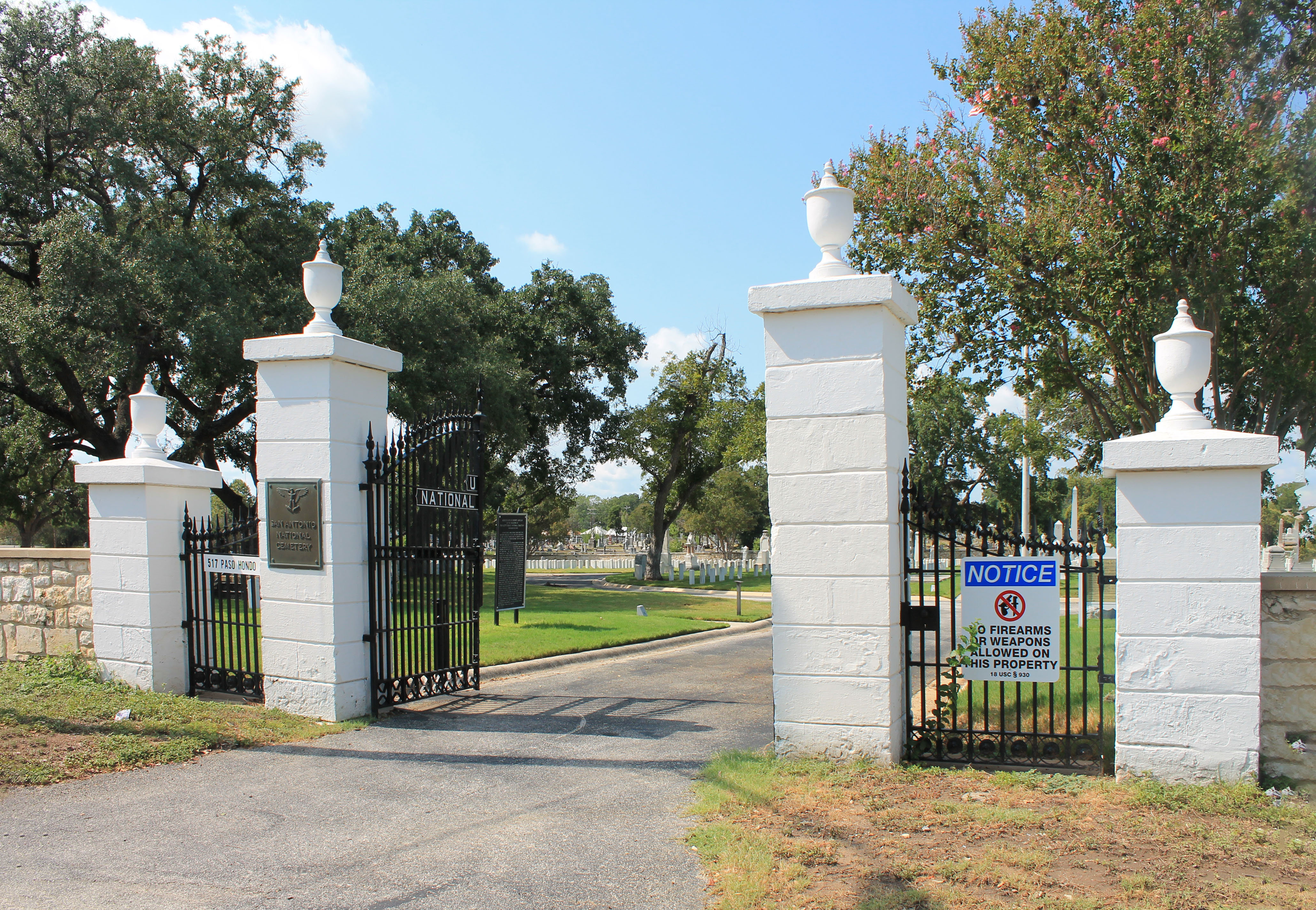
San Antonio Confederate Cemetery
The San Antonio Confederate Cemetery is a private cemetery in the city of San Antonio, Texas, which is now surrounded by the Old San Antonio City Cemeteries Historic District. There are more than 900 graves of Confederate veterans in the 2 acre (0.8 ha) cemetery, including those of colonels John S. Ford and George W. Baylor. The Confederate Cemetery Association - San Antonio, Texas are the caretakers of this cemetery, allowing access to all visitors and the decedents of those intured within its grounds, under Texas State cemetery laws. The CCA has maintained the grounds, roads, and gravesites of the cemetery since the City of San Antonio decided not to renew its contract for maintenance in 2019. See also * San Antonio National Cemetery References External links "Confederate Cemetery Association – San Antonio, TX" Website. Retrieved April 19, 2024. "Confederate Cemetery in San Antonio, Texas"Find a Grave. July 26, 2001. Retrieved March 21, 2023. "Confederate Cemetery ... [...More Info...] [...Related Items...] OR: [Wikipedia] [Google] [Baidu] |
San Antonio
("Cradle of Freedom") , image_map = , mapsize = 220px , map_caption = Interactive map of San Antonio , subdivision_type = Country , subdivision_name = United States , subdivision_type1= U.S. state, State , subdivision_name1 = Texas , subdivision_type2 = County (United States), Counties , subdivision_name2 = Bexar County, Texas, Bexar, Comal County, Texas, Comal, Medina County, Texas, Medina , established_title = Foundation , established_date = May 1, 1718 , established_title1 = Incorporated , established_date1 = June 5, 1837 , named_for = Saint Anthony of Padua , government_type = Council-manager government, Council-Manager , governing_body = San Antonio City Council , leader_title = Mayor of San Antonio, Mayor , leader_name = Ron Nirenberg (Independent politician, I) , leader_title2 = City Manager , leader_name2 = Erik Walsh , leader_title3 = San Antonio City Council, City Council , leader_name3 = , unit_pref = Imperial , area_total_sq_m ... [...More Info...] [...Related Items...] OR: [Wikipedia] [Google] [Baidu] |
Old San Antonio City Cemeteries Historic District
The Old San Antonio City Cemeteries Historic District, also known as the Eastside Cemetery Historic District, is a 103-acre complex collection of the oldest cemeteries in San Antonio, all established between 1853 and 1904. (Downloading is slow). The individual cemeteries in the district were once part of land acreage that the City of San Antonio parceled off and sold to local churches and other organizations to be used as their private cemeteries. It was listed on the National Register of Historic Places in 2000. The cemeteries are notable for their layout and size, their diversity of design (from simple to formal), their funerary monuments (from works of accomplished sculptors to folk design), and for the array of community leaders interred there. While burials in 24 of the cemeteries are predominantly Anglo, seven cemeteries are solely or largely African American. There are scattered Hispanic burials, though the majority of Hispanics in the 19th century were interred in San Fe ... [...More Info...] [...Related Items...] OR: [Wikipedia] [Google] [Baidu] |
Texas Standard
Kūt ( ar, ٱلْكُوت, al-Kūt), officially Al-Kut, also spelled Kutulamare or Kut al-Imara, is a city in eastern Iraq, on the left bank of the Tigris River, about south east of Baghdad. the estimated population is about 389,400 people. It is the capital of the province long known as Al Kut, but since the 1960s renamed Wasit. The old town of Kut is within a sharp "U" bend of the river, opposite from the point where the Shatt al-Gharraf branches off from the Tigris.Naval Intelligence Division guidebook (1944), p. 543 This "U"-shaped bend almost makes it an island but for a narrow connection to the shore. For centuries Kut was a regional center of the carpet trade. The area around Kut is a fertile cereal grain growing region. The Baghdad Nuclear Research Facility, looted following the 2003 US invasion of Iraq, is located near Kut. The Kut Barrage was constructed in the city in the 1930s to provide irrigation water for the surrounding area. The barrage supports a road and i ... [...More Info...] [...Related Items...] OR: [Wikipedia] [Google] [Baidu] |

