|
Salmo Marmoratus
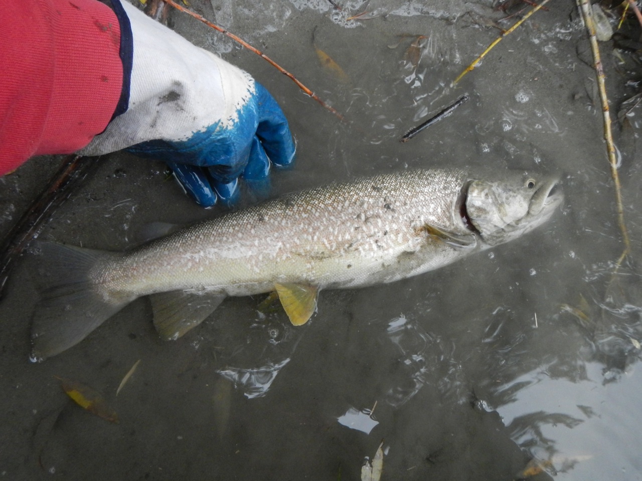
''Salmo marmoratus'', the marble trout, is a species of freshwater fish in the family Salmonidae. It is characterized by a distinctive marbled color pattern and high growth capacity. The marble trout is found in only a handful of drainages and rivers of the Adriatic basin in (going from north to south) Italy, Slovenia, Croatia, Bosnia and Herzegovina, and Montenegro, while in Albania, the species is considered most likely extirpated. Distribution In Italy, marble trout inhabits left tributaries of the upper northwestern reaches of the Po River, and Italian northeastern sub-Alpine region's direct Adriatic watersheds, namely the Adige, the Brenta, the Piave, the Tagliamento, and the Livenza; in shared Slovenia and Italy drainage of the Soča with Natisone; in shared Bosnia and Herzegovina and Croatia drainage of the Neretva river, and in shared Montenegro and Albania drainage of the Morača with Zeta river, and the tributary Cem (Cijevna). While once present in the Drin ... [...More Info...] [...Related Items...] OR: [Wikipedia] [Google] [Baidu] |
Georges Cuvier
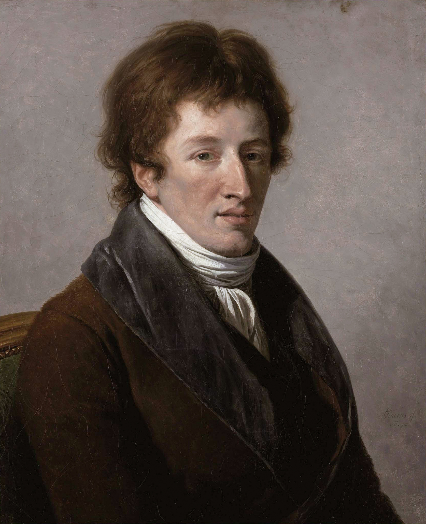
Jean Léopold Nicolas Frédéric, Baron Cuvier (; 23 August 1769 – 13 May 1832), known as Georges Cuvier, was a French natural history, naturalist and zoology, zoologist, sometimes referred to as the "founding father of paleontology". Cuvier was a major figure in natural sciences research in the early 19th century and was instrumental in establishing the fields of comparative anatomy and paleontology through his work in comparing living animals with fossils. Cuvier's work is considered the foundation of vertebrate paleontology, and he expanded Linnaean taxonomy by grouping classes into phylum, phyla and incorporating both fossils and living species into the classification. Cuvier is also known for establishing extinction as a fact—at the time, extinction was considered by many of Cuvier's contemporaries to be merely controversial speculation. In his ''Essay on the Theory of the Earth'' (1813) Cuvier proposed that now-extinct species had been wiped out by periodic catastrophi ... [...More Info...] [...Related Items...] OR: [Wikipedia] [Google] [Baidu] |
Soča
The Soča ( in Slovene) or Isonzo ( in Italian; other names fur, Lusinç, german: Sontig, la, Aesontius or ') is a long river that flows through western Slovenia () and northeastern Italy (). An Alpine river in character, its source lies in the Trenta Valley in the Julian Alps in northwestern Slovenia, at an elevation of . The river runs past the towns of Bovec, Kobarid, Tolmin, Kanal ob Soči, Nova Gorica (where it is crossed by the Solkan Bridge), and Gorizia, entering the Adriatic Sea close to the town of Monfalcone. It has a nival-pluvial regime in its upper course and pluvial-nival in its lower course. Prior to the First World War, the river ran parallel to the border between Kingdom of Italy and the Austro-Hungarian Empire. During World War I, it was the scene of bitter fighting between the two countries, culminating in the Battle of Caporetto in 1917. Name The river was recorded in antiquity as ''Aesontius'', ''Sontius'', and ''Isontius''. Later attestations inc ... [...More Info...] [...Related Items...] OR: [Wikipedia] [Google] [Baidu] |
Sarantaporos (Epirus)
The Sarantaporos ( el, Σαραντάπορος, sq, Sarandapor) is a river in northwestern Greece and southern Albania. It is a right tributary of the river Aoös (''Vjosë''), which flows into the Adriatic Sea. Its length is , of which the final approx. form the border between Greece and Albania. Its source is between the mountain ranges Gramos and Voio, in the Kastoria regional unit. It flows through the municipal units Arrenes, Mastorochoria and Konitsa in Greece, and the municipalities Qendër Leskovik and Çarshovë in Albania. Its basin area is , and its year-average discharge is per second. See also * * |
Greece
Greece,, or , romanized: ', officially the Hellenic Republic, is a country in Southeast Europe. It is situated on the southern tip of the Balkans, and is located at the crossroads of Europe, Asia, and Africa. Greece shares land borders with Albania to the northwest, North Macedonia and Bulgaria to the north, and Turkey to the northeast. The Aegean Sea lies to the east of the Geography of Greece, mainland, the Ionian Sea to the west, and the Sea of Crete and the Mediterranean Sea to the south. Greece has the longest coastline on the Mediterranean Basin, featuring List of islands of Greece, thousands of islands. The country consists of nine Geographic regions of Greece, traditional geographic regions, and has a population of approximately 10.4 million. Athens is the nation's capital and List of cities and towns in Greece, largest city, followed by Thessaloniki and Patras. Greece is considered the cradle of Western culture, Western civilization, being the birthplace of Athenian ... [...More Info...] [...Related Items...] OR: [Wikipedia] [Google] [Baidu] |
Aoos
The Vjosa (; indefinite form: ) or Aoös ( el, Αώος) is a river in northwestern Greece and southwestern Albania. Its total length is about , of which the first are in Greece, and the remaining in Albania. Its drainage basin is and its average discharge is . The main tributaries are Voidomatis, Sarantaporos, Drino and Shushicë. The river arises in the Pindus mountains of Epirus, Greece, and generally flows northwest. It enters Albania near Çarshovë, and empties into the Adriatic Sea just north of Vlorë. Generally wild and unpolluted, the river is surrounded by the Vikos–Aoös National Park in Greece and the Vjosa-Narta Protected Landscape near its mouth. In December 2020, the Albanian portion of the river was designated a "Managed Nature Reserve" by the government. There is a campaign by the environmentalist groups to designate the whole Albanian part of the course a national park, to guard against the prospective hydroelectric projects. Name The Vjosa is known b ... [...More Info...] [...Related Items...] OR: [Wikipedia] [Google] [Baidu] |
North Macedonia
North Macedonia, ; sq, Maqedonia e Veriut, (Macedonia before February 2019), officially the Republic of North Macedonia,, is a country in Southeast Europe. It gained independence in 1991 as one of the successor states of Socialist Federal Republic of Yugoslavia, Yugoslavia. It is a landlocked country bordering Kosovo to the northwest, Serbia to the north, Bulgaria to the east, Greece to the south, and Albania to the west. It constitutes approximately the northern third of the larger geographical Macedonia (region), region of Macedonia. Skopje, the capital and largest city, is home to a quarter of the country's 1.83 million people. The majority of the residents are ethnic Macedonians (ethnic group), Macedonians, a South Slavs, South Slavic people. Albanians in North Macedonia, Albanians form a significant minority at around 25%, followed by Turks in North Macedonia, Turks, Romani people in North Macedonia, Romani, Serbs in North Macedonia, Serbs, Bosniaks in North Mac ... [...More Info...] [...Related Items...] OR: [Wikipedia] [Google] [Baidu] |
Black Drin
The Black Drin, or Black Drim ( sq, Drini i Zi, mk, , translit=Crn Drim) is a river in North Macedonia and Albania. It flows out of Lake Ohrid in Struga, North Macedonia. It is long and its drainage basin is . Its average discharge is . After about it crosses the border to Albania, west of Debar, North Macedonia. It merges with the White Drin in Kukës to form the Drin, which flows into the Adriatic Sea. It drains most of the eastern border region of Albania. The name is ancient - Drinius, Trinius (Pliny), Δρεῖνος (Ptolemy). Its origin is Illyrian from older ''*Drūn'', from Indo-European ''*drū''- into Old Indian ''drāvayate'', run, flow, Avestan ''dru'', run.Георгиев, Вл., Ив. Гълъбов, Й. Заимов, Ст. Илчев (съставители). Български етимологичен речник, том 1 (А - З). София, Българска академия на науките. Институт за български език. Изда ... [...More Info...] [...Related Items...] OR: [Wikipedia] [Google] [Baidu] |
Kosovo
Kosovo ( sq, Kosova or ; sr-Cyrl, Косово ), officially the Republic of Kosovo ( sq, Republika e Kosovës, links=no; sr, Република Косово, Republika Kosovo, links=no), is a partially recognised state in Southeast Europe. It lies at the centre of the Balkans. Kosovo unilaterally declared its independence from Serbia on 17 February 2008, and has since gained diplomatic recognition as a sovereign state by 101 member states of the United Nations. It is bordered by Serbia to the north and east, North Macedonia to the southeast, Albania to the southwest, and Montenegro to the west. Most of central Kosovo is dominated by the vast plains and fields of Dukagjini and Kosovo field. The Accursed Mountains and Šar Mountains rise in the southwest and southeast, respectively. Its capital and largest city is Pristina. In classical antiquity, the central tribe which emerged in the territory of Kosovo were Dardani, who formed an independent polity known as th ... [...More Info...] [...Related Items...] OR: [Wikipedia] [Google] [Baidu] |
White Drin
The White Drin or White Drim ( sq, Drini i Bardhë,/ ''Beli Drim'') is a river in Kosovo and northern Albania, a ca. -long headstream of the Drin. Course Kosovo The Kosovo section of the White Drin flows entirely in the semi-karst part of Kosovo, in an arc-shaped -long course. The river originates in the southern slopes of the Zhleb mountain, north of the town of Peja. The river springs near the Radavc Cave. The cave is multi-levelled, not much explored and has a lake inside. The water from the spring was used by the Peja brewery. The stream is originally a sinking river which eventually springs out from the strong well and falls down as a -high waterfall named the White Drin Waterfall near the village of Radac, away from Peja. In 1934, Russian émigré Dimitry Tyapkin projected and constructed a hydroelectric power plant next to the waterfalls which produced electricity for the town. The White Drin first flows to the east, next to the spa of Banja of Peja or Ilixhe, ... [...More Info...] [...Related Items...] OR: [Wikipedia] [Google] [Baidu] |
Drin (river)
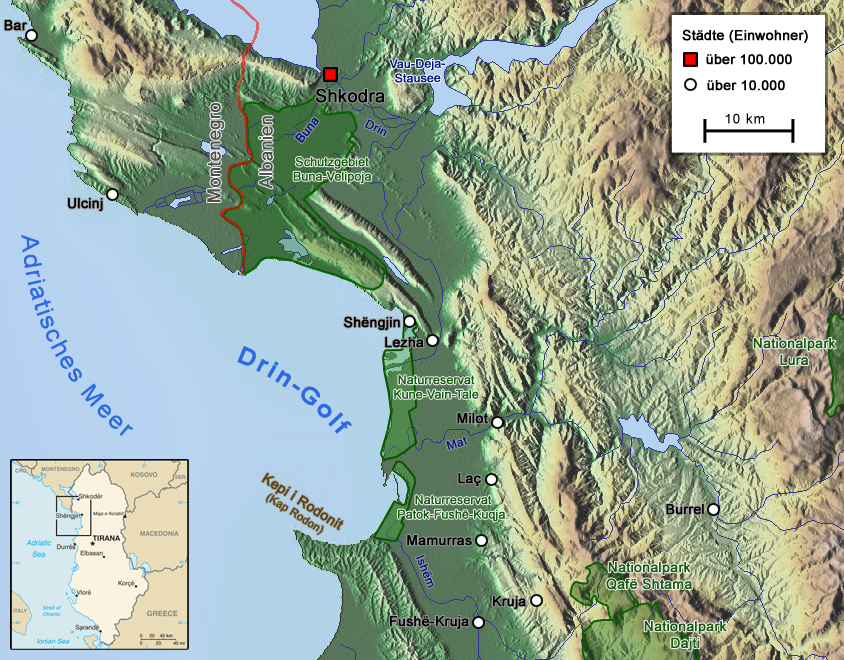
The Drin (; sq, Drin or ; mk, Дрим, Drim ) is a river in Southern and Southeastern Europe with two distributaries one discharging into the Adriatic Sea and the other one into the Buna River. Its catchment area extends across Albania, Kosovo, Serbia, Greece, Montenegro and North Macedonia. The river and its tributaries form the Gulf of Drin, an ocean basin that encompasses the northern Albanian Adriatic Sea Coast. At long, the Drin is the longest river of Albania of which passes across Albania and the remainder through Kosovo and North Macedonia. It starts at the confluence of its two headwaters, namely the Black Drin and White Drin. It originates in the mountainous northern mountain range, flows westwards through the Albanian Alps and Dukagjin Highlands, and eventually drains into the Adriatic Sea, between Shëngjin and Durrës. Numerous lakes and reservoirs are formed by the river or flow into it such as the Fierza Lake and Koman Lake. Located in the Balkan Pen ... [...More Info...] [...Related Items...] OR: [Wikipedia] [Google] [Baidu] |
Cem (river)
The Cem ( sq, Cem, or in its definite form ), also known as the Cijevna ( cyrl, Цијевна), is a river that rises in Kelmend, Albania and after nearly half of its length crosses into Montenegro, where it flows into the River Morača near the capital Podgorica. The Cem is fully formed at the confluence of its two tributaries the Vukël Cem and the Selcë Cem. It passes mostly through limestone terrain with many karstic formations. These features of the Cem's basin have their origin in the tectonic activity of the Alpine orogeny, which formed the Dinaric Alps. The terrain through which it flows in its course, is at an elevation of more than and can reach as low as . It passes through narrow valleys and steep canyons, where waterfalls are formed before it reaches the Zeta plain. As it approaches the Morača, the Cem area shifts from a continental climate to a Mediterranean one. The drainage basin of the Cem encompasses and is part of the Adriatic river basin. The first ... [...More Info...] [...Related Items...] OR: [Wikipedia] [Google] [Baidu] |
Zeta
Zeta (, ; uppercase Ζ, lowercase ζ; grc, ζῆτα, el, ζήτα, label= Demotic Greek, classical or ''zē̂ta''; ''zíta'') is the sixth letter of the Greek alphabet. In the system of Greek numerals, it has a value of 7. It was derived from the Phoenician letter zayin . Letters that arose from zeta include the Roman Z and Cyrillic З. Name Unlike the other Greek letters, this letter did not take its name from the Phoenician letter from which it was derived; it was given a new name on the pattern of beta, eta and theta. The word ''zeta'' is the ancestor of ''zed'', the name of the Latin letter Z in Commonwealth English. Swedish and many Romanic languages (such as Italian and Spanish) do not distinguish between the Greek and Roman forms of the letter; "''zeta''" is used to refer to the Roman letter Z as well as the Greek letter. Uses Letter The letter ζ represents the voiced alveolar fricative in Modern Greek Modern Greek (, , or , ''Kiní Neoellinikí Gl ... [...More Info...] [...Related Items...] OR: [Wikipedia] [Google] [Baidu] |


