|
Sakalua
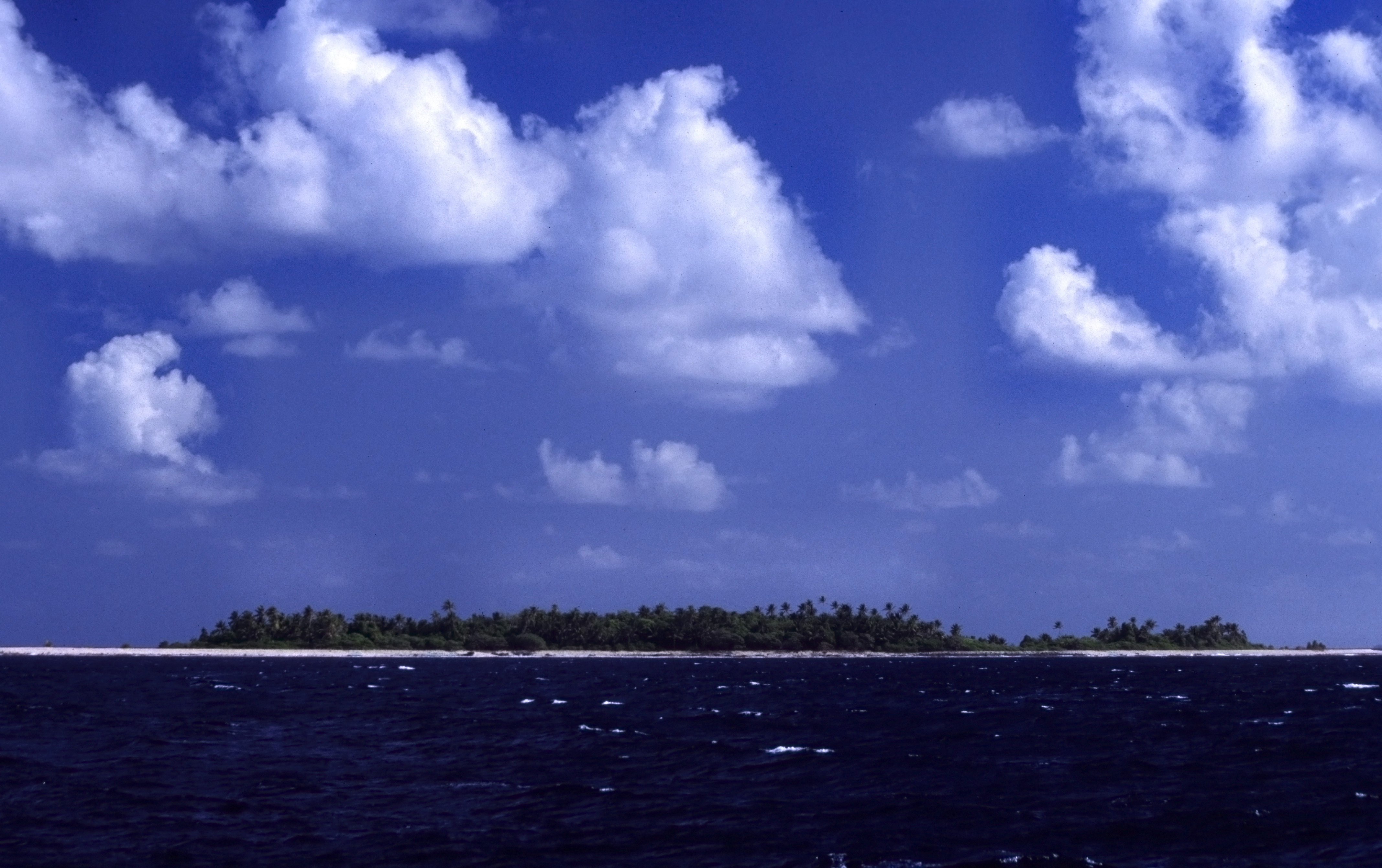
Sakalua is an islet of Nukufetau, Tuvalu. In the 19th century whalers established a shore camp on Sakalua where coal was used to melt down the whale blubber. The islet has been known as 'Coal Island'. The island has a large colony of terns Terns are seabirds in the family Laridae that have a worldwide distribution and are normally found near the sea, rivers, or wetlands. Terns are treated as a subgroup of the family Laridae which includes gulls and skimmers and consists of .... References Islands of Tuvalu Pacific islands claimed under the Guano Islands Act Nukufetau {{tuvalu-geo-stub ... [...More Info...] [...Related Items...] OR: [Wikipedia] [Google] [Baidu] |
Nukufetau
Nukufetau is an atoll that is part of the nation of Tuvalu. The atoll was claimed by the US under the Guano Islands Act some time in the 19th century and was ceded in a treaty of friendship concluded in 1979 and coming into force in 1983. It has a population of 597 who live on Savave islet (2017 Census). In 1951 the school that was located on Motumua islet was transferred to Savave and became the government primary school for Nukufetau. It was named the Tutasi Memorial School in honour of its predecessor. Geography Nukufetau is an atoll with passages through the reef that allow large ships to enter and anchor in the lagoon. Nukufetau consists of at least 33 islets: * Faiava Lasi * Fale * Funaota * Kongo Loto Lafanga * Lafanga * Matanukulaelae * Motufetau * Motulalo * Motuloa (north of Nukufetau) * Motuloa (south of Nukufetau) * Motumua * Niualuka * Niuatui * Oua * Sakalua * Savave * Teafatule * Teafuaniua * Teafuanonu * Teafuone * Temotuloto * and at least 12 other islan ... [...More Info...] [...Related Items...] OR: [Wikipedia] [Google] [Baidu] |
Tuvalu
Tuvalu ( or ; formerly known as the Ellice Islands) is an island country and microstate in the Polynesian subregion of Oceania in the Pacific Ocean. Its islands are situated about midway between Hawaii and Australia. They lie east-northeast of the Santa Cruz Islands (which belong to the Solomon Islands), northeast of Vanuatu, southeast of Nauru, south of Kiribati, west of Tokelau, northwest of Samoa and Wallis and Futuna, and north of Fiji. Tuvalu is composed of three reef islands and six atolls. They are spread out between the latitude of 5th parallel south, 5° and 10th parallel south, 10° south and between the longitude of 176th meridian east, 176° and 180th meridian, 180°. They lie west of the International Date Line. Tuvalu has a population of 10,507 (2017 census). The total land area of the islands of Tuvalu is . The first inhabitants of Tuvalu were Polynesians, according to well-established theories regarding a History of the Polynesian people, migration of Polynes ... [...More Info...] [...Related Items...] OR: [Wikipedia] [Google] [Baidu] |
Map Of Nukufetau
A map is a symbolic depiction emphasizing relationships between elements of some space, such as objects, regions, or themes. Many maps are static, fixed to paper or some other durable medium, while others are dynamic or interactive. Although most commonly used to depict geography, maps may represent any space, real or fictional, without regard to context or scale, such as in brain mapping, DNA mapping, or computer network topology mapping. The space being mapped may be two dimensional, such as the surface of the earth, three dimensional, such as the interior of the earth, or even more abstract spaces of any dimension, such as arise in modeling phenomena having many independent variables. Although the earliest maps known are of the heavens, geographic maps of territory have a very long tradition and exist from ancient times. The word "map" comes from the , wherein ''mappa'' meant 'napkin' or 'cloth' and ''mundi'' 'the world'. Thus, "map" became a shortened term referring to ... [...More Info...] [...Related Items...] OR: [Wikipedia] [Google] [Baidu] |
Islet
An islet is a very small, often unnamed island. Most definitions are not precise, but some suggest that an islet has little or no vegetation and cannot support human habitation. It may be made of rock, sand and/or hard coral; may be permanent or tidal (i.e. surfaced reef or seamount); and may exist in the sea, lakes, rivers or any other sizeable bodies of water. Definition As suggested by its origin ''islette'', an Old French diminutive of "isle", use of the term implies small size, but little attention is given to drawing an upper limit on its applicability. The World Landforms website says, "An islet landform is generally considered to be a rock or small island that has little vegetation and cannot sustain human habitation", and further that size may vary from a few square feet to several square miles, with no specific rule pertaining to size. Other terms * Ait (/eɪt/, like eight) or eyot (/aɪ(ə)t, eɪt/), a small island. It is especially used to refer to river i ... [...More Info...] [...Related Items...] OR: [Wikipedia] [Google] [Baidu] |
Whaling
Whaling is the process of hunting of whales for their usable products such as meat and blubber, which can be turned into a type of oil that became increasingly important in the Industrial Revolution. It was practiced as an organized industry as early as 875 AD. By the 16th century, it had risen to be the principal industry in the Basque coastal regions of Spain and France. The industry spread throughout the world, and became increasingly profitable in terms of trade and resources. Some regions of the world's oceans, along the animals' migration routes, had a particularly dense whale population, and became the targets for large concentrations of whaling ships, and the industry continued to grow well into the 20th century. The depletion of some whale species to near extinction led to the banning of whaling in many countries by 1969, and to an international cessation of whaling as an industry in the late 1980s. The earliest known forms of whaling date to at least 3000 BC. Coasta ... [...More Info...] [...Related Items...] OR: [Wikipedia] [Google] [Baidu] |
Terns
Terns are seabirds in the family Laridae that have a worldwide distribution and are normally found near the sea, rivers, or wetlands. Terns are treated as a subgroup of the family Laridae which includes gulls and skimmers and consists of eleven genera. They are slender, lightly built birds with long, forked tails, narrow wings, long bills, and relatively short legs. Most species are pale grey above and white below, with a contrasting black cap to the head, but the marsh terns, the Inca tern, and some noddies have dark plumage for at least part of the year. The sexes are identical in appearance, but young birds are readily distinguishable from adults. Terns have a non-breeding plumage, which usually involves a white forehead and much-reduced black cap. Terns are long-lived birds and are relatively free from natural predators and parasites; most species are declining in numbers due directly or indirectly to human activities, including habitat loss, pollution, disturbance, an ... [...More Info...] [...Related Items...] OR: [Wikipedia] [Google] [Baidu] |
Islands Of Tuvalu
Tuvalu consists of nine separate islands: six atolls and three reef islands. An atoll typically consists of several islets: Tuvalu has a total of 124 islands and islets. Each island is surrounded by a coral reef. Tuvalu's small, widely scattered atolls have poor soil and a total land area of only about making Tuvalu the fourth-smallest country in the world. The sea level at the Funafuti tide gauge has been rising at a rate of 3.9 mm per year, and it has been determined that rising sea levels are causing more wave energy to be transferred across reef surfaces, which has tended to push more sand onto island shorelines, increasing islands’ land area. Over a recent four-decade period, there was a net increase in the land area of the islets of 2.9% (73.5 ha), although the changes were not uniform: About 74% of them increased in size and about 27% decreased in size. Islands of Tuvalu The islands of Tuvalu are spread out between the latitude of 5° to 10° south and longitude ... [...More Info...] [...Related Items...] OR: [Wikipedia] [Google] [Baidu] |
Pacific Islands Claimed Under The Guano Islands Act
The Pacific Ocean is the largest and deepest of Earth's five oceanic divisions. It extends from the Arctic Ocean in the north to the Southern Ocean (or, depending on definition, to Antarctica) in the south, and is bounded by the continents of Asia and Oceania in the west and the Americas in the east. At in area (as defined with a southern Antarctic border), this largest division of the World Ocean—and, in turn, the hydrosphere—covers about 46% of Earth's water surface and about 32% of its total surface area, larger than Earth's entire land area combined .Pacific Ocean . '' Britannica Concise.'' 2008: Encyclopædia Britannica, Inc. The centers of both the |


.jpg)