|
Saint Mary's Island (other) Island, in Banjul division
{{Disambig ...
St Mary's Island may refer to: Places ;England * St Mary's Island, Kent, in Medway * St Mary's Island, River Thames, in the county of Berkshire * St Mary's Island (Tyne and Wear), in the metropolitan county of Tyne and Wear * St Mary's, Isles of Scilly, in the county of Cornwall ;India * St. Mary's Islands, in the state of Karnataka ;Isle of Man * St Mary's Isle, Douglas Bay ;Madagascar * ĂŽle Sainte-Marie, also known as St Mary's Island in English, in the region of Analanjirofo ;The Gambia * Another name for Banjul Banjul (,"Banjul" (US) and ), officially the City of Ba ... [...More Info...] [...Related Items...] OR: [Wikipedia] [Google] [Baidu] |
St Mary's Island, Kent
St Mary's Island, is part of the Chatham Maritime development area in Medway, South East England. It is located at the northern end of Chatham, adjacent to Brompton and Gillingham. Once part of the Royal Dockyard, Chatham, the area had consisted of a mixture of sports fields and warehousing during the later years of the Royal Navy's time in occupation. St.Mary's Island is divided from mainland Chatham by three basins used by the dockyard. History The Romans were the first people to use the Island. They constructed a road through the marshy swamp criss-crossed by tidal channels land, and established a ferry route from the Island to the Hoo Peninsula. The ferry was named 'Prince's Bridge' on early maps, it was used until the final years of the last century.http://www.stmarysisland.uk.com/island-living/the-concept/history The 3 dockyard basins are sited on St Mary's Creek, which passed from the River Medway, near Gillingham to the River Medway (again) near Chatham. In 1575, ... [...More Info...] [...Related Items...] OR: [Wikipedia] [Google] [Baidu] |
St Mary's Island, River Thames
St Mary's Island is a tiny island in the River Thames in England. It has a size of about 150 m by 50 m. (Layer at OpenStreetMap The island is on the reach above on the western outskirts of the town of , . It is close in to the northern ( Caversham) bank in an area called The Fishery ... [...More Info...] [...Related Items...] OR: [Wikipedia] [Google] [Baidu] |
St Mary's Island (Tyne And Wear)
St Mary's Island, sometimes referred to as Bait Island is a small sandstone island near the seaside resort of Whitley Bay, Tyne and Wear, England. It is a Local Nature Reserve. St Mary's Island was originally called Bates Island, Hartley Bates or Bates Hill as it was originally owned by the Bates family who were prominent locally, and the area of coastal mainland lying between the Brierdene Burn and Seaton Burn formed the township of Hartley. It is sometimes known as Bait Island, probably due to a misunderstanding of the meaning of the name. The island is opposite Curry's Point on the mainland and is connected to the coast at low tide by a rocky causeway for about 16 hours a day. The main feature of the island is St Mary's Lighthouse which was built in 1898. In medieval times there was a chapel on the island dedicated to St Helen. Within the chapel was the Lady Light, also known as St Katherine's Light. The light was later, wrongly, ascribed to St Mary and, as a result, the i ... [...More Info...] [...Related Items...] OR: [Wikipedia] [Google] [Baidu] |
St Mary's, Isles Of Scilly
St Mary's ( kw, Ennor, meaning ''The Mainland'') is the largest and most populous island of the Isles of Scilly, an archipelago off the southwest coast of Cornwall in England. Description St Mary's has an area of — 40 percent of the total land area of the Isles of Scilly — this includes four small tidal islands which connect with St Mary's at low tide: Toll's Island, Taylor's Island, Newford Island and the island at Innisidgen. With a population of 1,723 (out of a total population for Scilly of 2,203) St Mary's is relatively densely populated, with twice the average population density of the Isles of Scilly as a whole. The majority of St Mary's residents live in the western half of the island, with Hugh Town alone having a population of 1,097. The main settlement, Hugh Town ''( Cornish: Tre Huw)'', was sold to the inhabitants by the Crown in 1949 (it had belonged to the Duchy of Cornwall — which still owns much of the rest of the island). Other settlements on the island ... [...More Info...] [...Related Items...] OR: [Wikipedia] [Google] [Baidu] |
St Mary's Isle
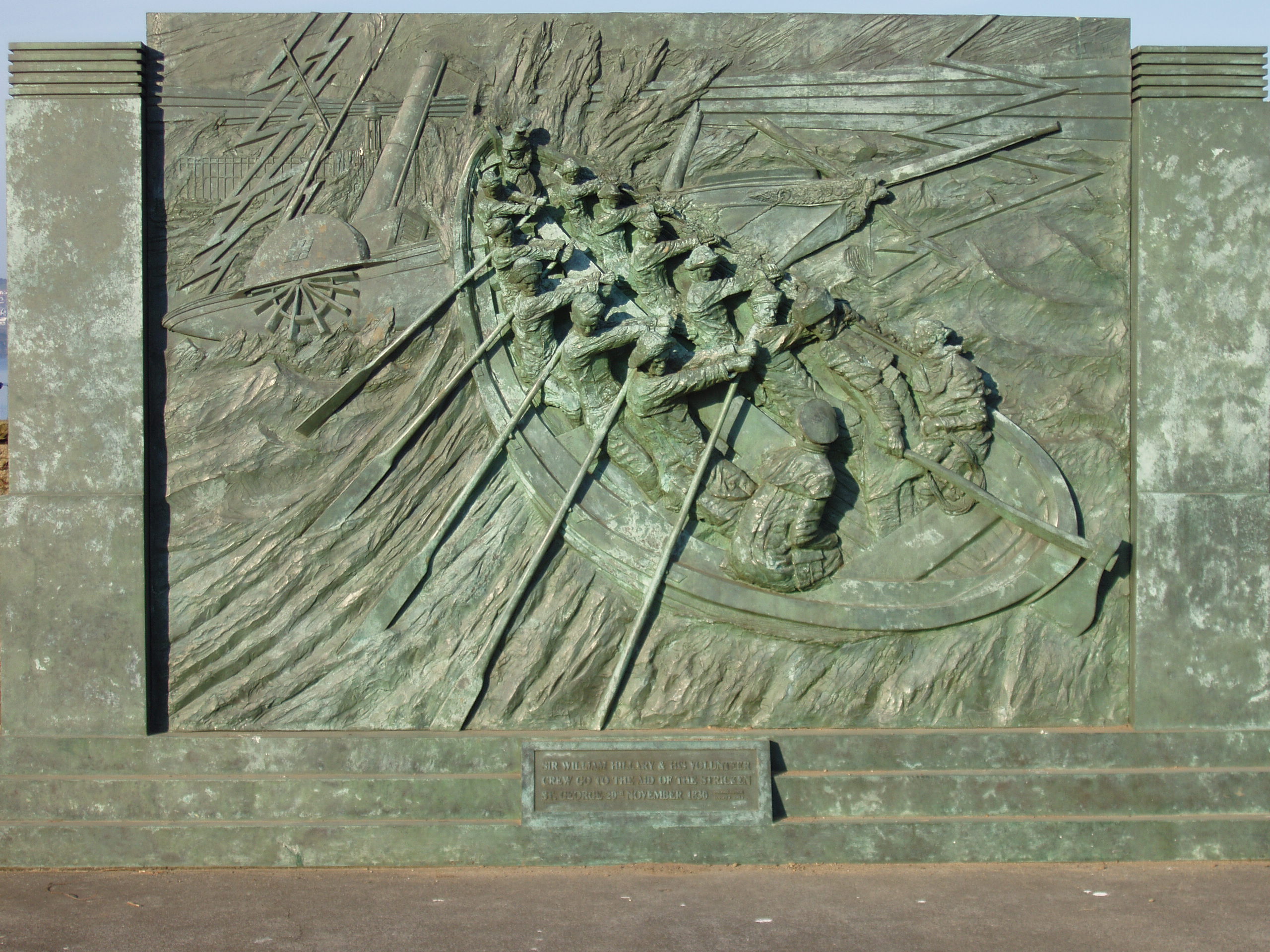
St Mary's Isle (also known as Conister Rock or the Tower of Refuge, Manx language, Manx: or ''Creg Voirrey'') is a partially submerged reef in Douglas, Isle of Man, Douglas Bay on the Isle of Man. Prior to 1832 the rock was the property of the Quane family until John Quane, Attorney General of the Isle of Man, presented the rock to Sir William Hillary, in his capacity as President of the Isle of Man District of the Royal National Lifeboat Institution to build the Tower of Refuge.Isle of Man Times, February 13, 1932; Page 4 Since then the custody of St Mary's Isle has been held by each president of the local lifeboat association. The reef is not far from the ferry terminal. Its eastern part, the Conister Shoals, had to be blasted away when a new harbour breakwater was built in the early 1980s. The rocks are only fully submerged at spring high tides; they can be accessed very briefly on foot at low spring tides. Etymology Conister is a corruption of the Manx meaning the 'head of ... [...More Info...] [...Related Items...] OR: [Wikipedia] [Google] [Baidu] |
ĂŽle Sainte-Marie
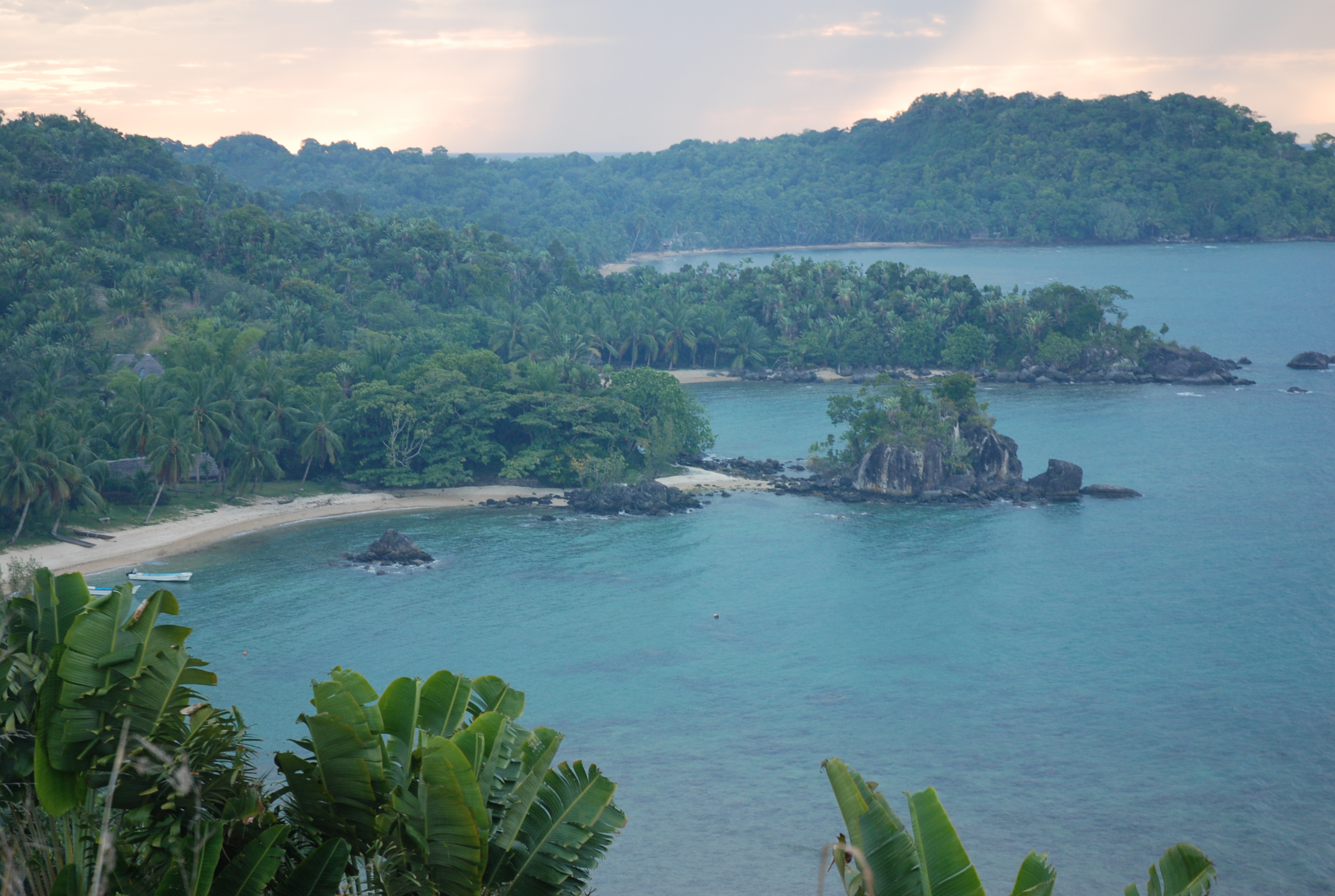
Nosy Boraha , previously known as Sainte-Marie, main town Ambodifotatra, is an island off the east coast of Madagascar. The island forms an administrative district within Analanjirofo Region, and covers an area of 222 km2. It has a population estimated at 30,000. Sainte-Marie Island is known for its authentic and preserved character, its whale watching, its beautiful beaches, its romantic history and the kindness of its inhabitants. Administration The island is organized as the city (''commune urbaine'') and district of Nosy Boraha in Analanjirofo Region. *1 town hall *17 fokontany (villages) *1 deputy Population The Betsimisaraka are the largest ethnic group on the island, though there had been a long history of mixed marriages, including with pirates in the 17th century. Transport infrastructure *1 international airport in the South (inaugurated 2015) *1 commercial port (Ilot Madame) *1 passenger port (Ambodifotatra) Ferries leave from Soanierana Ivongo and Mahambo, ... [...More Info...] [...Related Items...] OR: [Wikipedia] [Google] [Baidu] |
_-_geograph.org.uk_-_587100.jpg)


