|
Saint Elizabeth Parish
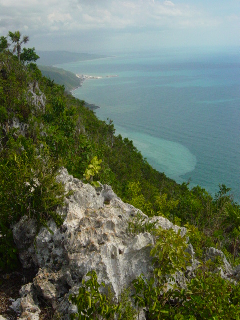
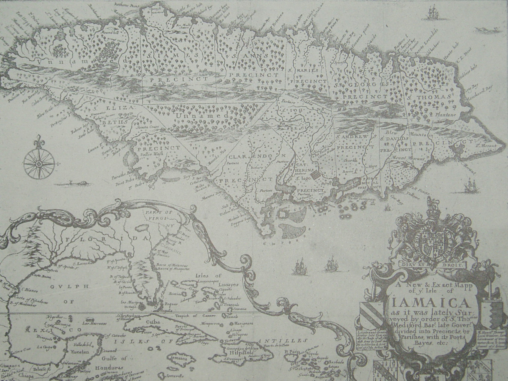
Saint Elizabeth, one of Jamaica's largest parishes, is located in the southwest of the island, in the county of Cornwall. Its capital, Black River, is located at the mouth of the Black River, the widest on the island. History Saint Elizabeth originally included most of the southwest part of the island, but Westmoreland was taken from it in 1703, and in 1814 a part of Manchester. The resulting areas were named after the wife of Sir Thomas Modyford, the first English Governor of Jamaica. There are archeological traces of Taíno/Arawak existence in the parish, as well as of 17th-century colonial Spanish settlements. After 1655, when the English settled on the island, they concentrated on developing large sugar cane plantations with enslaved African workers. Today, buildings with 'Spanish wall' construction (masonry of limestone sand and stone between wooden frames) can still be seen in some areas. St Elizabeth became a prosperous parish, and Black River an important seaport. ... [...More Info...] [...Related Items...] OR: [Wikipedia] [Google] [Baidu] |
Parishes Of Jamaica
The parishes of Jamaica are the main units of local government in Jamaica. They were created following the English Invasion of Jamaica in 1655. This administrative structure for the Colony of Jamaica developed slowly. However, since 1 May 1867 Jamaica has been divided into the current fourteen parishes. These were retained after independence in 1962. They are grouped into three historic counties, which no longer have any administrative relevance. Every parish has a coast; none are landlocked. List (1) The parishes of Kingston and Saint Andrew together form the ''Kingston and St. Andrew Corporation''. (2) The parish of Kingston does not encompass all of the city of Kingston. Most of the city is in the parish of St. Andrew. History Early history Following the English conquest of Jamaica the first phase of colonisation was carried out by the Army, with a system of Regimental plantations. These were drawn up on the southern flat lands, with the Regimental commanders charge ... [...More Info...] [...Related Items...] OR: [Wikipedia] [Google] [Baidu] |
Manchester Parish, Jamaica
The Parish of Manchester is a parish located in west-central Jamaica, in the county of Middlesex. Its capital, Mandeville, is a major business centre. Its St. Paul of the Cross Pro-Cathedral is the episcopal see of the Latin Catholic Diocese of Mandeville. History Taino/Arawak settlement in the parish was substantiated when in 1792, a surveyor found three carvings, believed to be Amerindian Zemi, in a cave in the Carpenter's Mountains. They are now at the British Museum. Manchester was formed in 1814, by an Act of the House of Assembly, making it one of the newest parishes of Jamaica. It was formed as a result of the amalgamation of portions of the parishes St. Elizabeth, Clarendon and the entirety of Vere. The amalgamation was done in response to a petition from the inhabitants of Mile Gully, May Pen and Carpenters Mountain who complained that they were too far away from an administrative centre. Manchester was named in honour of William Montagu, 5th Duke of Manches ... [...More Info...] [...Related Items...] OR: [Wikipedia] [Google] [Baidu] |
Plain
In geography, a plain is a flat expanse of land that generally does not change much in elevation, and is primarily treeless. Plains occur as lowlands along valleys or at the base of mountains, as coastal plains, and as plateaus or uplands. In a valley, a plain is enclosed on two sides, but in other cases a plain may be delineated by a complete or partial ring of hills, by mountains, or by cliffs. Where a geological region contains more than one plain, they may be connected by a pass (sometimes termed a gap). Coastal plains mostly rise from sea level until they run into elevated features such as mountains or plateaus. Plains are one of the major landforms on earth, where they are present on all continents, and cover more than one-third of the world's land area. Plains can be formed from flowing lava; from deposition of sediment by water, ice, or wind; or formed by erosion by the agents from hills and mountains. Biomes on plains include grassland ( temperate or subtr ... [...More Info...] [...Related Items...] OR: [Wikipedia] [Google] [Baidu] |
Mountainous
A mountain is an elevated portion of the Earth's crust, generally with steep sides that show significant exposed bedrock. Although definitions vary, a mountain may differ from a plateau in having a limited Summit (topography), summit area, and is usually higher than a hill, typically rising at least 300 metres (1,000 feet) above the surrounding land. A few mountains are Monadnock, isolated summits, but most occur in mountain ranges. Mountain formation, Mountains are formed through Tectonic plate, tectonic forces, erosion, or volcanism, which act on time scales of up to tens of millions of years. Once mountain building ceases, mountains are slowly leveled through the action of weathering, through Slump (geology), slumping and other forms of mass wasting, as well as through erosion by rivers and glaciers. High elevations on mountains produce Alpine climate, colder climates than at sea level at similar latitude. These colder climates strongly affect the Montane ecosystems, ecosys ... [...More Info...] [...Related Items...] OR: [Wikipedia] [Google] [Baidu] |
Lovers' Leap
Lover's Leap, or (in plural) Lovers' Leap, is a toponym given to a number of locations of varying height, usually isolated, with the risk of a fatal fall and the possibility of a deliberate jump. Legends of romantic tragedy are often associated with a Lover's Leap. List of locations In the United States * Bluff Park, Hoover, Alabama * Lovers Leap, DeSoto Caverns, Childersburg, Alabama * Lovers' Leap, Tombigbee River Mile 96, Jackson, Alabama * Noccalula Falls Park, Gadsden, Alabama * Lovers Leap, Green Forest, Arkansas * Lovers' Leap, Greenwood, Arkansas * Lovers Leap, Levesque, Arkansas * Lovers Leap, Knights Ferry, California, alongside California Highway 120 * Lovers' Leap, Lake Tahoe, California * Quincy, California, off Buck's Lake Road * Vail, Colorado, name of a run on Blue Sky Basin * Lovers' Leap Bridge and State Park, New Milford, Connecticut * Lover's Leap, Yonah Mountain, Georgia * Rock City, a roadside attraction in Lookout Mountain, Georgia * Two Lovers Point ( ... [...More Info...] [...Related Items...] OR: [Wikipedia] [Google] [Baidu] |
Saint Ann Parish, Jamaica
Saint Ann is the largest parish in Jamaica. It is situated on the north coast of the island, in the county of Middlesex, roughly halfway between the eastern and western ends of the island. It is often called "the Garden Parish of Jamaica" on account of its natural floral beauty. Its capital is Saint Ann's Bay. Saint Ann comprises New Seville, the first Spanish settlement in Jamaica. Saint Ann is the birthplace of reggae singers Floyd Lloyd, Burning Spear, Busy Signal, Bryan Art, Romain Virgo, Rashawn Dally, Chezidek, Shabba Ranks, Justin Hinds, Perfect, and Bob Marley. Marcus Mosiah Garvey, one of the seven recipients of Jamaica's Order of National Hero, was also born there. History Saint Ann is one of the oldest populated areas in the island of Jamaica tracing back to 600–650 A.D. It is believed to be the earliest Taino/Arawak settlement in Jamaica. When Christopher Columbus first came to Jamaica in 1494, he landed on the shores of Saint Ann at Discovery Bay, Jamaic ... [...More Info...] [...Related Items...] OR: [Wikipedia] [Google] [Baidu] |
Trelawny Parish, Jamaica
Trelawny (Jamaican Patois: ''Trilaani'' or ''Chrilaani'') is a Parishes of Jamaica, parish in the county of Cornwall County, Jamaica, Cornwall in northwest Jamaica. Its capital is Falmouth, Jamaica, Falmouth. It is bordered by the parishes of Saint Ann Parish, Saint Ann in the east, Saint James Parish, Jamaica, Saint James in the west, and Saint Elizabeth Parish, Saint Elizabeth and Manchester Parish, Manchester in the south. Trelawny is known for producing several Olympic sprinters. History In 1770, the wealthy Planter (plantation owner), planters in Saint James Parish, Jamaica, St James and Saint Ann Parish, St Ann succeeded in having sections of those parishes become the parish of Trelawny as they were too far from public administration, administrative centres. Trelawny was named after Sir William Trelawny, 6th Baronet, the then Governor of Jamaica, whose prominent family had originated at the Manorialism, manor of Trelawny, Pelynt, Trelawny in the parish of Pelynt in Corn ... [...More Info...] [...Related Items...] OR: [Wikipedia] [Google] [Baidu] |
Saint James Parish, Jamaica
St. James is a suburban parish, located on the north-west end of the island of Jamaica in the county of Cornwall. Its capital is Montego Bay (derived from the Spanish word ''manteca'' (lard) because many wild hogs were found there, from which lard was made). Montego Bay was officially named the second city of Jamaica, behind Kingston, in 1981, although Montego Bay became a city in 1980 through an act of the Jamaican Parliament. The parish is the birthplace of the Right Excellent Samuel Sharpe (died 1833), one of Jamaica's seven National Heroes. History When the Spanish occupied Jamaica, Montego Bay was an export point for lard, which was obtained from wild hogs in the forests. In many of the early maps of Jamaica, Montego Bay was listed as "Bahia de Manteca" (Lard Bay). The parish was given the name "St. James" in honour of King James II by Sir Thomas Modyford, the island's first English Governor. At the beginning of the English rule, the parish was one of the poorest; it h ... [...More Info...] [...Related Items...] OR: [Wikipedia] [Google] [Baidu] |
Longitude
Longitude (, ) is a geographic coordinate that specifies the east–west position of a point on the surface of the Earth, or another celestial body. It is an angular measurement, usually expressed in degrees and denoted by the Greek letter lambda (λ). Meridians are semicircular lines running from pole to pole that connect points with the same longitude. The prime meridian defines 0° longitude; by convention the International Reference Meridian for the Earth passes near the Royal Observatory in Greenwich, England on the island of Great Britain. Positive longitudes are east of the prime meridian, and negative ones are west. Because of the Earth's rotation, there is a close connection between longitude and time measurement. Scientifically precise local time varies with longitude: a difference of 15° longitude corresponds to a one-hour difference in local time, due to the differing position in relation to the Sun. Comparing local time to an absolute measure of time allows ... [...More Info...] [...Related Items...] OR: [Wikipedia] [Google] [Baidu] |
Latitude
In geography, latitude is a coordinate that specifies the north– south position of a point on the surface of the Earth or another celestial body. Latitude is given as an angle that ranges from –90° at the south pole to 90° at the north pole, with 0° at the Equator. Lines of constant latitude, or ''parallels'', run east–west as circles parallel to the equator. Latitude and ''longitude'' are used together as a coordinate pair to specify a location on the surface of the Earth. On its own, the term "latitude" normally refers to the ''geodetic latitude'' as defined below. Briefly, the geodetic latitude of a point is the angle formed between the vector perpendicular (or ''normal'') to the ellipsoidal surface from the point, and the plane of the equator. Background Two levels of abstraction are employed in the definitions of latitude and longitude. In the first step the physical surface is modeled by the geoid, a surface which approximates the mean sea level over the ocean ... [...More Info...] [...Related Items...] OR: [Wikipedia] [Google] [Baidu] |
Prussian Blue
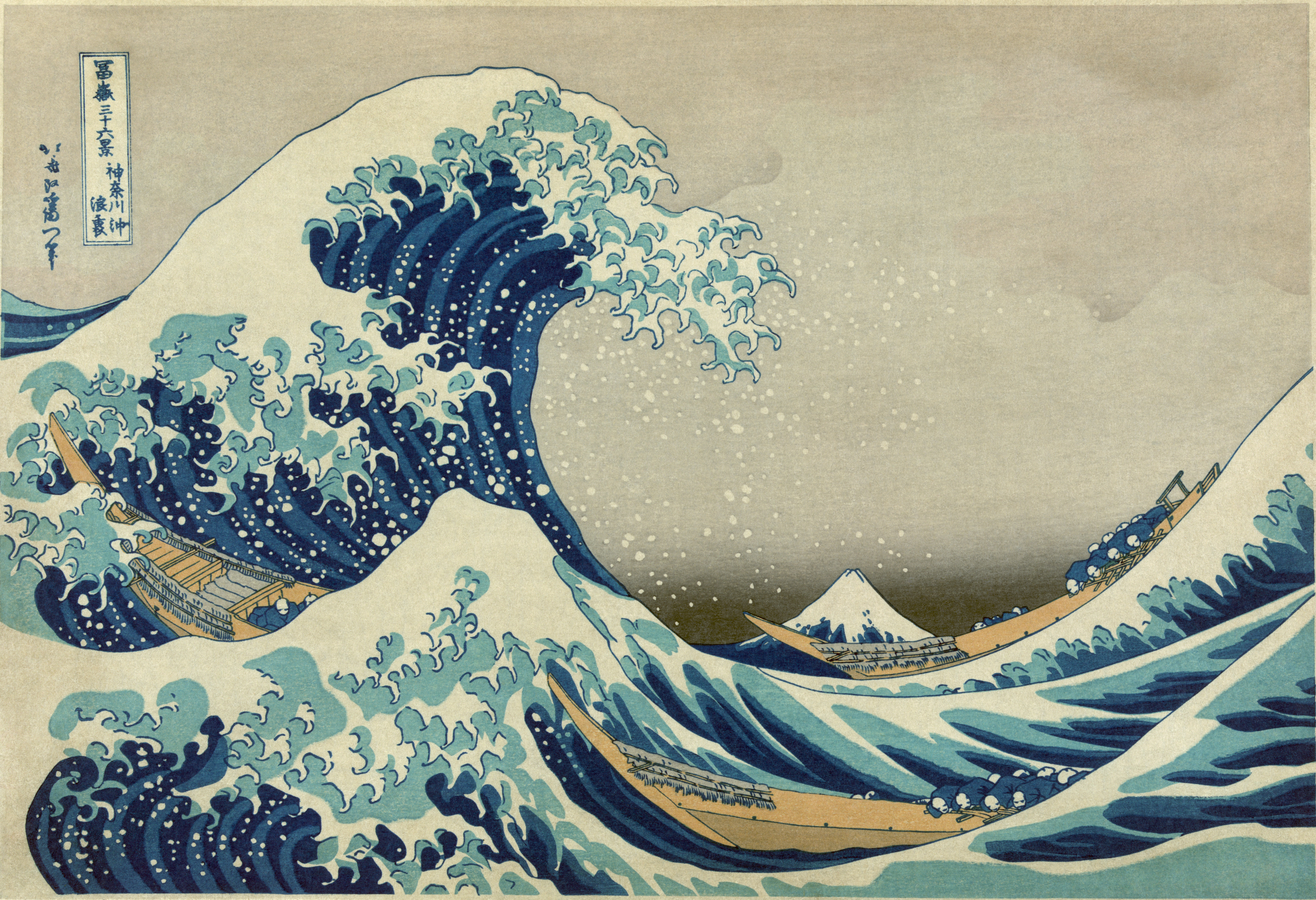
Prussian blue (also known as Berlin blue, Brandenburg blue or, in painting, Parisian or Paris blue) is a dark blue pigment produced by oxidation of ferrous ferrocyanide salts. It has the chemical formula Fe CN)">Cyanide.html" ;"title="e(Cyanide">CN) Turnbull's blue is chemically identical, but is made from different reagents, and its slightly different color stems from different impurities and particle sizes. Prussian blue was the first modern synthetic pigment. It is prepared as a very fine colloidal dispersion, because the compound is not soluble in water. It contains variable amounts of other ions and its appearance depends sensitively on the size of the colloidal particles. The pigment is used in paints, and it is the traditional "blue" in blueprints, and became prominent in 19th-century () Japanese woodblock prints. In medicine, orally administered Prussian blue is used as an antidote for certain kinds of heavy metal poisoning, e.g., by thallium(I) and radioactive is ... [...More Info...] [...Related Items...] OR: [Wikipedia] [Google] [Baidu] |
Logwood
''Haematoxylum campechianum'' (blackwood, bloodwood tree, bluewood, campeachy tree, campeachy wood, campeche logwood, campeche wood, Jamaica wood, logwood or logwood tree) is a species of flowering tree in the legume family, Fabaceae, that is native to southern Mexico,where it is known as ''Árbol de campeche'', and introduced to the Caribbean, northern Central America, and other localities around the world. The tree was of great economic importance from the 17th century to the 19th century, when it was commonly logged and exported to Europe for use in dyeing fabrics. The modern nation of Belize developed from 17th- and 18th-century logging camps established by the English. The tree's scientific name means "bloodwood" (''haima'' being Greek for blood and ''xylon'' for wood). Uses ''Haematoxylum campechianum'' was used for a long time as a natural source of dye. The woodchips are still used as an important source of haematoxylin, which is used in histology for staining. The ba ... [...More Info...] [...Related Items...] OR: [Wikipedia] [Google] [Baidu] |


_-_Copy.jpg)

