|
Sahasinaka
Sahasinaka is a municipality in the Manakara district of the Fitovinany Region in Madagascar. This municipality is situated at 42 Km north-west from Manakara. It lies at the Faraony River and Fangorinana River and the Fianarantsoa-Côte Est railway that links the town with Fianarantsoa and Manakara. Agriculture The economy is based on agriculture. Rice and coffee are grown, new is the plantation of cloves. For the local consumption also manioc ''Manihot esculenta'', commonly called cassava (), manioc, or yuca (among numerous regional names), is a woody shrub of the spurge family, Euphorbiaceae, native to South America. Although a perennial plant, cassava is extensively cultivated ... is planted. Sights The viaduct of the Fianarantsoa-Côte Est railway and the Faraony River waterfalls at a distance of 4km. References Populated places in Fitovinany {{Fitovinany-geo-stub ... [...More Info...] [...Related Items...] OR: [Wikipedia] [Google] [Baidu] |
Manakara-Atsimo (district)
Manakara-Atsimo is a district of Fitovinany in Madagascar. The main city is Manakara. Communes The district is further divided into 42 communes: * Ambahatrazo * Ambahive * Ambalaroka * Ambalavero * Ambila * Amboanjo * Ambohitsara M * Amborondra * Ambotaka * Ampasimanjeva * Ampasimboraka * Ampasipotsy * Analavory * Anorombato * Anosiala * Anteza * Bekatra * Fenomby * Lokomby * Mahabako * Mahamaibe * Manakara * Mangatsiotra * Marofarihy * Mavorano * Mitanty * Mizilo Gara * Nihaonana * Onilahy * Sahanambohitra * Saharefo * Sahasinaka * Sakoana * Sorombo * Tataho * Vatana * Vinanitelo * Vohilava * Vohimanitra * Vohimasina Nord * Vohimasina Sud * Vohimasy Rivers *the Manakara River Manakara is a city in Madagascar. It is the capital Fitovinany Region and of the district of Manakara Atsimo. The city is located at the east coast near the mouth of the Manakara River and has a small port. The bridge over the Manakara River ... *the Faraony River Infa ... [...More Info...] [...Related Items...] OR: [Wikipedia] [Google] [Baidu] |
Faraony River
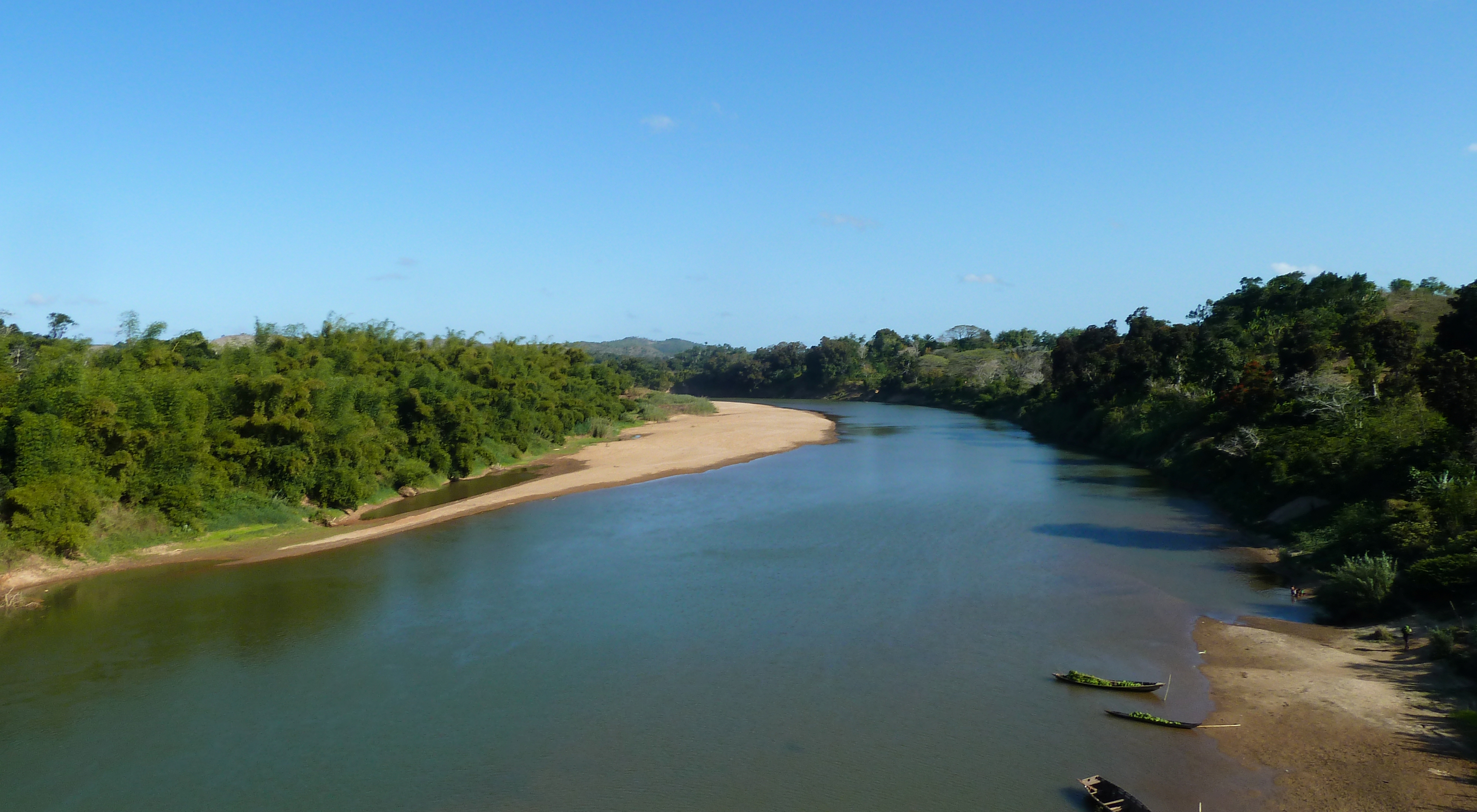
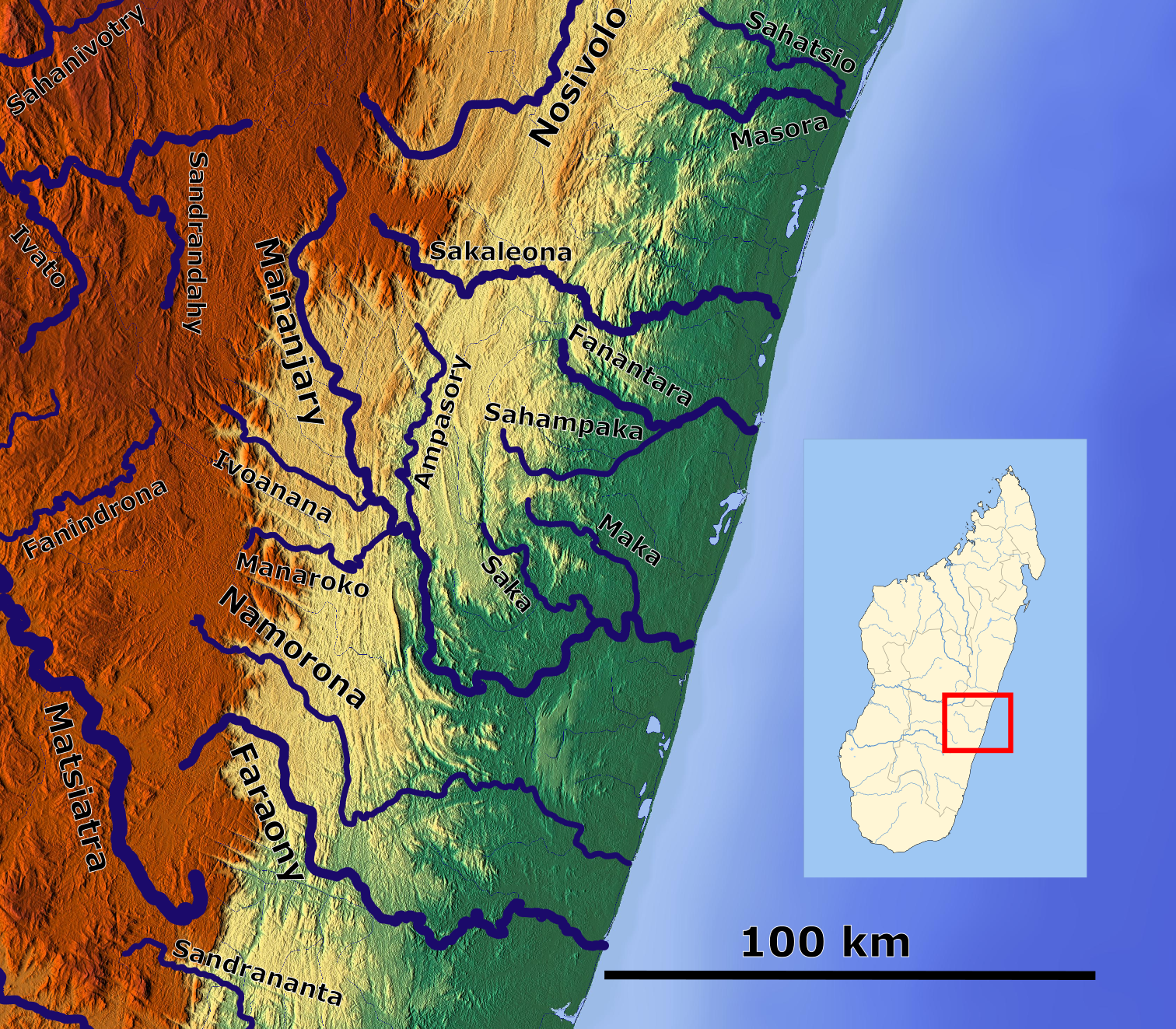
Faraony is a river in Fitovinany, eastern Madagascar. It flows down from the central highlands to the Indian Ocean. It flows thru Manampatrana, Vohimanitra, Mahabako, Sahasinaka Sahasinaka is a municipality in the Manakara district of the Fitovinany Region in Madagascar. This municipality is situated at 42 Km north-west from Manakara. It lies at the Faraony River and Fangorinana River and the Fianarantsoa-Côte Es ..., Mahavoky, Vohimasina Nord and empties south of Namorona in the Indian Ocean. References Rivers of Madagascar Rivers of Fitovinany {{Madagascar-river-stub ... [...More Info...] [...Related Items...] OR: [Wikipedia] [Google] [Baidu] |
Regions Of Madagascar
Madagascar is divided into 23 regions (''faritra''). These formerly second-tier administrative divisions became first-level administrative divisions when the former six provinces were dissolved on 4 October 2009. Elections Elections for the regional councils were held on 16 March 2008. See also * Subdivisions of Madagascar * Provinces of Madagascar * Districts of Madagascar *List of regions of Madagascar by Human Development Index * List of cities in Madagascar References Sources * Population, area: ''Madagascar: Profil des marchés pour les évaluations d’urgence de la sécurité alimentaire'* (in French:Découpage Territorial - L'Express.mg Regions of Madagascar, Subdivisions of Madagascar Madagascar, Regions Madagascar 2 ''Madagascar: Escape 2 Africa'' (also known as ''Madagascar 2: Escape to Africa'') is a 2008 American computer-animated adventure comedy film produced by DreamWorks Animation and distributed by Paramount Pictures. It is the sequel ... [...More Info...] [...Related Items...] OR: [Wikipedia] [Google] [Baidu] |
Fitovinany
Fitovinany is a region located in southeast Madagascar. Its capital is Manakara. It is inhabited by the Antemoro people. It formerly belonged to the region Vatovavy-Fitovinany that was split on 16 June 2021 to become the regions Vatovavy and Fitovinany. The region extends along the southern part of the east coast of Madagascar. It is bordered by Vatovavy (North), Amoron'i Mania and Haute Matsiatra (West) and Atsimo-Atsinanana (South). Administrative divisions Fitovinany Region is divided into three districts, which are sub-divided into 76 communes. * Ikongo District - 17 communes * Manakara-Atsimo District - 42 communes * Vohipeno District - 17 communes Transportation * Car, Taxi-Brousse * One airport and one seaport: **Manakara Airport **Manakara seaport is only used for transshipments and transit (Lychee, coffee, ...) Protected areas *Part of Fandriana-Vondrozo Corridor *Part of Marolambo National Park *Part of Ranomafana National Park Ranomafana National Park is in ... [...More Info...] [...Related Items...] OR: [Wikipedia] [Google] [Baidu] |
Districts Of Madagascar
Districts are second-level administrative divisions of Madagascar below the regions. There are 114 districts in Madagascar. Districts are in their turn divided into communes; while some of the districts in urban areas (such as the City districts of Antananarivo, Antsirabe I, Antsiranana I, Fianarantsoa I, Toamasina I and Toliara I) and offshore islands (such as the districts of Nosy Be and Nosy Boraha) each consist of only one commune, most of the districts are divided typically into 5–20 communes. List of districts * Note that Isandra, Lalangina and Vohibato Districts previously formed Fianarantsoa II District (within Haute Matsiatra Region) which has now been split into these three new districts. Another new district was formed by the splitting off of the new Mandoto District from Betafo District (within Vakinankaratra Region). See also * Subdivisions of Madagascar * Provinces of Madagascar * Regions of Madagascar * List of cities in Madagascar References ... [...More Info...] [...Related Items...] OR: [Wikipedia] [Google] [Baidu] |
East Africa Time
East Africa Time, or EAT, is a time zone used in eastern Africa. The time zone is three hours ahead of UTC ( UTC+03:00), which is the same as Moscow Time, Arabia Standard Time, Further-eastern European Time and Eastern European Summer Time. As this time zone is predominantly in the equatorial region, there is no significant change in day length throughout the year and so daylight saving time is not observed. East Africa Time is observed by the following countries: * * * * * * * * * See also *Moscow Time, an equivalent time zone covering Belarus, Turkey and most of European Russia, also at UTC+03:00 *Arabia Standard Time, an equivalent time zone covering Bahrain, Iraq, Kuwait, Qatar, Saudi Arabia and Yemen, also at UTC+03:00 *Eastern European Summer Time, an equivalent time zone covering European and Middle Eastern countries during daylight saving, also at UTC+03:00 *Israel Summer Time, an equivalent time zone covering the State of Israel during daylight saving, also at U ... [...More Info...] [...Related Items...] OR: [Wikipedia] [Google] [Baidu] |
Madagascar
Madagascar (; mg, Madagasikara, ), officially the Republic of Madagascar ( mg, Repoblikan'i Madagasikara, links=no, ; french: République de Madagascar), is an island country in the Indian Ocean, approximately off the coast of East Africa across the Mozambique Channel. At Madagascar is the world's List of island countries, second-largest island country, after Indonesia. The nation is home to around 30 million inhabitants and consists of the island of Geography of Madagascar, Madagascar (the List of islands by area, fourth-largest island in the world), along with numerous smaller peripheral islands. Following the prehistoric breakup of the supercontinent Gondwana, Madagascar split from the Indian subcontinent around 90 million years ago, allowing native plants and animals to evolve in relative isolation. Consequently, Madagascar is a biodiversity hotspot; over 90% of wildlife of Madagascar, its wildlife is endemic. Human settlement of Madagascar occurred during or befo ... [...More Info...] [...Related Items...] OR: [Wikipedia] [Google] [Baidu] |
Manakara
Manakara is a city in Madagascar. It is the capital Fitovinany Region and of the district of Manakara Atsimo. The city is located at the east coast near the mouth of the Manakara River and has a small port. The bridge over the Manakara River that connected the northern and southern parts of the city partly collapsed in September 2012. It is the endpoint of the Fianarantsoa-Côte Est railway (FCE), which connects the city of Fianarantsoa with the sea. For those interested in traveling to Manakara via the railway, please be advised the train can take over 12 hours at times. It usually leaves Fianarantsoa at 7 in the morning, and is supposed to reach Manakara by 4 pm, but there have been incidences of it not reaching Manakara until much later. If one needs to return to the capital from Manakara and time is an issue, take a plane or a taxi-brousse (Taxi-Bus). There is also an airport and a national road along the coastline. Manakara Airport is one of the few places where a railw ... [...More Info...] [...Related Items...] OR: [Wikipedia] [Google] [Baidu] |
Fianarantsoa
Fianarantsoa is a city (commune urbaine) in south central Madagascar, and is the capital of Haute Matsiatra Region. History It was built in the early 19th century by the Merina as the administrative capital for the newly conquered Betsileo kingdoms. Fianarantsoa means "Good education" in Malagasy. It is a cultural and intellectual center for the whole island. It is home to some of the oldest Protestant and Lutheran cathedrals on the island, the oldest theological seminary (also Lutheran), as well as the Roman Catholic Archdiocese of Fianarantsoa (seated in the Cathedral of the Holy Name of Jesus). The city of "good education" also boasts a university named after it and built in 1972. Fianarantsoa is considered to be the capital of wine in Madagascar, because of the presence of many wine industries in the city. Geography It is at an average altitude of , and has a population of 191,766. The town is linked to the rest of the country by the National road 7, one of the main hi ... [...More Info...] [...Related Items...] OR: [Wikipedia] [Google] [Baidu] |
Clove
Cloves are the aromatic flower buds of a tree in the family Myrtaceae, ''Syzygium aromaticum'' (). They are native to the Maluku Islands (or Moluccas) in Indonesia, and are commonly used as a spice, flavoring or fragrance in consumer products, such as toothpaste, soaps, or cosmetics. Cloves are available throughout the year owing to different harvest seasons across various countries. Etymology The word ''clove'', first used in English in the 15th century, derives via Middle English ''clow of gilofer'', Anglo-French ''clowes de gilofre'' and Old French ''clou de girofle'', from the Latin word ''clavus'' "nail". The related English word ''gillyflower'', originally meaning "clove", derives via said Old French ''girofle'' and Latin ''caryophyllon'', from the Greek ''karyophyllon'' "clove", literally "nut leaf". Botanical features The clove tree is an evergreen that grows up to tall, with large leaves and crimson flowers grouped in terminal clusters. The flower buds initiall ... [...More Info...] [...Related Items...] OR: [Wikipedia] [Google] [Baidu] |


