|
Sachsenburg
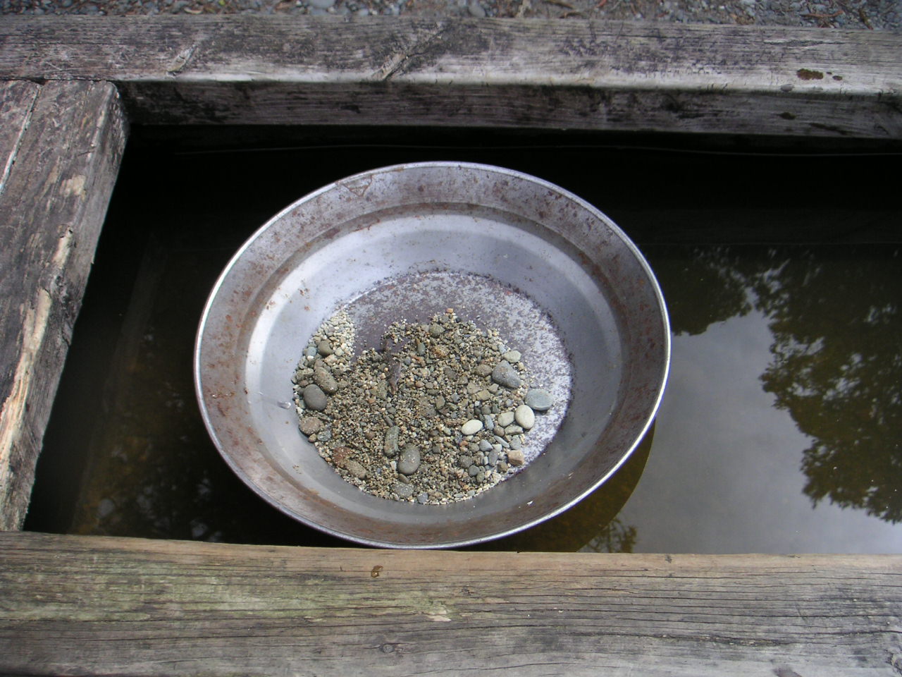
Sachsenburg is a market town in the district of Spittal an der Drau in Carinthia, Austria. Geography The municipal area stretches along the valley of the Drava river, where it enters the Lurnfeld plain between the Kreuzeck group of the Hohe Tauern mountain range in the north and Gailtal Alps in the south. The municipality comprises the cadastral communities of Sachsenburg and Obergottesfeld. History The origin of the name is uncertain: an affiliation with the far apart mediæval Duchy of Saxony has never been established; however the coat of arms probably awarded in the 16th century shows a ''Saxe'', a kind of pan formerly used for gold prospecting within the nearby Hohe Tauern range. The strategically important narrow place of the Drava valley (''Sachsenburger Klause'') probably was guarded already in Roman times, when the area was part of the ''Noricum'' province. Two fortresses blocking the passage along the river were first mentioned in a 1213 deed. Sachsenburg is document ... [...More Info...] [...Related Items...] OR: [Wikipedia] [Google] [Baidu] |
Lurnfeld
Lurnfeld is a market town in the district of Spittal an der Drau in the Austrian state of Carinthia. The municipality consists of the two Katastralgemeinden: Möllbrücke and Pusarnitz, comprising several small villages. It is located within the eponymous valley of the Drava river, on the southern slope of the Ankogel Group of the Hohe Tauern range, west of the district's capital Spittal an der Drau. At Möllbrücke is the confluence of the Drava with the Möll tributary. In the west the valley is confined by the mountains of the Kreuzeck group and in the south by the Gailtal Alps. History The Lurnfeld valley around the Roman city of Teurnia is a very old settlement area, in ancient times called ''vallis Lurna''. In an 891 deed mentioned as ''Liburnia'', it became the centre of the Upper Carinthian counts in the mediæval Lurn'' gau'', who resided at Hohenburg Castle. Their dominions then stretched from west of Villach up the Drava to Lienz and the Tyrolean border. Pusarnitz a ... [...More Info...] [...Related Items...] OR: [Wikipedia] [Google] [Baidu] |
Spittal An Der Drau (district)
Bezirk Spittal an der Drau is an administrative district (''Bezirk'') in the state of Carinthia, Austria. Geography With an area of the district is 2,763.99 km², it is Austria's second largest district by area (after Liezen), even larger than the Austrian state of Vorarlberg, and by far the largest district in Carinthia. The administrative centre is Spittal an der Drau, other major settlements are Gmünd, Greifenburg, Millstatt, Obervellach, Radenthein, Seeboden, Steinfeld, and Winklern. Together with the neighbouring districts of Hermagor and Feldkirchen, Spittal forms the Upper Carinthia (''Oberkärnten'') region according to the Nomenclature of Territorial Units for Statistics (NUTS). It borders on East Tyrol (Lienz District) in the west and the Austrian state of Salzburg in the north. The mountainous area comprises the southern ranges of the High Tauern and the Möll valley, the western Gurktal Alps (Nock Mountains), as well as the broad Drava Valley and the nort ... [...More Info...] [...Related Items...] OR: [Wikipedia] [Google] [Baidu] |
Spittal An Der Drau District
Bezirk Spittal an der Drau is an administrative district (''Bezirk'') in the state of Carinthia, Austria. Geography With an area of the district is 2,763.99 km², it is Austria's second largest district by area (after Liezen), even larger than the Austrian state of Vorarlberg, and by far the largest district in Carinthia. The administrative centre is Spittal an der Drau, other major settlements are Gmünd, Greifenburg, Millstatt, Obervellach, Radenthein, Seeboden, Steinfeld, and Winklern. Together with the neighbouring districts of Hermagor and Feldkirchen, Spittal forms the Upper Carinthia (''Oberkärnten'') region according to the Nomenclature of Territorial Units for Statistics (NUTS). It borders on East Tyrol (Lienz District) in the west and the Austrian state of Salzburg in the north. The mountainous area comprises the southern ranges of the High Tauern and the Möll valley, the western Gurktal Alps (Nock Mountains), as well as the broad Drava Valley and the norther ... [...More Info...] [...Related Items...] OR: [Wikipedia] [Google] [Baidu] |
Drava
The Drava or Drave''Utrata Fachwörterbuch: Geographie - Englisch-Deutsch/Deutsch-Englisch'' by Jürgen Utrata (2014). Retrieved 10 Apr 2014. (german: Drau, ; sl, Drava ; hr, Drava ; hu, Dráva ; it, Drava ) is a river in southern Central Europe. With a length of ,Joint Drava River Corridor Analysis Report 27 November 2014 including the Sextner Bach source, it is the fifth or sixth longest tributary of the Danube, after the Tisza, Sava, Prut, Mureș (river), Mureș and perhaps Siret (river), Siret. The Drava drains ... [...More Info...] [...Related Items...] OR: [Wikipedia] [Google] [Baidu] |
Drau Bei Sachsenburg2
The Drava or Drave''Utrata Fachwörterbuch: Geographie - Englisch-Deutsch/Deutsch-Englisch'' by Jürgen Utrata (2014). Retrieved 10 Apr 2014. (german: Drau, ; sl, Drava ; hr, Drava ; hu, Dráva ; it, Drava ) is a river in southern . With a length of ,Joint Drava River Corridor Analysis Report 27 November 2014 including the Sextner Bach source, it is the fifth or sixth longest tr ... [...More Info...] [...Related Items...] OR: [Wikipedia] [Google] [Baidu] |
Gailtal Alps
, ''Drauzug'' , photo=Grosse Sandspitze 1.jpg , photo_size= , photo_caption=Große Sandspitze, the highest peak in the range , country= Austria , subdivision1_type= States , subdivision1= , parent= , geology= Limestone , orogeny=Alpine orogeny , area_km2= , length_km=100 , length_orientation= , width_km= , width_orientation= , highest=Große Sandspitze , elevation_m=2770 , coordinates= , range_coordinates= , map_image=Alps location map (Gailtaler Alpen).png , map_caption=The Gailtal Alps (in red) within the Alps.The borders of the range according to Alpine Club classification of the Eastern Alps The Gailtal Alps (german: Gailtaler Alpen or ''Drauzug''), is a mountain range of the Southern Limestone Alps in Austria. It rises between the River Drava (''Drau'') and the Gail valley (in southwestern Carinthia) and through the southern part of East Tyrol. Its western group called " Lienz Dolomites" (''Lienzer Dolomiten''), is sometimes counted as part of this ra ... [...More Info...] [...Related Items...] OR: [Wikipedia] [Google] [Baidu] |
Carinthia
Carinthia (german: Kärnten ; sl, Koroška ) is the southernmost States of Austria, Austrian state, in the Eastern Alps, and is noted for its mountains and lakes. The main language is German language, German. Its regional dialects belong to the Southern Bavarian group. Carinthian dialect group, Carinthian Slovene dialects, forms of a South Slavic languages, Slavic language that predominated in the southeastern part of the region up to the first half of the 20th century, are now spoken by a Carinthian Slovenes, small minority in the area. Carinthia's main Industry (economics), industries are tourism, electronics, engineering, forestry, and agriculture. Name The etymology of the name "Carinthia", similar to Carnia or Carniola, has not been conclusively established. The ''Ravenna Cosmography'' (about AD 700) referred to a Slavic settlement of the Eastern Alps, Slavic "Carantani" tribe as the eastern neighbours of the Bavarians. In his ''History of the Lombards'', the 8th-c ... [...More Info...] [...Related Items...] OR: [Wikipedia] [Google] [Baidu] |
Lienz
Lienz (; Southern Bavarian: ''Lianz'') is a Town privileges, medieval town in the Austrian state of Tyrol (state), Tyrol. It is the administrative centre of the Lienz (district), Lienz district, which covers all of East Tyrol. The municipality also includes the Katastralgemeinden, cadastral subdivision of ''Patriasdorf''. Geography Lienz is located at the confluence of the rivers Isel River, Isel and Drava in the Eastern Alps, between the Hohe Tauern mountain range in the north (including the Schober group, Schober and Kreuzeck groups), and the Southern Limestone Alps, Gailtal Alps in the south. It is connected with Winklern in Carinthia (state), Carinthia by the Iselsberg Pass. The neighbouring municipality of Leisach marks the easternmost point of the Puster Valley. By the consistent growth of the city, some smaller villages around – though officially municipalities in their own right – are now widely considered to be suburbs of Lienz. Those suburbs comprise: History The ... [...More Info...] [...Related Items...] OR: [Wikipedia] [Google] [Baidu] |
County Of Gorizia
The County of Gorizia ( it, Contea di Gorizia, german: Grafschaft Görz, sl, Goriška grofija, fur, Contee di Gurize), from 1365 Princely County of Gorizia, was a State of the Holy Roman Empire. Originally mediate ''Vogts'' of the Patriarchs of Aquileia, the Counts of Gorizia (''Meinhardiner'') ruled over several fiefs in the area of Lienz and in the Friuli region of northeastern Italy with their residence at Gorizia (''Görz''). In 1253 the Counts of Gorizia inherited the County of Tyrol, from 1271 onwards ruled by the Gorizia-Tyrol branch which became extinct in the male line in 1335. The younger line ruled the comital lands of Gorizia and Lienz until its extinction in 1500, whereafter the estates were finally acquired by the Austrian House of Habsburg. History Gorizia (House of Meinhardin) Count Meinhard I, a descendant of the ''Meinhardiner'' noble family with possessions around Lienz in the Duchy of Bavaria, is mentioned as early as 1107. As a ''vogt'' official of the Pa ... [...More Info...] [...Related Items...] OR: [Wikipedia] [Google] [Baidu] |
Duchy Of Carinthia
The Duchy of Carinthia (german: Herzogtum Kärnten; sl, Vojvodina Koroška) was a duchy located in southern Austria and parts of northern Slovenia. It was separated from the Duchy of Bavaria in 976, and was the first newly created Imperial State after the original German stem duchies. Carinthia remained a State of the Holy Roman Empire until its dissolution in 1806, though from 1335 it was ruled within the Austrian dominions of the Habsburg dynasty. A constituent part of the Habsburg monarchy and of the Austrian Empire, it remained a Cisleithanian crown land of Austria-Hungary until 1918. By the Carinthian Plebiscite in October 1920, the main area of the duchy formed the Austrian state of Carinthia. History In the seventh century the area was part of the Slavic principality of Carantania, which fell under the suzerainty of Duke Odilo of Bavaria in about 743. The Bavarian stem duchy was incorporated into the Carolingian Empire when Charlemagne deposed Odilo's son Duke Ta ... [...More Info...] [...Related Items...] OR: [Wikipedia] [Google] [Baidu] |
Gold Prospecting
Gold prospecting is the act of searching for new gold deposits. Methods used vary with the type of deposit sought and the resources of the prospector. Although traditionally a commercial activity, in some developed countries placer gold prospecting has also become a popular outdoor recreation. Prospecting for placer gold Prospecting for placer gold is normally done with a gold pan or similar instrument to wash free gold particles from loose surface sediment. The use of gold pans is centuries old, but is still common among prospectors and miners with little financial backing. Deeper placer deposits may be sampled by trenching or drilling. Geophysical methods such as seismic, gravity or magnetics may be used to locate buried river channels that are likely locations for placer gold. Sampling and assaying a placer gold deposit to determine its economic viability is subject to many pitfalls. Once placer gold is discovered, the gold pan is usually replaced by sluices or mechan ... [...More Info...] [...Related Items...] OR: [Wikipedia] [Google] [Baidu] |


