|
SECOR
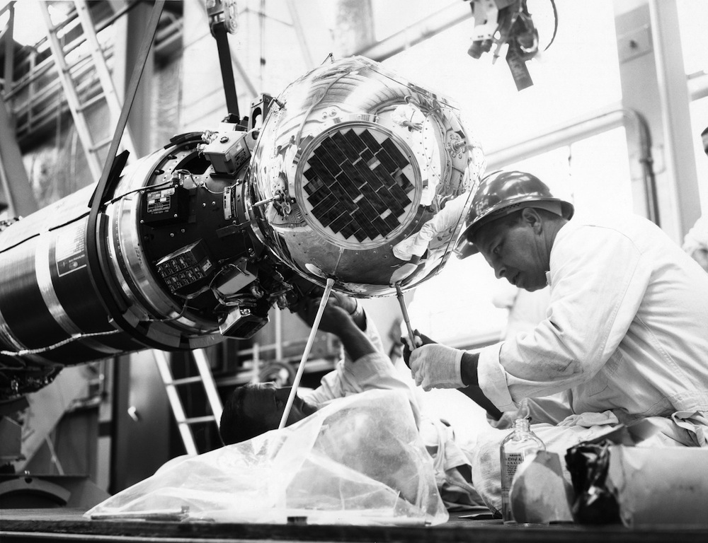
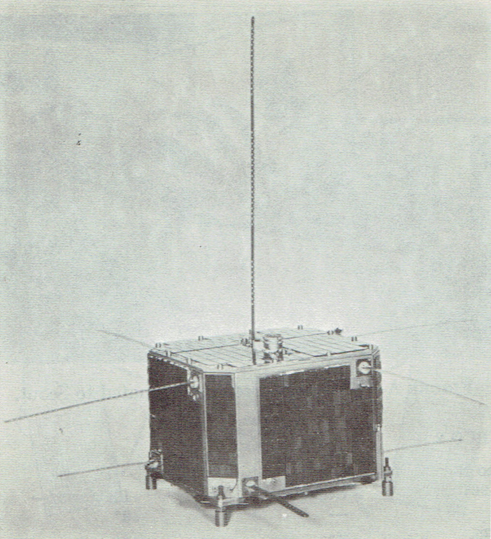
SECOR (Sequential Collation of Ranges) was a series of small United States Armed Forces satellites launched in the 1960s for geodesy measurements that precisely determined the locations of points on the Earth's surface, particularly of isolated islands in the Pacific Ocean. This data allowed for improved global mapping and precise positioning of ground stations for other satellites. Any SECOR satellite could be linked to four mobile ground stations: three were placed in accurately determined known locations, and a fourth one was placed in an unknown location. By measuring a satellite's distance from the three known stations, its position in space was determined. Then, the distance between the unknown ground station and the previously determined satellite's position was used to compute the unknown ground station's coordinates. This process was repeated many times, to enhance the accuracy of the measurement. Once the unknown station's position was accurately determined, it becam ... [...More Info...] [...Related Items...] OR: [Wikipedia] [Google] [Baidu] |
SECOR Satellite 1965
SECOR (Sequential Collation of Ranges) was a series of small United States Armed Forces satellites launched in the 1960s for geodesy measurements that precisely determined the locations of points on the Earth's surface, particularly of isolated islands in the Pacific Ocean. This data allowed for improved global mapping and precise positioning of ground stations for other satellites. Any SECOR satellite could be linked to four mobile ground stations: three were placed in accurately determined known locations, and a fourth one was placed in an unknown location. By measuring a satellite's distance from the three known stations, its position in space was determined. Then, the distance between the unknown ground station and the previously determined satellite's position was used to compute the unknown ground station's Geographic coordinate system, coordinates. This process was repeated many times, to enhance the accuracy of the measurement. Once the unknown station's position was accur ... [...More Info...] [...Related Items...] OR: [Wikipedia] [Google] [Baidu] |
Global Positioning System
The Global Positioning System (GPS), originally Navstar GPS, is a satellite-based radionavigation system owned by the United States government and operated by the United States Space Force. It is one of the global navigation satellite systems (GNSS) that provides geolocation and time information to a GPS receiver anywhere on or near the Earth where there is an unobstructed line of sight to four or more GPS satellites. It does not require the user to transmit any data, and operates independently of any telephonic or Internet reception, though these technologies can enhance the usefulness of the GPS positioning information. It provides critical positioning capabilities to military, civil, and commercial users around the world. Although the United States government created, controls and maintains the GPS system, it is freely accessible to anyone with a GPS receiver. The GPS project was started by the U.S. Department of Defense in 1973. The first prototype spacecraft was lau ... [...More Info...] [...Related Items...] OR: [Wikipedia] [Google] [Baidu] |
United States Armed Forces
The United States Armed Forces are the military forces of the United States. The armed forces consists of six service branches: the Army, Marine Corps, Navy, Air Force, Space Force, and Coast Guard. The president of the United States is the commander-in-chief of the armed forces and forms military policy with the Department of Defense (DoD) and Department of Homeland Security (DHS), both federal executive departments, acting as the principal organs by which military policy is carried out. All six armed services are among the eight uniformed services of the United States. From their inception during the American Revolutionary War, the U.S. Armed Forces have played a decisive role in the history of the United States. They helped forge a sense of national unity and identity through victories in the First Barbary War and the Second Barbary War. They played a critical role in the American Civil War, keeping the Confederacy from seceding from the republic and preser ... [...More Info...] [...Related Items...] OR: [Wikipedia] [Google] [Baidu] |
Earth's Magnetic Field
Earth's magnetic field, also known as the geomagnetic field, is the magnetic field that extends from Earth's interior out into space, where it interacts with the solar wind, a stream of charged particles emanating from the Sun. The magnetic field is generated by electric currents due to the motion of convection currents of a mixture of molten iron and nickel in Earth's outer core: these convection currents are caused by heat escaping from the core, a natural process called a geodynamo. The magnitude of Earth's magnetic field at its surface ranges from . As an approximation, it is represented by a field of a magnetic dipole currently tilted at an angle of about 11° with respect to Earth's rotational axis, as if there were an enormous bar magnet placed at that angle through the center of Earth. The North geomagnetic pole actually represents the South pole of Earth's magnetic field, and conversely the South geomagnetic pole corresponds to the north pole of Earth's magneti ... [...More Info...] [...Related Items...] OR: [Wikipedia] [Google] [Baidu] |
Thor Ablestar
The Thor-Ablestar, or Thor-Able-Star, also known as Thor-Epsilon was an early American expendable launch system consisting of a PGM-17 Thor missile, with an Ablestar upper stage. It was a member of the Thor family of rockets, and was derived from the Thor-Able. The Ablestar second stage was an enlarged version of the Able, which gave the Thor-Ablestar a greater payload capacity compared to the Thor-Able. It also incorporated restart capabilities, allowing a multiple-burn trajectory to be flown, further increasing payload, or allowing the rocket to reach different orbits. It was the first rocket to be developed with such a capability and development of the stage took a mere eight months. Nineteen Thor-Ablestar were launched between 1960–1965, of which four failed, and a fifth resulted in a partial failure, as only one of two payloads separated from the upper stage. The first failure was the launch of Courier 1A, an experimental communications satellite, on 19 August 1960 whe ... [...More Info...] [...Related Items...] OR: [Wikipedia] [Google] [Baidu] |
Vandenberg Space Force Base
Vandenberg Space Force Base , previously Vandenberg Air Force Base, is a United States Space Force Base in Santa Barbara County, California. Established in 1941, Vandenberg Space Force Base is a space launch base, launching spacecraft from the Western Range, and also performs missile testing. The United States Space Force's Space Launch Delta 30 serves as the host delta for the base. In addition to its military space launch mission, Vandenberg Space Force Base also performs space launches for civil and commercial space entities, such as NASA and SpaceX. History United States Army Camp Cooke (1941–1953) In 1941, the United States Army embarked on an initiative to acquire lands in the United States to be used to train its infantry and armored forces. These areas needed to be of a varied nature to ensure relevant training. In March 1941, the Army acquired approximately of open ranch lands along the Central Coast of California between Lompoc and Santa Maria. Most ... [...More Info...] [...Related Items...] OR: [Wikipedia] [Google] [Baidu] |
Cape Canaveral Space Force Station
Cape Canaveral Space Force Station (CCSFS) is an installation of the United States Space Force's Space Launch Delta 45, located on Cape Canaveral in Brevard County, Florida. Headquartered at the nearby Patrick Space Force Base, the station is the primary launch site for the Space Force's Eastern RangeCAST 1999, p. 1-12. with three launch pads currently active (Space Launch Complexes 37B, 40, and 41). The facility is south-southeast of NASA's Kennedy Space Center on adjacent Merritt Island, with the two linked by bridges and causeways. The Cape Canaveral Space Force Station Skid Strip provides a runway close to the launch complexes for military airlift aircraft delivering heavy and outsized payloads to the Cape. A number of American space exploration pioneers were launched from CCSFS, including the first U.S. Earth satellite (1958), first U.S. astronaut (1961), first U.S. astronaut in orbit (1962), first two-man U.S. spacecraft (1965), first U.S. unmanned lunar l ... [...More Info...] [...Related Items...] OR: [Wikipedia] [Google] [Baidu] |
Thor-Ablestar
The Thor-Ablestar, or Thor-Able-Star, also known as Thor-Epsilon was an early American expendable launch system consisting of a PGM-17 Thor missile, with an Ablestar upper stage. It was a member of the Thor family of rockets, and was derived from the Thor-Able. The Ablestar second stage was an enlarged version of the Able, which gave the Thor-Ablestar a greater payload capacity compared to the Thor-Able. It also incorporated restart capabilities, allowing a multiple-burn trajectory to be flown, further increasing payload, or allowing the rocket to reach different orbits. It was the first rocket to be developed with such a capability and development of the stage took a mere eight months. Nineteen Thor-Ablestar were launched between 1960–1965, of which four failed, and a fifth resulted in a partial failure, as only one of two payloads separated from the upper stage. The first failure was the launch of Courier 1A, an experimental communications satellite, on 19 August 1960 when ... [...More Info...] [...Related Items...] OR: [Wikipedia] [Google] [Baidu] |
Greenwich Mean Time
Greenwich Mean Time (GMT) is the mean solar time at the Royal Observatory in Greenwich, London, counted from midnight. At different times in the past, it has been calculated in different ways, including being calculated from noon; as a consequence, it cannot be used to specify a particular time unless a context is given. The term 'GMT' is also used as one of the names for the time zone UTC+00:00 and, in UK law, is the basis for civil time in the United Kingdom. English speakers often use GMT as a synonym for Coordinated Universal Time (UTC). For navigation, it is considered equivalent to UT1 (the modern form of mean solar time at 0° longitude); but this meaning can differ from UTC by up to 0.9s. The term GMT should thus not be used for purposes that require precision. Because of Earth's uneven angular velocity in its elliptical orbit and its axial tilt, noon (12:00:00) GMT is rarely the exact moment the Sun crosses the Greenwich Meridian and reaches its highest po ... [...More Info...] [...Related Items...] OR: [Wikipedia] [Google] [Baidu] |
Transit 3B
Transit 3B was an American satellite which was launched in 1961 and operated by the United States Navy. It was a replacement for Transit 3A, which was lost in a launch failure the previous year. It carried instruments to demonstrate navigation and timing systems, and study geodesy to support the development of the Transit satellite navigation system. The launch of Transit 3B was conducted at 03:45 UTC on 22 February 1961, using a Thor DM-21 Ablestar rocket flying from Launch Complex 17B at the Cape Canaveral Air Force Station. The LOFTI-1 satellite was launched aboard the same rocket. The rocket and upper stage used had the serial numbers Thor 313 and Ablestar 007 respectively. The launch resulted in a partial failure, with the spacecraft being placed in a more eccentric orbit than planned, and failing to separate from the upper stage. Transit 3B was a spacecraft, which was powered by 6,600 solar cells charging a nickel-cadmium battery. It ended up in a low Earth orbit with ... [...More Info...] [...Related Items...] OR: [Wikipedia] [Google] [Baidu] |
International Designator
The International Designator, also known as COSPAR ID, is an international identifier assigned to artificial objects in space. It consists of the launch year, a three-digit incrementing launch number of that year and up to a three-letter code representing the sequential identifier of a piece in a launch. In TLE format the first two digits of the year and the dash are dropped. For example1990-037Ais the Space Shuttle ''Discovery'' on mission STS-31, which carried the Hubble Space Telescope1990-037B into space. This launch was the 37th known successful launch worldwide in 1990. The designation system has been generally known as the COSPAR system, named for the Committee on Space Research (COSPAR) of the International Council for Science. COSPAR subsumed the first designation system, devised at Harvard University. That system used letters of the Greek alphabet to designate artificial satellites. This was based on the scientific naming convention for natural satellites. For exampl ... [...More Info...] [...Related Items...] OR: [Wikipedia] [Google] [Baidu] |
Solid-state Electronics
Solid-state electronics means semiconductor electronics: electronic equipment using semiconductor devices such as transistors, diodes and integrated circuits (ICs). The term is also used as an adjective for devices in which semiconductor electronics that have no moving parts replace devices with moving parts, such as the solid-state relay in which transistor switches are used in place of a moving-arm electromechanical relay, or the solid-state drive (SSD) a type of semiconductor memory used in computers to replace hard disk drives, which store data on a rotating disk. History The term "solid-state" became popular at the beginning of the semiconductor era in the 1960s to distinguish this new technology based on the transistor, in which the electronic action of devices occurred in a solid state, from previous electronic equipment that used vacuum tubes, in which the electronic action occurred in a gaseous state. A semiconductor device works by controlling an electric current ... [...More Info...] [...Related Items...] OR: [Wikipedia] [Google] [Baidu] |


